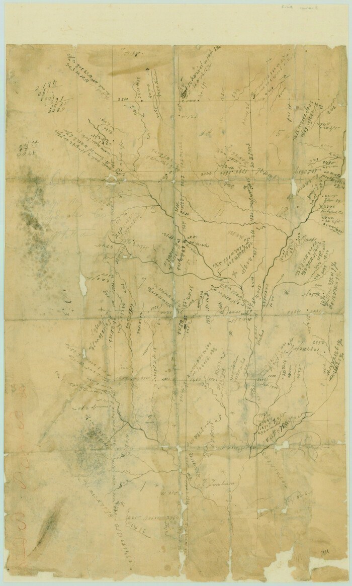
[Surveys near the Neches River]
Print $3.00
- Digital $50.00
[Surveys near the Neches River]
Size: 17.2 x 10.3 inches
8
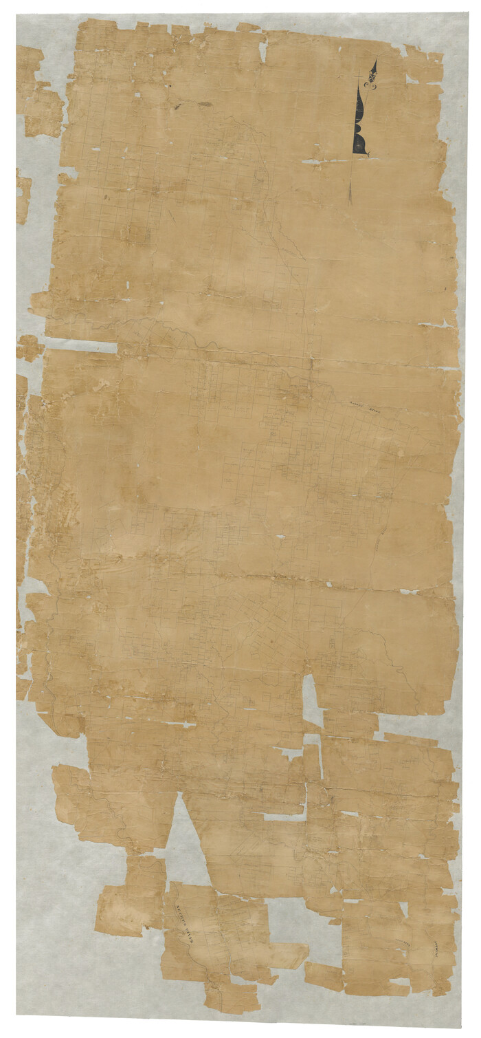
[Map of Nacogdoches County]
Print $40.00
- Digital $50.00
[Map of Nacogdoches County]
1840
Size: 79.3 x 69.8 inches
10784
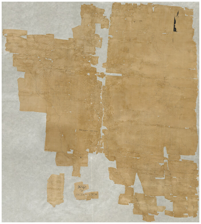
[Map of Nacogdoches County]
Print $40.00
- Digital $50.00
[Map of Nacogdoches County]
1840
Size: 79.3 x 38.0 inches
93368
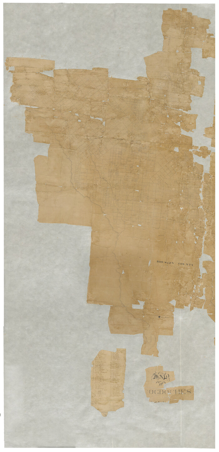
[Map of Nacogdoches County]
Print $40.00
- Digital $50.00
[Map of Nacogdoches County]
1840
Size: 79.3 x 36.8 inches
93369
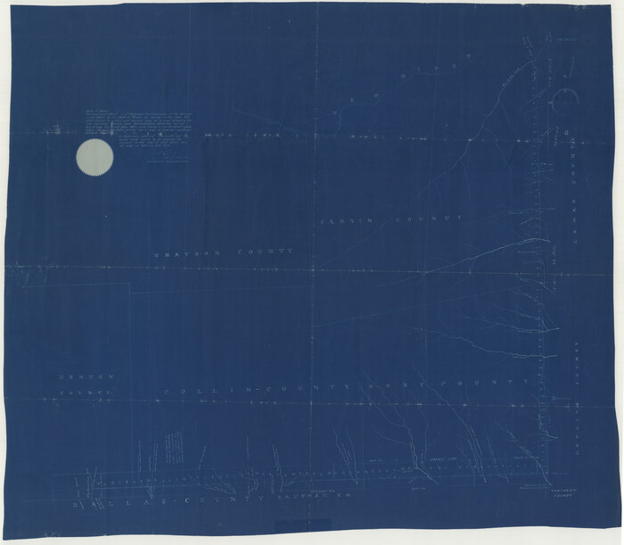
[Map of Line Dividing Fannin and Nacogdoches Districts]
Print $20.00
- Digital $50.00
[Map of Line Dividing Fannin and Nacogdoches Districts]
1850
Size: 34.2 x 39.0 inches
1707
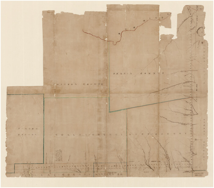
[Map of Line Dividing Fannin and Nacogdoches Districts]
Print $20.00
- Digital $50.00
[Map of Line Dividing Fannin and Nacogdoches Districts]
1850
Size: 35.6 x 40.8 inches
3134
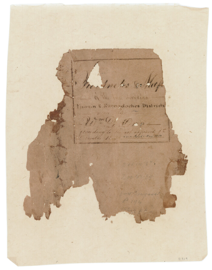
[Map of Line Dividing Fannin and Nacogdoches Districts]
Print $2.00
- Digital $50.00
[Map of Line Dividing Fannin and Nacogdoches Districts]
1850
Size: 11.0 x 8.6 inches
81919
[Cotton Belt] St. Louis Arkansas & Texas R'y, Lufkin Branch, Formely the Kansas & Gulf Short Line
Print $20.00
- Digital $50.00
[Cotton Belt] St. Louis Arkansas & Texas R'y, Lufkin Branch, Formely the Kansas & Gulf Short Line
1888
Size: 11.2 x 39.5 inches
64371
[Cherokee Reserve, West Boundary Line, plat and field notes]
![2000, [Cherokee Reserve, West Boundary Line, plat and field notes], General Map Collection](https://historictexasmaps.com/wmedia_w700/pdf_converted_jpg/qi_pdf_thumbnail_931.jpg)
Print $54.00
[Cherokee Reserve, West Boundary Line, plat and field notes]
1841
Size: 9.4 x 14.7 inches
2000
The Republic County of Nacogdoches. Spring 1842

Print $20.00
The Republic County of Nacogdoches. Spring 1842
2020
Size: 15.9 x 21.8 inches
96248
The Republic County of Nacogdoches. Proposed, Late Fall 1837-January 1, 1838

Print $20.00
The Republic County of Nacogdoches. Proposed, Late Fall 1837-January 1, 1838
2020
Size: 17.8 x 21.7 inches
96243
The Republic County of Nacogdoches. Proposed, Late Fall 1837

Print $20.00
The Republic County of Nacogdoches. Proposed, Late Fall 1837
2020
Size: 17.5 x 21.7 inches
96242
The Republic County of Nacogdoches. November 28. 1839

Print $20.00
The Republic County of Nacogdoches. November 28. 1839
2020
Size: 17.5 x 21.7 inches
96245
The Republic County of Nacogdoches. January 16, 1843

Print $20.00
The Republic County of Nacogdoches. January 16, 1843
2020
Size: 15.9 x 21.8 inches
96249
The Republic County of Nacogdoches. January 1, 1838

Print $20.00
The Republic County of Nacogdoches. January 1, 1838
2020
Size: 17.5 x 21.7 inches
96244
The Republic County of Nacogdoches. February 1, 1842

Print $20.00
The Republic County of Nacogdoches. February 1, 1842
2020
Size: 15.9 x 21.8 inches
96247
The Republic County of Nacogdoches. December 6, 1841

Print $20.00
The Republic County of Nacogdoches. December 6, 1841
2020
Size: 15.9 x 21.8 inches
96246
The Republic County of Nacogdoches. December 29, 1845

Print $20.00
The Republic County of Nacogdoches. December 29, 1845
2020
Size: 15.9 x 21.8 inches
96250
St. Louis, Arkansas & Texas R'y, Lufkin Branch, Formerly the Kansas & Gulf Short Line

Print $20.00
- Digital $50.00
St. Louis, Arkansas & Texas R'y, Lufkin Branch, Formerly the Kansas & Gulf Short Line
1888
Size: 10.5 x 42.8 inches
64271
Shelby County Working Sketch 21

Print $20.00
- Digital $50.00
Shelby County Working Sketch 21
1981
Size: 31.0 x 23.3 inches
63874
Shelby County Working Sketch 1

Print $20.00
- Digital $50.00
Shelby County Working Sketch 1
1917
Size: 26.2 x 30.0 inches
63854
Shelby County Sketch File 28

Print $4.00
- Digital $50.00
Shelby County Sketch File 28
Size: 6.2 x 7.9 inches
36664
Shelby County Sketch File 14

Print $4.00
- Digital $50.00
Shelby County Sketch File 14
1872
Size: 9.8 x 8.9 inches
36622
Shelby County Sketch File 13

Print $2.00
- Digital $50.00
Shelby County Sketch File 13
1859
Size: 8.2 x 12.8 inches
36621
Rusk County Working Sketch 34

Print $20.00
- Digital $50.00
Rusk County Working Sketch 34
1994
Size: 43.5 x 33.1 inches
63671
Rusk County Working Sketch 24

Print $20.00
- Digital $50.00
Rusk County Working Sketch 24
1949
Size: 20.2 x 24.7 inches
63660

Rusk County Sketch File 43

Print $20.00
Rusk County Sketch File 43
1951
Size: 23.5 x 26.6 inches
12278
Rusk County Sketch File 41

Print $20.00
Rusk County Sketch File 41
1951
Size: 23.1 x 26.2 inches
12277
[Surveys near the Neches River]
Print $3.00
- Digital $50.00
[Surveys near the Neches River]
-
Size
17.2 x 10.3 inches
-
Map/Doc
8
[Map of Nacogdoches County]
Print $40.00
- Digital $50.00
[Map of Nacogdoches County]
1840
-
Size
79.3 x 69.8 inches
-
Map/Doc
10784
-
Creation Date
1840
[Map of Nacogdoches County]
Print $40.00
- Digital $50.00
[Map of Nacogdoches County]
1840
-
Size
79.3 x 38.0 inches
-
Map/Doc
93368
-
Creation Date
1840
[Map of Nacogdoches County]
Print $40.00
- Digital $50.00
[Map of Nacogdoches County]
1840
-
Size
79.3 x 36.8 inches
-
Map/Doc
93369
-
Creation Date
1840
[Map of Line Dividing Fannin and Nacogdoches Districts]
Print $20.00
- Digital $50.00
[Map of Line Dividing Fannin and Nacogdoches Districts]
1850
-
Size
34.2 x 39.0 inches
-
Map/Doc
1707
-
Creation Date
1850
[Map of Line Dividing Fannin and Nacogdoches Districts]
Print $20.00
- Digital $50.00
[Map of Line Dividing Fannin and Nacogdoches Districts]
1850
-
Size
35.6 x 40.8 inches
-
Map/Doc
3134
-
Creation Date
1850
[Map of Line Dividing Fannin and Nacogdoches Districts]
Print $2.00
- Digital $50.00
[Map of Line Dividing Fannin and Nacogdoches Districts]
1850
-
Size
11.0 x 8.6 inches
-
Map/Doc
81919
-
Creation Date
1850
[Cotton Belt] St. Louis Arkansas & Texas R'y, Lufkin Branch, Formely the Kansas & Gulf Short Line
Print $20.00
- Digital $50.00
[Cotton Belt] St. Louis Arkansas & Texas R'y, Lufkin Branch, Formely the Kansas & Gulf Short Line
1888
-
Size
11.2 x 39.5 inches
-
Map/Doc
64371
-
Creation Date
1888
[Cherokee Reserve, West Boundary Line, plat and field notes]
Print $54.00
[Cherokee Reserve, West Boundary Line, plat and field notes]
1841
-
Size
9.4 x 14.7 inches
-
Map/Doc
2000
-
Creation Date
1841
The Republic County of Nacogdoches. Spring 1842
Print $20.00
The Republic County of Nacogdoches. Spring 1842
2020
-
Size
15.9 x 21.8 inches
-
Map/Doc
96248
-
Creation Date
2020
The Republic County of Nacogdoches. Proposed, Late Fall 1837-January 1, 1838
Print $20.00
The Republic County of Nacogdoches. Proposed, Late Fall 1837-January 1, 1838
2020
-
Size
17.8 x 21.7 inches
-
Map/Doc
96243
-
Creation Date
2020
The Republic County of Nacogdoches. Proposed, Late Fall 1837
Print $20.00
The Republic County of Nacogdoches. Proposed, Late Fall 1837
2020
-
Size
17.5 x 21.7 inches
-
Map/Doc
96242
-
Creation Date
2020
The Republic County of Nacogdoches. November 28. 1839
Print $20.00
The Republic County of Nacogdoches. November 28. 1839
2020
-
Size
17.5 x 21.7 inches
-
Map/Doc
96245
-
Creation Date
2020
The Republic County of Nacogdoches. January 16, 1843
Print $20.00
The Republic County of Nacogdoches. January 16, 1843
2020
-
Size
15.9 x 21.8 inches
-
Map/Doc
96249
-
Creation Date
2020
The Republic County of Nacogdoches. January 1, 1838
Print $20.00
The Republic County of Nacogdoches. January 1, 1838
2020
-
Size
17.5 x 21.7 inches
-
Map/Doc
96244
-
Creation Date
2020
The Republic County of Nacogdoches. February 1, 1842
Print $20.00
The Republic County of Nacogdoches. February 1, 1842
2020
-
Size
15.9 x 21.8 inches
-
Map/Doc
96247
-
Creation Date
2020
The Republic County of Nacogdoches. December 6, 1841
Print $20.00
The Republic County of Nacogdoches. December 6, 1841
2020
-
Size
15.9 x 21.8 inches
-
Map/Doc
96246
-
Creation Date
2020
The Republic County of Nacogdoches. December 29, 1845
Print $20.00
The Republic County of Nacogdoches. December 29, 1845
2020
-
Size
15.9 x 21.8 inches
-
Map/Doc
96250
-
Creation Date
2020
St. Louis, Arkansas & Texas R'y, Lufkin Branch, Formerly the Kansas & Gulf Short Line
Print $20.00
- Digital $50.00
St. Louis, Arkansas & Texas R'y, Lufkin Branch, Formerly the Kansas & Gulf Short Line
1888
-
Size
10.5 x 42.8 inches
-
Map/Doc
64271
-
Creation Date
1888
Shelby County Working Sketch 21
Print $20.00
- Digital $50.00
Shelby County Working Sketch 21
1981
-
Size
31.0 x 23.3 inches
-
Map/Doc
63874
-
Creation Date
1981
Shelby County Working Sketch 1
Print $20.00
- Digital $50.00
Shelby County Working Sketch 1
1917
-
Size
26.2 x 30.0 inches
-
Map/Doc
63854
-
Creation Date
1917
Shelby County Sketch File 28
Print $4.00
- Digital $50.00
Shelby County Sketch File 28
-
Size
6.2 x 7.9 inches
-
Map/Doc
36664
Shelby County Sketch File 14
Print $4.00
- Digital $50.00
Shelby County Sketch File 14
1872
-
Size
9.8 x 8.9 inches
-
Map/Doc
36622
-
Creation Date
1872
Shelby County Sketch File 13
Print $2.00
- Digital $50.00
Shelby County Sketch File 13
1859
-
Size
8.2 x 12.8 inches
-
Map/Doc
36621
-
Creation Date
1859
Rusk County Working Sketch 34
Print $20.00
- Digital $50.00
Rusk County Working Sketch 34
1994
-
Size
43.5 x 33.1 inches
-
Map/Doc
63671
-
Creation Date
1994
Rusk County Working Sketch 24
Print $20.00
- Digital $50.00
Rusk County Working Sketch 24
1949
-
Size
20.2 x 24.7 inches
-
Map/Doc
63660
-
Creation Date
1949
Rusk County Sketch File 8

Print $4.00
Rusk County Sketch File 8
1856
-
Size
12.7 x 8.2 inches
-
Map/Doc
35503
-
Creation Date
1856
Rusk County Sketch File 43
Print $20.00
Rusk County Sketch File 43
1951
-
Size
23.5 x 26.6 inches
-
Map/Doc
12278
-
Creation Date
1951
Rusk County Sketch File 41
Print $20.00
Rusk County Sketch File 41
1951
-
Size
23.1 x 26.2 inches
-
Map/Doc
12277
-
Creation Date
1951