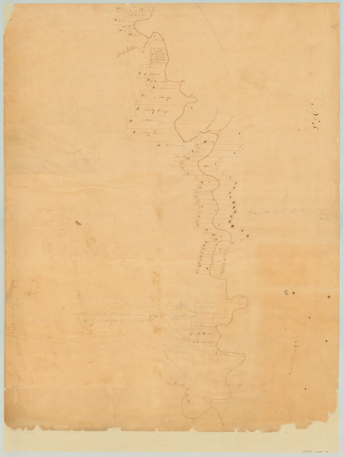
McCulloch County Rolled Sketch 8

Print $40.00
- Digital $50.00
McCulloch County Rolled Sketch 8
1982
Size: 51.3 x 31.4 inches
10292
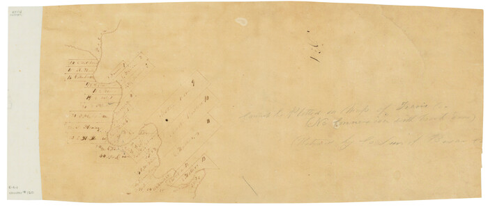
[Surveys along the Colorado River]
Print $2.00
- Digital $50.00
[Surveys along the Colorado River]
1841
Size: 12.2 x 8.3 inches
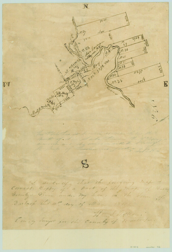
112
[Surveys in the Travis District along the Colorado River]
Print $2.00
- Digital $50.00
[Surveys in the Travis District along the Colorado River]
1840
Size: 8.9 x 6.3 inches
117
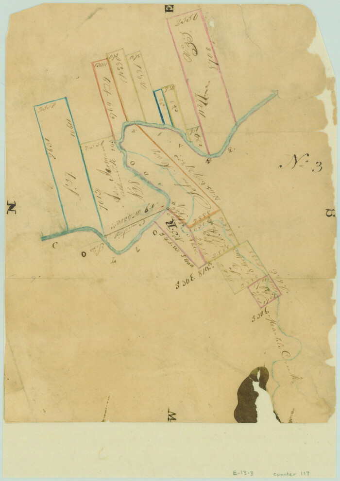
[Surveys along the Colorado River]
Print $20.00
- Digital $50.00
[Surveys along the Colorado River]
1840
Size: 23.8 x 17.9 inches
119
[Surveys in the Travis District along the Colorado River]
Print $3.00
- Digital $50.00
[Surveys in the Travis District along the Colorado River]
1841
Size: 7.0 x 16.5 inches
120
San Saba County Sketch File 10

Print $20.00
- Digital $50.00
San Saba County Sketch File 10
1883
Size: 20.4 x 16.5 inches
12290
San Saba County Sketch File 13

Print $20.00
- Digital $50.00
San Saba County Sketch File 13
1890
Size: 20.9 x 19.2 inches
12291
San Saba County Sketch File 13A

Print $20.00
- Digital $50.00
San Saba County Sketch File 13A
1891
Size: 25.2 x 17.6 inches
12292
San Saba County Sketch File 14

Print $20.00
- Digital $50.00
San Saba County Sketch File 14
1891
Size: 25.5 x 33.3 inches
12293
San Saba County Sketch File 16

Print $20.00
- Digital $50.00
San Saba County Sketch File 16
1902
Size: 16.9 x 18.8 inches
12294
Map of San Saba County

Print $20.00
- Digital $50.00
Map of San Saba County
1887
Size: 41.1 x 40.9 inches
16809
Map of Fisher and Miller's Colony made from the records in the Office of the District Surveyor of Bexar comprising also all the recent surveys

Print $20.00
- Digital $50.00
Map of Fisher and Miller's Colony made from the records in the Office of the District Surveyor of Bexar comprising also all the recent surveys
1855
Size: 23.7 x 35.2 inches
1971
Map of a part of Fisher and Miller's Colony - Harvey's District

Print $20.00
- Digital $50.00
Map of a part of Fisher and Miller's Colony - Harvey's District
1856
Size: 15.2 x 19.8 inches
1972
Llano County Sketch File 1

Print $24.00
- Digital $50.00
Llano County Sketch File 1
Size: 8.9 x 7.7 inches
30345
Llano County Sketch File 4

Print $6.00
- Digital $50.00
Llano County Sketch File 4
1869
Size: 12.4 x 8.0 inches
30353
Llano County Sketch File 14

Print $22.00
- Digital $50.00
Llano County Sketch File 14
Size: 8.0 x 12.7 inches
30389
Mason County Sketch File 13

Print $4.00
- Digital $50.00
Mason County Sketch File 13
Size: 7.3 x 6.2 inches
30701
McCulloch County Sketch File 5

Print $11.00
- Digital $50.00
McCulloch County Sketch File 5
1899
Size: 17.5 x 9.2 inches
31177
McCulloch County Sketch File 14

Print $8.00
- Digital $50.00
McCulloch County Sketch File 14
1990
Size: 11.2 x 8.7 inches
31203
San Saba County Sketch File 1

Print $46.00
- Digital $50.00
San Saba County Sketch File 1
1854
Size: 9.1 x 7.8 inches
36400
San Saba County Sketch File 2

Print $6.00
- Digital $50.00
San Saba County Sketch File 2
1854
Size: 4.8 x 7.4 inches
36405
San Saba County Sketch File 3

Print $4.00
- Digital $50.00
San Saba County Sketch File 3
1848
Size: 12.5 x 7.9 inches
36408
San Saba County Sketch File 4a

Print $4.00
- Digital $50.00
San Saba County Sketch File 4a
1854
Size: 9.6 x 8.5 inches
36410
San Saba County Sketch File 5

Print $4.00
- Digital $50.00
San Saba County Sketch File 5
Size: 12.8 x 8.0 inches
36412
San Saba County Sketch File 6

Print $6.00
- Digital $50.00
San Saba County Sketch File 6
1881
Size: 10.9 x 8.4 inches
36414
San Saba County Sketch File 7

Print $22.00
- Digital $50.00
San Saba County Sketch File 7
1883
Size: 8.6 x 7.8 inches
36417
San Saba County Sketch File 7a

Print $6.00
- Digital $50.00
San Saba County Sketch File 7a
1883
Size: 16.4 x 10.5 inches
36428
San Saba County Sketch File 8

Print $6.00
- Digital $50.00
San Saba County Sketch File 8
Size: 6.6 x 7.9 inches
36430
San Saba County Sketch File 9

Print $22.00
- Digital $50.00
San Saba County Sketch File 9
1883
Size: 12.3 x 13.7 inches
36433
McCulloch County Rolled Sketch 8
Print $40.00
- Digital $50.00
McCulloch County Rolled Sketch 8
1982
-
Size
51.3 x 31.4 inches
-
Map/Doc
10292
-
Creation Date
1982
[Surveys along the Colorado River]
Print $2.00
- Digital $50.00
[Surveys along the Colorado River]
1841
-
Size
12.2 x 8.3 inches
-
Map/Doc
112
-
Creation Date
1841
[Surveys in the Travis District along the Colorado River]
Print $2.00
- Digital $50.00
[Surveys in the Travis District along the Colorado River]
1840
-
Size
8.9 x 6.3 inches
-
Map/Doc
117
-
Creation Date
1840
[Surveys along the Colorado River]
Print $20.00
- Digital $50.00
[Surveys along the Colorado River]
1840
-
Size
23.8 x 17.9 inches
-
Map/Doc
119
-
Creation Date
1840
[Surveys in the Travis District along the Colorado River]
Print $3.00
- Digital $50.00
[Surveys in the Travis District along the Colorado River]
1841
-
Size
7.0 x 16.5 inches
-
Map/Doc
120
-
Creation Date
1841
San Saba County Sketch File 10
Print $20.00
- Digital $50.00
San Saba County Sketch File 10
1883
-
Size
20.4 x 16.5 inches
-
Map/Doc
12290
-
Creation Date
1883
San Saba County Sketch File 13
Print $20.00
- Digital $50.00
San Saba County Sketch File 13
1890
-
Size
20.9 x 19.2 inches
-
Map/Doc
12291
-
Creation Date
1890
San Saba County Sketch File 13A
Print $20.00
- Digital $50.00
San Saba County Sketch File 13A
1891
-
Size
25.2 x 17.6 inches
-
Map/Doc
12292
-
Creation Date
1891
San Saba County Sketch File 14
Print $20.00
- Digital $50.00
San Saba County Sketch File 14
1891
-
Size
25.5 x 33.3 inches
-
Map/Doc
12293
-
Creation Date
1891
San Saba County Sketch File 16
Print $20.00
- Digital $50.00
San Saba County Sketch File 16
1902
-
Size
16.9 x 18.8 inches
-
Map/Doc
12294
-
Creation Date
1902
Map of San Saba County
Print $20.00
- Digital $50.00
Map of San Saba County
1887
-
Size
41.1 x 40.9 inches
-
Map/Doc
16809
-
Creation Date
1887
San Saba Co.
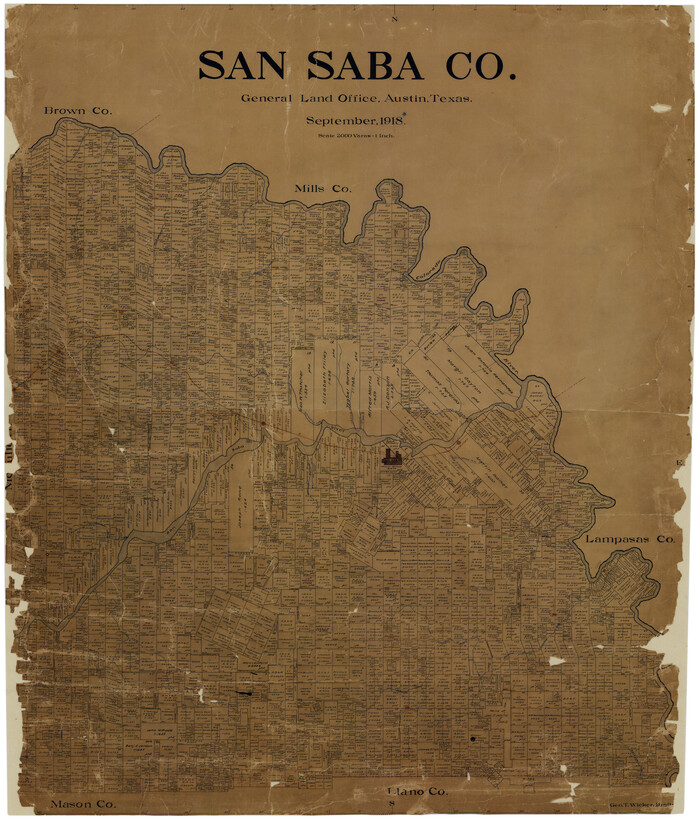
Print $20.00
- Digital $50.00
San Saba Co.
1918
-
Size
46.0 x 39.3 inches
-
Map/Doc
16810
-
Creation Date
1918
Map of Fisher and Miller's Colony made from the records in the Office of the District Surveyor of Bexar comprising also all the recent surveys
Print $20.00
- Digital $50.00
Map of Fisher and Miller's Colony made from the records in the Office of the District Surveyor of Bexar comprising also all the recent surveys
1855
-
Size
23.7 x 35.2 inches
-
Map/Doc
1971
-
Creation Date
1855
Map of a part of Fisher and Miller's Colony - Harvey's District
Print $20.00
- Digital $50.00
Map of a part of Fisher and Miller's Colony - Harvey's District
1856
-
Size
15.2 x 19.8 inches
-
Map/Doc
1972
-
Creation Date
1856
Llano County Sketch File 1
Print $24.00
- Digital $50.00
Llano County Sketch File 1
-
Size
8.9 x 7.7 inches
-
Map/Doc
30345
Llano County Sketch File 4
Print $6.00
- Digital $50.00
Llano County Sketch File 4
1869
-
Size
12.4 x 8.0 inches
-
Map/Doc
30353
-
Creation Date
1869
Llano County Sketch File 14
Print $22.00
- Digital $50.00
Llano County Sketch File 14
-
Size
8.0 x 12.7 inches
-
Map/Doc
30389
Mason County Sketch File 13
Print $4.00
- Digital $50.00
Mason County Sketch File 13
-
Size
7.3 x 6.2 inches
-
Map/Doc
30701
McCulloch County Sketch File 5
Print $11.00
- Digital $50.00
McCulloch County Sketch File 5
1899
-
Size
17.5 x 9.2 inches
-
Map/Doc
31177
-
Creation Date
1899
McCulloch County Sketch File 14
Print $8.00
- Digital $50.00
McCulloch County Sketch File 14
1990
-
Size
11.2 x 8.7 inches
-
Map/Doc
31203
-
Creation Date
1990
San Saba County Sketch File 1
Print $46.00
- Digital $50.00
San Saba County Sketch File 1
1854
-
Size
9.1 x 7.8 inches
-
Map/Doc
36400
-
Creation Date
1854
San Saba County Sketch File 2
Print $6.00
- Digital $50.00
San Saba County Sketch File 2
1854
-
Size
4.8 x 7.4 inches
-
Map/Doc
36405
-
Creation Date
1854
San Saba County Sketch File 3
Print $4.00
- Digital $50.00
San Saba County Sketch File 3
1848
-
Size
12.5 x 7.9 inches
-
Map/Doc
36408
-
Creation Date
1848
San Saba County Sketch File 4a
Print $4.00
- Digital $50.00
San Saba County Sketch File 4a
1854
-
Size
9.6 x 8.5 inches
-
Map/Doc
36410
-
Creation Date
1854
San Saba County Sketch File 5
Print $4.00
- Digital $50.00
San Saba County Sketch File 5
-
Size
12.8 x 8.0 inches
-
Map/Doc
36412
San Saba County Sketch File 6
Print $6.00
- Digital $50.00
San Saba County Sketch File 6
1881
-
Size
10.9 x 8.4 inches
-
Map/Doc
36414
-
Creation Date
1881
San Saba County Sketch File 7
Print $22.00
- Digital $50.00
San Saba County Sketch File 7
1883
-
Size
8.6 x 7.8 inches
-
Map/Doc
36417
-
Creation Date
1883
San Saba County Sketch File 7a
Print $6.00
- Digital $50.00
San Saba County Sketch File 7a
1883
-
Size
16.4 x 10.5 inches
-
Map/Doc
36428
-
Creation Date
1883
San Saba County Sketch File 8
Print $6.00
- Digital $50.00
San Saba County Sketch File 8
-
Size
6.6 x 7.9 inches
-
Map/Doc
36430
San Saba County Sketch File 9
Print $22.00
- Digital $50.00
San Saba County Sketch File 9
1883
-
Size
12.3 x 13.7 inches
-
Map/Doc
36433
-
Creation Date
1883