G. C. & S. F. Ry., San Saba Branch, Texas, Right of Way Map, Hall to Brady

Print $20.00
- Digital $50.00
G. C. & S. F. Ry., San Saba Branch, Texas, Right of Way Map, Hall to Brady
1916
Size: 36.9 x 34.0 inches
61419
General Highway Map, San Saba County, Texas

Print $20.00
General Highway Map, San Saba County, Texas
1940
Size: 18.3 x 24.8 inches
79238
General Highway Map, San Saba County, Texas

Print $20.00
General Highway Map, San Saba County, Texas
1961
Size: 18.3 x 24.5 inches
79648
Llano County Sketch File 1

Print $24.00
- Digital $50.00
Llano County Sketch File 1
Size: 8.9 x 7.7 inches
30345
Llano County Sketch File 14

Print $22.00
- Digital $50.00
Llano County Sketch File 14
Size: 8.0 x 12.7 inches
30389
Llano County Sketch File 4

Print $6.00
- Digital $50.00
Llano County Sketch File 4
1869
Size: 12.4 x 8.0 inches
30353
Map of Fisher & Miller's Colony made from the records in the office of the District Surveyor of Bexar comprising also all the recent surveys

Print $20.00
- Digital $50.00
Map of Fisher & Miller's Colony made from the records in the office of the District Surveyor of Bexar comprising also all the recent surveys
1855
Size: 22.6 x 36.2 inches
633
Map of Fisher and Miller's Colony made from the records in the Office of the District Surveyor of Bexar comprising also all the recent surveys

Print $20.00
- Digital $50.00
Map of Fisher and Miller's Colony made from the records in the Office of the District Surveyor of Bexar comprising also all the recent surveys
1855
Size: 23.7 x 35.2 inches
1971
Map of Fisher and Miller's Colony made from the records in the Office of the District Surveyor of Bexar comprising also all the recent surveys

Print $20.00
- Digital $50.00
Map of Fisher and Miller's Colony made from the records in the Office of the District Surveyor of Bexar comprising also all the recent surveys
1855
Size: 27.2 x 39.6 inches
82026
Map of San Saba County

Print $20.00
- Digital $50.00
Map of San Saba County
1887
Size: 41.1 x 40.9 inches
16809
Map of San Saba County

Print $20.00
- Digital $50.00
Map of San Saba County
1858
Size: 21.6 x 23.5 inches
4019
Map of San Saba County

Print $20.00
- Digital $50.00
Map of San Saba County
1887
Size: 41.7 x 41.7 inches
63020
Map of a part of Fisher and Miller's Colony - Harvey's District

Print $20.00
- Digital $50.00
Map of a part of Fisher and Miller's Colony - Harvey's District
1856
Size: 15.2 x 19.8 inches
1972
Map of a part of Fisher and Miller's Colony - Harvey's District

Print $20.00
- Digital $50.00
Map of a part of Fisher and Miller's Colony - Harvey's District
1856
Size: 19.0 x 24.7 inches
4657
Map of a part of Fisher and Miller's Colony - Harvey's District

Print $20.00
- Digital $50.00
Map of a part of Fisher and Miller's Colony - Harvey's District
1856
Size: 18.6 x 24.5 inches
4658
Mason County Sketch File 13

Print $4.00
- Digital $50.00
Mason County Sketch File 13
Size: 7.3 x 6.2 inches
30701
McCulloch County Rolled Sketch 8

Print $40.00
- Digital $50.00
McCulloch County Rolled Sketch 8
1982
Size: 51.3 x 31.4 inches
10292
McCulloch County Sketch File 14

Print $8.00
- Digital $50.00
McCulloch County Sketch File 14
1990
Size: 11.2 x 8.7 inches
31203
McCulloch County Sketch File 5

Print $11.00
- Digital $50.00
McCulloch County Sketch File 5
1899
Size: 17.5 x 9.2 inches
31177
McCulloch County Working Sketch 11

Print $20.00
- Digital $50.00
McCulloch County Working Sketch 11
1983
Size: 35.1 x 43.3 inches
70686
G. C. & S. F. Ry., San Saba Branch, Texas, Right of Way Map, Hall to Brady
Print $20.00
- Digital $50.00
G. C. & S. F. Ry., San Saba Branch, Texas, Right of Way Map, Hall to Brady
1916
-
Size
36.9 x 34.0 inches
-
Map/Doc
61419
-
Creation Date
1916
General Highway Map, San Saba County, Texas
Print $20.00
General Highway Map, San Saba County, Texas
1940
-
Size
18.3 x 24.8 inches
-
Map/Doc
79238
-
Creation Date
1940
General Highway Map, San Saba County, Texas
Print $20.00
General Highway Map, San Saba County, Texas
1961
-
Size
18.3 x 24.5 inches
-
Map/Doc
79648
-
Creation Date
1961
Llano County Sketch File 1
Print $24.00
- Digital $50.00
Llano County Sketch File 1
-
Size
8.9 x 7.7 inches
-
Map/Doc
30345
Llano County Sketch File 14
Print $22.00
- Digital $50.00
Llano County Sketch File 14
-
Size
8.0 x 12.7 inches
-
Map/Doc
30389
Llano County Sketch File 4
Print $6.00
- Digital $50.00
Llano County Sketch File 4
1869
-
Size
12.4 x 8.0 inches
-
Map/Doc
30353
-
Creation Date
1869
Map of Fisher & Miller's Colony made from the records in the office of the District Surveyor of Bexar comprising also all the recent surveys
Print $20.00
- Digital $50.00
Map of Fisher & Miller's Colony made from the records in the office of the District Surveyor of Bexar comprising also all the recent surveys
1855
-
Size
22.6 x 36.2 inches
-
Map/Doc
633
-
Creation Date
1855
Map of Fisher and Miller's Colony made from the records in the Office of the District Surveyor of Bexar comprising also all the recent surveys
Print $20.00
- Digital $50.00
Map of Fisher and Miller's Colony made from the records in the Office of the District Surveyor of Bexar comprising also all the recent surveys
1855
-
Size
23.7 x 35.2 inches
-
Map/Doc
1971
-
Creation Date
1855
Map of Fisher and Miller's Colony made from the records in the Office of the District Surveyor of Bexar comprising also all the recent surveys
Print $20.00
- Digital $50.00
Map of Fisher and Miller's Colony made from the records in the Office of the District Surveyor of Bexar comprising also all the recent surveys
1855
-
Size
27.2 x 39.6 inches
-
Map/Doc
82026
-
Creation Date
1855
Map of San Saba County
Print $20.00
- Digital $50.00
Map of San Saba County
1887
-
Size
41.1 x 40.9 inches
-
Map/Doc
16809
-
Creation Date
1887
Map of San Saba County
Print $20.00
- Digital $50.00
Map of San Saba County
1858
-
Size
21.6 x 23.5 inches
-
Map/Doc
4019
-
Creation Date
1858
Map of San Saba County
Print $20.00
- Digital $50.00
Map of San Saba County
1887
-
Size
41.7 x 41.7 inches
-
Map/Doc
63020
-
Creation Date
1887
Map of a part of Fisher and Miller's Colony - Harvey's District
Print $20.00
- Digital $50.00
Map of a part of Fisher and Miller's Colony - Harvey's District
1856
-
Size
15.2 x 19.8 inches
-
Map/Doc
1972
-
Creation Date
1856
Map of a part of Fisher and Miller's Colony - Harvey's District
Print $20.00
- Digital $50.00
Map of a part of Fisher and Miller's Colony - Harvey's District
1856
-
Size
19.0 x 24.7 inches
-
Map/Doc
4657
-
Creation Date
1856
Map of a part of Fisher and Miller's Colony - Harvey's District
Print $20.00
- Digital $50.00
Map of a part of Fisher and Miller's Colony - Harvey's District
1856
-
Size
18.6 x 24.5 inches
-
Map/Doc
4658
-
Creation Date
1856
Mason County Sketch File 13
Print $4.00
- Digital $50.00
Mason County Sketch File 13
-
Size
7.3 x 6.2 inches
-
Map/Doc
30701
McCulloch County Rolled Sketch 8
Print $40.00
- Digital $50.00
McCulloch County Rolled Sketch 8
1982
-
Size
51.3 x 31.4 inches
-
Map/Doc
10292
-
Creation Date
1982
McCulloch County Sketch File 14
Print $8.00
- Digital $50.00
McCulloch County Sketch File 14
1990
-
Size
11.2 x 8.7 inches
-
Map/Doc
31203
-
Creation Date
1990
McCulloch County Sketch File 5
Print $11.00
- Digital $50.00
McCulloch County Sketch File 5
1899
-
Size
17.5 x 9.2 inches
-
Map/Doc
31177
-
Creation Date
1899
McCulloch County Working Sketch 11
Print $20.00
- Digital $50.00
McCulloch County Working Sketch 11
1983
-
Size
35.1 x 43.3 inches
-
Map/Doc
70686
-
Creation Date
1983
San Saba Co.
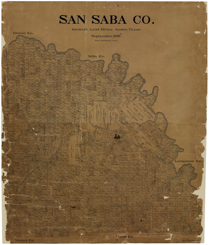
Print $20.00
- Digital $50.00
San Saba Co.
1918
-
Size
46.0 x 39.3 inches
-
Map/Doc
16810
-
Creation Date
1918
San Saba Co.

Print $20.00
- Digital $50.00
San Saba Co.
1918
-
Size
47.4 x 41.6 inches
-
Map/Doc
63021
-
Creation Date
1918
San Saba Co[unty]
![88994, San Saba Co[unty], Library of Congress](https://historictexasmaps.com/wmedia_w700/maps/88994-1.tif.jpg)
Print $20.00
San Saba Co[unty]
1879
-
Size
21.0 x 23.4 inches
-
Map/Doc
88994
-
Creation Date
1879
San Saba County

Print $20.00
- Digital $50.00
San Saba County
1877
-
Size
20.2 x 22.0 inches
-
Map/Doc
4020
-
Creation Date
1877
San Saba County

Print $20.00
- Digital $50.00
San Saba County
1918
-
Size
46.8 x 41.2 inches
-
Map/Doc
63022
-
Creation Date
1918
San Saba County

Print $40.00
- Digital $50.00
San Saba County
1918
-
Size
49.0 x 43.0 inches
-
Map/Doc
63023
-
Creation Date
1918
San Saba County

Print $20.00
- Digital $50.00
San Saba County
1987
-
Size
46.3 x 42.5 inches
-
Map/Doc
73284
-
Creation Date
1987
San Saba County

Print $20.00
- Digital $50.00
San Saba County
1987
-
Size
41.3 x 42.2 inches
-
Map/Doc
77417
-
Creation Date
1987
San Saba County

Print $20.00
- Digital $50.00
San Saba County
1918
-
Size
23.6 x 18.4 inches
-
Map/Doc
78397
-
Creation Date
1918
San Saba County

Print $20.00
- Digital $50.00
San Saba County
1987
-
Size
43.5 x 47.3 inches
-
Map/Doc
95635
-
Creation Date
1987