Geological Map of the route explored by Lieut. A.W. Whipple, Corps of Topl. Engrs. near the Parallel of 35° North Latitude from the Mississippi River to the Pacific Ocean 1853-1854
1854
                                                                        
                                Geological Map of the route explored by Capt. Jno. Pope, Corps of Topl. Engrs. near the 32nd Parallel of North Latitude from the Red River to the Rio Grande
1854
                                                                        
                                County and Railroad Map of Texas
1871
                                                                        
                                Map of the Houston & Texas Central Railway and connections
1871
                                                                        
                                County and Railroad Map of Texas
1875
                                                                        
                                Revised map of the State of Texas
1876
                                                                        
                                Red River County, Texas
                                                                        
                                A Geographically Correct Map of the State of Texas
1878
                                                                        
                                Map of the Cincinnati, New Orleans and Texas Pacific Ry and connections
1889
                                                                        
                                Map of the Southern Pacific Company and connections
1890
                                                                        
                                A New and Correct County Map of the State of Texas
1891
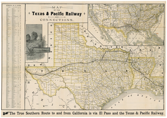
                                                                        
                                Map of the Texas & Pacific Railway and connections
1892
                                                                        
                                Correct Map of the Railway & Steamship Lines operated by the Southern Pacific Company
1893
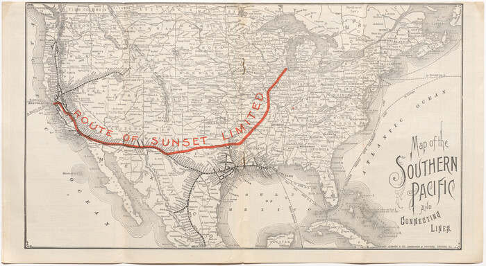
                                                                        
                                Map of the Southern Pacific and connecting lines
1897
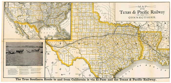
                                                                        
                                Map of the Texas & Pacific Railway and connections
1898
                                                                        
                                Map of the Texas & Pacific Railway and connections
1899
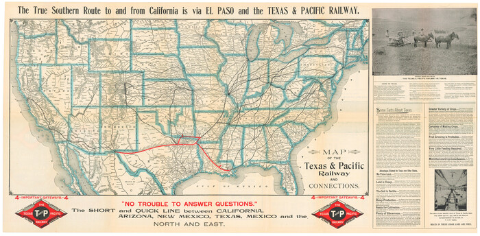
                                                                        
                                Map of the Texas & Pacific Railway and connections
1899
                                                                        
                                Map of the Texas & Pacific Railway and connections
1903
                                                                        
                                Correct Map of Texas
1904
                                                                        
                                Map of the Texas & Pacific Railway "Gould System" Lines and connections
1906
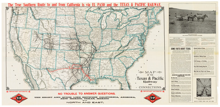
                                                                        
                                Map of the Texas & Pacific Railway and connections
1911
                                                                        
                                Geographically Correct Map of United States showing the Union Pacific System - Union Pacific R.R. Co., Oregon Short Line R.R. Co., Oregon-Washington R.R. & Nav. Co., Los Angeles & Salt Lake R.R. Co., St. Joseph & Grand Island Ry. Co. and connections
1922
                                                                        
                                Map of the Texas and Pacific Railway and connections
1925
                                                                        
                                Map of the Texas and Pacific Railway and connections
1927
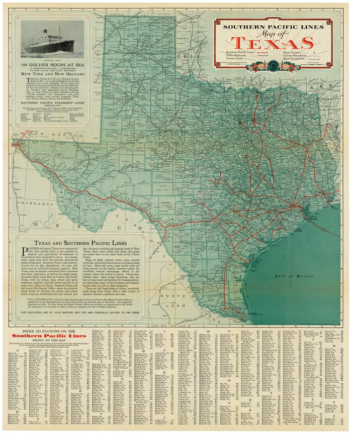
                                                                        
                                Southern Pacific Lines Map of Texas
1928
                                                                        
                                Correct Map of Texas
1873
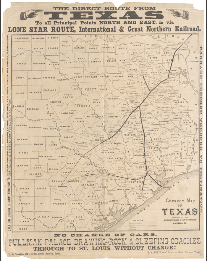
                                                                        
                                Correct Map of Texas
1873
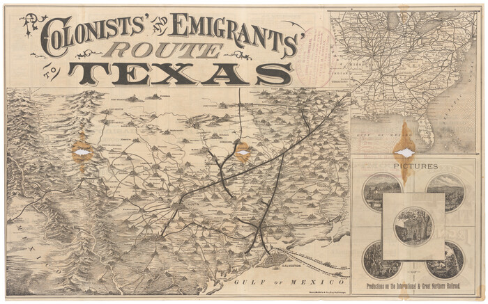
                                                                        
                                Colonists' and Emigrants' Route to Texas
1878
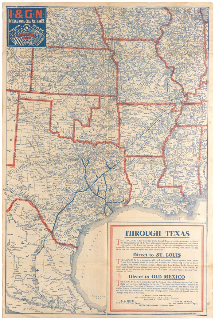
                                                                        
                                I. & G. N. - International and Great Northern R.R. - International Route - Galveston, Ft. Worth, Waco, Houston, Austin, Laredo, San Antonio
1905
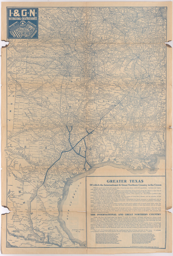
                                                                        
                                I. & G. N. - International and Great Northern R.R. - International Route - Galveston, Ft. Worth, Waco, Houston, Austin, Laredo, San Antonio
1910
                                                
                    Geological Map of the route explored by Lieut. A.W. Whipple, Corps of Topl. Engrs. near the Parallel of 35° North Latitude from the Mississippi River to the Pacific Ocean 1853-1854
1854
- 
                                Size
11.2 x 39.3 inches
 - 
                            Map/Doc
95750
 - 
                                Creation Date
1854
 
                                                
                    Geological Map of the route explored by Capt. Jno. Pope, Corps of Topl. Engrs. near the 32nd Parallel of North Latitude from the Red River to the Rio Grande
1854
- 
                                Size
11.1 x 24.8 inches
 - 
                            Map/Doc
95751
 - 
                                Creation Date
1854
 
                                                
                    County and Railroad Map of Texas
1871
- 
                                Size
16.7 x 15.5 inches
 - 
                            Map/Doc
95752
 - 
                                Creation Date
1871
 
                                                
                    Map of the Houston & Texas Central Railway and connections
1871
- 
                                Size
16.6 x 15.4 inches
 - 
                            Map/Doc
95753
 - 
                                Creation Date
1871
 
                                                
                    County and Railroad Map of Texas
1875
- 
                                Size
17.4 x 16.0 inches
 - 
                            Map/Doc
95754
 - 
                                Creation Date
1875
 
                                                
                    Revised map of the State of Texas
1876
- 
                                Size
19.6 x 19.7 inches
 - 
                            Map/Doc
95755
 - 
                                Creation Date
1876
 
                                                
                    Red River County, Texas
- 
                                Size
22.2 x 17.2 inches
 - 
                            Map/Doc
95756
 
                                                
                    A Geographically Correct Map of the State of Texas
1878
- 
                                Size
19.5 x 21.0 inches
 - 
                            Map/Doc
95757
 - 
                                Creation Date
1878
 
                                                
                    Map of the Cincinnati, New Orleans and Texas Pacific Ry and connections
1889
- 
                                Size
7.7 x 12.2 inches
 - 
                            Map/Doc
95758
 - 
                                Creation Date
1889
 
                                                
                    Map of the Southern Pacific Company and connections
1890
- 
                                Size
9.6 x 23.8 inches
 - 
                            Map/Doc
95759
 - 
                                Creation Date
1890
 
                                                
                    A New and Correct County Map of the State of Texas
1891
- 
                                Size
22.4 x 27.3 inches
 - 
                            Map/Doc
95760
 - 
                                Creation Date
1891
 
                                                
                    Map of the Texas & Pacific Railway and connections
1892
- 
                                Size
22.5 x 31.9 inches
 - 
                            Map/Doc
95761
 - 
                                Creation Date
1892
 
                                                
                    Correct Map of the Railway & Steamship Lines operated by the Southern Pacific Company
1893
- 
                                Size
16.7 x 40.1 inches
 - 
                            Map/Doc
95762
 - 
                                Creation Date
1893
 
                                                
                    Map of the Southern Pacific and connecting lines
1897
- 
                                Size
8.7 x 15.9 inches
 - 
                            Map/Doc
95763
 - 
                                Creation Date
1897
 
                                                
                    Map of the Texas & Pacific Railway and connections
1898
- 
                                Size
17.8 x 36.4 inches
 - 
                            Map/Doc
95764
 - 
                                Creation Date
1898
 
                                                
                    Map of the Texas & Pacific Railway and connections
1899
- 
                                Size
17.9 x 36.6 inches
 - 
                            Map/Doc
95765
 - 
                                Creation Date
1899
 
                                                
                    Map of the Texas & Pacific Railway and connections
1899
- 
                                Size
17.8 x 36.3 inches
 - 
                            Map/Doc
95766
 - 
                                Creation Date
1899
 
                                                
                    Map of the Texas & Pacific Railway and connections
1903
- 
                                Size
17.9 x 36.6 inches
 - 
                            Map/Doc
95767
 - 
                                Creation Date
1903
 
                                                
                    Correct Map of Texas
1904
- 
                                Size
17.9 x 22.3 inches
 - 
                            Map/Doc
95768
 - 
                                Creation Date
1904
 
                                                
                    Map of the Texas & Pacific Railway "Gould System" Lines and connections
1906
- 
                                Size
17.7 x 36.6 inches
 - 
                            Map/Doc
95769
 - 
                                Creation Date
1906
 
                                                
                    Map of the Texas & Pacific Railway and connections
1911
- 
                                Size
18.1 x 37.1 inches
 - 
                            Map/Doc
95770
 - 
                                Creation Date
1911
 
                                                
                    Geographically Correct Map of United States showing the Union Pacific System - Union Pacific R.R. Co., Oregon Short Line R.R. Co., Oregon-Washington R.R. & Nav. Co., Los Angeles & Salt Lake R.R. Co., St. Joseph & Grand Island Ry. Co. and connections
1922
- 
                                Size
18.2 x 32.2 inches
 - 
                            Map/Doc
95771
 - 
                                Creation Date
1922
 
                                                
                    Map of the Texas and Pacific Railway and connections
1925
- 
                                Size
8.2 x 9.3 inches
 - 
                            Map/Doc
95772
 - 
                                Creation Date
1925
 
                                                
                    Map of the Texas and Pacific Railway and connections
1927
- 
                                Size
8.2 x 9.4 inches
 - 
                            Map/Doc
95773
 - 
                                Creation Date
1927
 
                                                
                    Southern Pacific Lines Map of Texas
1928
- 
                                Size
27.4 x 22.4 inches
 - 
                            Map/Doc
95774
 - 
                                Creation Date
1928
 
                                                
                    Correct Map of Texas
1873
- 
                                Size
21.5 x 16.9 inches
 - 
                            Map/Doc
95775
 - 
                                Creation Date
1873
 
                                                
                    Correct Map of Texas
1873
- 
                                Size
21.3 x 16.9 inches
 - 
                            Map/Doc
95776
 - 
                                Creation Date
1873
 
                                                
                    Colonists' and Emigrants' Route to Texas
1878
- 
                                Size
14.8 x 23.7 inches
 - 
                            Map/Doc
95777
 - 
                                Creation Date
1878
 
                                                
                    I. & G. N. - International and Great Northern R.R. - International Route - Galveston, Ft. Worth, Waco, Houston, Austin, Laredo, San Antonio
1905
- 
                                Size
23.5 x 15.8 inches
 - 
                            Map/Doc
95778
 - 
                                Creation Date
1905
 
                                                
                    I. & G. N. - International and Great Northern R.R. - International Route - Galveston, Ft. Worth, Waco, Houston, Austin, Laredo, San Antonio
1910
- 
                                Size
24.0 x 16.2 inches
 - 
                            Map/Doc
95779
 - 
                                Creation Date
1910