2nd Chain to Long Reef, Texas

Print $40.00
- Digital $50.00
2nd Chain to Long Reef, Texas
1860
Size: 30.9 x 52.6 inches
69984
Aransas County Aerial Photograph Index Sheet 1

Print $20.00
- Digital $50.00
Aransas County Aerial Photograph Index Sheet 1
1957
Size: 22.9 x 18.2 inches
83659
Aransas County Aerial Photograph Index Sheet 2

Print $20.00
- Digital $50.00
Aransas County Aerial Photograph Index Sheet 2
1957
Size: 23.0 x 17.9 inches
83660
Aransas County Aerial Photograph Index Sheet 3

Print $20.00
- Digital $50.00
Aransas County Aerial Photograph Index Sheet 3
1957
Size: 22.8 x 18.1 inches
83661
Aransas County Aerial Photograph Index Sheet 4

Print $20.00
- Digital $50.00
Aransas County Aerial Photograph Index Sheet 4
1957
Size: 23.6 x 16.1 inches
83662
Aransas County Boundary File 1

Print $14.00
- Digital $50.00
Aransas County Boundary File 1
Size: 14.2 x 8.6 inches
49774
Aransas County Boundary File 2

Print $3.00
- Digital $50.00
Aransas County Boundary File 2
Size: 12.4 x 10.8 inches
49781
Aransas County Boundary File 3

Print $16.00
- Digital $50.00
Aransas County Boundary File 3
Size: 10.6 x 8.0 inches
49782
Aransas County Boundary File 4

Print $30.00
- Digital $50.00
Aransas County Boundary File 4
Size: 9.2 x 7.8 inches
49790
Aransas County Boundary File 5a

Print $14.00
- Digital $50.00
Aransas County Boundary File 5a
Size: 11.3 x 8.7 inches
49796
Aransas County Boundary File 5b

Print $8.00
- Digital $50.00
Aransas County Boundary File 5b
Size: 14.3 x 8.8 inches
49802
Aransas County Boundary File 6

Print $156.00
- Digital $50.00
Aransas County Boundary File 6
Size: 14.1 x 8.5 inches
49806
Aransas County Boundary File 7

Print $2.00
- Digital $50.00
Aransas County Boundary File 7
Size: 8.8 x 14.2 inches
50042
Aransas County Boundary File 8

Print $135.00
- Digital $50.00
Aransas County Boundary File 8
Size: 33.6 x 74.0 inches
50043
Aransas County NRC Article 33.136 Location Key Sheet

Print $20.00
- Digital $50.00
Aransas County NRC Article 33.136 Location Key Sheet
1975
Size: 27.0 x 23.0 inches
77004
Aransas County NRC Article 33.136 Location Key Sheet

Print $20.00
- Digital $50.00
Aransas County NRC Article 33.136 Location Key Sheet
1979
Size: 27.0 x 23.0 inches
77005
Aransas County NRC Article 33.136 Location Key Sheet

Print $20.00
- Digital $50.00
Aransas County NRC Article 33.136 Location Key Sheet
1979
Size: 27.0 x 23.0 inches
77006
Aransas County NRC Article 33.136 Location Key Sheet

Print $20.00
- Digital $50.00
Aransas County NRC Article 33.136 Location Key Sheet
1970
Size: 27.0 x 23.0 inches
87904
Aransas County NRC Article 33.136 Location Key Sheet

Print $20.00
- Digital $50.00
Aransas County NRC Article 33.136 Location Key Sheet
1979
Size: 27.0 x 23.0 inches
87905
Aransas County NRC Article 33.136 Location Key Sheet

Print $20.00
- Digital $50.00
Aransas County NRC Article 33.136 Location Key Sheet
1971
Size: 27.0 x 23.0 inches
88769
Aransas County NRC Article 33.136 Sketch 1

Print $55.00
- Digital $50.00
Aransas County NRC Article 33.136 Sketch 1
2000
Size: 24.8 x 35.6 inches
61630
Aransas County NRC Article 33.136 Sketch 10

Print $26.00
- Digital $50.00
Aransas County NRC Article 33.136 Sketch 10
Size: 24.2 x 36.0 inches
95016
Aransas County NRC Article 33.136 Sketch 11

Print $54.00
- Digital $50.00
Aransas County NRC Article 33.136 Sketch 11
2012
Size: 36.0 x 48.0 inches
94502
2nd Chain to Long Reef, Texas
Print $40.00
- Digital $50.00
2nd Chain to Long Reef, Texas
1860
-
Size
30.9 x 52.6 inches
-
Map/Doc
69984
-
Creation Date
1860
Aransas Co.

Print $20.00
- Digital $50.00
Aransas Co.
1947
-
Size
37.6 x 37.2 inches
-
Map/Doc
1771
-
Creation Date
1947
Aransas Co.

Print $20.00
- Digital $50.00
Aransas Co.
1896
-
Size
38.9 x 35.9 inches
-
Map/Doc
4869
-
Creation Date
1896
Aransas Co.

Print $20.00
- Digital $50.00
Aransas Co.
1947
-
Size
38.3 x 37.3 inches
-
Map/Doc
73069
-
Creation Date
1947
Aransas Co.

Print $20.00
- Digital $50.00
Aransas Co.
1947
-
Size
37.1 x 35.6 inches
-
Map/Doc
77201
-
Creation Date
1947
Aransas Co.

Print $20.00
- Digital $50.00
Aransas Co.
1947
-
Size
38.6 x 37.4 inches
-
Map/Doc
95418
-
Creation Date
1947
Aransas County

Print $20.00
- Digital $50.00
Aransas County
1871
-
Size
17.2 x 18.3 inches
-
Map/Doc
3235
-
Creation Date
1871
Aransas County
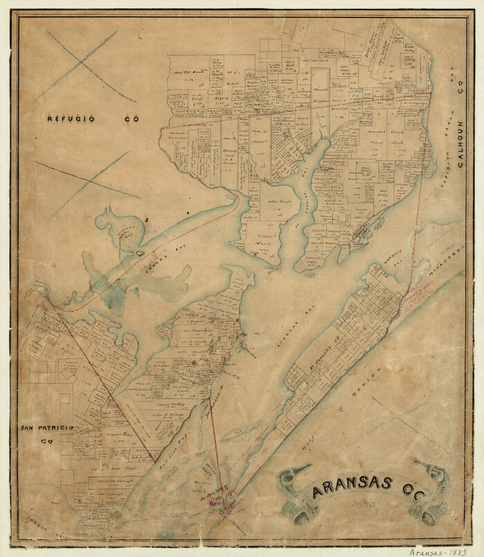
Print $20.00
- Digital $50.00
Aransas County
1883
-
Size
19.9 x 17.1 inches
-
Map/Doc
3236
-
Creation Date
1883
Aransas County Aerial Photograph Index Sheet 1
Print $20.00
- Digital $50.00
Aransas County Aerial Photograph Index Sheet 1
1957
-
Size
22.9 x 18.2 inches
-
Map/Doc
83659
-
Creation Date
1957
Aransas County Aerial Photograph Index Sheet 2
Print $20.00
- Digital $50.00
Aransas County Aerial Photograph Index Sheet 2
1957
-
Size
23.0 x 17.9 inches
-
Map/Doc
83660
-
Creation Date
1957
Aransas County Aerial Photograph Index Sheet 3
Print $20.00
- Digital $50.00
Aransas County Aerial Photograph Index Sheet 3
1957
-
Size
22.8 x 18.1 inches
-
Map/Doc
83661
-
Creation Date
1957
Aransas County Aerial Photograph Index Sheet 4
Print $20.00
- Digital $50.00
Aransas County Aerial Photograph Index Sheet 4
1957
-
Size
23.6 x 16.1 inches
-
Map/Doc
83662
-
Creation Date
1957
Aransas County Boundary File 1
Print $14.00
- Digital $50.00
Aransas County Boundary File 1
-
Size
14.2 x 8.6 inches
-
Map/Doc
49774
Aransas County Boundary File 2
Print $3.00
- Digital $50.00
Aransas County Boundary File 2
-
Size
12.4 x 10.8 inches
-
Map/Doc
49781
Aransas County Boundary File 3
Print $16.00
- Digital $50.00
Aransas County Boundary File 3
-
Size
10.6 x 8.0 inches
-
Map/Doc
49782
Aransas County Boundary File 4
Print $30.00
- Digital $50.00
Aransas County Boundary File 4
-
Size
9.2 x 7.8 inches
-
Map/Doc
49790
Aransas County Boundary File 5a
Print $14.00
- Digital $50.00
Aransas County Boundary File 5a
-
Size
11.3 x 8.7 inches
-
Map/Doc
49796
Aransas County Boundary File 5b
Print $8.00
- Digital $50.00
Aransas County Boundary File 5b
-
Size
14.3 x 8.8 inches
-
Map/Doc
49802
Aransas County Boundary File 6
Print $156.00
- Digital $50.00
Aransas County Boundary File 6
-
Size
14.1 x 8.5 inches
-
Map/Doc
49806
Aransas County Boundary File 7
Print $2.00
- Digital $50.00
Aransas County Boundary File 7
-
Size
8.8 x 14.2 inches
-
Map/Doc
50042
Aransas County Boundary File 8
Print $135.00
- Digital $50.00
Aransas County Boundary File 8
-
Size
33.6 x 74.0 inches
-
Map/Doc
50043
Aransas County NRC Article 33.136 Location Key Sheet
Print $20.00
- Digital $50.00
Aransas County NRC Article 33.136 Location Key Sheet
1975
-
Size
27.0 x 23.0 inches
-
Map/Doc
77004
-
Creation Date
1975
Aransas County NRC Article 33.136 Location Key Sheet
Print $20.00
- Digital $50.00
Aransas County NRC Article 33.136 Location Key Sheet
1979
-
Size
27.0 x 23.0 inches
-
Map/Doc
77005
-
Creation Date
1979
Aransas County NRC Article 33.136 Location Key Sheet
Print $20.00
- Digital $50.00
Aransas County NRC Article 33.136 Location Key Sheet
1979
-
Size
27.0 x 23.0 inches
-
Map/Doc
77006
-
Creation Date
1979
Aransas County NRC Article 33.136 Location Key Sheet
Print $20.00
- Digital $50.00
Aransas County NRC Article 33.136 Location Key Sheet
1970
-
Size
27.0 x 23.0 inches
-
Map/Doc
87904
-
Creation Date
1970
Aransas County NRC Article 33.136 Location Key Sheet
Print $20.00
- Digital $50.00
Aransas County NRC Article 33.136 Location Key Sheet
1979
-
Size
27.0 x 23.0 inches
-
Map/Doc
87905
-
Creation Date
1979
Aransas County NRC Article 33.136 Location Key Sheet
Print $20.00
- Digital $50.00
Aransas County NRC Article 33.136 Location Key Sheet
1971
-
Size
27.0 x 23.0 inches
-
Map/Doc
88769
-
Creation Date
1971
Aransas County NRC Article 33.136 Sketch 1
Print $55.00
- Digital $50.00
Aransas County NRC Article 33.136 Sketch 1
2000
-
Size
24.8 x 35.6 inches
-
Map/Doc
61630
-
Creation Date
2000
Aransas County NRC Article 33.136 Sketch 10
Print $26.00
- Digital $50.00
Aransas County NRC Article 33.136 Sketch 10
-
Size
24.2 x 36.0 inches
-
Map/Doc
95016
Aransas County NRC Article 33.136 Sketch 11
Print $54.00
- Digital $50.00
Aransas County NRC Article 33.136 Sketch 11
2012
-
Size
36.0 x 48.0 inches
-
Map/Doc
94502
-
Creation Date
2012