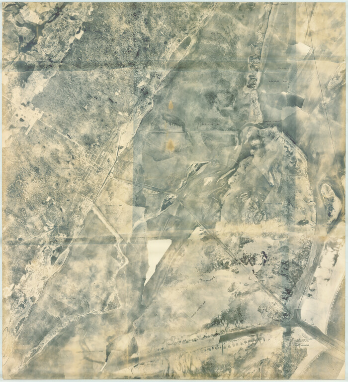
[Wm. Lewis No. 254 and Surrounding Surveys, Aransas County, Texas]
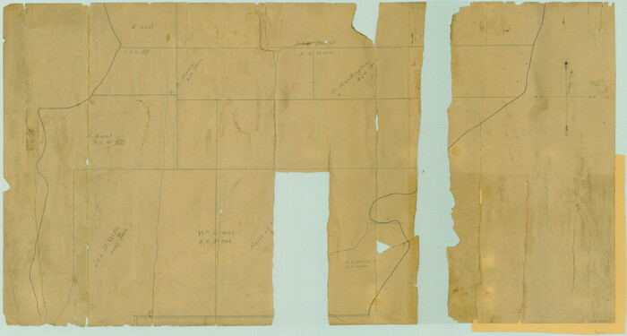
Print $20.00
- Digital $50.00
[Wm. Lewis No. 254 and Surrounding Surveys, Aransas County, Texas]
Size: 18.8 x 35.2 inches
82557
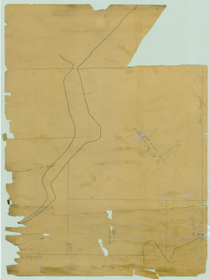
[William Steele Survey near Copano Bay]
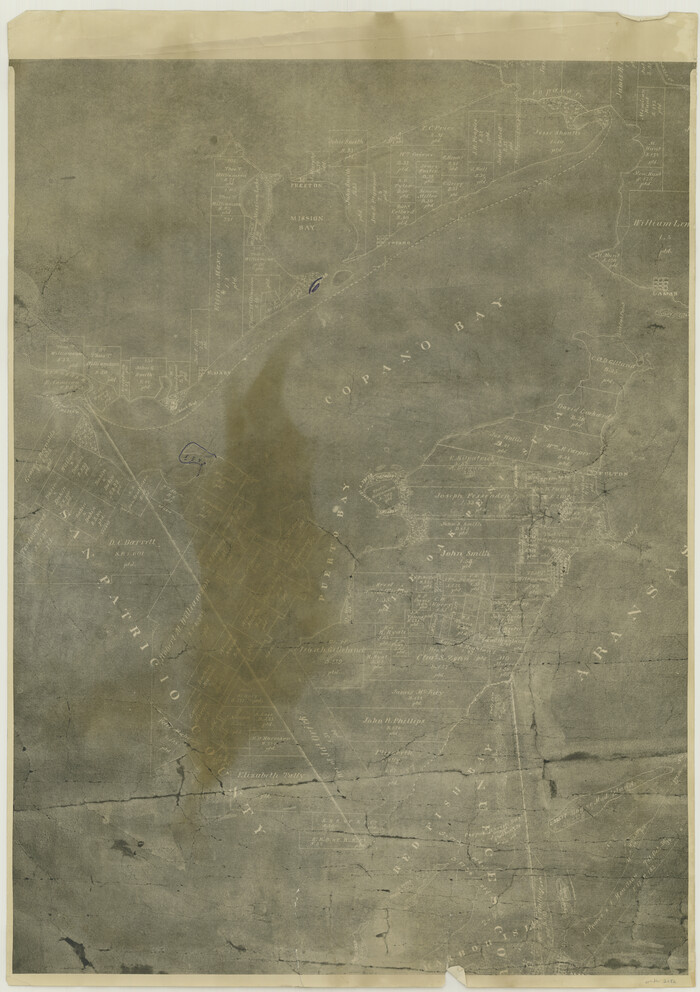
Print $20.00
- Digital $50.00
[William Steele Survey near Copano Bay]
1927
Size: 26.1 x 18.4 inches
2082
[William Steele Survey near Copano Bay]
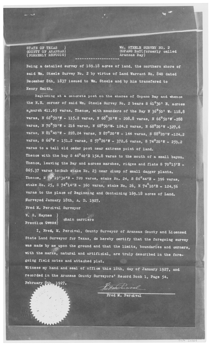
Print $3.00
- Digital $50.00
[William Steele Survey near Copano Bay]
1927
Size: 15.5 x 9.5 inches
60284
[William Steele Survey near Copano Bay]
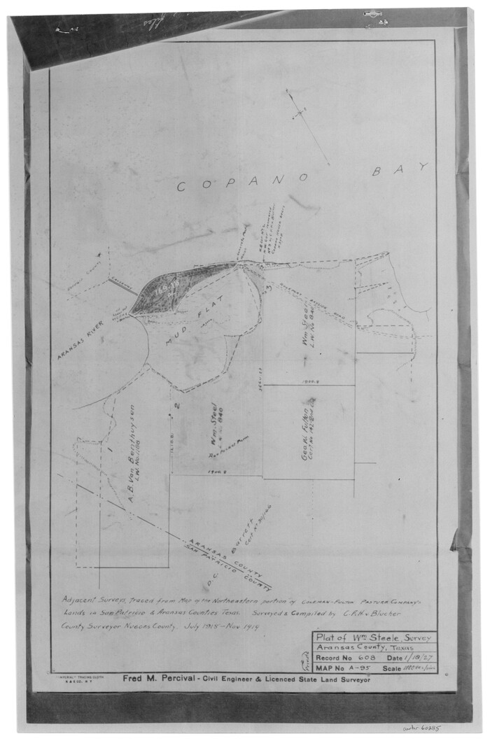
Print $3.00
- Digital $50.00
[William Steele Survey near Copano Bay]
1927
Size: 14.9 x 9.8 inches
60285
[Town Plat of Lamar]
Print $20.00
- Digital $50.00
[Town Plat of Lamar]
Size: 19.0 x 25.0 inches
4462
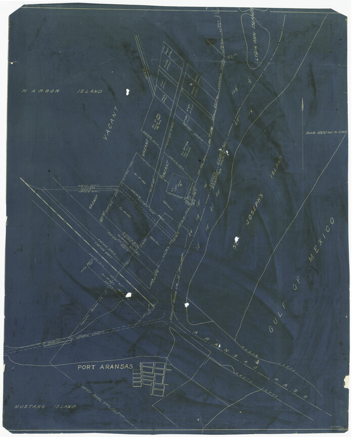
[Sketch of Surveys Near Port Aransas and Aransas Pass, Aransas County, Texas]
Print $20.00
- Digital $50.00
[Sketch of Surveys Near Port Aransas and Aransas Pass, Aransas County, Texas]
Size: 22.8 x 18.5 inches
676
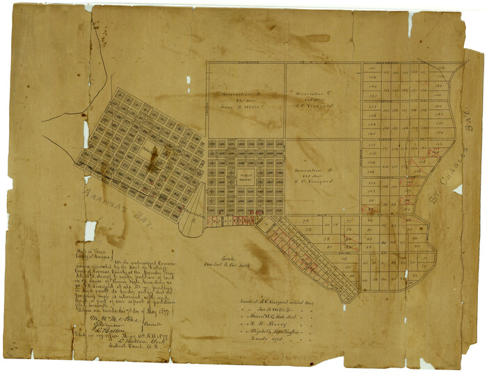
[S. C. Vineyard and Adjacent Surveys, Aransas County, Texas]
Print $20.00
- Digital $50.00
[S. C. Vineyard and Adjacent Surveys, Aransas County, Texas]
Size: 24.7 x 18.6 inches
82558
[Redfish Bay, Aransas Pass, and part of Mustang Island]
Print $40.00
- Digital $50.00
[Redfish Bay, Aransas Pass, and part of Mustang Island]
1930
Size: 51.0 x 46.5 inches
83009
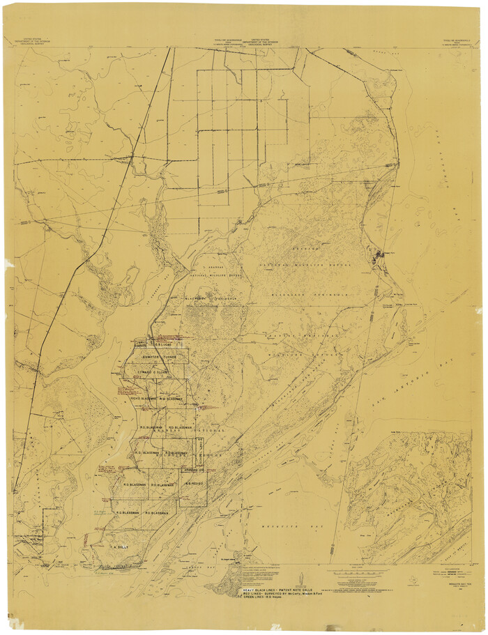
[Aransas Wildlife Refuge]
Print $40.00
- Digital $50.00
[Aransas Wildlife Refuge]
1965
Size: 55.6 x 42.9 inches
2081
[Aransas National Wildlife Refuge]
Print $40.00
- Digital $50.00
[Aransas National Wildlife Refuge]
1952
Size: 55.9 x 43.4 inches
3119
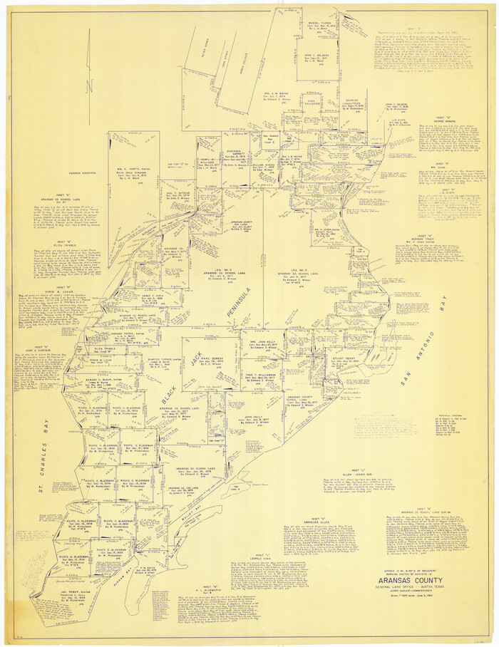
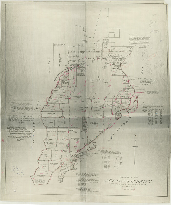
[Aransas County, Texas]
Print $20.00
- Digital $50.00
[Aransas County, Texas]
1928
Size: 37.5 x 31.3 inches
2083
West End of Copano Bay and Town of Saint Marys, Texas

Print $40.00
- Digital $50.00
West End of Copano Bay and Town of Saint Marys, Texas
1861
Size: 54.5 x 32.9 inches
73428
The Coast & Bays of Western Texas

Print $20.00
- Digital $50.00
The Coast & Bays of Western Texas
1857
Size: 18.2 x 23.9 inches
73424
Texas, San Antonio Bay, Panther Point

Print $40.00
- Digital $50.00
Texas, San Antonio Bay, Panther Point
1934
Size: 33.2 x 48.3 inches
69995
Texas, San Antonio Bay, Hynes Bay

Print $40.00
- Digital $50.00
Texas, San Antonio Bay, Hynes Bay
1934
Size: 33.0 x 48.9 inches
69998
Texas, Intracoastal Waterway, Ayres Bay to Aransas Bay

Print $40.00
- Digital $50.00
Texas, Intracoastal Waterway, Ayres Bay to Aransas Bay
1934
Size: 33.2 x 48.5 inches
69997
Texas, Copano Bay, Mission Bay and Fish Point

Print $40.00
- Digital $50.00
Texas, Copano Bay, Mission Bay and Fish Point
1934
Size: 33.3 x 48.9 inches
73433
Texas, Aransas Bay, Copano Bay and St. Charles Bay

Print $40.00
- Digital $50.00
Texas, Aransas Bay, Copano Bay and St. Charles Bay
1934
Size: 34.0 x 48.6 inches
73434
Texas, Aransas Bay, Aransas Pass to Nine Mile Point

Print $40.00
- Digital $50.00
Texas, Aransas Bay, Aransas Pass to Nine Mile Point
1934
Size: 35.2 x 48.4 inches
73431
Texas Intracoastal Waterway, Aransas Bay to Aransas Pass

Print $20.00
- Digital $50.00
Texas Intracoastal Waterway, Aransas Bay to Aransas Pass
1957
Size: 27.5 x 39.1 inches
73436
Texas Intracoastal Waterway, Aransas Bay to Aransas Pass

Print $20.00
- Digital $50.00
Texas Intracoastal Waterway, Aransas Bay to Aransas Pass
1957
Size: 38.9 x 27.6 inches
73437
Texas Intracoastal Waterway, Aransas Bay to Aransas Pass

Print $20.00
- Digital $50.00
Texas Intracoastal Waterway, Aransas Bay to Aransas Pass
1962
Size: 26.8 x 38.7 inches
73438
Texas Intracoastal Waterway, Aransas Bay to Aransas Pass

Print $20.00
- Digital $50.00
Texas Intracoastal Waterway, Aransas Bay to Aransas Pass
1962
Size: 38.7 x 26.8 inches
73439
Texas Intracoastal Waterway - Port O'Connor to San Antonio Bay, Including Pass Cavallo

Print $20.00
- Digital $50.00
Texas Intracoastal Waterway - Port O'Connor to San Antonio Bay, Including Pass Cavallo
1957
Size: 28.1 x 40.0 inches
73372
Texas Intracoastal Waterway - Port O'Connor to San Antonio Bay, Including Pass Cavallo

Print $20.00
- Digital $50.00
Texas Intracoastal Waterway - Port O'Connor to San Antonio Bay, Including Pass Cavallo
1961
Size: 26.5 x 38.7 inches
73373
Texas Gulf Coast, from the Sabine River to the Rio Grande as Subdivided for Mineral Development; Matagorda, Calhoun and Aransas Counties

Print $40.00
- Digital $50.00
Texas Gulf Coast, from the Sabine River to the Rio Grande as Subdivided for Mineral Development; Matagorda, Calhoun and Aransas Counties
1976
Size: 43.0 x 90.9 inches
1939
Texas Gulf Coast, from the Sabine River to the Rio Grande as Subdivided for Mineral Development; Aransas, Nueces, Kleberg, Kenedy, Willacy, and Cameron Counties

Print $40.00
- Digital $50.00
Texas Gulf Coast, from the Sabine River to the Rio Grande as Subdivided for Mineral Development; Aransas, Nueces, Kleberg, Kenedy, Willacy, and Cameron Counties
1976
Size: 118.0 x 43.0 inches
1940
Texas Gulf Coast Map from the Sabine River to the Rio Grande as subdivided for mineral development

Print $40.00
- Digital $50.00
Texas Gulf Coast Map from the Sabine River to the Rio Grande as subdivided for mineral development
Size: 46.0 x 91.3 inches
2901
Texas Gulf Coast Map from the Sabine River to the Rio Grande as subdivided for mineral development

Print $40.00
- Digital $50.00
Texas Gulf Coast Map from the Sabine River to the Rio Grande as subdivided for mineral development
Size: 117.9 x 46.0 inches
2902
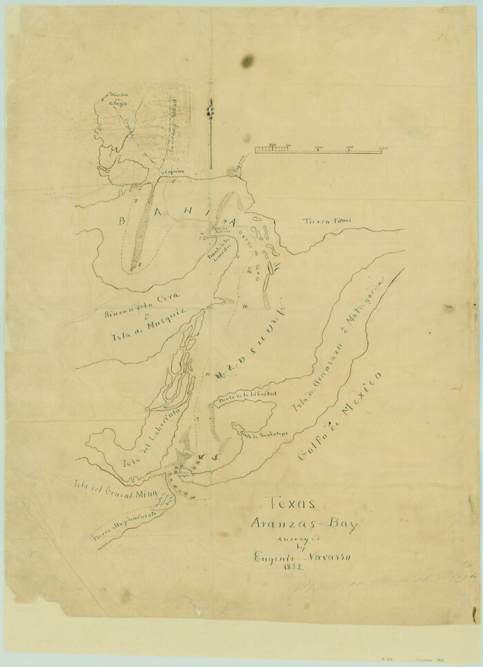
Texas Aranzas-Bay [sic]
Print $20.00
- Digital $50.00
Texas Aranzas-Bay [sic]
1832
Size: 21.4 x 15.5 inches
145
[Wm. Lewis No. 254 and Surrounding Surveys, Aransas County, Texas]
Print $20.00
- Digital $50.00
[Wm. Lewis No. 254 and Surrounding Surveys, Aransas County, Texas]
-
Size
18.8 x 35.2 inches
-
Map/Doc
82557
[William Steele Survey near Copano Bay]
Print $20.00
- Digital $50.00
[William Steele Survey near Copano Bay]
1927
-
Size
26.1 x 18.4 inches
-
Map/Doc
2082
-
Creation Date
1927
[William Steele Survey near Copano Bay]
Print $3.00
- Digital $50.00
[William Steele Survey near Copano Bay]
1927
-
Size
15.5 x 9.5 inches
-
Map/Doc
60284
-
Creation Date
1927
[William Steele Survey near Copano Bay]
Print $3.00
- Digital $50.00
[William Steele Survey near Copano Bay]
1927
-
Size
14.9 x 9.8 inches
-
Map/Doc
60285
-
Creation Date
1927
[Town Plat of Lamar]
Print $20.00
- Digital $50.00
[Town Plat of Lamar]
-
Size
19.0 x 25.0 inches
-
Map/Doc
4462
[Sketch of Surveys Near Port Aransas and Aransas Pass, Aransas County, Texas]
Print $20.00
- Digital $50.00
[Sketch of Surveys Near Port Aransas and Aransas Pass, Aransas County, Texas]
-
Size
22.8 x 18.5 inches
-
Map/Doc
676
[S. C. Vineyard and Adjacent Surveys, Aransas County, Texas]
Print $20.00
- Digital $50.00
[S. C. Vineyard and Adjacent Surveys, Aransas County, Texas]
-
Size
24.7 x 18.6 inches
-
Map/Doc
82558
[Redfish Bay, Aransas Pass, and part of Mustang Island]
Print $40.00
- Digital $50.00
[Redfish Bay, Aransas Pass, and part of Mustang Island]
1930
-
Size
51.0 x 46.5 inches
-
Map/Doc
83009
-
Creation Date
1930
[Aransas Wildlife Refuge]
Print $40.00
- Digital $50.00
[Aransas Wildlife Refuge]
1965
-
Size
55.6 x 42.9 inches
-
Map/Doc
2081
-
Creation Date
1965
[Aransas National Wildlife Refuge]
Print $40.00
- Digital $50.00
[Aransas National Wildlife Refuge]
1952
-
Size
55.9 x 43.4 inches
-
Map/Doc
3119
-
Creation Date
1952
[Aransas County, Texas]
Print $20.00
- Digital $50.00
[Aransas County, Texas]
1928
-
Size
37.5 x 31.3 inches
-
Map/Doc
2083
-
Creation Date
1928
West End of Copano Bay and Town of Saint Marys, Texas
Print $40.00
- Digital $50.00
West End of Copano Bay and Town of Saint Marys, Texas
1861
-
Size
54.5 x 32.9 inches
-
Map/Doc
73428
-
Creation Date
1861
The Coast & Bays of Western Texas
Print $20.00
- Digital $50.00
The Coast & Bays of Western Texas
1857
-
Size
18.2 x 23.9 inches
-
Map/Doc
73424
-
Creation Date
1857
Texas, San Antonio Bay, Panther Point
Print $40.00
- Digital $50.00
Texas, San Antonio Bay, Panther Point
1934
-
Size
33.2 x 48.3 inches
-
Map/Doc
69995
-
Creation Date
1934
Texas, San Antonio Bay, Hynes Bay
Print $40.00
- Digital $50.00
Texas, San Antonio Bay, Hynes Bay
1934
-
Size
33.0 x 48.9 inches
-
Map/Doc
69998
-
Creation Date
1934
Texas, Intracoastal Waterway, Ayres Bay to Aransas Bay
Print $40.00
- Digital $50.00
Texas, Intracoastal Waterway, Ayres Bay to Aransas Bay
1934
-
Size
33.2 x 48.5 inches
-
Map/Doc
69997
-
Creation Date
1934
Texas, Copano Bay, Mission Bay and Fish Point
Print $40.00
- Digital $50.00
Texas, Copano Bay, Mission Bay and Fish Point
1934
-
Size
33.3 x 48.9 inches
-
Map/Doc
73433
-
Creation Date
1934
Texas, Aransas Bay, Copano Bay and St. Charles Bay
Print $40.00
- Digital $50.00
Texas, Aransas Bay, Copano Bay and St. Charles Bay
1934
-
Size
34.0 x 48.6 inches
-
Map/Doc
73434
-
Creation Date
1934
Texas, Aransas Bay, Aransas Pass to Nine Mile Point
Print $40.00
- Digital $50.00
Texas, Aransas Bay, Aransas Pass to Nine Mile Point
1934
-
Size
35.2 x 48.4 inches
-
Map/Doc
73431
-
Creation Date
1934
Texas Intracoastal Waterway, Aransas Bay to Aransas Pass
Print $20.00
- Digital $50.00
Texas Intracoastal Waterway, Aransas Bay to Aransas Pass
1957
-
Size
27.5 x 39.1 inches
-
Map/Doc
73436
-
Creation Date
1957
Texas Intracoastal Waterway, Aransas Bay to Aransas Pass
Print $20.00
- Digital $50.00
Texas Intracoastal Waterway, Aransas Bay to Aransas Pass
1957
-
Size
38.9 x 27.6 inches
-
Map/Doc
73437
-
Creation Date
1957
Texas Intracoastal Waterway, Aransas Bay to Aransas Pass
Print $20.00
- Digital $50.00
Texas Intracoastal Waterway, Aransas Bay to Aransas Pass
1962
-
Size
26.8 x 38.7 inches
-
Map/Doc
73438
-
Creation Date
1962
Texas Intracoastal Waterway, Aransas Bay to Aransas Pass
Print $20.00
- Digital $50.00
Texas Intracoastal Waterway, Aransas Bay to Aransas Pass
1962
-
Size
38.7 x 26.8 inches
-
Map/Doc
73439
-
Creation Date
1962
Texas Intracoastal Waterway - Port O'Connor to San Antonio Bay, Including Pass Cavallo
Print $20.00
- Digital $50.00
Texas Intracoastal Waterway - Port O'Connor to San Antonio Bay, Including Pass Cavallo
1957
-
Size
28.1 x 40.0 inches
-
Map/Doc
73372
-
Creation Date
1957
Texas Intracoastal Waterway - Port O'Connor to San Antonio Bay, Including Pass Cavallo
Print $20.00
- Digital $50.00
Texas Intracoastal Waterway - Port O'Connor to San Antonio Bay, Including Pass Cavallo
1961
-
Size
26.5 x 38.7 inches
-
Map/Doc
73373
-
Creation Date
1961
Texas Gulf Coast, from the Sabine River to the Rio Grande as Subdivided for Mineral Development; Matagorda, Calhoun and Aransas Counties
Print $40.00
- Digital $50.00
Texas Gulf Coast, from the Sabine River to the Rio Grande as Subdivided for Mineral Development; Matagorda, Calhoun and Aransas Counties
1976
-
Size
43.0 x 90.9 inches
-
Map/Doc
1939
-
Creation Date
1976
Texas Gulf Coast, from the Sabine River to the Rio Grande as Subdivided for Mineral Development; Aransas, Nueces, Kleberg, Kenedy, Willacy, and Cameron Counties
Print $40.00
- Digital $50.00
Texas Gulf Coast, from the Sabine River to the Rio Grande as Subdivided for Mineral Development; Aransas, Nueces, Kleberg, Kenedy, Willacy, and Cameron Counties
1976
-
Size
118.0 x 43.0 inches
-
Map/Doc
1940
-
Creation Date
1976
Texas Gulf Coast Map from the Sabine River to the Rio Grande as subdivided for mineral development
Print $40.00
- Digital $50.00
Texas Gulf Coast Map from the Sabine River to the Rio Grande as subdivided for mineral development
-
Size
46.0 x 91.3 inches
-
Map/Doc
2901
Texas Gulf Coast Map from the Sabine River to the Rio Grande as subdivided for mineral development
Print $40.00
- Digital $50.00
Texas Gulf Coast Map from the Sabine River to the Rio Grande as subdivided for mineral development
-
Size
117.9 x 46.0 inches
-
Map/Doc
2902
Texas Aranzas-Bay [sic]
Print $20.00
- Digital $50.00
Texas Aranzas-Bay [sic]
1832
-
Size
21.4 x 15.5 inches
-
Map/Doc
145
-
Creation Date
1832