Agua Fria Quadrangle

Print $20.00
- Digital $50.00
Agua Fria Quadrangle
1917
Size: 17.2 x 21.1 inches
90136
Amistad International Reservoir on Rio Grande Key Sheet

Print $20.00
- Digital $50.00
Amistad International Reservoir on Rio Grande Key Sheet
1960
Size: 13.0 x 32.4 inches
73345
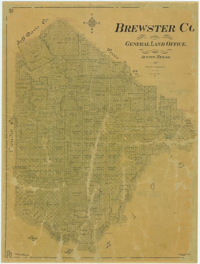
Brewster Co[unty]
Print $40.00
- Digital $50.00
Brewster Co[unty]
1904
Size: 63.5 x 48.0 inches
16947
Brewster County Boundary File 1a

Print $80.00
- Digital $50.00
Brewster County Boundary File 1a
Size: 94.0 x 13.8 inches
50738
Brewster County Boundary File 1b

Print $32.00
- Digital $50.00
Brewster County Boundary File 1b
Size: 9.2 x 11.3 inches
50740
Brewster County Boundary File 2

Print $40.00
- Digital $50.00
Brewster County Boundary File 2
Size: 14.0 x 16.3 inches
50756
Brewster County Rolled Sketch 100

Print $133.00
- Digital $50.00
Brewster County Rolled Sketch 100
1893
Size: 10.1 x 15.4 inches
43055
Brewster County Rolled Sketch 101

Print $40.00
- Digital $50.00
Brewster County Rolled Sketch 101
1927
Size: 63.0 x 46.2 inches
10648
Brewster County Rolled Sketch 101

Print $40.00
- Digital $50.00
Brewster County Rolled Sketch 101
1927
Size: 74.7 x 50.4 inches
10649
Brewster County Rolled Sketch 101

Print $40.00
- Digital $50.00
Brewster County Rolled Sketch 101
1927
Size: 55.0 x 40.0 inches
8509
Brewster County Rolled Sketch 101

Print $40.00
- Digital $50.00
Brewster County Rolled Sketch 101
1927
Size: 73.0 x 44.9 inches
8923
Brewster County Rolled Sketch 101

Print $20.00
- Digital $50.00
Brewster County Rolled Sketch 101
1944
Size: 34.6 x 42.4 inches
8924
Brewster County Rolled Sketch 101

Print $40.00
- Digital $50.00
Brewster County Rolled Sketch 101
1927
Size: 74.2 x 42.3 inches
9192
Brewster County Rolled Sketch 101

Print $40.00
- Digital $50.00
Brewster County Rolled Sketch 101
1927
Size: 73.5 x 42.3 inches
9194
Brewster County Rolled Sketch 101

Print $40.00
- Digital $50.00
Brewster County Rolled Sketch 101
1927
Size: 74.4 x 42.4 inches
9196
Brewster County Rolled Sketch 102

Print $20.00
- Digital $50.00
Brewster County Rolled Sketch 102
Size: 37.0 x 43.4 inches
8513
Brewster County Rolled Sketch 103

Print $40.00
- Digital $50.00
Brewster County Rolled Sketch 103
1955
Size: 51.8 x 27.9 inches
5256
Brewster County Rolled Sketch 104

Print $40.00
- Digital $50.00
Brewster County Rolled Sketch 104
1938
Size: 68.3 x 45.3 inches
8511
Brewster County Rolled Sketch 105

Print $20.00
- Digital $50.00
Brewster County Rolled Sketch 105
Size: 27.2 x 24.5 inches
5257
Brewster County Rolled Sketch 106

Print $20.00
- Digital $50.00
Brewster County Rolled Sketch 106
1958
Size: 20.7 x 24.6 inches
5258
Brewster County Rolled Sketch 107

Print $20.00
- Digital $50.00
Brewster County Rolled Sketch 107
Size: 22.2 x 11.2 inches
5259
Brewster County Rolled Sketch 108

Print $20.00
- Digital $50.00
Brewster County Rolled Sketch 108
1958
Size: 29.8 x 17.1 inches
5260
Brewster County Rolled Sketch 109

Print $20.00
- Digital $50.00
Brewster County Rolled Sketch 109
1961
Size: 19.3 x 25.3 inches
5261
Brewster County Rolled Sketch 11

Print $20.00
- Digital $50.00
Brewster County Rolled Sketch 11
1881
Size: 24.9 x 23.1 inches
5191
Brewster County Rolled Sketch 110

Print $20.00
- Digital $50.00
Brewster County Rolled Sketch 110
1961
Size: 19.7 x 37.7 inches
5262
Agua Fria Quadrangle
Print $20.00
- Digital $50.00
Agua Fria Quadrangle
1917
-
Size
17.2 x 21.1 inches
-
Map/Doc
90136
-
Creation Date
1917
Amistad International Reservoir on Rio Grande Key Sheet
Print $20.00
- Digital $50.00
Amistad International Reservoir on Rio Grande Key Sheet
1960
-
Size
13.0 x 32.4 inches
-
Map/Doc
73345
-
Creation Date
1960
Brewster Co.

Print $40.00
- Digital $50.00
Brewster Co.
1915
-
Size
34.8 x 49.6 inches
-
Map/Doc
4759
-
Creation Date
1915
Brewster Co.

Print $20.00
- Digital $50.00
Brewster Co.
1896
-
Size
36.7 x 35.8 inches
-
Map/Doc
4891
-
Creation Date
1896
Brewster Co.

Print $20.00
- Digital $50.00
Brewster Co.
1887
-
Size
31.3 x 47.4 inches
-
Map/Doc
66721
-
Creation Date
1887
Brewster Co.

Print $40.00
- Digital $50.00
Brewster Co.
1887
-
Size
57.9 x 20.8 inches
-
Map/Doc
66726
-
Creation Date
1887
Brewster Co[unty]
Print $40.00
- Digital $50.00
Brewster Co[unty]
1904
-
Size
63.5 x 48.0 inches
-
Map/Doc
16947
-
Creation Date
1904
Brewster County

Print $20.00
- Digital $50.00
Brewster County
1920
-
Size
24.4 x 19.5 inches
-
Map/Doc
3330
-
Creation Date
1920
Brewster County Boundary File 1a
Print $80.00
- Digital $50.00
Brewster County Boundary File 1a
-
Size
94.0 x 13.8 inches
-
Map/Doc
50738
Brewster County Boundary File 1b
Print $32.00
- Digital $50.00
Brewster County Boundary File 1b
-
Size
9.2 x 11.3 inches
-
Map/Doc
50740
Brewster County Boundary File 2
Print $40.00
- Digital $50.00
Brewster County Boundary File 2
-
Size
14.0 x 16.3 inches
-
Map/Doc
50756
Brewster County Rolled Sketch 100
Print $133.00
- Digital $50.00
Brewster County Rolled Sketch 100
1893
-
Size
10.1 x 15.4 inches
-
Map/Doc
43055
-
Creation Date
1893
Brewster County Rolled Sketch 101
Print $40.00
- Digital $50.00
Brewster County Rolled Sketch 101
1927
-
Size
63.0 x 46.2 inches
-
Map/Doc
10648
-
Creation Date
1927
Brewster County Rolled Sketch 101
Print $40.00
- Digital $50.00
Brewster County Rolled Sketch 101
1927
-
Size
74.7 x 50.4 inches
-
Map/Doc
10649
-
Creation Date
1927
Brewster County Rolled Sketch 101
Print $40.00
- Digital $50.00
Brewster County Rolled Sketch 101
1927
-
Size
55.0 x 40.0 inches
-
Map/Doc
8509
-
Creation Date
1927
Brewster County Rolled Sketch 101
Print $40.00
- Digital $50.00
Brewster County Rolled Sketch 101
1927
-
Size
73.0 x 44.9 inches
-
Map/Doc
8923
-
Creation Date
1927
Brewster County Rolled Sketch 101
Print $20.00
- Digital $50.00
Brewster County Rolled Sketch 101
1944
-
Size
34.6 x 42.4 inches
-
Map/Doc
8924
-
Creation Date
1944
Brewster County Rolled Sketch 101
Print $40.00
- Digital $50.00
Brewster County Rolled Sketch 101
1927
-
Size
74.2 x 42.3 inches
-
Map/Doc
9192
-
Creation Date
1927
Brewster County Rolled Sketch 101
Print $40.00
- Digital $50.00
Brewster County Rolled Sketch 101
1927
-
Size
73.5 x 42.3 inches
-
Map/Doc
9194
-
Creation Date
1927
Brewster County Rolled Sketch 101
Print $40.00
- Digital $50.00
Brewster County Rolled Sketch 101
1927
-
Size
74.4 x 42.4 inches
-
Map/Doc
9196
-
Creation Date
1927
Brewster County Rolled Sketch 102
Print $20.00
- Digital $50.00
Brewster County Rolled Sketch 102
-
Size
37.0 x 43.4 inches
-
Map/Doc
8513
Brewster County Rolled Sketch 103
Print $40.00
- Digital $50.00
Brewster County Rolled Sketch 103
1955
-
Size
51.8 x 27.9 inches
-
Map/Doc
5256
-
Creation Date
1955
Brewster County Rolled Sketch 104
Print $40.00
- Digital $50.00
Brewster County Rolled Sketch 104
1938
-
Size
68.3 x 45.3 inches
-
Map/Doc
8511
-
Creation Date
1938
Brewster County Rolled Sketch 105
Print $20.00
- Digital $50.00
Brewster County Rolled Sketch 105
-
Size
27.2 x 24.5 inches
-
Map/Doc
5257
Brewster County Rolled Sketch 106
Print $20.00
- Digital $50.00
Brewster County Rolled Sketch 106
1958
-
Size
20.7 x 24.6 inches
-
Map/Doc
5258
-
Creation Date
1958
Brewster County Rolled Sketch 107
Print $20.00
- Digital $50.00
Brewster County Rolled Sketch 107
-
Size
22.2 x 11.2 inches
-
Map/Doc
5259
Brewster County Rolled Sketch 108
Print $20.00
- Digital $50.00
Brewster County Rolled Sketch 108
1958
-
Size
29.8 x 17.1 inches
-
Map/Doc
5260
-
Creation Date
1958
Brewster County Rolled Sketch 109
Print $20.00
- Digital $50.00
Brewster County Rolled Sketch 109
1961
-
Size
19.3 x 25.3 inches
-
Map/Doc
5261
-
Creation Date
1961
Brewster County Rolled Sketch 11
Print $20.00
- Digital $50.00
Brewster County Rolled Sketch 11
1881
-
Size
24.9 x 23.1 inches
-
Map/Doc
5191
-
Creation Date
1881
Brewster County Rolled Sketch 110
Print $20.00
- Digital $50.00
Brewster County Rolled Sketch 110
1961
-
Size
19.7 x 37.7 inches
-
Map/Doc
5262
-
Creation Date
1961