Carson County Working Sketch 5

Print $20.00
- Digital $50.00
Carson County Working Sketch 5
1979
Size: 42.2 x 14.5 inches
67876
Potter County Working Sketch 12

Print $40.00
- Digital $50.00
Potter County Working Sketch 12
1972
Size: 64.4 x 42.4 inches
71672
General Highway Map, Carson County, Texas

Print $20.00
General Highway Map, Carson County, Texas
1961
Size: 18.2 x 24.9 inches
79401
Gray County Working Sketch 1

Print $20.00
- Digital $50.00
Gray County Working Sketch 1
1957
Size: 37.3 x 17.4 inches
62196
Hutchinson County Sketch File 41

Print $14.00
- Digital $50.00
Hutchinson County Sketch File 41
1955
Size: 9.8 x 8.5 inches
27298
Carson County Working Sketch 4

Print $20.00
- Digital $50.00
Carson County Working Sketch 4
1952
Size: 26.1 x 37.0 inches
67875
Hutchinson County Sketch File 36

Print $10.00
- Digital $50.00
Hutchinson County Sketch File 36
1941
Size: 11.2 x 8.9 inches
27270
General Highway Map, Carson County, Texas

Print $20.00
General Highway Map, Carson County, Texas
1940
Size: 18.5 x 25.1 inches
79041
Carson County Working Sketch Graphic Index

Print $20.00
- Digital $50.00
Carson County Working Sketch Graphic Index
1932
Size: 41.3 x 37.9 inches
76488
Carson County Sketch File 8

Print $6.00
- Digital $50.00
Carson County Sketch File 8
1931
Size: 11.2 x 8.6 inches
17389
Potter County Sketch File 21

Print $6.00
- Digital $50.00
Potter County Sketch File 21
1930
Size: 14.1 x 9.7 inches
34413
Carson County Sketch File 6a

Print $10.00
- Digital $50.00
Carson County Sketch File 6a
1928
Size: 14.1 x 8.4 inches
17374
Carson County Sketch File 6

Print $32.00
- Digital $50.00
Carson County Sketch File 6
1928
Size: 9.1 x 9.6 inches
17358
Carson County Sketch File 6b

Print $22.00
- Digital $50.00
Carson County Sketch File 6b
1928
Size: 13.4 x 8.6 inches
17378
Carson County Working Sketch 3

Print $20.00
- Digital $50.00
Carson County Working Sketch 3
1922
Size: 18.3 x 26.3 inches
67874
[Parts of Blocks M-20, 22 and S]
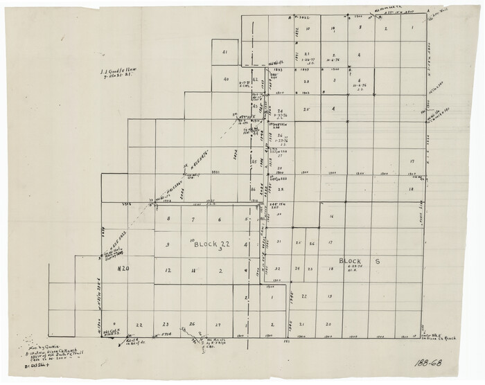
Print $20.00
- Digital $50.00
[Parts of Blocks M-20, 22 and S]
1921
Size: 23.3 x 18.3 inches
91825
Hutchinson County Working Sketch 10

Print $20.00
- Digital $50.00
Hutchinson County Working Sketch 10
1920
Size: 42.4 x 32.4 inches
66368
Potter County Sketch File 17

Print $16.00
- Digital $50.00
Potter County Sketch File 17
1920
Size: 11.2 x 8.7 inches
34403
Potter County Working Sketch 3

Print $20.00
- Digital $50.00
Potter County Working Sketch 3
1920
Size: 42.1 x 16.8 inches
71663
Carson County Sketch File 5

Print $28.00
- Digital $50.00
Carson County Sketch File 5
1916
Size: 7.5 x 8.7 inches
17353
Working Sketch in Gray, Donley, and Carson Counties, Texas

Print $20.00
- Digital $50.00
Working Sketch in Gray, Donley, and Carson Counties, Texas
1909
Size: 22.7 x 27.0 inches
90779
Hutchinson County Sketch File 12

Print $40.00
- Digital $50.00
Hutchinson County Sketch File 12
1908
Size: 16.1 x 15.7 inches
27211
Carson County Working Sketch 2

Print $3.00
- Digital $50.00
Carson County Working Sketch 2
1907
Size: 16.7 x 10.0 inches
67873
Working Sketch Carson County

Print $3.00
- Digital $50.00
Working Sketch Carson County
1907
Size: 10.6 x 17.1 inches
90223
Working Sketch Carson County

Print $3.00
- Digital $50.00
Working Sketch Carson County
1907
Size: 11.6 x 17.8 inches
90224
Map Showing North and West Boundaries of Gray County, Texas

Print $20.00
- Digital $50.00
Map Showing North and West Boundaries of Gray County, Texas
1906
Size: 42.4 x 38.9 inches
89942
Carson County Working Sketch 5
Print $20.00
- Digital $50.00
Carson County Working Sketch 5
1979
-
Size
42.2 x 14.5 inches
-
Map/Doc
67876
-
Creation Date
1979
Potter County Working Sketch 12
Print $40.00
- Digital $50.00
Potter County Working Sketch 12
1972
-
Size
64.4 x 42.4 inches
-
Map/Doc
71672
-
Creation Date
1972
General Highway Map, Carson County, Texas
Print $20.00
General Highway Map, Carson County, Texas
1961
-
Size
18.2 x 24.9 inches
-
Map/Doc
79401
-
Creation Date
1961
Gray County Working Sketch 1
Print $20.00
- Digital $50.00
Gray County Working Sketch 1
1957
-
Size
37.3 x 17.4 inches
-
Map/Doc
62196
-
Creation Date
1957
Hutchinson County Sketch File 41
Print $14.00
- Digital $50.00
Hutchinson County Sketch File 41
1955
-
Size
9.8 x 8.5 inches
-
Map/Doc
27298
-
Creation Date
1955
Carson County Working Sketch 4
Print $20.00
- Digital $50.00
Carson County Working Sketch 4
1952
-
Size
26.1 x 37.0 inches
-
Map/Doc
67875
-
Creation Date
1952
Hutchinson County Sketch File 36
Print $10.00
- Digital $50.00
Hutchinson County Sketch File 36
1941
-
Size
11.2 x 8.9 inches
-
Map/Doc
27270
-
Creation Date
1941
General Highway Map, Carson County, Texas
Print $20.00
General Highway Map, Carson County, Texas
1940
-
Size
18.5 x 25.1 inches
-
Map/Doc
79041
-
Creation Date
1940
Carson County

Print $20.00
- Digital $50.00
Carson County
1932
-
Size
44.8 x 40.1 inches
-
Map/Doc
1795
-
Creation Date
1932
Carson County

Print $20.00
- Digital $50.00
Carson County
1932
-
Size
42.0 x 38.5 inches
-
Map/Doc
73100
-
Creation Date
1932
Carson County

Print $20.00
- Digital $50.00
Carson County
1932
-
Size
43.4 x 38.8 inches
-
Map/Doc
95449
-
Creation Date
1932
Carson County Working Sketch Graphic Index
Print $20.00
- Digital $50.00
Carson County Working Sketch Graphic Index
1932
-
Size
41.3 x 37.9 inches
-
Map/Doc
76488
-
Creation Date
1932
Carson County

Print $20.00
- Digital $50.00
Carson County
1932
-
Size
38.2 x 35.0 inches
-
Map/Doc
77232
-
Creation Date
1932
Carson County Sketch File 8
Print $6.00
- Digital $50.00
Carson County Sketch File 8
1931
-
Size
11.2 x 8.6 inches
-
Map/Doc
17389
-
Creation Date
1931
Potter County Sketch File 21
Print $6.00
- Digital $50.00
Potter County Sketch File 21
1930
-
Size
14.1 x 9.7 inches
-
Map/Doc
34413
-
Creation Date
1930
Carson County Sketch File 6a
Print $10.00
- Digital $50.00
Carson County Sketch File 6a
1928
-
Size
14.1 x 8.4 inches
-
Map/Doc
17374
-
Creation Date
1928
Carson County Sketch File 6
Print $32.00
- Digital $50.00
Carson County Sketch File 6
1928
-
Size
9.1 x 9.6 inches
-
Map/Doc
17358
-
Creation Date
1928
Carson County Sketch File 6b
Print $22.00
- Digital $50.00
Carson County Sketch File 6b
1928
-
Size
13.4 x 8.6 inches
-
Map/Doc
17378
-
Creation Date
1928
Carson County Working Sketch 3
Print $20.00
- Digital $50.00
Carson County Working Sketch 3
1922
-
Size
18.3 x 26.3 inches
-
Map/Doc
67874
-
Creation Date
1922
[Parts of Blocks M-20, 22 and S]
Print $20.00
- Digital $50.00
[Parts of Blocks M-20, 22 and S]
1921
-
Size
23.3 x 18.3 inches
-
Map/Doc
91825
-
Creation Date
1921
Hutchinson County Working Sketch 10
Print $20.00
- Digital $50.00
Hutchinson County Working Sketch 10
1920
-
Size
42.4 x 32.4 inches
-
Map/Doc
66368
-
Creation Date
1920
Potter County Sketch File 17
Print $16.00
- Digital $50.00
Potter County Sketch File 17
1920
-
Size
11.2 x 8.7 inches
-
Map/Doc
34403
-
Creation Date
1920
Potter County Working Sketch 3
Print $20.00
- Digital $50.00
Potter County Working Sketch 3
1920
-
Size
42.1 x 16.8 inches
-
Map/Doc
71663
-
Creation Date
1920
Carson County Sketch File 5
Print $28.00
- Digital $50.00
Carson County Sketch File 5
1916
-
Size
7.5 x 8.7 inches
-
Map/Doc
17353
-
Creation Date
1916
Working Sketch in Gray, Donley, and Carson Counties, Texas
Print $20.00
- Digital $50.00
Working Sketch in Gray, Donley, and Carson Counties, Texas
1909
-
Size
22.7 x 27.0 inches
-
Map/Doc
90779
-
Creation Date
1909
Hutchinson County Sketch File 12
Print $40.00
- Digital $50.00
Hutchinson County Sketch File 12
1908
-
Size
16.1 x 15.7 inches
-
Map/Doc
27211
-
Creation Date
1908
Carson County Working Sketch 2
Print $3.00
- Digital $50.00
Carson County Working Sketch 2
1907
-
Size
16.7 x 10.0 inches
-
Map/Doc
67873
-
Creation Date
1907
Working Sketch Carson County
Print $3.00
- Digital $50.00
Working Sketch Carson County
1907
-
Size
10.6 x 17.1 inches
-
Map/Doc
90223
-
Creation Date
1907
Working Sketch Carson County
Print $3.00
- Digital $50.00
Working Sketch Carson County
1907
-
Size
11.6 x 17.8 inches
-
Map/Doc
90224
-
Creation Date
1907
Map Showing North and West Boundaries of Gray County, Texas
Print $20.00
- Digital $50.00
Map Showing North and West Boundaries of Gray County, Texas
1906
-
Size
42.4 x 38.9 inches
-
Map/Doc
89942
-
Creation Date
1906