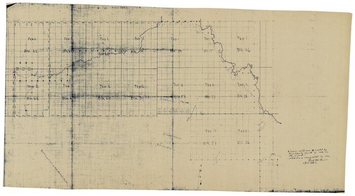
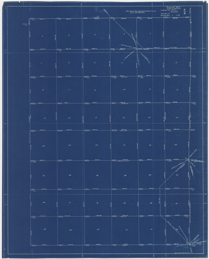
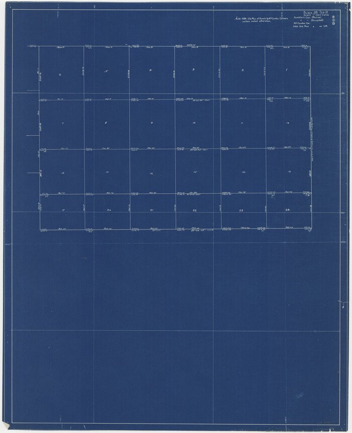
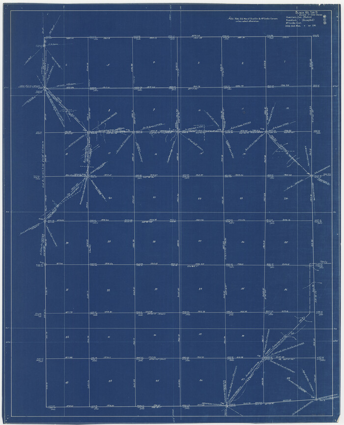
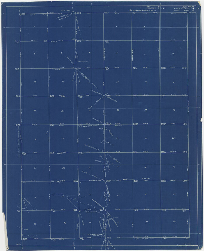
[Townships 1, 2, 3, Blocks, 62, 61, 60, 59, 58, 57, 56]
Print $20.00
- Digital $50.00
[Townships 1, 2, 3, Blocks, 62, 61, 60, 59, 58, 57, 56]
1885
Size: 19.1 x 10.3 inches
92884
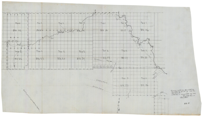
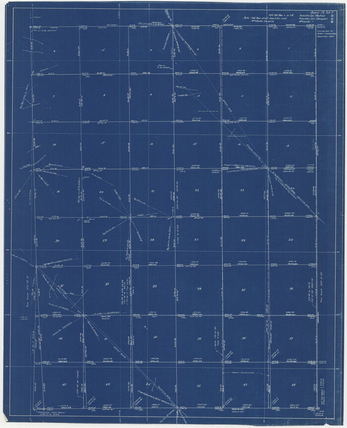
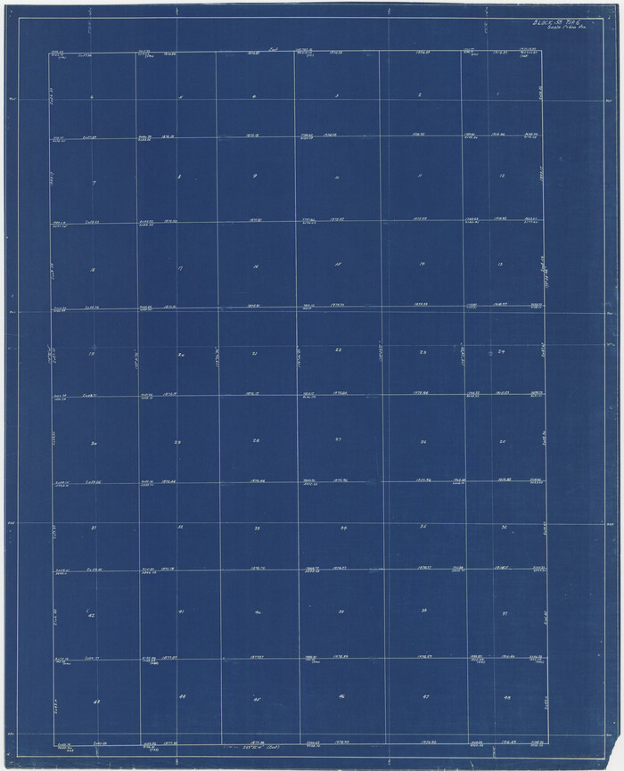
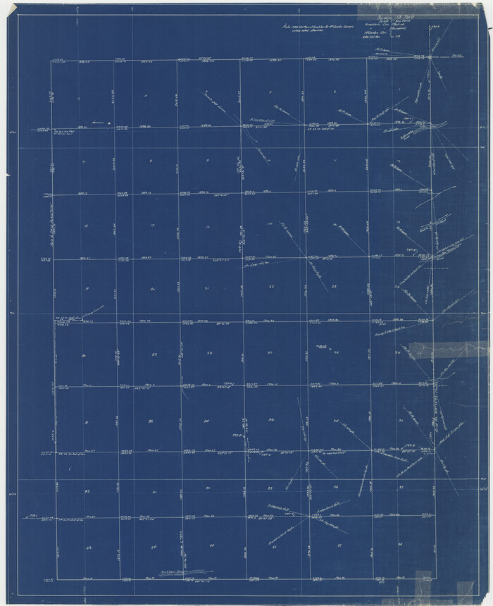
[Texas and Pacific Blocks 56-62, Townships 1-3]
Print $20.00
- Digital $50.00
[Texas and Pacific Blocks 56-62, Townships 1-3]
1885
Size: 28.4 x 15.9 inches
90501
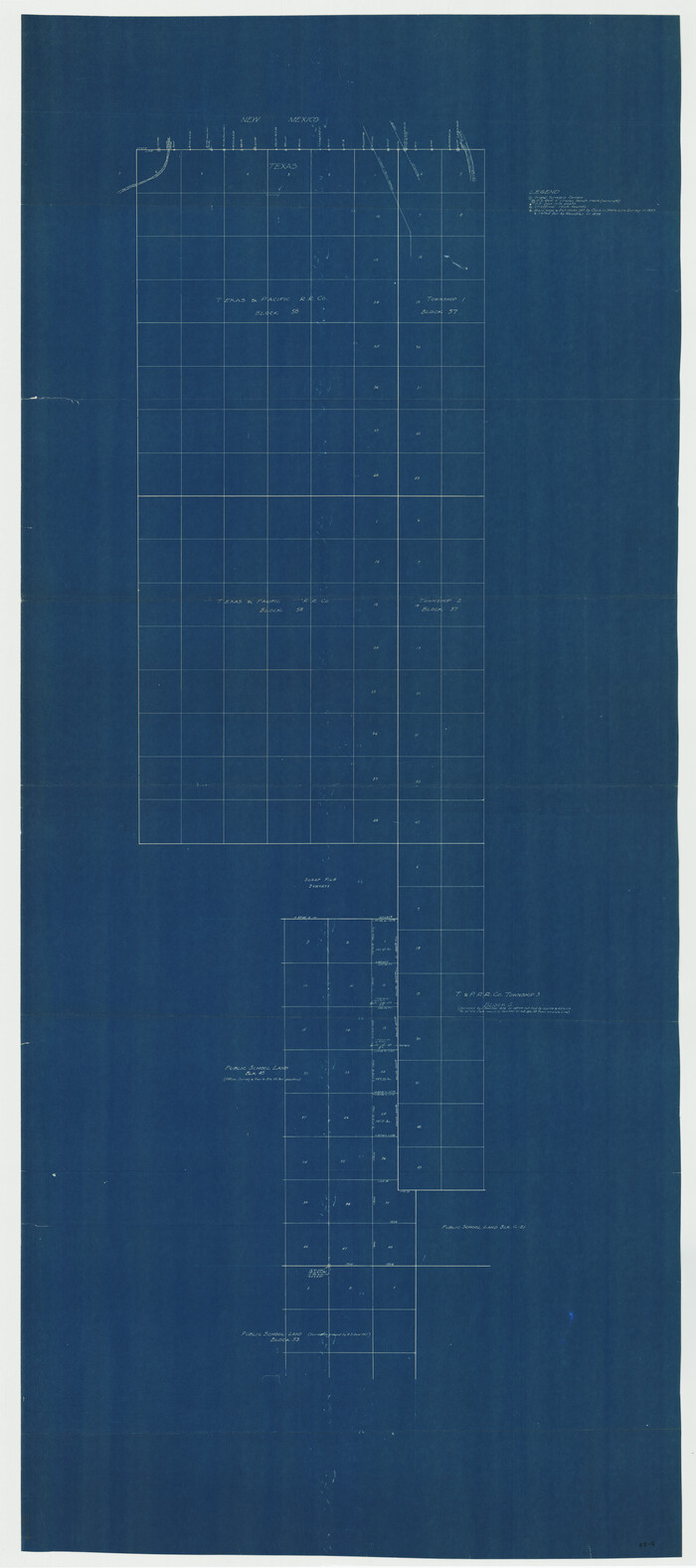
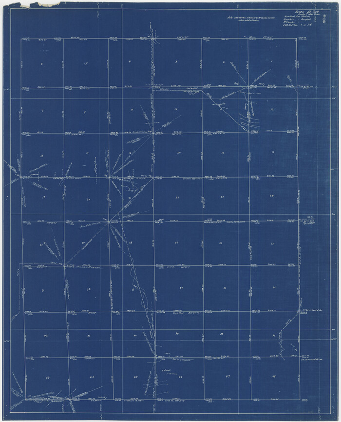
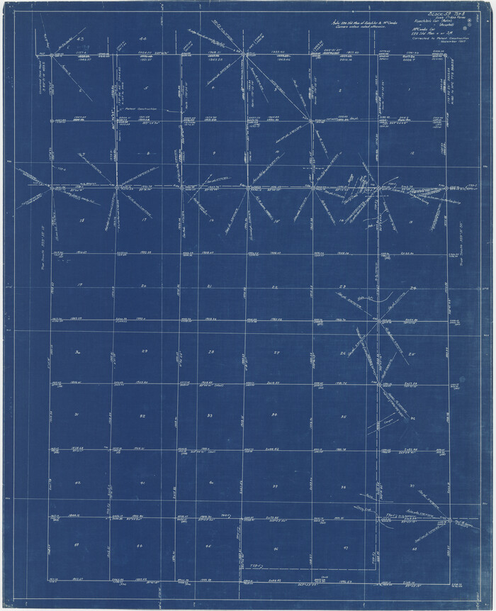
[T.&P. Blocks 57 and 58, South to PSL Block 53]
Print $40.00
- Digital $50.00
[T.&P. Blocks 57 and 58, South to PSL Block 53]
Size: 30.5 x 68.7 inches
89763
[Sketch showing Jeff Davis County, Blocks 1, 2, 3, 4, 360, 363 and JG1]
Print $20.00
- Digital $50.00
[Sketch showing Jeff Davis County, Blocks 1, 2, 3, 4, 360, 363 and JG1]
Size: 20.5 x 13.7 inches
91776
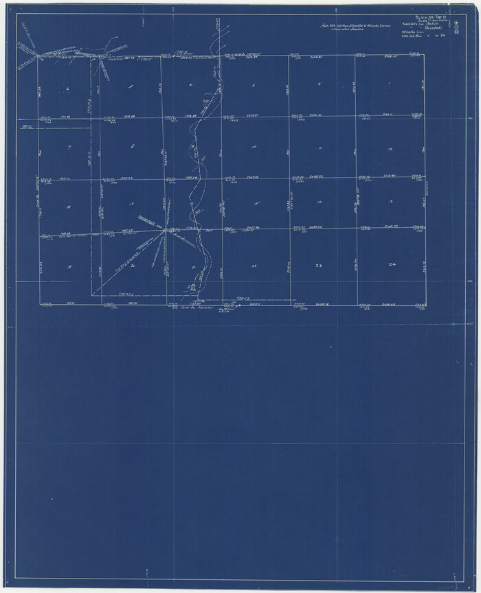
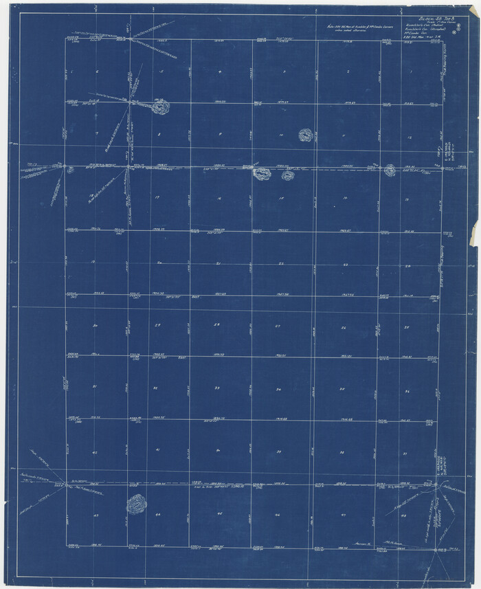
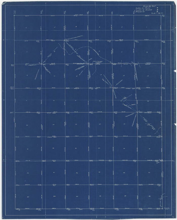
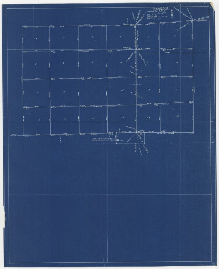
[Sketch from Paul McCombs Map of 1884, showing T. & P. Township 5, Block 60, Township 6, Block 59, and Township 7, Blocks 59 and 60]
Print $2.00
- Digital $50.00
[Sketch from Paul McCombs Map of 1884, showing T. & P. Township 5, Block 60, Township 6, Block 59, and Township 7, Blocks 59 and 60]
Size: 9.2 x 15.0 inches
91774
[North part H. & T. C. Blk. 5 and PSL Blk. 64]
Print $20.00
- Digital $50.00
[North part H. & T. C. Blk. 5 and PSL Blk. 64]
Size: 13.2 x 12.0 inches
90499
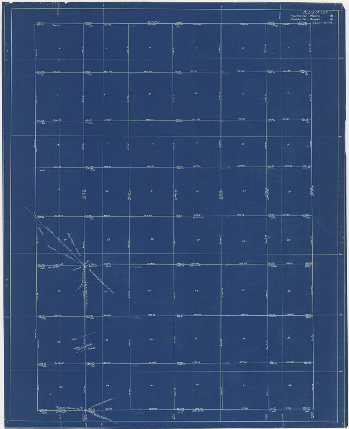
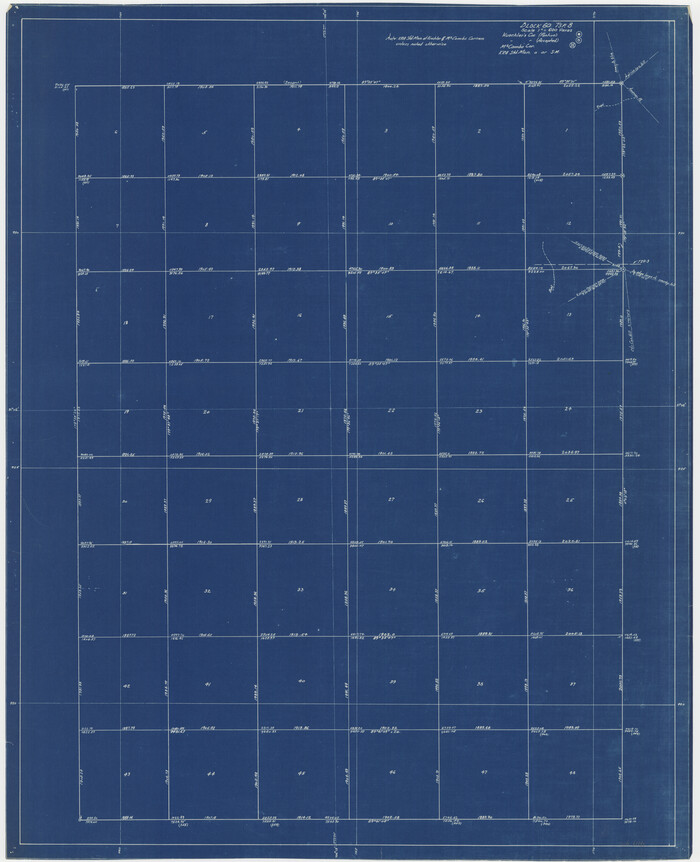
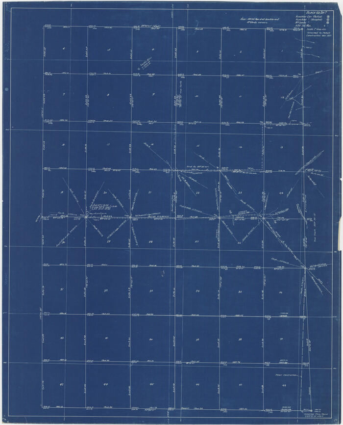
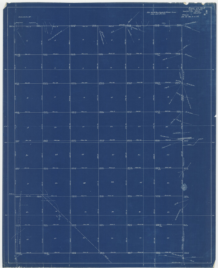
[Maps of surveys in Reeves & Culberson Cos]
Print $20.00
- Digital $50.00
[Maps of surveys in Reeves & Culberson Cos]
1937
Size: 30.7 x 25.0 inches
61129
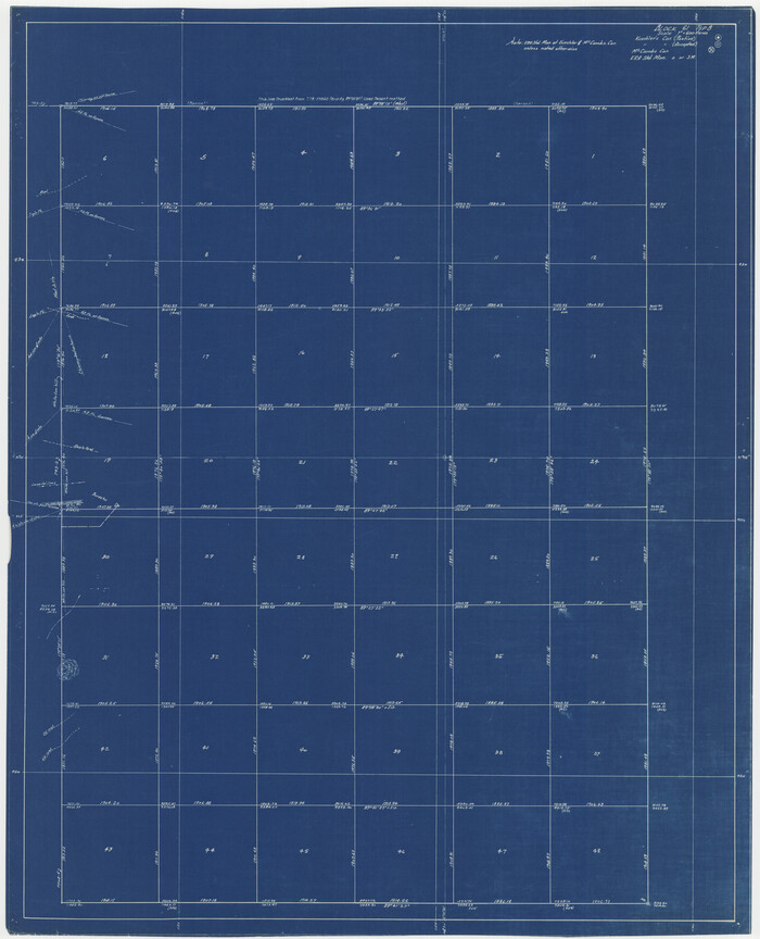
[Maps of surveys in Reeves & Culberson Cos]
Print $20.00
- Digital $50.00
[Maps of surveys in Reeves & Culberson Cos]
1937
Size: 30.7 x 24.9 inches
61130
[Maps of surveys in Reeves & Culberson Cos]
Print $20.00
- Digital $50.00
[Maps of surveys in Reeves & Culberson Cos]
1937
Size: 30.6 x 24.8 inches
61131
[Maps of surveys in Reeves & Culberson Cos]
Print $20.00
- Digital $50.00
[Maps of surveys in Reeves & Culberson Cos]
1937
Size: 30.8 x 24.9 inches
61132
[Maps of surveys in Reeves & Culberson Cos]
Print $20.00
- Digital $50.00
[Maps of surveys in Reeves & Culberson Cos]
1937
Size: 30.7 x 24.8 inches
61133
[Maps of surveys in Reeves & Culberson Cos]
Print $20.00
- Digital $50.00
[Maps of surveys in Reeves & Culberson Cos]
1937
Size: 30.7 x 24.9 inches
61134
[Maps of surveys in Reeves & Culberson Cos]
Print $20.00
- Digital $50.00
[Maps of surveys in Reeves & Culberson Cos]
1937
Size: 30.6 x 24.9 inches
61135
[Maps of surveys in Reeves & Culberson Cos]
Print $20.00
- Digital $50.00
[Maps of surveys in Reeves & Culberson Cos]
1937
Size: 30.5 x 24.7 inches
61136
[Maps of surveys in Reeves & Culberson Cos]
Print $20.00
- Digital $50.00
[Maps of surveys in Reeves & Culberson Cos]
1937
Size: 30.5 x 24.8 inches
61137
[Maps of surveys in Reeves & Culberson Cos]
Print $20.00
- Digital $50.00
[Maps of surveys in Reeves & Culberson Cos]
1937
Size: 30.6 x 25.0 inches
61138
[Maps of surveys in Reeves & Culberson Cos]
Print $20.00
- Digital $50.00
[Maps of surveys in Reeves & Culberson Cos]
1937
Size: 30.7 x 24.7 inches
61139
[Maps of surveys in Reeves & Culberson Cos]
Print $20.00
- Digital $50.00
[Maps of surveys in Reeves & Culberson Cos]
1937
Size: 30.6 x 24.9 inches
61140
[Maps of surveys in Reeves & Culberson Cos]
Print $20.00
- Digital $50.00
[Maps of surveys in Reeves & Culberson Cos]
1937
Size: 30.7 x 24.9 inches
61141
[Maps of surveys in Reeves & Culberson Cos]
Print $20.00
- Digital $50.00
[Maps of surveys in Reeves & Culberson Cos]
1937
Size: 30.6 x 24.8 inches
61142
[Maps of surveys in Reeves & Culberson Cos]
Print $20.00
- Digital $50.00
[Maps of surveys in Reeves & Culberson Cos]
1937
Size: 30.7 x 24.9 inches
61143
[Maps of surveys in Reeves & Culberson Cos]
Print $20.00
- Digital $50.00
[Maps of surveys in Reeves & Culberson Cos]
1937
Size: 30.9 x 25.1 inches
61144
[Maps of surveys in Reeves & Culberson Cos]
Print $20.00
- Digital $50.00
[Maps of surveys in Reeves & Culberson Cos]
1937
Size: 30.8 x 25.0 inches
61145
[Maps of surveys in Reeves & Culberson Cos]
Print $20.00
- Digital $50.00
[Maps of surveys in Reeves & Culberson Cos]
1937
Size: 30.8 x 24.9 inches
61146
[Maps of surveys in Reeves & Culberson Cos]
Print $20.00
- Digital $50.00
[Maps of surveys in Reeves & Culberson Cos]
1937
Size: 30.6 x 24.9 inches
61147
[Maps of surveys in Reeves & Culberson Cos]
Print $20.00
- Digital $50.00
[Maps of surveys in Reeves & Culberson Cos]
1937
Size: 30.7 x 24.9 inches
61148
[Letters to and from Maj. W. J. Powell regarding surveys of Texas and Pacific Ry. Lands west of the Pecos. Blks 53-55, Township 1 & 2 map within]
![2249, [Letters to and from Maj. W. J. Powell regarding surveys of Texas and Pacific Ry. Lands west of the Pecos. Blks 53-55, Township 1 & 2 map within], General Map Collection](https://historictexasmaps.com/wmedia_w700/pdf_converted_jpg/qi_pdf_thumbnail_1039.jpg)
Print $124.00
- Digital $50.00
[Letters to and from Maj. W. J. Powell regarding surveys of Texas and Pacific Ry. Lands west of the Pecos. Blks 53-55, Township 1 & 2 map within]
1934
Size: 10.2 x 15.4 inches
2249
[Index map of T. & P. Ry. Company’s 80-mile Trans-Pecos Reserve’s perpetuated corners - North Part]
Print $40.00
- Digital $50.00
[Index map of T. & P. Ry. Company’s 80-mile Trans-Pecos Reserve’s perpetuated corners - North Part]
Size: 25.4 x 92.1 inches
89622
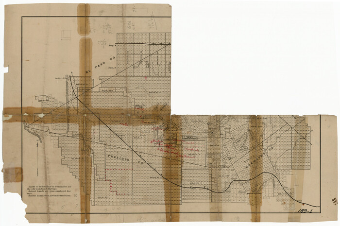
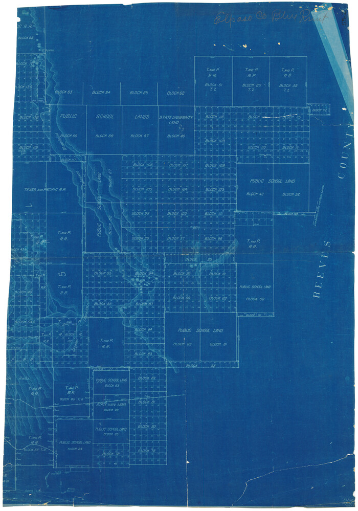
[Eastern part of Culberson County]
Print $20.00
- Digital $50.00
[Eastern part of Culberson County]
Size: 29.0 x 40.5 inches
90505
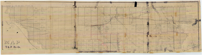
[Central Part of County]
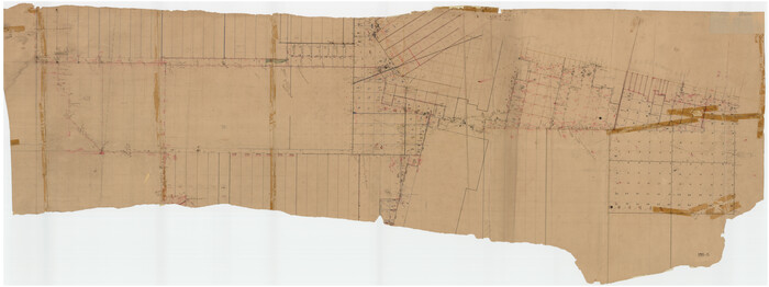
Print $40.00
- Digital $50.00
[Central Part of County]
Size: 70.0 x 26.3 inches
89791
[Townships 1, 2, 3, Blocks, 62, 61, 60, 59, 58, 57, 56]
Print $20.00
- Digital $50.00
[Townships 1, 2, 3, Blocks, 62, 61, 60, 59, 58, 57, 56]
1885
-
Size
19.1 x 10.3 inches
-
Map/Doc
92884
-
Creation Date
1885
[Texas and Pacific Blocks 56-62, Townships 1-3]
Print $20.00
- Digital $50.00
[Texas and Pacific Blocks 56-62, Townships 1-3]
1885
-
Size
28.4 x 15.9 inches
-
Map/Doc
90501
-
Creation Date
1885
[T.&P. Blocks 57 and 58, South to PSL Block 53]
Print $40.00
- Digital $50.00
[T.&P. Blocks 57 and 58, South to PSL Block 53]
-
Size
30.5 x 68.7 inches
-
Map/Doc
89763
[Sketch showing Jeff Davis County, Blocks 1, 2, 3, 4, 360, 363 and JG1]
Print $20.00
- Digital $50.00
[Sketch showing Jeff Davis County, Blocks 1, 2, 3, 4, 360, 363 and JG1]
-
Size
20.5 x 13.7 inches
-
Map/Doc
91776
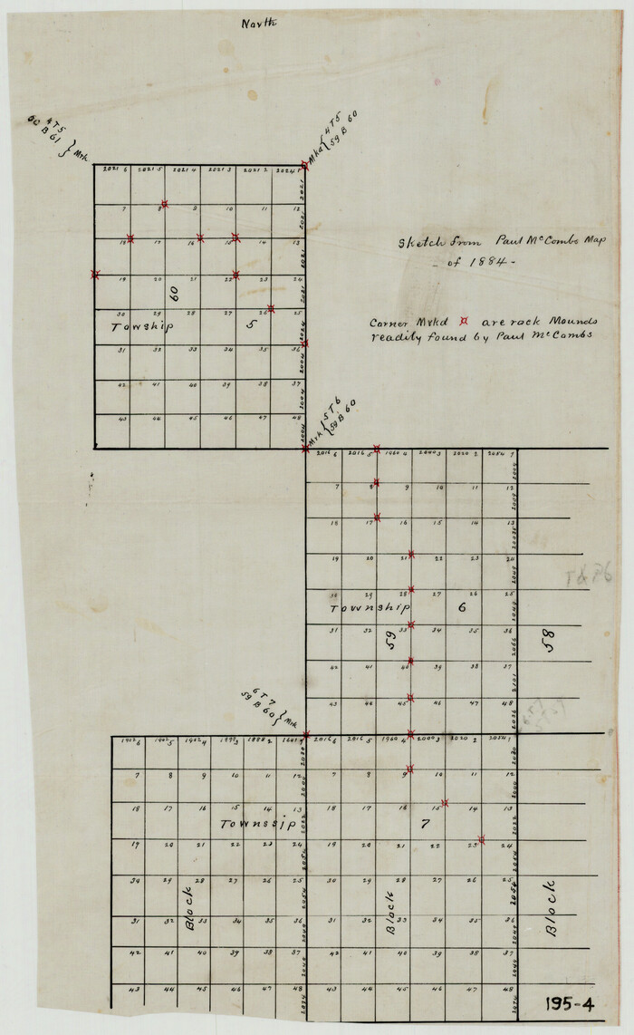
[Sketch from Paul McCombs Map of 1884, showing T. & P. Township 5, Block 60, Township 6, Block 59, and Township 7, Blocks 59 and 60]
Print $2.00
- Digital $50.00
[Sketch from Paul McCombs Map of 1884, showing T. & P. Township 5, Block 60, Township 6, Block 59, and Township 7, Blocks 59 and 60]
-
Size
9.2 x 15.0 inches
-
Map/Doc
91774
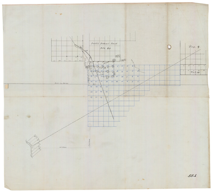
[North part H. & T. C. Blk. 5 and PSL Blk. 64]
Print $20.00
- Digital $50.00
[North part H. & T. C. Blk. 5 and PSL Blk. 64]
-
Size
13.2 x 12.0 inches
-
Map/Doc
90499
[Maps of surveys in Reeves & Culberson Cos]
Print $20.00
- Digital $50.00
[Maps of surveys in Reeves & Culberson Cos]
1937
-
Size
30.7 x 25.0 inches
-
Map/Doc
61129
-
Creation Date
1937
[Maps of surveys in Reeves & Culberson Cos]
Print $20.00
- Digital $50.00
[Maps of surveys in Reeves & Culberson Cos]
1937
-
Size
30.7 x 24.9 inches
-
Map/Doc
61130
-
Creation Date
1937
[Maps of surveys in Reeves & Culberson Cos]
Print $20.00
- Digital $50.00
[Maps of surveys in Reeves & Culberson Cos]
1937
-
Size
30.6 x 24.8 inches
-
Map/Doc
61131
-
Creation Date
1937
[Maps of surveys in Reeves & Culberson Cos]
Print $20.00
- Digital $50.00
[Maps of surveys in Reeves & Culberson Cos]
1937
-
Size
30.8 x 24.9 inches
-
Map/Doc
61132
-
Creation Date
1937
[Maps of surveys in Reeves & Culberson Cos]
Print $20.00
- Digital $50.00
[Maps of surveys in Reeves & Culberson Cos]
1937
-
Size
30.7 x 24.8 inches
-
Map/Doc
61133
-
Creation Date
1937
[Maps of surveys in Reeves & Culberson Cos]
Print $20.00
- Digital $50.00
[Maps of surveys in Reeves & Culberson Cos]
1937
-
Size
30.7 x 24.9 inches
-
Map/Doc
61134
-
Creation Date
1937
[Maps of surveys in Reeves & Culberson Cos]
Print $20.00
- Digital $50.00
[Maps of surveys in Reeves & Culberson Cos]
1937
-
Size
30.6 x 24.9 inches
-
Map/Doc
61135
-
Creation Date
1937
[Maps of surveys in Reeves & Culberson Cos]
Print $20.00
- Digital $50.00
[Maps of surveys in Reeves & Culberson Cos]
1937
-
Size
30.5 x 24.7 inches
-
Map/Doc
61136
-
Creation Date
1937
[Maps of surveys in Reeves & Culberson Cos]
Print $20.00
- Digital $50.00
[Maps of surveys in Reeves & Culberson Cos]
1937
-
Size
30.5 x 24.8 inches
-
Map/Doc
61137
-
Creation Date
1937
[Maps of surveys in Reeves & Culberson Cos]
Print $20.00
- Digital $50.00
[Maps of surveys in Reeves & Culberson Cos]
1937
-
Size
30.6 x 25.0 inches
-
Map/Doc
61138
-
Creation Date
1937
[Maps of surveys in Reeves & Culberson Cos]
Print $20.00
- Digital $50.00
[Maps of surveys in Reeves & Culberson Cos]
1937
-
Size
30.7 x 24.7 inches
-
Map/Doc
61139
-
Creation Date
1937
[Maps of surveys in Reeves & Culberson Cos]
Print $20.00
- Digital $50.00
[Maps of surveys in Reeves & Culberson Cos]
1937
-
Size
30.6 x 24.9 inches
-
Map/Doc
61140
-
Creation Date
1937
[Maps of surveys in Reeves & Culberson Cos]
Print $20.00
- Digital $50.00
[Maps of surveys in Reeves & Culberson Cos]
1937
-
Size
30.7 x 24.9 inches
-
Map/Doc
61141
-
Creation Date
1937
[Maps of surveys in Reeves & Culberson Cos]
Print $20.00
- Digital $50.00
[Maps of surveys in Reeves & Culberson Cos]
1937
-
Size
30.6 x 24.8 inches
-
Map/Doc
61142
-
Creation Date
1937
[Maps of surveys in Reeves & Culberson Cos]
Print $20.00
- Digital $50.00
[Maps of surveys in Reeves & Culberson Cos]
1937
-
Size
30.7 x 24.9 inches
-
Map/Doc
61143
-
Creation Date
1937
[Maps of surveys in Reeves & Culberson Cos]
Print $20.00
- Digital $50.00
[Maps of surveys in Reeves & Culberson Cos]
1937
-
Size
30.9 x 25.1 inches
-
Map/Doc
61144
-
Creation Date
1937
[Maps of surveys in Reeves & Culberson Cos]
Print $20.00
- Digital $50.00
[Maps of surveys in Reeves & Culberson Cos]
1937
-
Size
30.8 x 25.0 inches
-
Map/Doc
61145
-
Creation Date
1937
[Maps of surveys in Reeves & Culberson Cos]
Print $20.00
- Digital $50.00
[Maps of surveys in Reeves & Culberson Cos]
1937
-
Size
30.8 x 24.9 inches
-
Map/Doc
61146
-
Creation Date
1937
[Maps of surveys in Reeves & Culberson Cos]
Print $20.00
- Digital $50.00
[Maps of surveys in Reeves & Culberson Cos]
1937
-
Size
30.6 x 24.9 inches
-
Map/Doc
61147
-
Creation Date
1937
[Maps of surveys in Reeves & Culberson Cos]
Print $20.00
- Digital $50.00
[Maps of surveys in Reeves & Culberson Cos]
1937
-
Size
30.7 x 24.9 inches
-
Map/Doc
61148
-
Creation Date
1937
[Letters to and from Maj. W. J. Powell regarding surveys of Texas and Pacific Ry. Lands west of the Pecos. Blks 53-55, Township 1 & 2 map within]
Print $124.00
- Digital $50.00
[Letters to and from Maj. W. J. Powell regarding surveys of Texas and Pacific Ry. Lands west of the Pecos. Blks 53-55, Township 1 & 2 map within]
1934
-
Size
10.2 x 15.4 inches
-
Map/Doc
2249
-
Creation Date
1934
[Index map of T. & P. Ry. Company’s 80-mile Trans-Pecos Reserve’s perpetuated corners - North Part]
Print $40.00
- Digital $50.00
[Index map of T. & P. Ry. Company’s 80-mile Trans-Pecos Reserve’s perpetuated corners - North Part]
-
Size
25.4 x 92.1 inches
-
Map/Doc
89622
[Eastern part of Culberson County]
Print $20.00
- Digital $50.00
[Eastern part of Culberson County]
-
Size
29.0 x 40.5 inches
-
Map/Doc
90505
[Central Part of County]
Print $40.00
- Digital $50.00
[Central Part of County]
-
Size
70.0 x 26.3 inches
-
Map/Doc
89791