[South part of Lamar County]
Print $20.00
- Digital $50.00
[South part of Lamar County]
1844
Size: 15.5 x 20.5 inches
76045
Sulphur River, Ringo Crossing Sheet

Print $20.00
- Digital $50.00
Sulphur River, Ringo Crossing Sheet
1933
Size: 30.5 x 35.9 inches
65162
Sulphur River, Ringo Crossing Sheet

Print $20.00
- Digital $50.00
Sulphur River, Ringo Crossing Sheet
1933
Size: 18.5 x 20.4 inches
78334
South Sulphur River, Klondike Sheet

Print $6.00
- Digital $50.00
South Sulphur River, Klondike Sheet
1925
Size: 32.2 x 35.5 inches
65170
South Sulphur River, Klondike Sheet

Print $20.00
- Digital $50.00
South Sulphur River, Klondike Sheet
1925
Size: 18.2 x 19.9 inches
78332
South Sulphur River, Harpers Crossing Sheet

Print $20.00
- Digital $50.00
South Sulphur River, Harpers Crossing Sheet
1925
Size: 42.2 x 29.2 inches
65169
South Sulphur River, Harpers Crossing Sheet

Print $20.00
- Digital $50.00
South Sulphur River, Harpers Crossing Sheet
1925
Size: 23.3 x 18.0 inches
78328
South Sulphur River, Charleston Sheet

Print $4.00
- Digital $50.00
South Sulphur River, Charleston Sheet
1924
Size: 29.4 x 29.5 inches
65168
South Sulphur River, Charleston Sheet

Print $20.00
- Digital $50.00
South Sulphur River, Charleston Sheet
1924
Size: 16.6 x 18.0 inches
78326
South Sulphur River, Bonner Point Sheet

Print $20.00
- Digital $50.00
South Sulphur River, Bonner Point Sheet
1922
Size: 32.9 x 35.7 inches
65164
Red River County Rolled Sketch 7A

Print $20.00
- Digital $50.00
Red River County Rolled Sketch 7A
Size: 28.3 x 33.1 inches
7472
North and South Sulphur Rivers, Sulphur Bluff Sheet

Print $20.00
- Digital $50.00
North and South Sulphur Rivers, Sulphur Bluff Sheet
1933
Size: 37.6 x 37.2 inches
65163
North Sulphur River, Sims Crossing Sheet

Print $20.00
- Digital $50.00
North Sulphur River, Sims Crossing Sheet
1924
Size: 23.4 x 39.9 inches
65167
North Sulphur River, Sims Crossing Sheet

Print $20.00
- Digital $50.00
North Sulphur River, Sims Crossing Sheet
1924
Size: 12.4 x 25.1 inches
78335
North Sulphur River, Mt. Joy Sheet

Print $20.00
- Digital $50.00
North Sulphur River, Mt. Joy Sheet
1926
Size: 33.7 x 40.9 inches
65166
North Sulphur River, Mt. Joy Sheet

Print $20.00
- Digital $50.00
North Sulphur River, Mt. Joy Sheet
1926
Size: 18.4 x 21.6 inches
78333
North Sulphur River, Kinsing Sheet

Print $20.00
- Digital $50.00
North Sulphur River, Kinsing Sheet
1925
Size: 30.5 x 40.8 inches
65165
North Sulphur River, Kinsing Sheet

Print $20.00
- Digital $50.00
North Sulphur River, Kinsing Sheet
1925
Size: 18.6 x 23.4 inches
78331
North Sulphur River, Ben Franklin Sheet

Print $40.00
- Digital $50.00
North Sulphur River, Ben Franklin Sheet
1928
Size: 24.6 x 57.4 inches
65172
North Sulphur River, Ben Franklin Sheet

Print $20.00
- Digital $50.00
North Sulphur River, Ben Franklin Sheet
1928
Size: 14.2 x 30.0 inches
78324
Middle Sulphur and South Sulphur Rivers, Horton Sheet

Print $20.00
- Digital $50.00
Middle Sulphur and South Sulphur Rivers, Horton Sheet
1925
Size: 42.2 x 40.3 inches
65171
Middle Sulphur and South Sulphur Rivers, Horton Sheet

Print $20.00
- Digital $50.00
Middle Sulphur and South Sulphur Rivers, Horton Sheet
1925
Size: 25.6 x 22.0 inches
78330
Levee Improvement Districts Widths of Floodways - Sulphur River and Cuthand Creek

Print $20.00
- Digital $50.00
Levee Improvement Districts Widths of Floodways - Sulphur River and Cuthand Creek
1924
Size: 15.4 x 38.6 inches
65155
Levee Improvement Districts Width of Floodways - South Sulphur River

Print $6.00
- Digital $50.00
Levee Improvement Districts Width of Floodways - South Sulphur River
1918
Size: 19.6 x 34.1 inches
65175
Lampasas County Working Sketch 1

Print $20.00
- Digital $50.00
Lampasas County Working Sketch 1
Size: 16.2 x 20.3 inches
70278
Lamar County Working Sketch 12

Print $20.00
- Digital $50.00
Lamar County Working Sketch 12
1994
Size: 40.3 x 34.4 inches
70273
Hopkins County Sketch File 7

Print $6.00
- Digital $50.00
Hopkins County Sketch File 7
Size: 10.4 x 6.1 inches
26692
Hopkins County Sketch File 4

Print $47.00
- Digital $50.00
Hopkins County Sketch File 4
Size: 21.2 x 18.4 inches
4565
Hopkins County Sketch File 28

Print $20.00
- Digital $50.00
Hopkins County Sketch File 28
Size: 24.8 x 34.0 inches
11786
Hopkins County Sketch File 17

Print $6.00
- Digital $50.00
Hopkins County Sketch File 17
1870
Size: 7.8 x 8.0 inches
26720
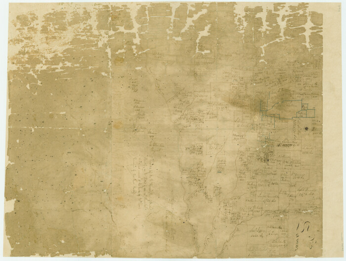
[South part of Lamar County]
Print $20.00
- Digital $50.00
[South part of Lamar County]
1844
-
Size
15.5 x 20.5 inches
-
Map/Doc
76045
-
Creation Date
1844
Sulphur River, Ringo Crossing Sheet
Print $20.00
- Digital $50.00
Sulphur River, Ringo Crossing Sheet
1933
-
Size
30.5 x 35.9 inches
-
Map/Doc
65162
-
Creation Date
1933
Sulphur River, Ringo Crossing Sheet
Print $20.00
- Digital $50.00
Sulphur River, Ringo Crossing Sheet
1933
-
Size
18.5 x 20.4 inches
-
Map/Doc
78334
-
Creation Date
1933
South Sulphur River, Klondike Sheet
Print $6.00
- Digital $50.00
South Sulphur River, Klondike Sheet
1925
-
Size
32.2 x 35.5 inches
-
Map/Doc
65170
-
Creation Date
1925
South Sulphur River, Klondike Sheet
Print $20.00
- Digital $50.00
South Sulphur River, Klondike Sheet
1925
-
Size
18.2 x 19.9 inches
-
Map/Doc
78332
-
Creation Date
1925
South Sulphur River, Harpers Crossing Sheet
Print $20.00
- Digital $50.00
South Sulphur River, Harpers Crossing Sheet
1925
-
Size
42.2 x 29.2 inches
-
Map/Doc
65169
-
Creation Date
1925
South Sulphur River, Harpers Crossing Sheet
Print $20.00
- Digital $50.00
South Sulphur River, Harpers Crossing Sheet
1925
-
Size
23.3 x 18.0 inches
-
Map/Doc
78328
-
Creation Date
1925
South Sulphur River, Charleston Sheet
Print $4.00
- Digital $50.00
South Sulphur River, Charleston Sheet
1924
-
Size
29.4 x 29.5 inches
-
Map/Doc
65168
-
Creation Date
1924
South Sulphur River, Charleston Sheet
Print $20.00
- Digital $50.00
South Sulphur River, Charleston Sheet
1924
-
Size
16.6 x 18.0 inches
-
Map/Doc
78326
-
Creation Date
1924
South Sulphur River, Bonner Point Sheet
Print $20.00
- Digital $50.00
South Sulphur River, Bonner Point Sheet
1922
-
Size
32.9 x 35.7 inches
-
Map/Doc
65164
-
Creation Date
1922
Red River County Rolled Sketch 7A
Print $20.00
- Digital $50.00
Red River County Rolled Sketch 7A
-
Size
28.3 x 33.1 inches
-
Map/Doc
7472
North and South Sulphur Rivers, Sulphur Bluff Sheet
Print $20.00
- Digital $50.00
North and South Sulphur Rivers, Sulphur Bluff Sheet
1933
-
Size
37.6 x 37.2 inches
-
Map/Doc
65163
-
Creation Date
1933
North Sulphur River, Sims Crossing Sheet
Print $20.00
- Digital $50.00
North Sulphur River, Sims Crossing Sheet
1924
-
Size
23.4 x 39.9 inches
-
Map/Doc
65167
-
Creation Date
1924
North Sulphur River, Sims Crossing Sheet
Print $20.00
- Digital $50.00
North Sulphur River, Sims Crossing Sheet
1924
-
Size
12.4 x 25.1 inches
-
Map/Doc
78335
-
Creation Date
1924
North Sulphur River, Mt. Joy Sheet
Print $20.00
- Digital $50.00
North Sulphur River, Mt. Joy Sheet
1926
-
Size
33.7 x 40.9 inches
-
Map/Doc
65166
-
Creation Date
1926
North Sulphur River, Mt. Joy Sheet
Print $20.00
- Digital $50.00
North Sulphur River, Mt. Joy Sheet
1926
-
Size
18.4 x 21.6 inches
-
Map/Doc
78333
-
Creation Date
1926
North Sulphur River, Kinsing Sheet
Print $20.00
- Digital $50.00
North Sulphur River, Kinsing Sheet
1925
-
Size
30.5 x 40.8 inches
-
Map/Doc
65165
-
Creation Date
1925
North Sulphur River, Kinsing Sheet
Print $20.00
- Digital $50.00
North Sulphur River, Kinsing Sheet
1925
-
Size
18.6 x 23.4 inches
-
Map/Doc
78331
-
Creation Date
1925
North Sulphur River, Ben Franklin Sheet
Print $40.00
- Digital $50.00
North Sulphur River, Ben Franklin Sheet
1928
-
Size
24.6 x 57.4 inches
-
Map/Doc
65172
-
Creation Date
1928
North Sulphur River, Ben Franklin Sheet
Print $20.00
- Digital $50.00
North Sulphur River, Ben Franklin Sheet
1928
-
Size
14.2 x 30.0 inches
-
Map/Doc
78324
-
Creation Date
1928
Middle Sulphur and South Sulphur Rivers, Horton Sheet
Print $20.00
- Digital $50.00
Middle Sulphur and South Sulphur Rivers, Horton Sheet
1925
-
Size
42.2 x 40.3 inches
-
Map/Doc
65171
-
Creation Date
1925
Middle Sulphur and South Sulphur Rivers, Horton Sheet
Print $20.00
- Digital $50.00
Middle Sulphur and South Sulphur Rivers, Horton Sheet
1925
-
Size
25.6 x 22.0 inches
-
Map/Doc
78330
-
Creation Date
1925
Levee Improvement Districts Widths of Floodways - Sulphur River and Cuthand Creek
Print $20.00
- Digital $50.00
Levee Improvement Districts Widths of Floodways - Sulphur River and Cuthand Creek
1924
-
Size
15.4 x 38.6 inches
-
Map/Doc
65155
-
Creation Date
1924
Levee Improvement Districts Width of Floodways - South Sulphur River
Print $6.00
- Digital $50.00
Levee Improvement Districts Width of Floodways - South Sulphur River
1918
-
Size
19.6 x 34.1 inches
-
Map/Doc
65175
-
Creation Date
1918
Lampasas County Working Sketch 1
Print $20.00
- Digital $50.00
Lampasas County Working Sketch 1
-
Size
16.2 x 20.3 inches
-
Map/Doc
70278
Lamar County Working Sketch 12
Print $20.00
- Digital $50.00
Lamar County Working Sketch 12
1994
-
Size
40.3 x 34.4 inches
-
Map/Doc
70273
-
Creation Date
1994
Hopkins County Sketch File 7
Print $6.00
- Digital $50.00
Hopkins County Sketch File 7
-
Size
10.4 x 6.1 inches
-
Map/Doc
26692
Hopkins County Sketch File 4
Print $47.00
- Digital $50.00
Hopkins County Sketch File 4
-
Size
21.2 x 18.4 inches
-
Map/Doc
4565
Hopkins County Sketch File 28
Print $20.00
- Digital $50.00
Hopkins County Sketch File 28
-
Size
24.8 x 34.0 inches
-
Map/Doc
11786
Hopkins County Sketch File 17
Print $6.00
- Digital $50.00
Hopkins County Sketch File 17
1870
-
Size
7.8 x 8.0 inches
-
Map/Doc
26720
-
Creation Date
1870