Delta County Sketch File 1

Print $4.00
- Digital $50.00
Delta County Sketch File 1
1871
Size: 12.7 x 8.1 inches
20666
Delta County Sketch File 1a

Print $4.00
- Digital $50.00
Delta County Sketch File 1a
Size: 8.3 x 8.9 inches
20668
Delta County Sketch File 2

Print $4.00
- Digital $50.00
Delta County Sketch File 2
1871
Size: 8.4 x 13.2 inches
20670
Delta County Sketch File 3

Print $6.00
- Digital $50.00
Delta County Sketch File 3
Size: 10.2 x 12.6 inches
20672
Delta County Sketch File 4

Print $4.00
- Digital $50.00
Delta County Sketch File 4
Size: 10.9 x 7.3 inches
20674
Delta County Sketch File 5

Print $2.00
- Digital $50.00
Delta County Sketch File 5
1886
Size: 14.6 x 8.6 inches
20676
Delta County Sketch File 6

Print $20.00
- Digital $50.00
Delta County Sketch File 6
Size: 18.3 x 22.4 inches
11310
Delta County Working Sketch 1

Print $20.00
- Digital $50.00
Delta County Working Sketch 1
1942
Size: 24.7 x 28.8 inches
68638
Delta County Working Sketch 2

Print $20.00
- Digital $50.00
Delta County Working Sketch 2
1963
Size: 26.6 x 25.2 inches
68639
Delta County Working Sketch 3

Print $20.00
- Digital $50.00
Delta County Working Sketch 3
1963
Size: 24.9 x 24.4 inches
68640
Delta County Working Sketch 4

Print $20.00
- Digital $50.00
Delta County Working Sketch 4
Size: 16.8 x 21.1 inches
62179
Delta County Working Sketch Graphic Index

Print $20.00
- Digital $50.00
Delta County Working Sketch Graphic Index
1942
Size: 25.3 x 39.2 inches
76520
Delta County, Texas

Print $20.00
- Digital $50.00
Delta County, Texas
1884
Size: 14.1 x 20.0 inches
416
Fannin County Sketch File 8

Print $4.00
- Digital $50.00
Fannin County Sketch File 8
Size: 8.7 x 13.3 inches
22453
General Highway Map, Delta County, Hopkins County, Texas

Print $20.00
General Highway Map, Delta County, Hopkins County, Texas
1940
Size: 25.2 x 18.5 inches
79073
General Highway Map, Delta County, Hopkins County, Texas

Print $20.00
General Highway Map, Delta County, Hopkins County, Texas
1961
Size: 24.6 x 18.2 inches
79439
General Highway Map, Detail of Cities and Towns in Delta County, Hopkins County [Cooper and vicinity]
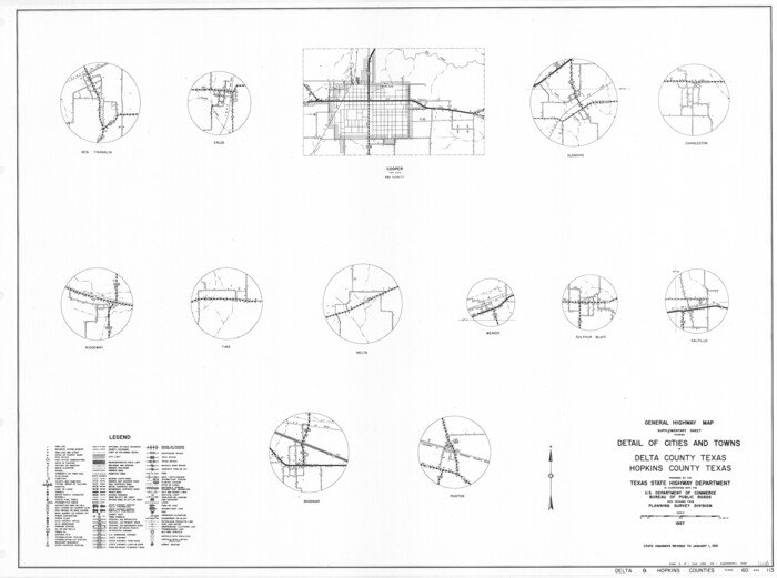
Print $20.00
General Highway Map, Detail of Cities and Towns in Delta County, Hopkins County [Cooper and vicinity]
1961
Size: 18.2 x 24.4 inches
79440
Hopkins County Sketch File 17

Print $6.00
- Digital $50.00
Hopkins County Sketch File 17
1870
Size: 7.8 x 8.0 inches
26720
Hopkins County Sketch File 28

Print $20.00
- Digital $50.00
Hopkins County Sketch File 28
Size: 24.8 x 34.0 inches
11786
Hopkins County Sketch File 4

Print $47.00
- Digital $50.00
Hopkins County Sketch File 4
Size: 21.2 x 18.4 inches
4565
Hopkins County Sketch File 7

Print $6.00
- Digital $50.00
Hopkins County Sketch File 7
Size: 10.4 x 6.1 inches
26692
Lamar County Working Sketch 12

Print $20.00
- Digital $50.00
Lamar County Working Sketch 12
1994
Size: 40.3 x 34.4 inches
70273
Delta Co.

Print $20.00
- Digital $50.00
Delta Co.
1889
-
Size
29.2 x 38.3 inches
-
Map/Doc
4931
-
Creation Date
1889
Delta County

Print $20.00
- Digital $50.00
Delta County
1870
-
Size
15.2 x 18.8 inches
-
Map/Doc
3472
-
Creation Date
1870
Delta County

Print $20.00
- Digital $50.00
Delta County
1889
-
Size
27.9 x 36.4 inches
-
Map/Doc
3473
-
Creation Date
1889
Delta County

Print $20.00
- Digital $50.00
Delta County
1870
-
Size
13.3 x 17.3 inches
-
Map/Doc
4528
-
Creation Date
1870
Delta County

Print $20.00
- Digital $50.00
Delta County
1942
-
Size
26.9 x 39.9 inches
-
Map/Doc
66801
-
Creation Date
1942
Delta County

Print $20.00
- Digital $50.00
Delta County
1942
-
Size
28.6 x 39.0 inches
-
Map/Doc
73129
-
Creation Date
1942
Delta County

Print $20.00
- Digital $50.00
Delta County
1942
-
Size
24.5 x 38.0 inches
-
Map/Doc
77261
-
Creation Date
1942
Delta County

Print $20.00
- Digital $50.00
Delta County
1942
-
Size
28.4 x 40.1 inches
-
Map/Doc
95478
-
Creation Date
1942
Delta County Sketch File 1
Print $4.00
- Digital $50.00
Delta County Sketch File 1
1871
-
Size
12.7 x 8.1 inches
-
Map/Doc
20666
-
Creation Date
1871
Delta County Sketch File 1a
Print $4.00
- Digital $50.00
Delta County Sketch File 1a
-
Size
8.3 x 8.9 inches
-
Map/Doc
20668
Delta County Sketch File 2
Print $4.00
- Digital $50.00
Delta County Sketch File 2
1871
-
Size
8.4 x 13.2 inches
-
Map/Doc
20670
-
Creation Date
1871
Delta County Sketch File 3
Print $6.00
- Digital $50.00
Delta County Sketch File 3
-
Size
10.2 x 12.6 inches
-
Map/Doc
20672
Delta County Sketch File 4
Print $4.00
- Digital $50.00
Delta County Sketch File 4
-
Size
10.9 x 7.3 inches
-
Map/Doc
20674
Delta County Sketch File 5
Print $2.00
- Digital $50.00
Delta County Sketch File 5
1886
-
Size
14.6 x 8.6 inches
-
Map/Doc
20676
-
Creation Date
1886
Delta County Sketch File 6
Print $20.00
- Digital $50.00
Delta County Sketch File 6
-
Size
18.3 x 22.4 inches
-
Map/Doc
11310
Delta County Working Sketch 1
Print $20.00
- Digital $50.00
Delta County Working Sketch 1
1942
-
Size
24.7 x 28.8 inches
-
Map/Doc
68638
-
Creation Date
1942
Delta County Working Sketch 2
Print $20.00
- Digital $50.00
Delta County Working Sketch 2
1963
-
Size
26.6 x 25.2 inches
-
Map/Doc
68639
-
Creation Date
1963
Delta County Working Sketch 3
Print $20.00
- Digital $50.00
Delta County Working Sketch 3
1963
-
Size
24.9 x 24.4 inches
-
Map/Doc
68640
-
Creation Date
1963
Delta County Working Sketch 4
Print $20.00
- Digital $50.00
Delta County Working Sketch 4
-
Size
16.8 x 21.1 inches
-
Map/Doc
62179
Delta County Working Sketch Graphic Index
Print $20.00
- Digital $50.00
Delta County Working Sketch Graphic Index
1942
-
Size
25.3 x 39.2 inches
-
Map/Doc
76520
-
Creation Date
1942
Delta County, Texas
Print $20.00
- Digital $50.00
Delta County, Texas
1884
-
Size
14.1 x 20.0 inches
-
Map/Doc
416
-
Creation Date
1884
Fannin County Sketch File 8
Print $4.00
- Digital $50.00
Fannin County Sketch File 8
-
Size
8.7 x 13.3 inches
-
Map/Doc
22453
General Highway Map, Delta County, Hopkins County, Texas
Print $20.00
General Highway Map, Delta County, Hopkins County, Texas
1940
-
Size
25.2 x 18.5 inches
-
Map/Doc
79073
-
Creation Date
1940
General Highway Map, Delta County, Hopkins County, Texas
Print $20.00
General Highway Map, Delta County, Hopkins County, Texas
1961
-
Size
24.6 x 18.2 inches
-
Map/Doc
79439
-
Creation Date
1961
General Highway Map, Detail of Cities and Towns in Delta County, Hopkins County [Cooper and vicinity]
Print $20.00
General Highway Map, Detail of Cities and Towns in Delta County, Hopkins County [Cooper and vicinity]
1961
-
Size
18.2 x 24.4 inches
-
Map/Doc
79440
-
Creation Date
1961
Hopkins County Sketch File 17
Print $6.00
- Digital $50.00
Hopkins County Sketch File 17
1870
-
Size
7.8 x 8.0 inches
-
Map/Doc
26720
-
Creation Date
1870
Hopkins County Sketch File 28
Print $20.00
- Digital $50.00
Hopkins County Sketch File 28
-
Size
24.8 x 34.0 inches
-
Map/Doc
11786
Hopkins County Sketch File 4
Print $47.00
- Digital $50.00
Hopkins County Sketch File 4
-
Size
21.2 x 18.4 inches
-
Map/Doc
4565
Hopkins County Sketch File 7
Print $6.00
- Digital $50.00
Hopkins County Sketch File 7
-
Size
10.4 x 6.1 inches
-
Map/Doc
26692
Lamar County Working Sketch 12
Print $20.00
- Digital $50.00
Lamar County Working Sketch 12
1994
-
Size
40.3 x 34.4 inches
-
Map/Doc
70273
-
Creation Date
1994