[Sketch showing Jeff Davis County, Blocks 1, 2, 3, 4, 360, 363 and JG1]
Print $20.00
- Digital $50.00
[Sketch showing Jeff Davis County, Blocks 1, 2, 3, 4, 360, 363 and JG1]
Size: 20.5 x 13.7 inches
91776
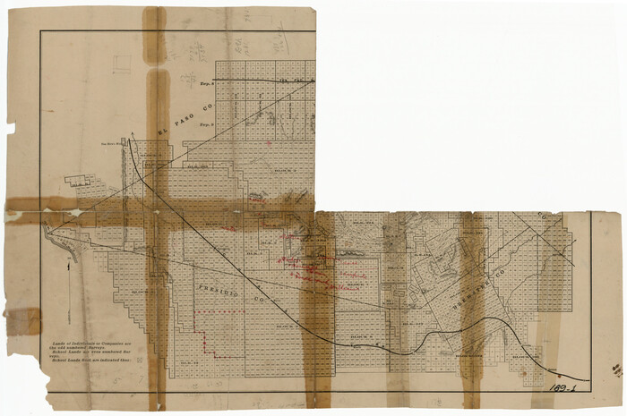
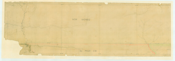
[Plat of Location and Right of Way from El Paso, Tex. To New Mexico Line, Rio Grande and El Paso R. R.]
Print $40.00
- Digital $50.00
[Plat of Location and Right of Way from El Paso, Tex. To New Mexico Line, Rio Grande and El Paso R. R.]
Size: 23.8 x 122.6 inches
64082
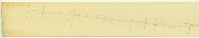
[Plat of Location and Right of Way from El Paso, Tex. To New Mexico Line, Rio Grande and El Paso R. R.]
Print $20.00
- Digital $50.00
[Plat of Location and Right of Way from El Paso, Tex. To New Mexico Line, Rio Grande and El Paso R. R.]
Size: 22.7 x 46.8 inches
64084
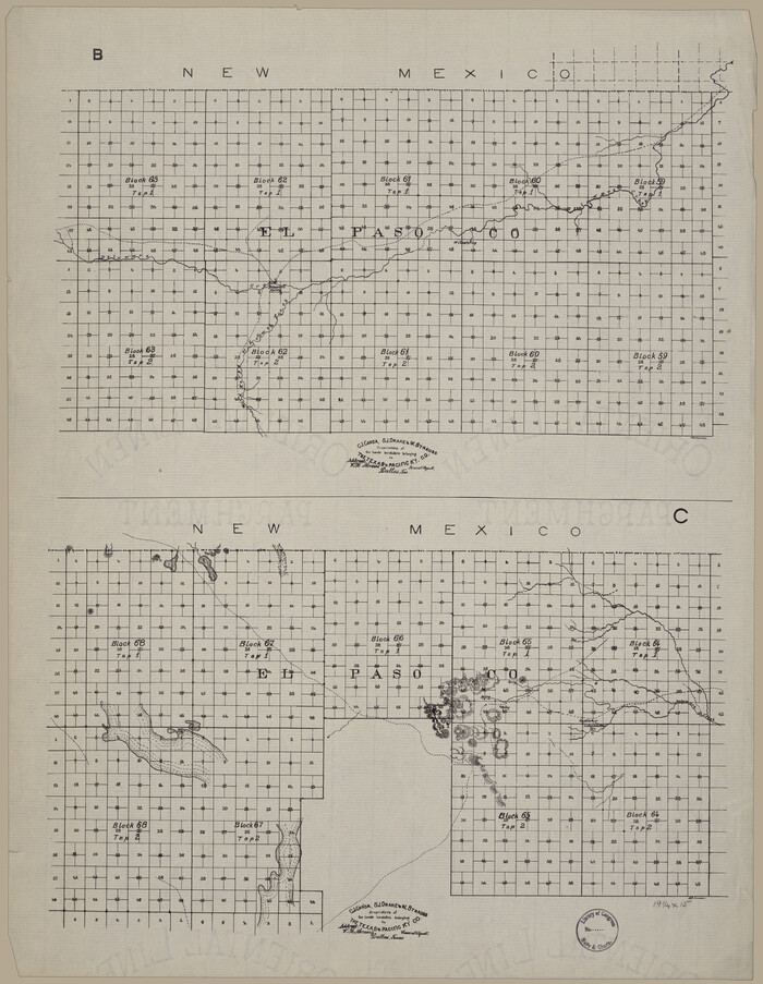
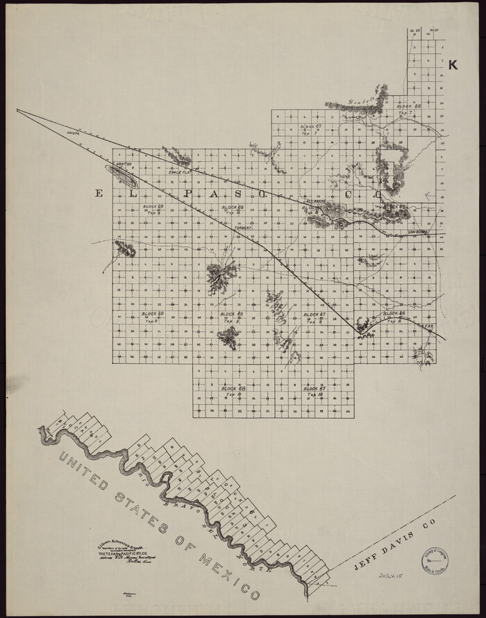
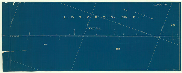
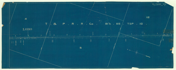
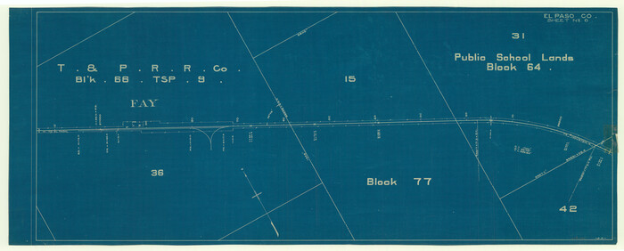
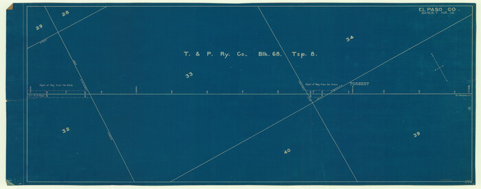
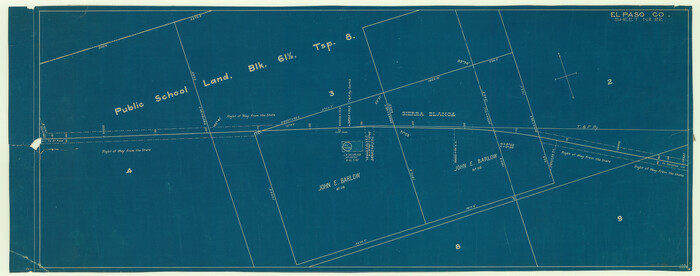
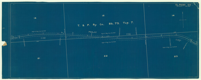
[Map showing T&P Lands in El Paso County]
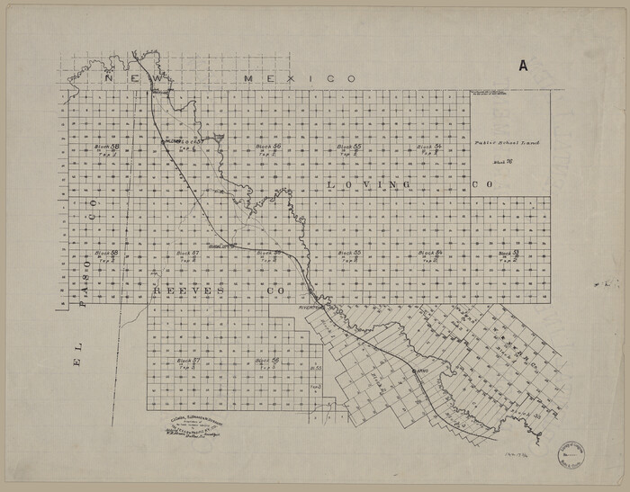
Print $20.00
[Map showing T&P Lands in El Paso County]
Size: 17.5 x 22.3 inches
88930
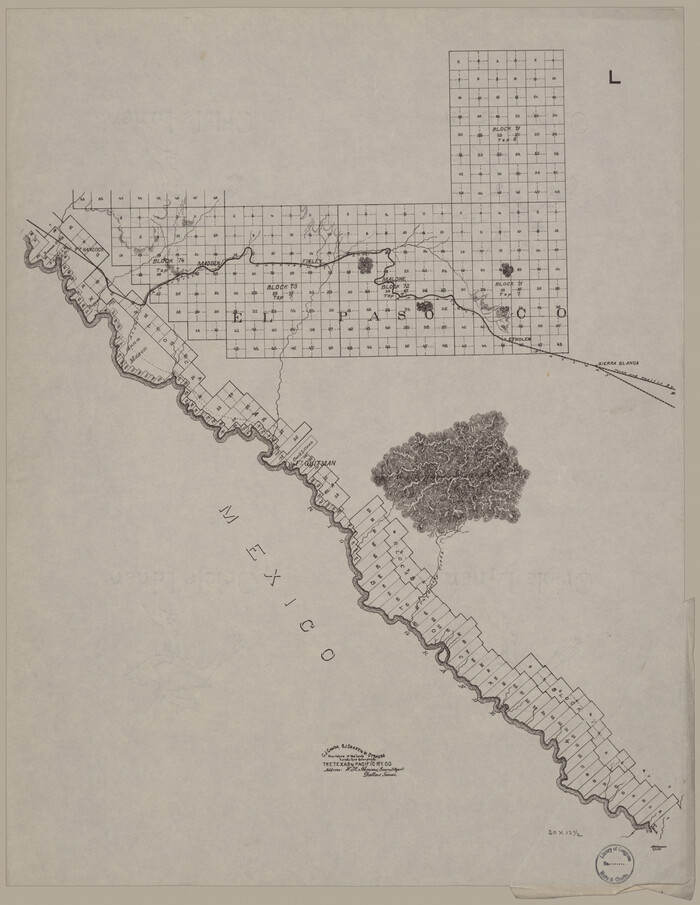
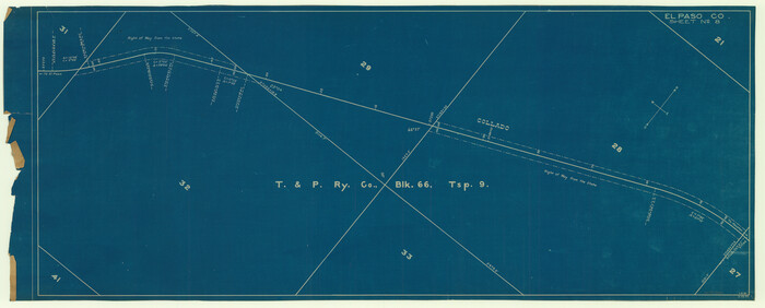
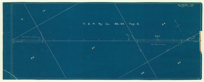
[Map showing T&P Lands in El Paso County]
Print $20.00
[Map showing T&P Lands in El Paso County]
Size: 22.4 x 17.3 inches
88931
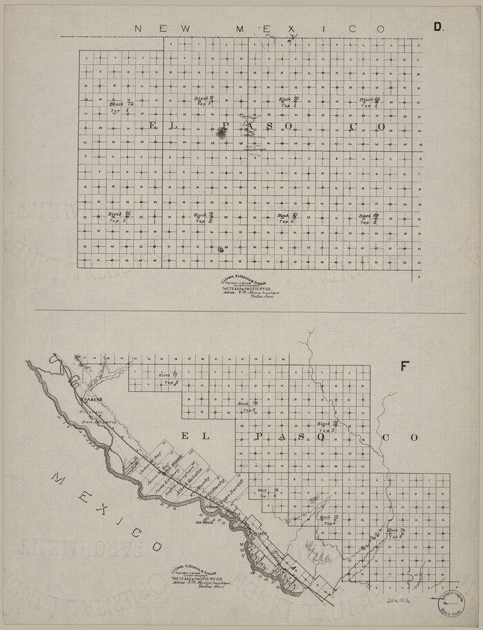
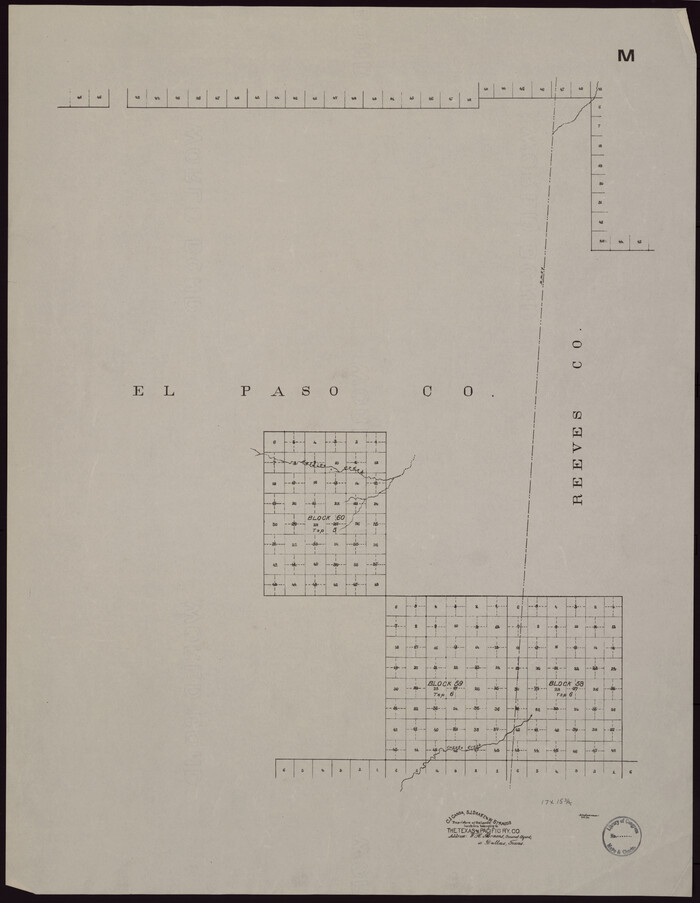
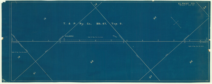
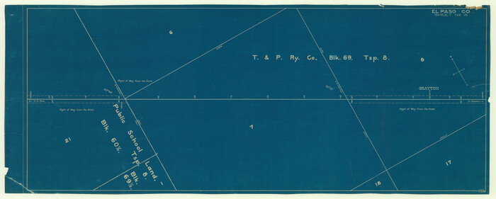
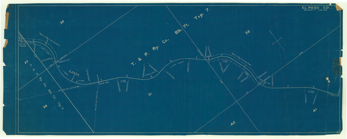
[Map showing T&P Lands in El Paso County]
Print $20.00
[Map showing T&P Lands in El Paso County]
Size: 22.2 x 17.1 inches
88932
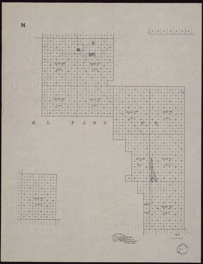
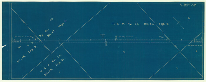
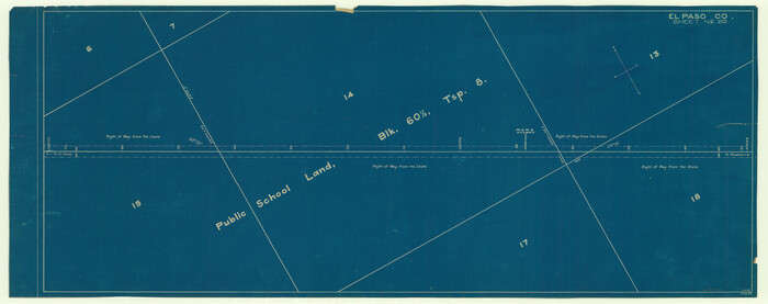
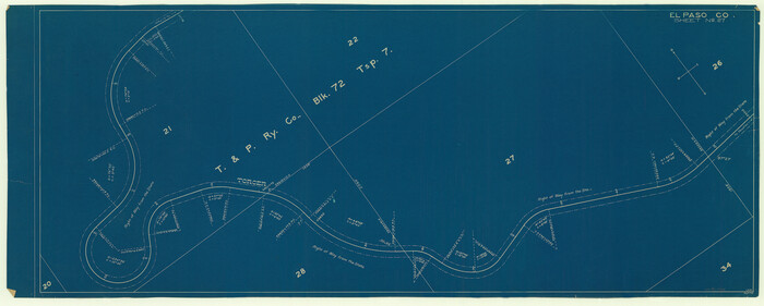
[Map showing T&P Lands in El Paso County]
Print $20.00
[Map showing T&P Lands in El Paso County]
Size: 17.2 x 22.1 inches
88933
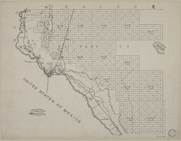
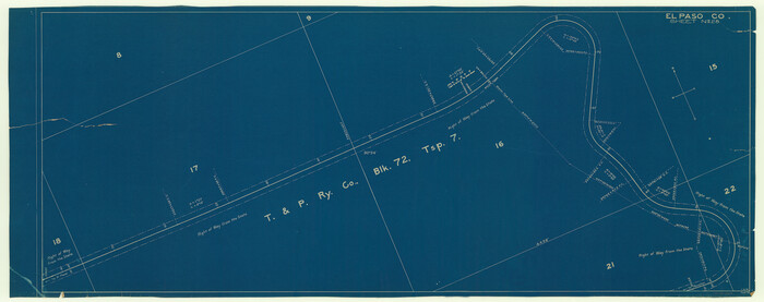
[Map showing T&P Lands in El Paso County]
Print $20.00
[Map showing T&P Lands in El Paso County]
Size: 17.3 x 22.2 inches
88934
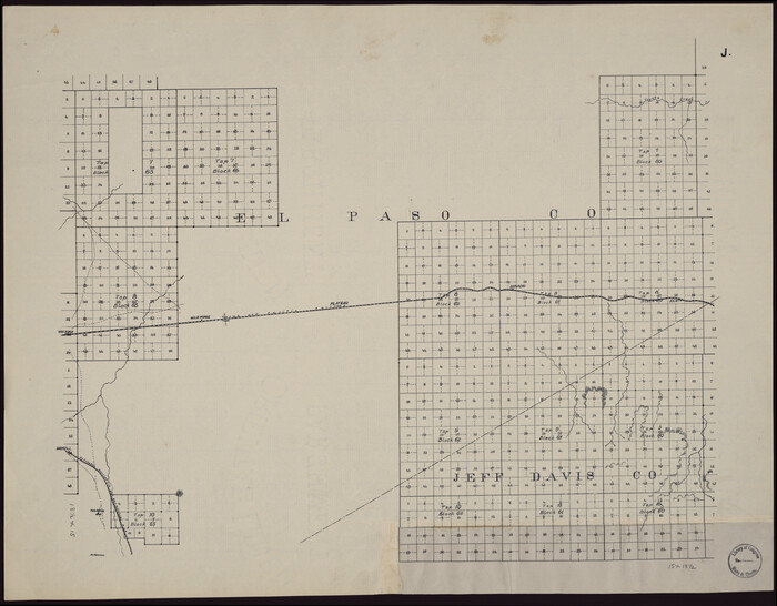
[Map showing T&P Lands in El Paso County]
Print $20.00
[Map showing T&P Lands in El Paso County]
Size: 22.2 x 17.4 inches
88935
[Map showing T&P Lands in El Paso County]
Print $20.00
[Map showing T&P Lands in El Paso County]
Size: 22.6 x 17.5 inches
88936
[Map showing T&P Lands in El Paso County]
Print $20.00
[Map showing T&P Lands in El Paso County]
Size: 22.3 x 17.3 inches
88937
[Map showing T&P Lands in El Paso County]
Print $20.00
[Map showing T&P Lands in El Paso County]
Size: 22.4 x 17.2 inches
88938
[Map of the Recognised Line M. EL. P. & P. R. R. from East Line of Bexar Land District to El Paso]
Print $40.00
- Digital $50.00
[Map of the Recognised Line M. EL. P. & P. R. R. from East Line of Bexar Land District to El Paso]
1857
Size: 56.9 x 20.0 inches
85323
[Letters to and from Maj. W. J. Powell regarding surveys of Texas and Pacific Ry. Lands west of the Pecos. Blks 53-55, Township 1 & 2 map within]
![2249, [Letters to and from Maj. W. J. Powell regarding surveys of Texas and Pacific Ry. Lands west of the Pecos. Blks 53-55, Township 1 & 2 map within], General Map Collection](https://historictexasmaps.com/wmedia_w700/pdf_converted_jpg/qi_pdf_thumbnail_1039.jpg)
Print $124.00
- Digital $50.00
[Letters to and from Maj. W. J. Powell regarding surveys of Texas and Pacific Ry. Lands west of the Pecos. Blks 53-55, Township 1 & 2 map within]
1934
Size: 10.2 x 15.4 inches
2249
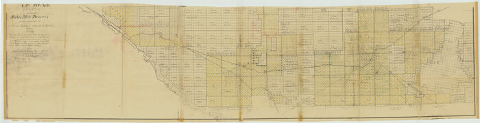
[Index map of T. & P. Ry. Company’s 80-mile Trans-Pecos Reserve’s perpetuated corners - South Part]
Print $40.00
- Digital $50.00
[Index map of T. & P. Ry. Company’s 80-mile Trans-Pecos Reserve’s perpetuated corners - South Part]
Size: 23.1 x 90.1 inches
69766
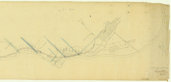
[Galveston, Harrisburg & San Antonio through El Paso County]
Print $20.00
- Digital $50.00
[Galveston, Harrisburg & San Antonio through El Paso County]
1907
Size: 13.6 x 33.7 inches
64001
[Galveston, Harrisburg & San Antonio through El Paso County]
Print $20.00
- Digital $50.00
[Galveston, Harrisburg & San Antonio through El Paso County]
1907
Size: 13.6 x 33.9 inches
64002
[Galveston, Harrisburg & San Antonio through El Paso County]
Print $20.00
- Digital $50.00
[Galveston, Harrisburg & San Antonio through El Paso County]
1907
Size: 13.7 x 33.9 inches
64003
[Galveston, Harrisburg & San Antonio through El Paso County]
Print $20.00
- Digital $50.00
[Galveston, Harrisburg & San Antonio through El Paso County]
Size: 13.6 x 33.6 inches
64004
[Galveston, Harrisburg & San Antonio through El Paso County]
Print $20.00
- Digital $50.00
[Galveston, Harrisburg & San Antonio through El Paso County]
1906
Size: 13.3 x 33.6 inches
64005
[Galveston, Harrisburg & San Antonio through El Paso County]
Print $20.00
- Digital $50.00
[Galveston, Harrisburg & San Antonio through El Paso County]
Size: 13.5 x 33.7 inches
64006
[Galveston, Harrisburg & San Antonio through El Paso County]
Print $20.00
- Digital $50.00
[Galveston, Harrisburg & San Antonio through El Paso County]
1906
Size: 13.4 x 33.9 inches
64007
[Galveston, Harrisburg & San Antonio through El Paso County]
Print $20.00
- Digital $50.00
[Galveston, Harrisburg & San Antonio through El Paso County]
1906
Size: 13.7 x 33.8 inches
64008
[Galveston, Harrisburg & San Antonio through El Paso County]
Print $20.00
- Digital $50.00
[Galveston, Harrisburg & San Antonio through El Paso County]
1906
Size: 13.6 x 33.8 inches
64009
[Galveston, Harrisburg & San Antonio through El Paso County]
Print $20.00
- Digital $50.00
[Galveston, Harrisburg & San Antonio through El Paso County]
1906
Size: 13.4 x 33.9 inches
64010
[Galveston, Harrisburg & San Antonio through El Paso County]
Print $20.00
- Digital $50.00
[Galveston, Harrisburg & San Antonio through El Paso County]
1906
Size: 13.3 x 33.8 inches
64011
[Galveston, Harrisburg & San Antonio through El Paso County]
Print $20.00
- Digital $50.00
[Galveston, Harrisburg & San Antonio through El Paso County]
1906
Size: 13.6 x 33.8 inches
64012
[Galveston, Harrisburg & San Antonio through El Paso County]
Print $20.00
- Digital $50.00
[Galveston, Harrisburg & San Antonio through El Paso County]
1906
Size: 13.5 x 33.5 inches
64013
[Galveston, Harrisburg & San Antonio through El Paso County]
Print $20.00
- Digital $50.00
[Galveston, Harrisburg & San Antonio through El Paso County]
1906
Size: 13.4 x 33.8 inches
64014
[Galveston, Harrisburg & San Antonio through El Paso County]
Print $20.00
- Digital $50.00
[Galveston, Harrisburg & San Antonio through El Paso County]
1907
Size: 13.5 x 33.7 inches
64015
[Sketch showing Jeff Davis County, Blocks 1, 2, 3, 4, 360, 363 and JG1]
Print $20.00
- Digital $50.00
[Sketch showing Jeff Davis County, Blocks 1, 2, 3, 4, 360, 363 and JG1]
-
Size
20.5 x 13.7 inches
-
Map/Doc
91776
[Plat of Location and Right of Way from El Paso, Tex. To New Mexico Line, Rio Grande and El Paso R. R.]
Print $40.00
- Digital $50.00
[Plat of Location and Right of Way from El Paso, Tex. To New Mexico Line, Rio Grande and El Paso R. R.]
-
Size
23.8 x 122.6 inches
-
Map/Doc
64082
[Plat of Location and Right of Way from El Paso, Tex. To New Mexico Line, Rio Grande and El Paso R. R.]
Print $20.00
- Digital $50.00
[Plat of Location and Right of Way from El Paso, Tex. To New Mexico Line, Rio Grande and El Paso R. R.]
-
Size
22.7 x 46.8 inches
-
Map/Doc
64084
[Map showing T&P Lands in El Paso County]
Print $20.00
[Map showing T&P Lands in El Paso County]
-
Size
17.5 x 22.3 inches
-
Map/Doc
88930
[Map showing T&P Lands in El Paso County]
Print $20.00
[Map showing T&P Lands in El Paso County]
-
Size
22.4 x 17.3 inches
-
Map/Doc
88931
[Map showing T&P Lands in El Paso County]
Print $20.00
[Map showing T&P Lands in El Paso County]
-
Size
22.2 x 17.1 inches
-
Map/Doc
88932
[Map showing T&P Lands in El Paso County]
Print $20.00
[Map showing T&P Lands in El Paso County]
-
Size
17.2 x 22.1 inches
-
Map/Doc
88933
[Map showing T&P Lands in El Paso County]
Print $20.00
[Map showing T&P Lands in El Paso County]
-
Size
17.3 x 22.2 inches
-
Map/Doc
88934
[Map showing T&P Lands in El Paso County]
Print $20.00
[Map showing T&P Lands in El Paso County]
-
Size
22.2 x 17.4 inches
-
Map/Doc
88935
[Map showing T&P Lands in El Paso County]
Print $20.00
[Map showing T&P Lands in El Paso County]
-
Size
22.6 x 17.5 inches
-
Map/Doc
88936
[Map showing T&P Lands in El Paso County]
Print $20.00
[Map showing T&P Lands in El Paso County]
-
Size
22.3 x 17.3 inches
-
Map/Doc
88937
[Map showing T&P Lands in El Paso County]
Print $20.00
[Map showing T&P Lands in El Paso County]
-
Size
22.4 x 17.2 inches
-
Map/Doc
88938
[Map of the Recognised Line M. EL. P. & P. R. R. from East Line of Bexar Land District to El Paso]
Print $40.00
- Digital $50.00
[Map of the Recognised Line M. EL. P. & P. R. R. from East Line of Bexar Land District to El Paso]
1857
-
Size
56.9 x 20.0 inches
-
Map/Doc
85323
-
Creation Date
1857
[Letters to and from Maj. W. J. Powell regarding surveys of Texas and Pacific Ry. Lands west of the Pecos. Blks 53-55, Township 1 & 2 map within]
Print $124.00
- Digital $50.00
[Letters to and from Maj. W. J. Powell regarding surveys of Texas and Pacific Ry. Lands west of the Pecos. Blks 53-55, Township 1 & 2 map within]
1934
-
Size
10.2 x 15.4 inches
-
Map/Doc
2249
-
Creation Date
1934
[Index map of T. & P. Ry. Company’s 80-mile Trans-Pecos Reserve’s perpetuated corners - South Part]
Print $40.00
- Digital $50.00
[Index map of T. & P. Ry. Company’s 80-mile Trans-Pecos Reserve’s perpetuated corners - South Part]
-
Size
23.1 x 90.1 inches
-
Map/Doc
69766
[Galveston, Harrisburg & San Antonio through El Paso County]
Print $20.00
- Digital $50.00
[Galveston, Harrisburg & San Antonio through El Paso County]
1907
-
Size
13.6 x 33.7 inches
-
Map/Doc
64001
-
Creation Date
1907
[Galveston, Harrisburg & San Antonio through El Paso County]
Print $20.00
- Digital $50.00
[Galveston, Harrisburg & San Antonio through El Paso County]
1907
-
Size
13.6 x 33.9 inches
-
Map/Doc
64002
-
Creation Date
1907
[Galveston, Harrisburg & San Antonio through El Paso County]
Print $20.00
- Digital $50.00
[Galveston, Harrisburg & San Antonio through El Paso County]
1907
-
Size
13.7 x 33.9 inches
-
Map/Doc
64003
-
Creation Date
1907
[Galveston, Harrisburg & San Antonio through El Paso County]
Print $20.00
- Digital $50.00
[Galveston, Harrisburg & San Antonio through El Paso County]
-
Size
13.6 x 33.6 inches
-
Map/Doc
64004
[Galveston, Harrisburg & San Antonio through El Paso County]
Print $20.00
- Digital $50.00
[Galveston, Harrisburg & San Antonio through El Paso County]
1906
-
Size
13.3 x 33.6 inches
-
Map/Doc
64005
-
Creation Date
1906
[Galveston, Harrisburg & San Antonio through El Paso County]
Print $20.00
- Digital $50.00
[Galveston, Harrisburg & San Antonio through El Paso County]
-
Size
13.5 x 33.7 inches
-
Map/Doc
64006
[Galveston, Harrisburg & San Antonio through El Paso County]
Print $20.00
- Digital $50.00
[Galveston, Harrisburg & San Antonio through El Paso County]
1906
-
Size
13.4 x 33.9 inches
-
Map/Doc
64007
-
Creation Date
1906
[Galveston, Harrisburg & San Antonio through El Paso County]
Print $20.00
- Digital $50.00
[Galveston, Harrisburg & San Antonio through El Paso County]
1906
-
Size
13.7 x 33.8 inches
-
Map/Doc
64008
-
Creation Date
1906
[Galveston, Harrisburg & San Antonio through El Paso County]
Print $20.00
- Digital $50.00
[Galveston, Harrisburg & San Antonio through El Paso County]
1906
-
Size
13.6 x 33.8 inches
-
Map/Doc
64009
-
Creation Date
1906
[Galveston, Harrisburg & San Antonio through El Paso County]
Print $20.00
- Digital $50.00
[Galveston, Harrisburg & San Antonio through El Paso County]
1906
-
Size
13.4 x 33.9 inches
-
Map/Doc
64010
-
Creation Date
1906
[Galveston, Harrisburg & San Antonio through El Paso County]
Print $20.00
- Digital $50.00
[Galveston, Harrisburg & San Antonio through El Paso County]
1906
-
Size
13.3 x 33.8 inches
-
Map/Doc
64011
-
Creation Date
1906
[Galveston, Harrisburg & San Antonio through El Paso County]
Print $20.00
- Digital $50.00
[Galveston, Harrisburg & San Antonio through El Paso County]
1906
-
Size
13.6 x 33.8 inches
-
Map/Doc
64012
-
Creation Date
1906
[Galveston, Harrisburg & San Antonio through El Paso County]
Print $20.00
- Digital $50.00
[Galveston, Harrisburg & San Antonio through El Paso County]
1906
-
Size
13.5 x 33.5 inches
-
Map/Doc
64013
-
Creation Date
1906
[Galveston, Harrisburg & San Antonio through El Paso County]
Print $20.00
- Digital $50.00
[Galveston, Harrisburg & San Antonio through El Paso County]
1906
-
Size
13.4 x 33.8 inches
-
Map/Doc
64014
-
Creation Date
1906
[Galveston, Harrisburg & San Antonio through El Paso County]
Print $20.00
- Digital $50.00
[Galveston, Harrisburg & San Antonio through El Paso County]
1907
-
Size
13.5 x 33.7 inches
-
Map/Doc
64015
-
Creation Date
1907