Ellis County Working Sketch 5

Print $40.00
- Digital $50.00
Ellis County Working Sketch 5
1997
Size: 49.2 x 32.4 inches
69021
Ellis County Working Sketch 4

Print $40.00
- Digital $50.00
Ellis County Working Sketch 4
1997
Size: 48.0 x 30.3 inches
69020
Baseline Parcels 83 - Superconducting Super Collider

Print $20.00
- Digital $50.00
Baseline Parcels 83 - Superconducting Super Collider
1991
Size: 31.0 x 39.2 inches
93676
Dallas County Working Sketch 12

Print $20.00
- Digital $50.00
Dallas County Working Sketch 12
1983
Size: 30.5 x 44.1 inches
68578
Ellis County Working Sketch 3

Print $40.00
- Digital $50.00
Ellis County Working Sketch 3
1981
Size: 39.1 x 50.0 inches
69019
General Highway Map, Ellis County, Texas

Print $20.00
General Highway Map, Ellis County, Texas
1961
Size: 18.2 x 24.6 inches
79453
Flight Mission No. DJV-3P, Frame 13, Ellis County

Print $20.00
- Digital $50.00
Flight Mission No. DJV-3P, Frame 13, Ellis County
1956
Size: 18.6 x 22.2 inches
84975
Flight Mission No. DJV-3P, Frame 14, Ellis County

Print $20.00
- Digital $50.00
Flight Mission No. DJV-3P, Frame 14, Ellis County
1956
Size: 18.8 x 22.4 inches
84976
Flight Mission No. DJV-3P, Frame 15, Ellis County

Print $20.00
- Digital $50.00
Flight Mission No. DJV-3P, Frame 15, Ellis County
1956
Size: 18.8 x 22.4 inches
84977
Navarro County Sketch File 19

Print $14.00
- Digital $50.00
Navarro County Sketch File 19
1951
Size: 11.4 x 8.8 inches
32336
Ellis County Working Sketch 2

Print $20.00
- Digital $50.00
Ellis County Working Sketch 2
1947
Size: 27.0 x 25.6 inches
69018
Ellis County Working Sketch Graphic Index

Print $20.00
- Digital $50.00
Ellis County Working Sketch Graphic Index
1943
Size: 43.1 x 47.7 inches
76535
Ellis County Working Sketch 1

Print $20.00
- Digital $50.00
Ellis County Working Sketch 1
1939
Size: 19.1 x 19.3 inches
69017
General Highway Map, Ellis County, Texas

Print $20.00
General Highway Map, Ellis County, Texas
1939
Size: 18.4 x 24.9 inches
79083
Ennis, Ellis County, Texas

Print $20.00
- Digital $50.00
Ennis, Ellis County, Texas
1934
Size: 34.6 x 22.9 inches
4826
Trinity River, Onion Creek Station Sheet/Chambers Creek

Print $6.00
- Digital $50.00
Trinity River, Onion Creek Station Sheet/Chambers Creek
1931
Size: 35.1 x 32.4 inches
65234
Trinity River, Reagor Springs Sheet/Waxahachie Creek

Print $4.00
- Digital $50.00
Trinity River, Reagor Springs Sheet/Waxahachie Creek
1931
Size: 29.9 x 25.6 inches
65236
Trinity River, Waxahachie Sheet/Waxahachie Creek

Print $6.00
- Digital $50.00
Trinity River, Waxahachie Sheet/Waxahachie Creek
1931
Size: 30.1 x 32.8 inches
65237
Trinity River, Boyd Crossing Sheet/Chambers Creek

Print $20.00
- Digital $50.00
Trinity River, Boyd Crossing Sheet/Chambers Creek
1931
Size: 17.5 x 43.1 inches
65238
Trinity River, Hughes Crossing Sheet/Chambers Creek

Print $6.00
- Digital $50.00
Trinity River, Hughes Crossing Sheet/Chambers Creek
1931
Size: 32.5 x 30.2 inches
65239
Trinity River, Ham Crossing Sheet/Waxahachie Creek

Print $6.00
- Digital $50.00
Trinity River, Ham Crossing Sheet/Waxahachie Creek
1930
Size: 31.4 x 31.1 inches
65235
G.C. & S.F. Ry. Alinement and Right of Way map of Dallas Branch, Ellis County, Texas

Print $40.00
- Digital $50.00
G.C. & S.F. Ry. Alinement and Right of Way map of Dallas Branch, Ellis County, Texas
1925
Size: 31.4 x 120.7 inches
64547
G.C. & S.F. Ry. Alinement and Right of Way map of Dallas Branch, Ellis County, Texas

Print $20.00
- Digital $50.00
G.C. & S.F. Ry. Alinement and Right of Way map of Dallas Branch, Ellis County, Texas
1925
Size: 30.9 x 44.2 inches
64548
G. C. & S. F. Ry. Alinement [sic] and Right of Way Map of Dallas Branch, Johnson County, Texas
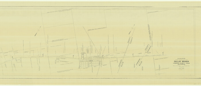
Print $40.00
- Digital $50.00
G. C. & S. F. Ry. Alinement [sic] and Right of Way Map of Dallas Branch, Johnson County, Texas
1925
Size: 37.6 x 87.9 inches
64652
Trinity River, Red Bank Sheet

Print $20.00
- Digital $50.00
Trinity River, Red Bank Sheet
1925
Size: 16.4 x 24.4 inches
69687
Trinity River, Club House Sheet

Print $20.00
- Digital $50.00
Trinity River, Club House Sheet
1925
Size: 27.7 x 23.7 inches
69688
Ellis County Working Sketch 5
Print $40.00
- Digital $50.00
Ellis County Working Sketch 5
1997
-
Size
49.2 x 32.4 inches
-
Map/Doc
69021
-
Creation Date
1997
Ellis County Working Sketch 4
Print $40.00
- Digital $50.00
Ellis County Working Sketch 4
1997
-
Size
48.0 x 30.3 inches
-
Map/Doc
69020
-
Creation Date
1997
Baseline Parcels 83 - Superconducting Super Collider
Print $20.00
- Digital $50.00
Baseline Parcels 83 - Superconducting Super Collider
1991
-
Size
31.0 x 39.2 inches
-
Map/Doc
93676
-
Creation Date
1991
Dallas County Working Sketch 12
Print $20.00
- Digital $50.00
Dallas County Working Sketch 12
1983
-
Size
30.5 x 44.1 inches
-
Map/Doc
68578
-
Creation Date
1983
Ellis County Working Sketch 3
Print $40.00
- Digital $50.00
Ellis County Working Sketch 3
1981
-
Size
39.1 x 50.0 inches
-
Map/Doc
69019
-
Creation Date
1981
General Highway Map, Ellis County, Texas
Print $20.00
General Highway Map, Ellis County, Texas
1961
-
Size
18.2 x 24.6 inches
-
Map/Doc
79453
-
Creation Date
1961
Flight Mission No. DJV-3P, Frame 13, Ellis County
Print $20.00
- Digital $50.00
Flight Mission No. DJV-3P, Frame 13, Ellis County
1956
-
Size
18.6 x 22.2 inches
-
Map/Doc
84975
-
Creation Date
1956
Flight Mission No. DJV-3P, Frame 14, Ellis County
Print $20.00
- Digital $50.00
Flight Mission No. DJV-3P, Frame 14, Ellis County
1956
-
Size
18.8 x 22.4 inches
-
Map/Doc
84976
-
Creation Date
1956
Flight Mission No. DJV-3P, Frame 15, Ellis County
Print $20.00
- Digital $50.00
Flight Mission No. DJV-3P, Frame 15, Ellis County
1956
-
Size
18.8 x 22.4 inches
-
Map/Doc
84977
-
Creation Date
1956
Navarro County Sketch File 19
Print $14.00
- Digital $50.00
Navarro County Sketch File 19
1951
-
Size
11.4 x 8.8 inches
-
Map/Doc
32336
-
Creation Date
1951
Ellis County Working Sketch 2
Print $20.00
- Digital $50.00
Ellis County Working Sketch 2
1947
-
Size
27.0 x 25.6 inches
-
Map/Doc
69018
-
Creation Date
1947
Ellis County

Print $20.00
- Digital $50.00
Ellis County
1943
-
Size
42.2 x 46.2 inches
-
Map/Doc
1822
-
Creation Date
1943
Ellis County

Print $20.00
- Digital $50.00
Ellis County
1943
-
Size
42.3 x 46.0 inches
-
Map/Doc
73140
-
Creation Date
1943
Ellis County Working Sketch Graphic Index
Print $20.00
- Digital $50.00
Ellis County Working Sketch Graphic Index
1943
-
Size
43.1 x 47.7 inches
-
Map/Doc
76535
-
Creation Date
1943
Ellis County

Print $20.00
- Digital $50.00
Ellis County
1943
-
Size
38.3 x 43.4 inches
-
Map/Doc
77272
-
Creation Date
1943
Ellis County

Print $20.00
- Digital $50.00
Ellis County
1943
-
Size
43.5 x 47.8 inches
-
Map/Doc
95492
-
Creation Date
1943
Ellis County Working Sketch 1
Print $20.00
- Digital $50.00
Ellis County Working Sketch 1
1939
-
Size
19.1 x 19.3 inches
-
Map/Doc
69017
-
Creation Date
1939
General Highway Map, Ellis County, Texas
Print $20.00
General Highway Map, Ellis County, Texas
1939
-
Size
18.4 x 24.9 inches
-
Map/Doc
79083
-
Creation Date
1939
Ennis, Ellis County, Texas
Print $20.00
- Digital $50.00
Ennis, Ellis County, Texas
1934
-
Size
34.6 x 22.9 inches
-
Map/Doc
4826
-
Creation Date
1934
Trinity River, Onion Creek Station Sheet/Chambers Creek
Print $6.00
- Digital $50.00
Trinity River, Onion Creek Station Sheet/Chambers Creek
1931
-
Size
35.1 x 32.4 inches
-
Map/Doc
65234
-
Creation Date
1931
Trinity River, Reagor Springs Sheet/Waxahachie Creek
Print $4.00
- Digital $50.00
Trinity River, Reagor Springs Sheet/Waxahachie Creek
1931
-
Size
29.9 x 25.6 inches
-
Map/Doc
65236
-
Creation Date
1931
Trinity River, Waxahachie Sheet/Waxahachie Creek
Print $6.00
- Digital $50.00
Trinity River, Waxahachie Sheet/Waxahachie Creek
1931
-
Size
30.1 x 32.8 inches
-
Map/Doc
65237
-
Creation Date
1931
Trinity River, Boyd Crossing Sheet/Chambers Creek
Print $20.00
- Digital $50.00
Trinity River, Boyd Crossing Sheet/Chambers Creek
1931
-
Size
17.5 x 43.1 inches
-
Map/Doc
65238
-
Creation Date
1931
Trinity River, Hughes Crossing Sheet/Chambers Creek
Print $6.00
- Digital $50.00
Trinity River, Hughes Crossing Sheet/Chambers Creek
1931
-
Size
32.5 x 30.2 inches
-
Map/Doc
65239
-
Creation Date
1931
Trinity River, Ham Crossing Sheet/Waxahachie Creek
Print $6.00
- Digital $50.00
Trinity River, Ham Crossing Sheet/Waxahachie Creek
1930
-
Size
31.4 x 31.1 inches
-
Map/Doc
65235
-
Creation Date
1930
G.C. & S.F. Ry. Alinement and Right of Way map of Dallas Branch, Ellis County, Texas
Print $40.00
- Digital $50.00
G.C. & S.F. Ry. Alinement and Right of Way map of Dallas Branch, Ellis County, Texas
1925
-
Size
31.4 x 120.7 inches
-
Map/Doc
64547
-
Creation Date
1925
G.C. & S.F. Ry. Alinement and Right of Way map of Dallas Branch, Ellis County, Texas
Print $20.00
- Digital $50.00
G.C. & S.F. Ry. Alinement and Right of Way map of Dallas Branch, Ellis County, Texas
1925
-
Size
30.9 x 44.2 inches
-
Map/Doc
64548
-
Creation Date
1925
G. C. & S. F. Ry. Alinement [sic] and Right of Way Map of Dallas Branch, Johnson County, Texas
Print $40.00
- Digital $50.00
G. C. & S. F. Ry. Alinement [sic] and Right of Way Map of Dallas Branch, Johnson County, Texas
1925
-
Size
37.6 x 87.9 inches
-
Map/Doc
64652
-
Creation Date
1925
Trinity River, Red Bank Sheet
Print $20.00
- Digital $50.00
Trinity River, Red Bank Sheet
1925
-
Size
16.4 x 24.4 inches
-
Map/Doc
69687
-
Creation Date
1925
Trinity River, Club House Sheet
Print $20.00
- Digital $50.00
Trinity River, Club House Sheet
1925
-
Size
27.7 x 23.7 inches
-
Map/Doc
69688
-
Creation Date
1925