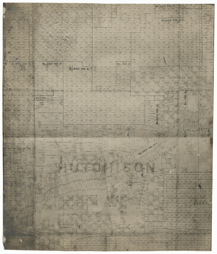
Hutchinson County Sketch File 20m

Print $20.00
- Digital $50.00
Hutchinson County Sketch File 20m
Size: 36.2 x 43.6 inches
10501
Hutchinson County Sketch File 4a

Print $7.00
- Digital $50.00
Hutchinson County Sketch File 4a
Size: 25.9 x 43.8 inches
10625
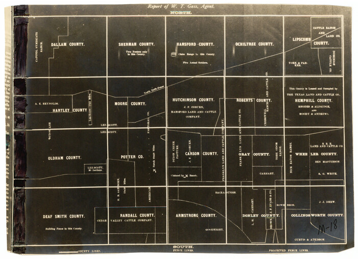
Hansford County Sketch File 3

Print $20.00
- Digital $50.00
Hansford County Sketch File 3
Size: 18.6 x 23.1 inches
11620
Sherman County Sketch File 2

Print $20.00
- Digital $50.00
Sherman County Sketch File 2
Size: 19.5 x 36.3 inches
12323
Hansford County Sketch File 11

Print $6.00
- Digital $50.00
Hansford County Sketch File 11
Size: 11.2 x 8.7 inches
24972
Hansford County Boundary File 1

Print $24.00
- Digital $50.00
Hansford County Boundary File 1
Size: 9.2 x 8.6 inches
54232
Hansford County Boundary File 1a

Print $2.00
- Digital $50.00
Hansford County Boundary File 1a
Size: 11.2 x 8.8 inches
54244
Hansford County Boundary File 2

Print $14.00
- Digital $50.00
Hansford County Boundary File 2
Size: 9.3 x 4.9 inches
54245
Hansford County Boundary File 2a

Print $40.00
- Digital $50.00
Hansford County Boundary File 2a
Size: 14.2 x 8.7 inches
54252
Hansford County Boundary File 2b

Print $14.00
- Digital $50.00
Hansford County Boundary File 2b
Size: 14.3 x 8.8 inches
54263
Hansford County Boundary File 3

Print $10.00
- Digital $50.00
Hansford County Boundary File 3
Size: 13.6 x 8.7 inches
54270
Hansford County Boundary File 3a

Print $80.00
- Digital $50.00
Hansford County Boundary File 3a
Size: 15.3 x 64.7 inches
54275
Hansford County Boundary File 4

Print $26.00
- Digital $50.00
Hansford County Boundary File 4
Size: 14.1 x 8.7 inches
54279
Hutchinson County Rolled Sketch 21

Print $20.00
- Digital $50.00
Hutchinson County Rolled Sketch 21
Size: 28.4 x 36.1 inches
6286
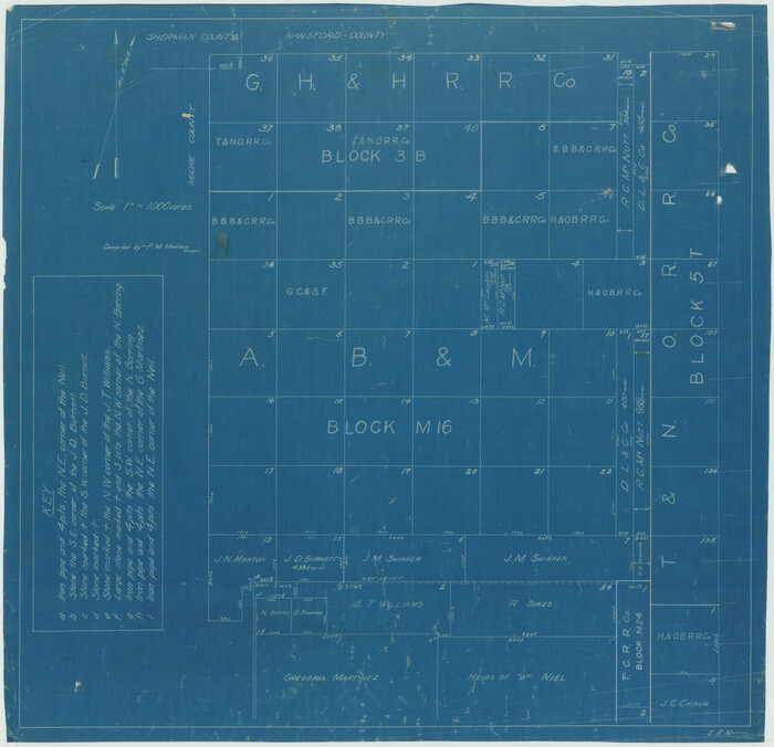
[Sketch Showing G. H. & H. R.R. Co. Block 3B and A. B. & M. Block M16, Hutchinson County, Texas]
Print $20.00
- Digital $50.00
[Sketch Showing G. H. & H. R.R. Co. Block 3B and A. B. & M. Block M16, Hutchinson County, Texas]
Size: 20.7 x 21.5 inches
75813
Hutchinson County Rolled Sketch 2

Print $20.00
- Digital $50.00
Hutchinson County Rolled Sketch 2
Size: 36.1 x 42.0 inches
76069
Sherman County Rolled Sketch 4

Print $20.00
- Digital $50.00
Sherman County Rolled Sketch 4
Size: 23.1 x 31.7 inches
7786
Sherman County Rolled Sketch 8

Print $20.00
- Digital $50.00
Sherman County Rolled Sketch 8
Size: 25.3 x 26.2 inches
7788
PSL Field Notes for Blocks 1 and 2, Hansford and Sherman Counties, Blocks 3 and 4, Hansford County, Blocks A1, A2, A4, A5, and A6 in Hartley County, Block C0 in Hockley, Lubbock, Lynn, and Terry Counties, and Blocks A and B in Kent County

PSL Field Notes for Blocks 1 and 2, Hansford and Sherman Counties, Blocks 3 and 4, Hansford County, Blocks A1, A2, A4, A5, and A6 in Hartley County, Block C0 in Hockley, Lubbock, Lynn, and Terry Counties, and Blocks A and B in Kent County
81655

[PSL Block 1 along State line]
Print $2.00
- Digital $50.00
[PSL Block 1 along State line]
Size: 14.1 x 8.0 inches
90579
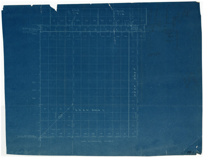
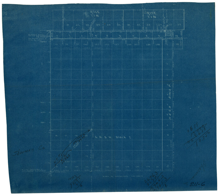
[G. H. & H. Block 2]
Print $20.00
- Digital $50.00
[G. H. & H. Block 2]
Size: 24.1 x 18.5 inches
90714
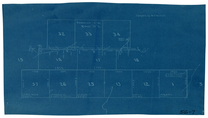
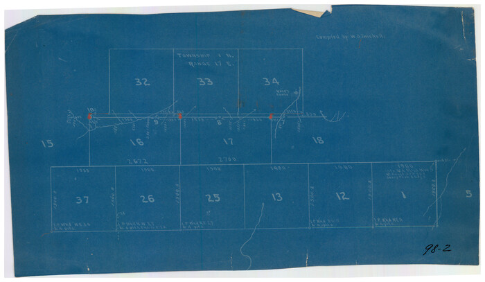
[Township 1 North, Range 17 East]
Print $2.00
- Digital $50.00
[Township 1 North, Range 17 East]
Size: 14.5 x 8.2 inches
90771
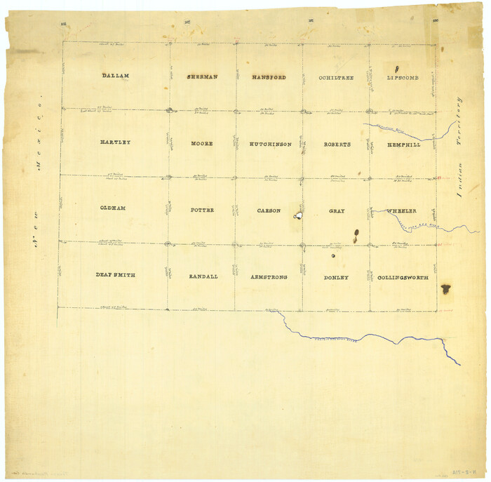
[Map of Panhandle Counties]
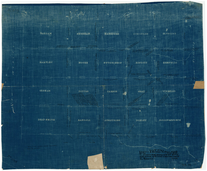
Print $20.00
- Digital $50.00
[Map of Panhandle Counties]
Size: 27.4 x 22.9 inches
91170
[G. H. & H. Block 2]
Print $20.00
- Digital $50.00
[G. H. & H. Block 2]
Size: 20.6 x 18.4 inches
91894
[Panhandle Counties]
Print $2.00
- Digital $50.00
[Panhandle Counties]
Size: 12.3 x 9.1 inches
92067
[Map of North Half of Hutchinson and South Half of Hansford Counties]
Print $3.00
- Digital $50.00
[Map of North Half of Hutchinson and South Half of Hansford Counties]
Size: 11.6 x 13.5 inches
92114
[North line of Sherman, Hansford, Ochiltree and Lipscomb Counties]

Print $40.00
- Digital $50.00
[North line of Sherman, Hansford, Ochiltree and Lipscomb Counties]
Size: 127.0 x 14.3 inches
93189
[Young Territory]

Print $40.00
- Digital $50.00
[Young Territory]
1875
Size: 49.0 x 87.4 inches
16784
[Map Showing Panhandle Counties in Texas]
Print $20.00
- Digital $50.00
[Map Showing Panhandle Counties in Texas]
1876
Size: 27.3 x 27.9 inches
2087
Hutchinson County Sketch File 20m
Print $20.00
- Digital $50.00
Hutchinson County Sketch File 20m
-
Size
36.2 x 43.6 inches
-
Map/Doc
10501
Hutchinson County Sketch File 4a
Print $7.00
- Digital $50.00
Hutchinson County Sketch File 4a
-
Size
25.9 x 43.8 inches
-
Map/Doc
10625
Hansford County Sketch File 3
Print $20.00
- Digital $50.00
Hansford County Sketch File 3
-
Size
18.6 x 23.1 inches
-
Map/Doc
11620
Sherman County Sketch File 2
Print $20.00
- Digital $50.00
Sherman County Sketch File 2
-
Size
19.5 x 36.3 inches
-
Map/Doc
12323
Hansford County Sketch File 11
Print $6.00
- Digital $50.00
Hansford County Sketch File 11
-
Size
11.2 x 8.7 inches
-
Map/Doc
24972
Hansford County Boundary File 1
Print $24.00
- Digital $50.00
Hansford County Boundary File 1
-
Size
9.2 x 8.6 inches
-
Map/Doc
54232
Hansford County Boundary File 1a
Print $2.00
- Digital $50.00
Hansford County Boundary File 1a
-
Size
11.2 x 8.8 inches
-
Map/Doc
54244
Hansford County Boundary File 2
Print $14.00
- Digital $50.00
Hansford County Boundary File 2
-
Size
9.3 x 4.9 inches
-
Map/Doc
54245
Hansford County Boundary File 2a
Print $40.00
- Digital $50.00
Hansford County Boundary File 2a
-
Size
14.2 x 8.7 inches
-
Map/Doc
54252
Hansford County Boundary File 2b
Print $14.00
- Digital $50.00
Hansford County Boundary File 2b
-
Size
14.3 x 8.8 inches
-
Map/Doc
54263
Hansford County Boundary File 3
Print $10.00
- Digital $50.00
Hansford County Boundary File 3
-
Size
13.6 x 8.7 inches
-
Map/Doc
54270
Hansford County Boundary File 3a
Print $80.00
- Digital $50.00
Hansford County Boundary File 3a
-
Size
15.3 x 64.7 inches
-
Map/Doc
54275
Hansford County Boundary File 4
Print $26.00
- Digital $50.00
Hansford County Boundary File 4
-
Size
14.1 x 8.7 inches
-
Map/Doc
54279
Hutchinson County Rolled Sketch 21
Print $20.00
- Digital $50.00
Hutchinson County Rolled Sketch 21
-
Size
28.4 x 36.1 inches
-
Map/Doc
6286
[Sketch Showing G. H. & H. R.R. Co. Block 3B and A. B. & M. Block M16, Hutchinson County, Texas]
Print $20.00
- Digital $50.00
[Sketch Showing G. H. & H. R.R. Co. Block 3B and A. B. & M. Block M16, Hutchinson County, Texas]
-
Size
20.7 x 21.5 inches
-
Map/Doc
75813
Hutchinson County Rolled Sketch 2
Print $20.00
- Digital $50.00
Hutchinson County Rolled Sketch 2
-
Size
36.1 x 42.0 inches
-
Map/Doc
76069
Sherman County Rolled Sketch 4
Print $20.00
- Digital $50.00
Sherman County Rolled Sketch 4
-
Size
23.1 x 31.7 inches
-
Map/Doc
7786
Sherman County Rolled Sketch 8
Print $20.00
- Digital $50.00
Sherman County Rolled Sketch 8
-
Size
25.3 x 26.2 inches
-
Map/Doc
7788
PSL Field Notes for Blocks 1 and 2, Hansford and Sherman Counties, Blocks 3 and 4, Hansford County, Blocks A1, A2, A4, A5, and A6 in Hartley County, Block C0 in Hockley, Lubbock, Lynn, and Terry Counties, and Blocks A and B in Kent County
PSL Field Notes for Blocks 1 and 2, Hansford and Sherman Counties, Blocks 3 and 4, Hansford County, Blocks A1, A2, A4, A5, and A6 in Hartley County, Block C0 in Hockley, Lubbock, Lynn, and Terry Counties, and Blocks A and B in Kent County
-
Map/Doc
81655
[PSL Block 1 along State line]
Print $2.00
- Digital $50.00
[PSL Block 1 along State line]
-
Size
14.1 x 8.0 inches
-
Map/Doc
90579
[G. H. & H. Block 2]
Print $20.00
- Digital $50.00
[G. H. & H. Block 2]
-
Size
24.1 x 18.5 inches
-
Map/Doc
90714
[Township 1 North, Range 17 East]
Print $2.00
- Digital $50.00
[Township 1 North, Range 17 East]
-
Size
14.5 x 8.2 inches
-
Map/Doc
90771
[Map of Panhandle Counties]
Print $20.00
- Digital $50.00
[Map of Panhandle Counties]
-
Size
27.4 x 22.9 inches
-
Map/Doc
91170
[G. H. & H. Block 2]
Print $20.00
- Digital $50.00
[G. H. & H. Block 2]
-
Size
20.6 x 18.4 inches
-
Map/Doc
91894
[Panhandle Counties]
Print $2.00
- Digital $50.00
[Panhandle Counties]
-
Size
12.3 x 9.1 inches
-
Map/Doc
92067
[Map of North Half of Hutchinson and South Half of Hansford Counties]
Print $3.00
- Digital $50.00
[Map of North Half of Hutchinson and South Half of Hansford Counties]
-
Size
11.6 x 13.5 inches
-
Map/Doc
92114
[North line of Sherman, Hansford, Ochiltree and Lipscomb Counties]
Print $40.00
- Digital $50.00
[North line of Sherman, Hansford, Ochiltree and Lipscomb Counties]
-
Size
127.0 x 14.3 inches
-
Map/Doc
93189
[Young Territory]
Print $40.00
- Digital $50.00
[Young Territory]
1875
-
Size
49.0 x 87.4 inches
-
Map/Doc
16784
-
Creation Date
1875
[Map Showing Panhandle Counties in Texas]
Print $20.00
- Digital $50.00
[Map Showing Panhandle Counties in Texas]
1876
-
Size
27.3 x 27.9 inches
-
Map/Doc
2087
-
Creation Date
1876