[Sketch Showing Surveys on Pease River in Hardeman County, Texas]
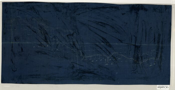
Print $20.00
- Digital $50.00
[Sketch Showing Surveys on Pease River in Hardeman County, Texas]
Size: 19.2 x 37.5 inches
10760
[Northern Portion of] Cottle County
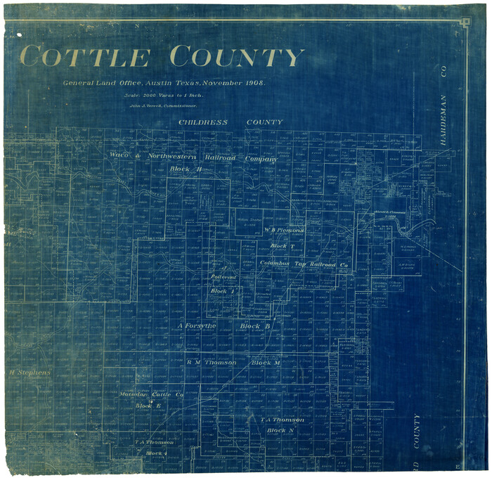
Print $20.00
- Digital $50.00
[Northern Portion of] Cottle County
1908
Size: 28.4 x 29.5 inches
4436
[Location, Fort Worth & Denver Railroad, through Wilbarger County]
Print $40.00
- Digital $50.00
[Location, Fort Worth & Denver Railroad, through Wilbarger County]
Size: 20.8 x 123.5 inches
64344
Working Sketch in Cottle, Foard & Hardeman Counties

Print $20.00
- Digital $50.00
Working Sketch in Cottle, Foard & Hardeman Counties
1917
Size: 26.9 x 28.0 inches
4485
Wilbarger County Working Sketch 4

Print $20.00
- Digital $50.00
Wilbarger County Working Sketch 4
1925
Size: 14.6 x 17.1 inches
72542
Wilbarger County Working Sketch 11

Print $40.00
- Digital $50.00
Wilbarger County Working Sketch 11
1952
Size: 27.7 x 51.7 inches
72549
Wilbarger County Sketch File 7a

Print $4.00
- Digital $50.00
Wilbarger County Sketch File 7a
1885
Size: 14.3 x 8.6 inches
40177
Wilbarger County Sketch File 3

Print $26.00
- Digital $50.00
Wilbarger County Sketch File 3
Size: 7.4 x 13.9 inches
40166
Wilbarger County Sketch File 25

Print $6.00
- Digital $50.00
Wilbarger County Sketch File 25
Size: 11.0 x 16.7 inches
40225
Wilbarger County Sketch File 24

Print $20.00
- Digital $50.00
Wilbarger County Sketch File 24
1894
Size: 23.3 x 14.9 inches
12691
Wilbarger County Sketch File 19

Print $4.00
- Digital $50.00
Wilbarger County Sketch File 19
1887
Size: 14.2 x 8.7 inches
40215
Wilbarger County Sketch File 14

Print $4.00
- Digital $50.00
Wilbarger County Sketch File 14
1885
Size: 14.2 x 8.7 inches
40203
Wilbarger County Rolled Sketch 6

Print $20.00
- Digital $50.00
Wilbarger County Rolled Sketch 6
1885
Size: 20.3 x 28.0 inches
8256
Western portion of the Ward Ranch, Cottle, Foard & Hardeman Counties, Swearingen, Texas sold to Luther T. Clark

Print $20.00
- Digital $50.00
Western portion of the Ward Ranch, Cottle, Foard & Hardeman Counties, Swearingen, Texas sold to Luther T. Clark
1916
Size: 30.4 x 30.7 inches
4460
Swearingen Township situated in Cottle County, Texas

Print $20.00
- Digital $50.00
Swearingen Township situated in Cottle County, Texas
Size: 26.4 x 15.7 inches
4437
Sketch of Block B, GH & H RR & Blk C, CT RR Co, with surrounding & conflicting surveys in Knox & Baylor Counties

Print $20.00
- Digital $50.00
Sketch of Block B, GH & H RR & Blk C, CT RR Co, with surrounding & conflicting surveys in Knox & Baylor Counties
Size: 24.9 x 17.9 inches
75784
Sketch in Hardeman Co.

Print $20.00
- Digital $50.00
Sketch in Hardeman Co.
1890
Size: 17.8 x 17.6 inches
558
Sketch in Hardeman Co.

Print $3.00
- Digital $50.00
Sketch in Hardeman Co.
1890
Size: 12.4 x 11.0 inches
75925
Right of Way Map Fort Worth & Denver City Railroad through Hardeman County

Print $40.00
- Digital $50.00
Right of Way Map Fort Worth & Denver City Railroad through Hardeman County
1885
Size: 23.8 x 121.2 inches
64424
Right of Way Map Fort Worth & Denver City Railroad through Hardeman County

Print $40.00
- Digital $50.00
Right of Way Map Fort Worth & Denver City Railroad through Hardeman County
1885
Size: 23.8 x 60.4 inches
64425
Map of the Surveyed Part of Young District

Print $40.00
- Digital $50.00
Map of the Surveyed Part of Young District
1860
Size: 56.2 x 54.7 inches
1986
Map of the Surveyed Part of Young District

Print $40.00
- Digital $50.00
Map of the Surveyed Part of Young District
1860
Size: 56.3 x 32.6 inches
87373
Map of the Surveyed Part of Young District

Print $40.00
- Digital $50.00
Map of the Surveyed Part of Young District
1860
Size: 56.3 x 27.3 inches
87374
Map of the Fort Worth and Denver City Railway, through Wilbarger County Texas, 1882

Print $40.00
- Digital $50.00
Map of the Fort Worth and Denver City Railway, through Wilbarger County Texas, 1882
Size: 22.9 x 121.1 inches
64426
Map of Part of the YL Ranch

Print $20.00
- Digital $50.00
Map of Part of the YL Ranch
1917
Size: 29.1 x 27.3 inches
4442
Map of Hardeman Co., Texas

Print $20.00
- Digital $50.00
Map of Hardeman Co., Texas
1903
Size: 36.8 x 25.6 inches
4559
Lipscomb County Sketch File 2

Print $20.00
- Digital $50.00
Lipscomb County Sketch File 2
1902
Size: 10.7 x 8.2 inches
30223
Knox County Sketch File 7

Print $40.00
- Digital $50.00
Knox County Sketch File 7
1885
Size: 32.2 x 19.9 inches
11955
Hardeman County Working Sketch Graphic Index

Print $20.00
- Digital $50.00
Hardeman County Working Sketch Graphic Index
1935
Size: 42.9 x 40.5 inches
76566
[Sketch Showing Surveys on Pease River in Hardeman County, Texas]
Print $20.00
- Digital $50.00
[Sketch Showing Surveys on Pease River in Hardeman County, Texas]
-
Size
19.2 x 37.5 inches
-
Map/Doc
10760
[Northern Portion of] Cottle County
Print $20.00
- Digital $50.00
[Northern Portion of] Cottle County
1908
-
Size
28.4 x 29.5 inches
-
Map/Doc
4436
-
Creation Date
1908
[Location, Fort Worth & Denver Railroad, through Wilbarger County]
Print $40.00
- Digital $50.00
[Location, Fort Worth & Denver Railroad, through Wilbarger County]
-
Size
20.8 x 123.5 inches
-
Map/Doc
64344
Working Sketch in Cottle, Foard & Hardeman Counties
Print $20.00
- Digital $50.00
Working Sketch in Cottle, Foard & Hardeman Counties
1917
-
Size
26.9 x 28.0 inches
-
Map/Doc
4485
-
Creation Date
1917
Wilbarger County Working Sketch 4
Print $20.00
- Digital $50.00
Wilbarger County Working Sketch 4
1925
-
Size
14.6 x 17.1 inches
-
Map/Doc
72542
-
Creation Date
1925
Wilbarger County Working Sketch 11
Print $40.00
- Digital $50.00
Wilbarger County Working Sketch 11
1952
-
Size
27.7 x 51.7 inches
-
Map/Doc
72549
-
Creation Date
1952
Wilbarger County Sketch File 7a
Print $4.00
- Digital $50.00
Wilbarger County Sketch File 7a
1885
-
Size
14.3 x 8.6 inches
-
Map/Doc
40177
-
Creation Date
1885
Wilbarger County Sketch File 3
Print $26.00
- Digital $50.00
Wilbarger County Sketch File 3
-
Size
7.4 x 13.9 inches
-
Map/Doc
40166
Wilbarger County Sketch File 25
Print $6.00
- Digital $50.00
Wilbarger County Sketch File 25
-
Size
11.0 x 16.7 inches
-
Map/Doc
40225
Wilbarger County Sketch File 24
Print $20.00
- Digital $50.00
Wilbarger County Sketch File 24
1894
-
Size
23.3 x 14.9 inches
-
Map/Doc
12691
-
Creation Date
1894
Wilbarger County Sketch File 19
Print $4.00
- Digital $50.00
Wilbarger County Sketch File 19
1887
-
Size
14.2 x 8.7 inches
-
Map/Doc
40215
-
Creation Date
1887
Wilbarger County Sketch File 14
Print $4.00
- Digital $50.00
Wilbarger County Sketch File 14
1885
-
Size
14.2 x 8.7 inches
-
Map/Doc
40203
-
Creation Date
1885
Wilbarger County Rolled Sketch 6
Print $20.00
- Digital $50.00
Wilbarger County Rolled Sketch 6
1885
-
Size
20.3 x 28.0 inches
-
Map/Doc
8256
-
Creation Date
1885
Western portion of the Ward Ranch, Cottle, Foard & Hardeman Counties, Swearingen, Texas sold to Luther T. Clark
Print $20.00
- Digital $50.00
Western portion of the Ward Ranch, Cottle, Foard & Hardeman Counties, Swearingen, Texas sold to Luther T. Clark
1916
-
Size
30.4 x 30.7 inches
-
Map/Doc
4460
-
Creation Date
1916
Swearingen Township situated in Cottle County, Texas
Print $20.00
- Digital $50.00
Swearingen Township situated in Cottle County, Texas
-
Size
26.4 x 15.7 inches
-
Map/Doc
4437
Sketch of Block B, GH & H RR & Blk C, CT RR Co, with surrounding & conflicting surveys in Knox & Baylor Counties
Print $20.00
- Digital $50.00
Sketch of Block B, GH & H RR & Blk C, CT RR Co, with surrounding & conflicting surveys in Knox & Baylor Counties
-
Size
24.9 x 17.9 inches
-
Map/Doc
75784
Sketch in Hardeman Co.
Print $20.00
- Digital $50.00
Sketch in Hardeman Co.
1890
-
Size
17.8 x 17.6 inches
-
Map/Doc
558
-
Creation Date
1890
Sketch in Hardeman Co.
Print $3.00
- Digital $50.00
Sketch in Hardeman Co.
1890
-
Size
12.4 x 11.0 inches
-
Map/Doc
75925
-
Creation Date
1890
Right of Way Map Fort Worth & Denver City Railroad through Hardeman County
Print $40.00
- Digital $50.00
Right of Way Map Fort Worth & Denver City Railroad through Hardeman County
1885
-
Size
23.8 x 121.2 inches
-
Map/Doc
64424
-
Creation Date
1885
Right of Way Map Fort Worth & Denver City Railroad through Hardeman County
Print $40.00
- Digital $50.00
Right of Way Map Fort Worth & Denver City Railroad through Hardeman County
1885
-
Size
23.8 x 60.4 inches
-
Map/Doc
64425
-
Creation Date
1885
Quanah, Texas

Print $20.00
Quanah, Texas
1890
-
Size
13.0 x 20.6 inches
-
Map/Doc
89202
-
Creation Date
1890
Map of the Surveyed Part of Young District
Print $40.00
- Digital $50.00
Map of the Surveyed Part of Young District
1860
-
Size
56.2 x 54.7 inches
-
Map/Doc
1986
-
Creation Date
1860
Map of the Surveyed Part of Young District
Print $40.00
- Digital $50.00
Map of the Surveyed Part of Young District
1860
-
Size
56.3 x 32.6 inches
-
Map/Doc
87373
-
Creation Date
1860
Map of the Surveyed Part of Young District
Print $40.00
- Digital $50.00
Map of the Surveyed Part of Young District
1860
-
Size
56.3 x 27.3 inches
-
Map/Doc
87374
-
Creation Date
1860
Map of the Fort Worth and Denver City Railway, through Wilbarger County Texas, 1882
Print $40.00
- Digital $50.00
Map of the Fort Worth and Denver City Railway, through Wilbarger County Texas, 1882
-
Size
22.9 x 121.1 inches
-
Map/Doc
64426
Map of Part of the YL Ranch
Print $20.00
- Digital $50.00
Map of Part of the YL Ranch
1917
-
Size
29.1 x 27.3 inches
-
Map/Doc
4442
-
Creation Date
1917
Map of Hardeman Co., Texas
Print $20.00
- Digital $50.00
Map of Hardeman Co., Texas
1903
-
Size
36.8 x 25.6 inches
-
Map/Doc
4559
-
Creation Date
1903
Lipscomb County Sketch File 2
Print $20.00
- Digital $50.00
Lipscomb County Sketch File 2
1902
-
Size
10.7 x 8.2 inches
-
Map/Doc
30223
-
Creation Date
1902
Knox County Sketch File 7
Print $40.00
- Digital $50.00
Knox County Sketch File 7
1885
-
Size
32.2 x 19.9 inches
-
Map/Doc
11955
-
Creation Date
1885
Hardeman County Working Sketch Graphic Index
Print $20.00
- Digital $50.00
Hardeman County Working Sketch Graphic Index
1935
-
Size
42.9 x 40.5 inches
-
Map/Doc
76566
-
Creation Date
1935