Erath County Sketch File 33

Print $11.00
- Digital $50.00
Erath County Sketch File 33
1962
Size: 14.4 x 8.8 inches
22315
Erath County Sketch File A2

Print $20.00
- Digital $50.00
Erath County Sketch File A2
Size: 15.9 x 19.5 inches
11464
Ft. W. & R. G. Ry. Right of Way Map, Chapin to Bluffdale, Hood County, Texas

Print $40.00
- Digital $50.00
Ft. W. & R. G. Ry. Right of Way Map, Chapin to Bluffdale, Hood County, Texas
1918
Size: 37.3 x 120.2 inches
64642
Ft. W. & R. G. Ry. Right of Way Map, Chapin to Bluffdale, Hood County, Texas

Print $40.00
- Digital $50.00
Ft. W. & R. G. Ry. Right of Way Map, Chapin to Bluffdale, Hood County, Texas
1918
Size: 36.5 x 50.5 inches
64645
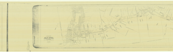
G. C. & S. F. Ry. Alinement [sic] and Right of Way Map of Dallas Branch, Johnson County, Texas
Print $40.00
- Digital $50.00
G. C. & S. F. Ry. Alinement [sic] and Right of Way Map of Dallas Branch, Johnson County, Texas
1925
Size: 38.0 x 125.2 inches
64650
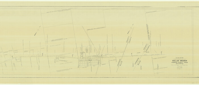
G. C. & S. F. Ry. Alinement [sic] and Right of Way Map of Dallas Branch, Johnson County, Texas
Print $40.00
- Digital $50.00
G. C. & S. F. Ry. Alinement [sic] and Right of Way Map of Dallas Branch, Johnson County, Texas
1925
Size: 37.6 x 87.9 inches
64652
G. C. & S. F. Ry. Northern-Division, Alignment and Right of Way Map, Weatherford Branch, Johnson and Hood Counties, Texas

Print $40.00
- Digital $50.00
G. C. & S. F. Ry. Northern-Division, Alignment and Right of Way Map, Weatherford Branch, Johnson and Hood Counties, Texas
1935
Size: 37.2 x 121.7 inches
64647
G. C. & S. F. Ry. Northern-Division, Alignment and Right of Way Map, Weatherford Branch, Johnson and Hood Counties, Texas

Print $40.00
- Digital $50.00
G. C. & S. F. Ry. Northern-Division, Alignment and Right of Way Map, Weatherford Branch, Johnson and Hood Counties, Texas
1935
Size: 37.8 x 100.5 inches
64649
G. C. & S. F., Main Line, Texas, Right of Way map, Rio Vista to Crowley

Print $40.00
- Digital $50.00
G. C. & S. F., Main Line, Texas, Right of Way map, Rio Vista to Crowley
1910
Size: 38.1 x 122.4 inches
64653
G. C. & S. F., Main Line, Texas, Right of Way map, Rio Vista to Crowley

Print $40.00
- Digital $50.00
G. C. & S. F., Main Line, Texas, Right of Way map, Rio Vista to Crowley
1916
Size: 40.2 x 92.0 inches
64654
General Highway Map, Hood County, Somervell County, Texas

Print $20.00
General Highway Map, Hood County, Somervell County, Texas
1940
Size: 18.3 x 24.8 inches
79131
General Highway Map, Hood County, Somervell County, Texas

Print $20.00
General Highway Map, Hood County, Somervell County, Texas
1961
Size: 18.1 x 24.6 inches
79523
Hood County Boundary File 40

Print $44.00
- Digital $50.00
Hood County Boundary File 40
Size: 14.4 x 8.8 inches
55019
Hood County Boundary File 41

Print $6.00
- Digital $50.00
Hood County Boundary File 41
Size: 11.2 x 8.8 inches
55041
Hood County Rolled Sketch 1

Print $20.00
- Digital $50.00
Hood County Rolled Sketch 1
1946
Size: 31.9 x 38.6 inches
9177
Hood County Rolled Sketch 2

Print $20.00
- Digital $50.00
Hood County Rolled Sketch 2
1958
Size: 18.0 x 27.4 inches
6219
Hood County Rolled Sketch 3

Print $20.00
- Digital $50.00
Hood County Rolled Sketch 3
1967
Size: 33.2 x 36.2 inches
9179
Hood County Rolled Sketch 4

Print $20.00
- Digital $50.00
Hood County Rolled Sketch 4
Size: 33.4 x 43.1 inches
6220
Erath County Sketch File 33
Print $11.00
- Digital $50.00
Erath County Sketch File 33
1962
-
Size
14.4 x 8.8 inches
-
Map/Doc
22315
-
Creation Date
1962
Erath County Sketch File A2
Print $20.00
- Digital $50.00
Erath County Sketch File A2
-
Size
15.9 x 19.5 inches
-
Map/Doc
11464
Ft. W. & R. G. Ry. Right of Way Map, Chapin to Bluffdale, Hood County, Texas
Print $40.00
- Digital $50.00
Ft. W. & R. G. Ry. Right of Way Map, Chapin to Bluffdale, Hood County, Texas
1918
-
Size
37.3 x 120.2 inches
-
Map/Doc
64642
-
Creation Date
1918
Ft. W. & R. G. Ry. Right of Way Map, Chapin to Bluffdale, Hood County, Texas
Print $40.00
- Digital $50.00
Ft. W. & R. G. Ry. Right of Way Map, Chapin to Bluffdale, Hood County, Texas
1918
-
Size
36.5 x 50.5 inches
-
Map/Doc
64645
-
Creation Date
1918
G. C. & S. F. Ry. Alinement [sic] and Right of Way Map of Dallas Branch, Johnson County, Texas
Print $40.00
- Digital $50.00
G. C. & S. F. Ry. Alinement [sic] and Right of Way Map of Dallas Branch, Johnson County, Texas
1925
-
Size
38.0 x 125.2 inches
-
Map/Doc
64650
-
Creation Date
1925
G. C. & S. F. Ry. Alinement [sic] and Right of Way Map of Dallas Branch, Johnson County, Texas
Print $40.00
- Digital $50.00
G. C. & S. F. Ry. Alinement [sic] and Right of Way Map of Dallas Branch, Johnson County, Texas
1925
-
Size
37.6 x 87.9 inches
-
Map/Doc
64652
-
Creation Date
1925
G. C. & S. F. Ry. Northern-Division, Alignment and Right of Way Map, Weatherford Branch, Johnson and Hood Counties, Texas
Print $40.00
- Digital $50.00
G. C. & S. F. Ry. Northern-Division, Alignment and Right of Way Map, Weatherford Branch, Johnson and Hood Counties, Texas
1935
-
Size
37.2 x 121.7 inches
-
Map/Doc
64647
-
Creation Date
1935
G. C. & S. F. Ry. Northern-Division, Alignment and Right of Way Map, Weatherford Branch, Johnson and Hood Counties, Texas
Print $40.00
- Digital $50.00
G. C. & S. F. Ry. Northern-Division, Alignment and Right of Way Map, Weatherford Branch, Johnson and Hood Counties, Texas
1935
-
Size
37.8 x 100.5 inches
-
Map/Doc
64649
-
Creation Date
1935
G. C. & S. F., Main Line, Texas, Right of Way map, Rio Vista to Crowley
Print $40.00
- Digital $50.00
G. C. & S. F., Main Line, Texas, Right of Way map, Rio Vista to Crowley
1910
-
Size
38.1 x 122.4 inches
-
Map/Doc
64653
-
Creation Date
1910
G. C. & S. F., Main Line, Texas, Right of Way map, Rio Vista to Crowley
Print $40.00
- Digital $50.00
G. C. & S. F., Main Line, Texas, Right of Way map, Rio Vista to Crowley
1916
-
Size
40.2 x 92.0 inches
-
Map/Doc
64654
-
Creation Date
1916
General Highway Map, Hood County, Somervell County, Texas
Print $20.00
General Highway Map, Hood County, Somervell County, Texas
1940
-
Size
18.3 x 24.8 inches
-
Map/Doc
79131
-
Creation Date
1940
General Highway Map, Hood County, Somervell County, Texas
Print $20.00
General Highway Map, Hood County, Somervell County, Texas
1961
-
Size
18.1 x 24.6 inches
-
Map/Doc
79523
-
Creation Date
1961
Hood Co.

Print $20.00
- Digital $50.00
Hood Co.
1893
-
Size
35.0 x 30.9 inches
-
Map/Doc
4687
-
Creation Date
1893
Hood Co.

Print $20.00
- Digital $50.00
Hood Co.
1893
-
Size
35.6 x 32.8 inches
-
Map/Doc
66867
-
Creation Date
1893
Hood Co.

Print $20.00
- Digital $50.00
Hood Co.
1894
-
Size
32.3 x 30.2 inches
-
Map/Doc
66868
-
Creation Date
1894
Hood Co[unty]
![88956, Hood Co[unty], Library of Congress](https://historictexasmaps.com/wmedia_w700/maps/88956.tif.jpg)
Print $20.00
Hood Co[unty]
1894
-
Size
18.5 x 17.4 inches
-
Map/Doc
88956
-
Creation Date
1894
Hood County

Print $20.00
- Digital $50.00
Hood County
1941
-
Size
39.5 x 32.8 inches
-
Map/Doc
1857
-
Creation Date
1941
Hood County

Print $20.00
- Digital $50.00
Hood County
1875
-
Size
22.1 x 17.3 inches
-
Map/Doc
3676
-
Creation Date
1875
Hood County

Print $20.00
- Digital $50.00
Hood County
1884
-
Size
31.8 x 30.4 inches
-
Map/Doc
3677
-
Creation Date
1884
Hood County

Print $20.00
- Digital $50.00
Hood County
1879
-
Size
27.1 x 29.2 inches
-
Map/Doc
4564
-
Creation Date
1879
Hood County

Print $20.00
- Digital $50.00
Hood County
1884
-
Size
36.9 x 33.5 inches
-
Map/Doc
4981
-
Creation Date
1884
Hood County

Print $20.00
- Digital $50.00
Hood County
1941
-
Size
39.5 x 32.6 inches
-
Map/Doc
73182
-
Creation Date
1941
Hood County

Print $20.00
- Digital $50.00
Hood County
1941
-
Size
35.6 x 31.2 inches
-
Map/Doc
77314
-
Creation Date
1941
Hood County

Print $20.00
- Digital $50.00
Hood County
1941
-
Size
40.9 x 33.9 inches
-
Map/Doc
95532
-
Creation Date
1941
Hood County Boundary File 40
Print $44.00
- Digital $50.00
Hood County Boundary File 40
-
Size
14.4 x 8.8 inches
-
Map/Doc
55019
Hood County Boundary File 41
Print $6.00
- Digital $50.00
Hood County Boundary File 41
-
Size
11.2 x 8.8 inches
-
Map/Doc
55041
Hood County Rolled Sketch 1
Print $20.00
- Digital $50.00
Hood County Rolled Sketch 1
1946
-
Size
31.9 x 38.6 inches
-
Map/Doc
9177
-
Creation Date
1946
Hood County Rolled Sketch 2
Print $20.00
- Digital $50.00
Hood County Rolled Sketch 2
1958
-
Size
18.0 x 27.4 inches
-
Map/Doc
6219
-
Creation Date
1958
Hood County Rolled Sketch 3
Print $20.00
- Digital $50.00
Hood County Rolled Sketch 3
1967
-
Size
33.2 x 36.2 inches
-
Map/Doc
9179
-
Creation Date
1967
Hood County Rolled Sketch 4
Print $20.00
- Digital $50.00
Hood County Rolled Sketch 4
-
Size
33.4 x 43.1 inches
-
Map/Doc
6220