[G. C. & S. F. Ry. Northern-Division, Alignment and Right of Way Map, Weatherford Branch, Johnson and Hood Counties, Texas]
Print $40.00
- Digital $50.00
[G. C. & S. F. Ry. Northern-Division, Alignment and Right of Way Map, Weatherford Branch, Johnson and Hood Counties, Texas]
1935
Size: 37.4 x 120.9 inches
64648
[G. C. & S. F. Ry. Alinement (sic) and Right of Way Map of Dallas Branch, Johnson County, Texas]
Print $40.00
- Digital $50.00
[G. C. & S. F. Ry. Alinement (sic) and Right of Way Map of Dallas Branch, Johnson County, Texas]
1926
Size: 37.6 x 124.3 inches
64651
[Ft. W. & R. G. Ry. Right of Way Map, Chapin to Bluffdale, Hood County, Texas]
Print $40.00
- Digital $50.00
[Ft. W. & R. G. Ry. Right of Way Map, Chapin to Bluffdale, Hood County, Texas]
1918
Size: 38.8 x 120.3 inches
64643
[Ft. W. & R. G. Ry. Right of Way Map, Chapin to Bluffdale, Hood County, Texas]
Print $40.00
- Digital $50.00
[Ft. W. & R. G. Ry. Right of Way Map, Chapin to Bluffdale, Hood County, Texas]
1918
Size: 37.7 x 84.3 inches
64644
[Ft. W. & R. G. Ry. Right of Way Map, Chapin to Bluffdale, Hood County, Texas]
Print $40.00
- Digital $50.00
[Ft. W. & R. G. Ry. Right of Way Map, Chapin to Bluffdale, Hood County, Texas]
1918
Size: 36.8 x 69.7 inches
64646
Somervell County Working Sketch 7

Print $20.00
- Digital $50.00
Somervell County Working Sketch 7
2008
Size: 27.9 x 34.2 inches
88889
Somervell County Working Sketch 3

Print $20.00
- Digital $50.00
Somervell County Working Sketch 3
1968
Size: 23.0 x 30.4 inches
63907
Somervell County Sketch File 6

Print $6.00
- Digital $50.00
Somervell County Sketch File 6
1939
Size: 13.6 x 8.6 inches
36847
Somervell County Sketch File 5

Print $95.00
- Digital $50.00
Somervell County Sketch File 5
1871
Size: 8.8 x 7.7 inches
36802
Somervell County Sketch File 1

Print $4.00
- Digital $50.00
Somervell County Sketch File 1
1859
Size: 12.8 x 8.1 inches
36795
Somervell County Rolled Sketch D

Print $20.00
- Digital $50.00
Somervell County Rolled Sketch D
1939
Size: 17.3 x 21.0 inches
7794
Sketch showing the Connnecting Lines run by Olliver Hedgcoxe for the Texan Emigration and Land Company connecting their Surveys made by them in Peters' Colony, Texas

Print $40.00
- Digital $50.00
Sketch showing the Connnecting Lines run by Olliver Hedgcoxe for the Texan Emigration and Land Company connecting their Surveys made by them in Peters' Colony, Texas
1854
Size: 45.8 x 61.9 inches
1969
Roberts County Sketch File 5

Print $4.00
- Digital $50.00
Roberts County Sketch File 5
Size: 8.0 x 9.8 inches
35312
Parker County Working Sketch 6

Print $20.00
- Digital $50.00
Parker County Working Sketch 6
1923
71456
Parker County Working Sketch 12

Print $20.00
- Digital $50.00
Parker County Working Sketch 12
1974
71462
Parker County Working Sketch 11

Print $20.00
- Digital $50.00
Parker County Working Sketch 11
1969
71461
Parker County Sketch File 48

Print $20.00
- Digital $50.00
Parker County Sketch File 48
1858
Size: 17.6 x 22.3 inches
12152
Parker County Sketch File 47

Print $20.00
- Digital $50.00
Parker County Sketch File 47
1857
Size: 16.4 x 34.7 inches
12151
Parker County Sketch File 42

Print $114.00
- Digital $50.00
Parker County Sketch File 42
1877
Size: 14.4 x 12.0 inches
33589
Parker County Sketch File 38

Print $20.00
- Digital $50.00
Parker County Sketch File 38
Size: 21.7 x 13.3 inches
12149
Parker County Sketch File 26

Print $4.00
- Digital $50.00
Parker County Sketch File 26
1877
Size: 14.3 x 9.0 inches
33566
Parker County Sketch File 14

Print $20.00
- Digital $50.00
Parker County Sketch File 14
1853
Size: 25.6 x 10.3 inches
12143
Map of Johnson County & Hood County

Print $20.00
- Digital $50.00
Map of Johnson County & Hood County
1863
Size: 19.3 x 28.3 inches
3735
Map of Hood County, Texas

Print $20.00
- Digital $50.00
Map of Hood County, Texas
1870
Size: 23.9 x 19.0 inches
732
Johnson County Working Sketch 29

Print $20.00
- Digital $50.00
Johnson County Working Sketch 29
2006
Size: 26.4 x 37.5 inches
83060
Johnson County Working Sketch 19

Print $20.00
- Digital $50.00
Johnson County Working Sketch 19
1990
Size: 35.2 x 42.5 inches
66632
Johnson County Sketch File 5

Print $20.00
- Digital $50.00
Johnson County Sketch File 5
1874
Size: 33.3 x 14.3 inches
11890
Johnson County Sketch File 25

Print $50.00
- Digital $50.00
Johnson County Sketch File 25
Size: 13.9 x 8.3 inches
28459
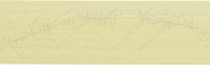
[G. C. & S. F. Ry. Northern-Division, Alignment and Right of Way Map, Weatherford Branch, Johnson and Hood Counties, Texas]
Print $40.00
- Digital $50.00
[G. C. & S. F. Ry. Northern-Division, Alignment and Right of Way Map, Weatherford Branch, Johnson and Hood Counties, Texas]
1935
-
Size
37.4 x 120.9 inches
-
Map/Doc
64648
-
Creation Date
1935
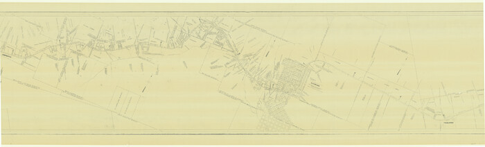
[G. C. & S. F. Ry. Alinement (sic) and Right of Way Map of Dallas Branch, Johnson County, Texas]
Print $40.00
- Digital $50.00
[G. C. & S. F. Ry. Alinement (sic) and Right of Way Map of Dallas Branch, Johnson County, Texas]
1926
-
Size
37.6 x 124.3 inches
-
Map/Doc
64651
-
Creation Date
1926
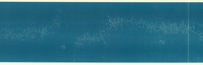
[Ft. W. & R. G. Ry. Right of Way Map, Chapin to Bluffdale, Hood County, Texas]
Print $40.00
- Digital $50.00
[Ft. W. & R. G. Ry. Right of Way Map, Chapin to Bluffdale, Hood County, Texas]
1918
-
Size
38.8 x 120.3 inches
-
Map/Doc
64643
-
Creation Date
1918
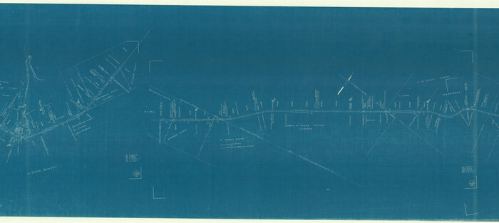
[Ft. W. & R. G. Ry. Right of Way Map, Chapin to Bluffdale, Hood County, Texas]
Print $40.00
- Digital $50.00
[Ft. W. & R. G. Ry. Right of Way Map, Chapin to Bluffdale, Hood County, Texas]
1918
-
Size
37.7 x 84.3 inches
-
Map/Doc
64644
-
Creation Date
1918
[Ft. W. & R. G. Ry. Right of Way Map, Chapin to Bluffdale, Hood County, Texas]
Print $40.00
- Digital $50.00
[Ft. W. & R. G. Ry. Right of Way Map, Chapin to Bluffdale, Hood County, Texas]
1918
-
Size
36.8 x 69.7 inches
-
Map/Doc
64646
-
Creation Date
1918
Somervell County Working Sketch 7
Print $20.00
- Digital $50.00
Somervell County Working Sketch 7
2008
-
Size
27.9 x 34.2 inches
-
Map/Doc
88889
-
Creation Date
2008
Somervell County Working Sketch 3
Print $20.00
- Digital $50.00
Somervell County Working Sketch 3
1968
-
Size
23.0 x 30.4 inches
-
Map/Doc
63907
-
Creation Date
1968
Somervell County Sketch File 6
Print $6.00
- Digital $50.00
Somervell County Sketch File 6
1939
-
Size
13.6 x 8.6 inches
-
Map/Doc
36847
-
Creation Date
1939
Somervell County Sketch File 5
Print $95.00
- Digital $50.00
Somervell County Sketch File 5
1871
-
Size
8.8 x 7.7 inches
-
Map/Doc
36802
-
Creation Date
1871
Somervell County Sketch File 1
Print $4.00
- Digital $50.00
Somervell County Sketch File 1
1859
-
Size
12.8 x 8.1 inches
-
Map/Doc
36795
-
Creation Date
1859
Somervell County Rolled Sketch D
Print $20.00
- Digital $50.00
Somervell County Rolled Sketch D
1939
-
Size
17.3 x 21.0 inches
-
Map/Doc
7794
-
Creation Date
1939
Sketch showing the Connnecting Lines run by Olliver Hedgcoxe for the Texan Emigration and Land Company connecting their Surveys made by them in Peters' Colony, Texas
Print $40.00
- Digital $50.00
Sketch showing the Connnecting Lines run by Olliver Hedgcoxe for the Texan Emigration and Land Company connecting their Surveys made by them in Peters' Colony, Texas
1854
-
Size
45.8 x 61.9 inches
-
Map/Doc
1969
-
Creation Date
1854
Roberts County Sketch File 5
Print $4.00
- Digital $50.00
Roberts County Sketch File 5
-
Size
8.0 x 9.8 inches
-
Map/Doc
35312
Parker County Working Sketch 6
Print $20.00
- Digital $50.00
Parker County Working Sketch 6
1923
-
Map/Doc
71456
-
Creation Date
1923
Parker County Working Sketch 12
Print $20.00
- Digital $50.00
Parker County Working Sketch 12
1974
-
Map/Doc
71462
-
Creation Date
1974
Parker County Working Sketch 11
Print $20.00
- Digital $50.00
Parker County Working Sketch 11
1969
-
Map/Doc
71461
-
Creation Date
1969
Parker County Sketch File 48
Print $20.00
- Digital $50.00
Parker County Sketch File 48
1858
-
Size
17.6 x 22.3 inches
-
Map/Doc
12152
-
Creation Date
1858
Parker County Sketch File 47
Print $20.00
- Digital $50.00
Parker County Sketch File 47
1857
-
Size
16.4 x 34.7 inches
-
Map/Doc
12151
-
Creation Date
1857
Parker County Sketch File 42
Print $114.00
- Digital $50.00
Parker County Sketch File 42
1877
-
Size
14.4 x 12.0 inches
-
Map/Doc
33589
-
Creation Date
1877
Parker County Sketch File 38
Print $20.00
- Digital $50.00
Parker County Sketch File 38
-
Size
21.7 x 13.3 inches
-
Map/Doc
12149
Parker County Sketch File 26
Print $4.00
- Digital $50.00
Parker County Sketch File 26
1877
-
Size
14.3 x 9.0 inches
-
Map/Doc
33566
-
Creation Date
1877
Parker County Sketch File 14
Print $20.00
- Digital $50.00
Parker County Sketch File 14
1853
-
Size
25.6 x 10.3 inches
-
Map/Doc
12143
-
Creation Date
1853
Milam [District]
![1948, Milam [District], General Map Collection](https://historictexasmaps.com/wmedia_w700/maps/1948.tif.jpg)
Print $40.00
- Digital $50.00
Milam [District]
1850
-
Size
60.8 x 46.4 inches
-
Map/Doc
1948
-
Creation Date
1850
Map of Johnson County & Hood County
Print $20.00
- Digital $50.00
Map of Johnson County & Hood County
1863
-
Size
19.3 x 28.3 inches
-
Map/Doc
3735
-
Creation Date
1863
Map of Hood County, Texas
Print $20.00
- Digital $50.00
Map of Hood County, Texas
1870
-
Size
23.9 x 19.0 inches
-
Map/Doc
732
-
Creation Date
1870
Map of Granbury

Print $20.00
- Digital $50.00
Map of Granbury
1960
-
Size
23.5 x 26.7 inches
-
Map/Doc
3041
-
Creation Date
1960
Johnson County Working Sketch 29
Print $20.00
- Digital $50.00
Johnson County Working Sketch 29
2006
-
Size
26.4 x 37.5 inches
-
Map/Doc
83060
-
Creation Date
2006
Johnson County Working Sketch 19
Print $20.00
- Digital $50.00
Johnson County Working Sketch 19
1990
-
Size
35.2 x 42.5 inches
-
Map/Doc
66632
-
Creation Date
1990
Johnson County Sketch File 5
Print $20.00
- Digital $50.00
Johnson County Sketch File 5
1874
-
Size
33.3 x 14.3 inches
-
Map/Doc
11890
-
Creation Date
1874
Johnson County Sketch File 25
Print $50.00
- Digital $50.00
Johnson County Sketch File 25
-
Size
13.9 x 8.3 inches
-
Map/Doc
28459