Wood County Working Sketch 23

Print $40.00
- Digital $50.00
Wood County Working Sketch 23
1962
Size: 54.9 x 43.5 inches
78230
Wood County Working Sketch 21

Print $20.00
- Digital $50.00
Wood County Working Sketch 21
1962
Size: 40.6 x 35.7 inches
62021
Wood County Working Sketch 22

Print $20.00
- Digital $50.00
Wood County Working Sketch 22
1962
Size: 45.9 x 36.6 inches
62022
General Highway Map, Delta County, Hopkins County, Texas

Print $20.00
General Highway Map, Delta County, Hopkins County, Texas
1961
Size: 24.6 x 18.2 inches
79439
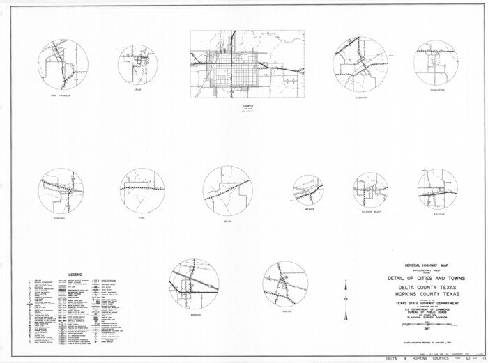
General Highway Map, Detail of Cities and Towns in Delta County, Hopkins County [Cooper and vicinity]
Print $20.00
General Highway Map, Detail of Cities and Towns in Delta County, Hopkins County [Cooper and vicinity]
1961
Size: 18.2 x 24.4 inches
79440
Hopkins County Working Sketch 5

Print $20.00
- Digital $50.00
Hopkins County Working Sketch 5
1960
Size: 21.8 x 20.5 inches
66230
Hopkins County Working Sketch 4

Print $20.00
- Digital $50.00
Hopkins County Working Sketch 4
1959
Size: 23.3 x 30.9 inches
66229
Hopkins County Working Sketch 3

Print $20.00
- Digital $50.00
Hopkins County Working Sketch 3
1955
Size: 24.2 x 20.0 inches
66228
Hunt County Working Sketch 7

Print $20.00
- Digital $50.00
Hunt County Working Sketch 7
1955
Size: 43.2 x 25.2 inches
66354
Hopkins County Working Sketch 2

Print $20.00
- Digital $50.00
Hopkins County Working Sketch 2
1954
Size: 25.3 x 21.2 inches
66227
Franklin County Sketch File 17

Print $16.00
- Digital $50.00
Franklin County Sketch File 17
1951
Size: 11.3 x 8.8 inches
23026
Hopkins County Working Sketch 1

Print $20.00
- Digital $50.00
Hopkins County Working Sketch 1
1951
Size: 24.1 x 19.0 inches
66226
Hopkins County Rolled Sketch 2

Print $40.00
- Digital $50.00
Hopkins County Rolled Sketch 2
1951
Size: 41.6 x 51.8 inches
9180
Nacogdoches County Sketch File 16

Print $20.00
- Digital $50.00
Nacogdoches County Sketch File 16
1945
Size: 24.6 x 18.5 inches
42155
Hopkins County Working Sketch Graphic Index

Print $20.00
- Digital $50.00
Hopkins County Working Sketch Graphic Index
1942
Size: 40.6 x 38.7 inches
76581
Delta County Working Sketch 1

Print $20.00
- Digital $50.00
Delta County Working Sketch 1
1942
Size: 24.7 x 28.8 inches
68638
General Highway Map, Delta County, Hopkins County, Texas

Print $20.00
General Highway Map, Delta County, Hopkins County, Texas
1940
Size: 25.2 x 18.5 inches
79073
Sulphur River, Ringo Crossing Sheet

Print $20.00
- Digital $50.00
Sulphur River, Ringo Crossing Sheet
1933
Size: 30.5 x 35.9 inches
65162
North and South Sulphur Rivers, Sulphur Bluff Sheet

Print $20.00
- Digital $50.00
North and South Sulphur Rivers, Sulphur Bluff Sheet
1933
Size: 37.6 x 37.2 inches
65163
Sulphur River, Ringo Crossing Sheet

Print $20.00
- Digital $50.00
Sulphur River, Ringo Crossing Sheet
1933
Size: 18.5 x 20.4 inches
78334
Water-Shed of the Sulphur River in Texas Drainage Area

Print $4.00
- Digital $50.00
Water-Shed of the Sulphur River in Texas Drainage Area
1925
Size: 16.6 x 28.4 inches
65154
South Sulphur River, Harpers Crossing Sheet

Print $20.00
- Digital $50.00
South Sulphur River, Harpers Crossing Sheet
1925
Size: 42.2 x 29.2 inches
65169
South Sulphur River, Klondike Sheet

Print $6.00
- Digital $50.00
South Sulphur River, Klondike Sheet
1925
Size: 32.2 x 35.5 inches
65170
Middle Sulphur and South Sulphur Rivers, Horton Sheet

Print $20.00
- Digital $50.00
Middle Sulphur and South Sulphur Rivers, Horton Sheet
1925
Size: 42.2 x 40.3 inches
65171
South Sulphur River, Harpers Crossing Sheet

Print $20.00
- Digital $50.00
South Sulphur River, Harpers Crossing Sheet
1925
Size: 23.3 x 18.0 inches
78328
Middle Sulphur and South Sulphur Rivers, Horton Sheet

Print $20.00
- Digital $50.00
Middle Sulphur and South Sulphur Rivers, Horton Sheet
1925
Size: 25.6 x 22.0 inches
78330
Wood County Working Sketch 23
Print $40.00
- Digital $50.00
Wood County Working Sketch 23
1962
-
Size
54.9 x 43.5 inches
-
Map/Doc
78230
-
Creation Date
1962
Wood County Working Sketch 21
Print $20.00
- Digital $50.00
Wood County Working Sketch 21
1962
-
Size
40.6 x 35.7 inches
-
Map/Doc
62021
-
Creation Date
1962
Wood County Working Sketch 22
Print $20.00
- Digital $50.00
Wood County Working Sketch 22
1962
-
Size
45.9 x 36.6 inches
-
Map/Doc
62022
-
Creation Date
1962
General Highway Map, Delta County, Hopkins County, Texas
Print $20.00
General Highway Map, Delta County, Hopkins County, Texas
1961
-
Size
24.6 x 18.2 inches
-
Map/Doc
79439
-
Creation Date
1961
General Highway Map, Detail of Cities and Towns in Delta County, Hopkins County [Cooper and vicinity]
Print $20.00
General Highway Map, Detail of Cities and Towns in Delta County, Hopkins County [Cooper and vicinity]
1961
-
Size
18.2 x 24.4 inches
-
Map/Doc
79440
-
Creation Date
1961
Hopkins County Working Sketch 5
Print $20.00
- Digital $50.00
Hopkins County Working Sketch 5
1960
-
Size
21.8 x 20.5 inches
-
Map/Doc
66230
-
Creation Date
1960
Hopkins County Working Sketch 4
Print $20.00
- Digital $50.00
Hopkins County Working Sketch 4
1959
-
Size
23.3 x 30.9 inches
-
Map/Doc
66229
-
Creation Date
1959
Hopkins County Working Sketch 3
Print $20.00
- Digital $50.00
Hopkins County Working Sketch 3
1955
-
Size
24.2 x 20.0 inches
-
Map/Doc
66228
-
Creation Date
1955
Hunt County Working Sketch 7
Print $20.00
- Digital $50.00
Hunt County Working Sketch 7
1955
-
Size
43.2 x 25.2 inches
-
Map/Doc
66354
-
Creation Date
1955
Hopkins County Working Sketch 2
Print $20.00
- Digital $50.00
Hopkins County Working Sketch 2
1954
-
Size
25.3 x 21.2 inches
-
Map/Doc
66227
-
Creation Date
1954
Franklin County Sketch File 17
Print $16.00
- Digital $50.00
Franklin County Sketch File 17
1951
-
Size
11.3 x 8.8 inches
-
Map/Doc
23026
-
Creation Date
1951
Hopkins County Working Sketch 1
Print $20.00
- Digital $50.00
Hopkins County Working Sketch 1
1951
-
Size
24.1 x 19.0 inches
-
Map/Doc
66226
-
Creation Date
1951
Hopkins County Rolled Sketch 2
Print $40.00
- Digital $50.00
Hopkins County Rolled Sketch 2
1951
-
Size
41.6 x 51.8 inches
-
Map/Doc
9180
-
Creation Date
1951
Nacogdoches County Sketch File 16
Print $20.00
- Digital $50.00
Nacogdoches County Sketch File 16
1945
-
Size
24.6 x 18.5 inches
-
Map/Doc
42155
-
Creation Date
1945
Hopkins County

Print $20.00
- Digital $50.00
Hopkins County
1942
-
Size
43.6 x 41.6 inches
-
Map/Doc
1858
-
Creation Date
1942
Hopkins County

Print $20.00
- Digital $50.00
Hopkins County
1942
-
Size
44.1 x 40.9 inches
-
Map/Doc
73183
-
Creation Date
1942
Hopkins County

Print $20.00
- Digital $50.00
Hopkins County
1942
-
Size
39.6 x 37.6 inches
-
Map/Doc
77315
-
Creation Date
1942
Hopkins County

Print $20.00
- Digital $50.00
Hopkins County
1942
-
Size
45.7 x 42.2 inches
-
Map/Doc
95533
-
Creation Date
1942
Hopkins County Working Sketch Graphic Index
Print $20.00
- Digital $50.00
Hopkins County Working Sketch Graphic Index
1942
-
Size
40.6 x 38.7 inches
-
Map/Doc
76581
-
Creation Date
1942
Delta County Working Sketch 1
Print $20.00
- Digital $50.00
Delta County Working Sketch 1
1942
-
Size
24.7 x 28.8 inches
-
Map/Doc
68638
-
Creation Date
1942
General Highway Map, Delta County, Hopkins County, Texas
Print $20.00
General Highway Map, Delta County, Hopkins County, Texas
1940
-
Size
25.2 x 18.5 inches
-
Map/Doc
79073
-
Creation Date
1940
Sulphur River, Ringo Crossing Sheet
Print $20.00
- Digital $50.00
Sulphur River, Ringo Crossing Sheet
1933
-
Size
30.5 x 35.9 inches
-
Map/Doc
65162
-
Creation Date
1933
North and South Sulphur Rivers, Sulphur Bluff Sheet
Print $20.00
- Digital $50.00
North and South Sulphur Rivers, Sulphur Bluff Sheet
1933
-
Size
37.6 x 37.2 inches
-
Map/Doc
65163
-
Creation Date
1933
Sulphur River, Ringo Crossing Sheet
Print $20.00
- Digital $50.00
Sulphur River, Ringo Crossing Sheet
1933
-
Size
18.5 x 20.4 inches
-
Map/Doc
78334
-
Creation Date
1933
Water-Shed of the Sulphur River in Texas Drainage Area
Print $4.00
- Digital $50.00
Water-Shed of the Sulphur River in Texas Drainage Area
1925
-
Size
16.6 x 28.4 inches
-
Map/Doc
65154
-
Creation Date
1925
South Sulphur River, Harpers Crossing Sheet
Print $20.00
- Digital $50.00
South Sulphur River, Harpers Crossing Sheet
1925
-
Size
42.2 x 29.2 inches
-
Map/Doc
65169
-
Creation Date
1925
South Sulphur River, Klondike Sheet
Print $6.00
- Digital $50.00
South Sulphur River, Klondike Sheet
1925
-
Size
32.2 x 35.5 inches
-
Map/Doc
65170
-
Creation Date
1925
Middle Sulphur and South Sulphur Rivers, Horton Sheet
Print $20.00
- Digital $50.00
Middle Sulphur and South Sulphur Rivers, Horton Sheet
1925
-
Size
42.2 x 40.3 inches
-
Map/Doc
65171
-
Creation Date
1925
South Sulphur River, Harpers Crossing Sheet
Print $20.00
- Digital $50.00
South Sulphur River, Harpers Crossing Sheet
1925
-
Size
23.3 x 18.0 inches
-
Map/Doc
78328
-
Creation Date
1925
Middle Sulphur and South Sulphur Rivers, Horton Sheet
Print $20.00
- Digital $50.00
Middle Sulphur and South Sulphur Rivers, Horton Sheet
1925
-
Size
25.6 x 22.0 inches
-
Map/Doc
78330
-
Creation Date
1925