Combination Map of Henderson, Kaufman, Rains, Van Zandt, Hunt & Rockwall Counties

Print $40.00
- Digital $50.00
Combination Map of Henderson, Kaufman, Rains, Van Zandt, Hunt & Rockwall Counties
Size: 42.6 x 64.8 inches
89810
Delta County Sketch File 3

Print $6.00
- Digital $50.00
Delta County Sketch File 3
Size: 10.2 x 12.6 inches
20672
Delta County Working Sketch 1

Print $20.00
- Digital $50.00
Delta County Working Sketch 1
1942
Size: 24.7 x 28.8 inches
68638
East Line & Red River Railroad, Map of the Line from Sulphur Springs to Greenville

Print $40.00
- Digital $50.00
East Line & Red River Railroad, Map of the Line from Sulphur Springs to Greenville
1881
Size: 19.0 x 88.2 inches
64350
English Field Notes of the Spanish Archives - Books J.S.2, 3, and 4

English Field Notes of the Spanish Archives - Books J.S.2, 3, and 4
1835
96550
Franklin County Sketch File 17

Print $16.00
- Digital $50.00
Franklin County Sketch File 17
1951
Size: 11.3 x 8.8 inches
23026
Franklin County Sketch File 2a

Print $6.00
- Digital $50.00
Franklin County Sketch File 2a
1857
Size: 8.6 x 10.5 inches
23012
Franklin County Sketch File 4

Print $6.00
- Digital $50.00
Franklin County Sketch File 4
1855
Size: 13.4 x 11.4 inches
23015
Franklin County Sketch File 9

Print $20.00
- Digital $50.00
Franklin County Sketch File 9
Size: 13.6 x 23.1 inches
11515
General Highway Map, Delta County, Hopkins County, Texas

Print $20.00
General Highway Map, Delta County, Hopkins County, Texas
1940
Size: 25.2 x 18.5 inches
79073
General Highway Map, Delta County, Hopkins County, Texas

Print $20.00
General Highway Map, Delta County, Hopkins County, Texas
1961
Size: 24.6 x 18.2 inches
79439
General Highway Map, Detail of Cities and Towns in Delta County, Hopkins County [Cooper and vicinity]
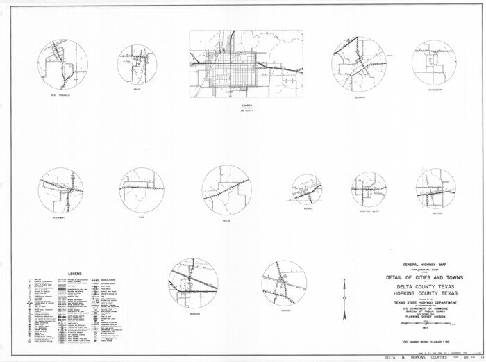
Print $20.00
General Highway Map, Detail of Cities and Towns in Delta County, Hopkins County [Cooper and vicinity]
1961
Size: 18.2 x 24.4 inches
79440
Hopkins County Boundary File 1

Print $26.00
- Digital $50.00
Hopkins County Boundary File 1
Size: 12.3 x 7.9 inches
55044
Hopkins County Boundary File 2

Print $4.00
- Digital $50.00
Hopkins County Boundary File 2
Size: 12.5 x 8.1 inches
55057
Hopkins County Boundary File 3

Print $46.00
- Digital $50.00
Hopkins County Boundary File 3
Size: 8.2 x 3.8 inches
55059
Hopkins County Boundary File 3a

Print $4.00
- Digital $50.00
Hopkins County Boundary File 3a
Size: 10.7 x 8.7 inches
55082
Hopkins County Boundary File 3b

Print $4.00
- Digital $50.00
Hopkins County Boundary File 3b
Size: 12.7 x 8.3 inches
55084
Hopkins County Rolled Sketch 1

Print $20.00
- Digital $50.00
Hopkins County Rolled Sketch 1
Size: 34.5 x 40.0 inches
6224
Hopkins County Rolled Sketch 2

Print $40.00
- Digital $50.00
Hopkins County Rolled Sketch 2
1951
Size: 41.6 x 51.8 inches
9180
Hopkins County Rolled Sketch 28

Print $20.00
- Digital $50.00
Hopkins County Rolled Sketch 28
Size: 25.3 x 19.9 inches
6225
Hopkins County Sketch File 1

Print $4.00
- Digital $50.00
Hopkins County Sketch File 1
1854
Size: 5.2 x 10.2 inches
26676
Combination Map of Henderson, Kaufman, Rains, Van Zandt, Hunt & Rockwall Counties
Print $40.00
- Digital $50.00
Combination Map of Henderson, Kaufman, Rains, Van Zandt, Hunt & Rockwall Counties
-
Size
42.6 x 64.8 inches
-
Map/Doc
89810
Delta County Sketch File 3
Print $6.00
- Digital $50.00
Delta County Sketch File 3
-
Size
10.2 x 12.6 inches
-
Map/Doc
20672
Delta County Working Sketch 1
Print $20.00
- Digital $50.00
Delta County Working Sketch 1
1942
-
Size
24.7 x 28.8 inches
-
Map/Doc
68638
-
Creation Date
1942
East Line & Red River Railroad, Map of the Line from Sulphur Springs to Greenville
Print $40.00
- Digital $50.00
East Line & Red River Railroad, Map of the Line from Sulphur Springs to Greenville
1881
-
Size
19.0 x 88.2 inches
-
Map/Doc
64350
-
Creation Date
1881
English Field Notes of the Spanish Archives - Books J.S.2, 3, and 4
English Field Notes of the Spanish Archives - Books J.S.2, 3, and 4
1835
-
Map/Doc
96550
-
Creation Date
1835
Franklin County Sketch File 17
Print $16.00
- Digital $50.00
Franklin County Sketch File 17
1951
-
Size
11.3 x 8.8 inches
-
Map/Doc
23026
-
Creation Date
1951
Franklin County Sketch File 2a
Print $6.00
- Digital $50.00
Franklin County Sketch File 2a
1857
-
Size
8.6 x 10.5 inches
-
Map/Doc
23012
-
Creation Date
1857
Franklin County Sketch File 4
Print $6.00
- Digital $50.00
Franklin County Sketch File 4
1855
-
Size
13.4 x 11.4 inches
-
Map/Doc
23015
-
Creation Date
1855
Franklin County Sketch File 9
Print $20.00
- Digital $50.00
Franklin County Sketch File 9
-
Size
13.6 x 23.1 inches
-
Map/Doc
11515
General Highway Map, Delta County, Hopkins County, Texas
Print $20.00
General Highway Map, Delta County, Hopkins County, Texas
1940
-
Size
25.2 x 18.5 inches
-
Map/Doc
79073
-
Creation Date
1940
General Highway Map, Delta County, Hopkins County, Texas
Print $20.00
General Highway Map, Delta County, Hopkins County, Texas
1961
-
Size
24.6 x 18.2 inches
-
Map/Doc
79439
-
Creation Date
1961
General Highway Map, Detail of Cities and Towns in Delta County, Hopkins County [Cooper and vicinity]
Print $20.00
General Highway Map, Detail of Cities and Towns in Delta County, Hopkins County [Cooper and vicinity]
1961
-
Size
18.2 x 24.4 inches
-
Map/Doc
79440
-
Creation Date
1961
Hopkins Co.

Print $20.00
- Digital $50.00
Hopkins Co.
1850
-
Size
21.7 x 20.3 inches
-
Map/Doc
16853
-
Creation Date
1850
Hopkins Co.

Print $20.00
- Digital $50.00
Hopkins Co.
1885
-
Size
35.3 x 37.2 inches
-
Map/Doc
66869
-
Creation Date
1885
Hopkins Co.

Print $20.00
- Digital $50.00
Hopkins Co.
1885
-
Size
37.2 x 42.1 inches
-
Map/Doc
66870
-
Creation Date
1885
Hopkins Co.

Print $20.00
- Digital $50.00
Hopkins Co.
1887
-
Size
37.7 x 36.3 inches
-
Map/Doc
66871
-
Creation Date
1887
Hopkins County

Print $20.00
- Digital $50.00
Hopkins County
1942
-
Size
43.6 x 41.6 inches
-
Map/Doc
1858
-
Creation Date
1942
Hopkins County

Print $20.00
- Digital $50.00
Hopkins County
1888
-
Size
36.4 x 36.6 inches
-
Map/Doc
448
-
Creation Date
1888
Hopkins County

Print $20.00
- Digital $50.00
Hopkins County
1942
-
Size
44.1 x 40.9 inches
-
Map/Doc
73183
-
Creation Date
1942
Hopkins County

Print $20.00
- Digital $50.00
Hopkins County
1942
-
Size
39.6 x 37.6 inches
-
Map/Doc
77315
-
Creation Date
1942
Hopkins County

Print $20.00
- Digital $50.00
Hopkins County
1942
-
Size
45.7 x 42.2 inches
-
Map/Doc
95533
-
Creation Date
1942
Hopkins County Boundary File 1
Print $26.00
- Digital $50.00
Hopkins County Boundary File 1
-
Size
12.3 x 7.9 inches
-
Map/Doc
55044
Hopkins County Boundary File 2
Print $4.00
- Digital $50.00
Hopkins County Boundary File 2
-
Size
12.5 x 8.1 inches
-
Map/Doc
55057
Hopkins County Boundary File 3
Print $46.00
- Digital $50.00
Hopkins County Boundary File 3
-
Size
8.2 x 3.8 inches
-
Map/Doc
55059
Hopkins County Boundary File 3a
Print $4.00
- Digital $50.00
Hopkins County Boundary File 3a
-
Size
10.7 x 8.7 inches
-
Map/Doc
55082
Hopkins County Boundary File 3b
Print $4.00
- Digital $50.00
Hopkins County Boundary File 3b
-
Size
12.7 x 8.3 inches
-
Map/Doc
55084
Hopkins County Rolled Sketch 1
Print $20.00
- Digital $50.00
Hopkins County Rolled Sketch 1
-
Size
34.5 x 40.0 inches
-
Map/Doc
6224
Hopkins County Rolled Sketch 2
Print $40.00
- Digital $50.00
Hopkins County Rolled Sketch 2
1951
-
Size
41.6 x 51.8 inches
-
Map/Doc
9180
-
Creation Date
1951
Hopkins County Rolled Sketch 28
Print $20.00
- Digital $50.00
Hopkins County Rolled Sketch 28
-
Size
25.3 x 19.9 inches
-
Map/Doc
6225
Hopkins County Sketch File 1
Print $4.00
- Digital $50.00
Hopkins County Sketch File 1
1854
-
Size
5.2 x 10.2 inches
-
Map/Doc
26676
-
Creation Date
1854