[Surveys in the Travis District along the Colorado River]
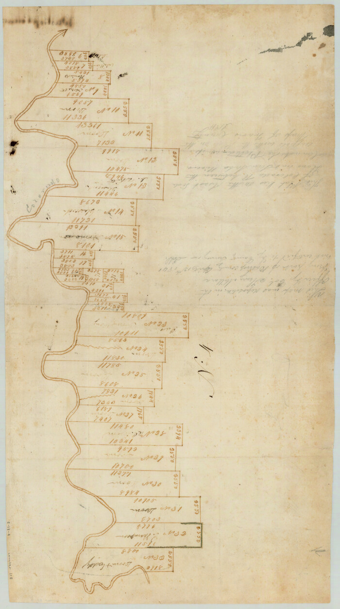
Print $2.00
- Digital $50.00
[Surveys in the Travis District along the Colorado River]
1841
Size: 8.6 x 15.3 inches
118
[Surveys in the Travis District along the Colorado River]
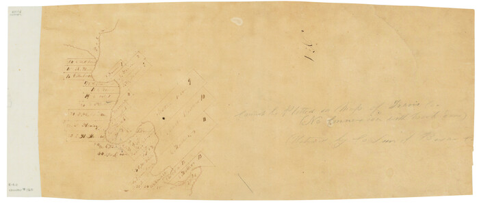
Print $3.00
- Digital $50.00
[Surveys in the Travis District along the Colorado River]
1841
Size: 7.0 x 16.5 inches
120
[Surveys along the Colorado River]
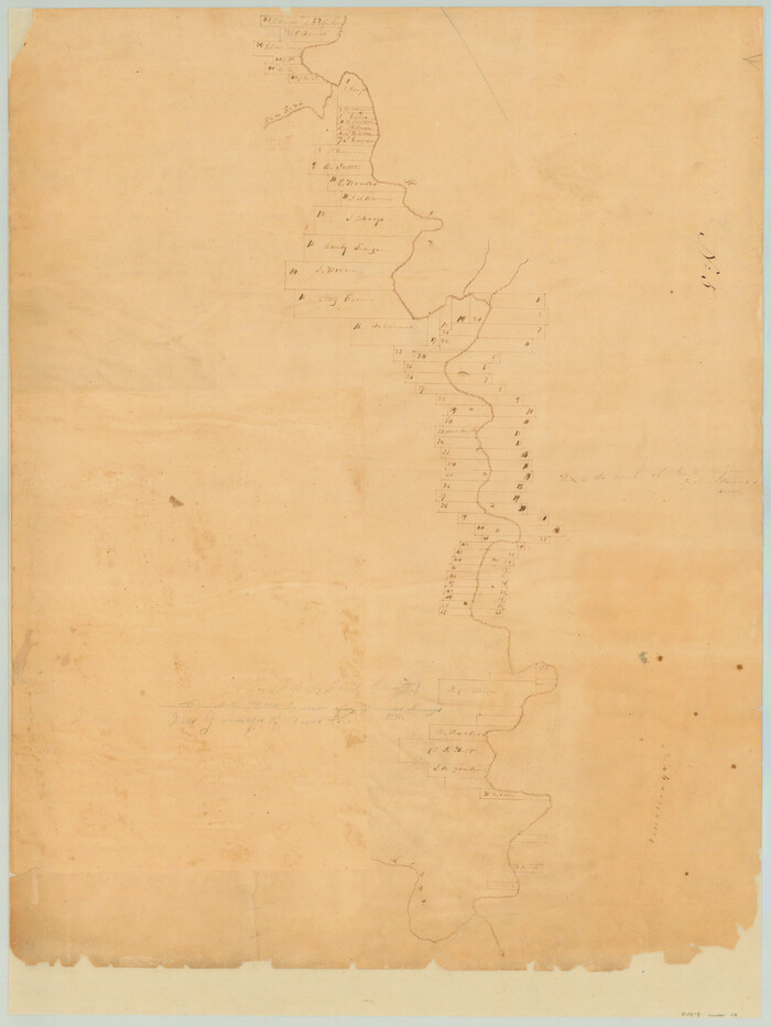
Print $20.00
- Digital $50.00
[Surveys along the Colorado River]
1840
Size: 23.8 x 17.9 inches
119
[Sketch showing Wm. B. Jaques survey on Llano River]
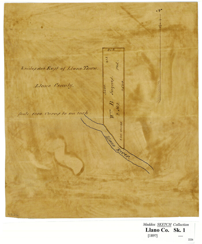
Print $2.00
- Digital $50.00
[Sketch showing Wm. B. Jaques survey on Llano River]
Size: 10.9 x 9.0 inches
591
Water-Shed of the Colorado River

Print $40.00
- Digital $50.00
Water-Shed of the Colorado River
1925
Size: 37.1 x 79.8 inches
65261
San Saba County Working Sketch 2

Print $20.00
- Digital $50.00
San Saba County Working Sketch 2
1928
Size: 23.2 x 27.2 inches
63790
San Saba County Working Sketch 11

Print $20.00
- Digital $50.00
San Saba County Working Sketch 11
1989
Size: 30.3 x 38.2 inches
63799
San Saba County Sketch File 11

Print $8.00
- Digital $50.00
San Saba County Sketch File 11
1882
Size: 12.4 x 8.3 inches
36435
Right of Way and Track Map Houston & Texas Central R.R. operated by the T. & N.O. R.R. Co., Austin Branch

Print $40.00
- Digital $50.00
Right of Way and Track Map Houston & Texas Central R.R. operated by the T. & N.O. R.R. Co., Austin Branch
1918
Size: 25.5 x 57.7 inches
64553
Right of Way and Track Map Houston & Texas Central R.R. operated by the T. & N.O. R.R. Co., Austin Branch

Print $40.00
- Digital $50.00
Right of Way and Track Map Houston & Texas Central R.R. operated by the T. & N.O. R.R. Co., Austin Branch
1918
Size: 25.8 x 58.2 inches
64554
Right of Way and Track Map Houston & Texas Central R.R. operated by the T. & N.O. R.R. Co., Austin Branch

Print $40.00
- Digital $50.00
Right of Way and Track Map Houston & Texas Central R.R. operated by the T. & N.O. R.R. Co., Austin Branch
1918
Size: 25.6 x 57.8 inches
64555
Right of Way and Track Map Houston & Texas Central R.R. operated by the T. & N.O. R.R. Co., Austin Branch

Print $40.00
- Digital $50.00
Right of Way and Track Map Houston & Texas Central R.R. operated by the T. & N.O. R.R. Co., Austin Branch
1918
Size: 26.0 x 58.4 inches
64556
Right of Way and Track Map Houston & Texas Central R.R. operated by the T. & N.O. R.R. Co., Austin Branch

Print $40.00
- Digital $50.00
Right of Way and Track Map Houston & Texas Central R.R. operated by the T. & N.O. R.R. Co., Austin Branch
1918
Size: 26.0 x 57.9 inches
64557
Right of Way and Track Map Houston & Texas Central R.R. operated by the T. & N.O. R.R. Co., Austin Branch

Print $40.00
- Digital $50.00
Right of Way and Track Map Houston & Texas Central R.R. operated by the T. & N.O. R.R. Co., Austin Branch
1918
Size: 25.8 x 57.8 inches
64558
Mason County Working Sketch 4

Print $20.00
- Digital $50.00
Mason County Working Sketch 4
1932
Size: 16.6 x 22.2 inches
70840
Mason County Working Sketch 3

Print $20.00
- Digital $50.00
Mason County Working Sketch 3
1911
Size: 17.8 x 22.9 inches
70839
Mason County Working Sketch 17

Print $20.00
- Digital $50.00
Mason County Working Sketch 17
1983
Size: 24.3 x 41.1 inches
70853
Mason County Working Sketch 11

Print $20.00
- Digital $50.00
Mason County Working Sketch 11
1951
Size: 24.7 x 23.7 inches
70847
Mason County Working Sketch 1

Print $3.00
- Digital $50.00
Mason County Working Sketch 1
Size: 10.7 x 16.2 inches
70837
Mason County Sketch File 23

Print $42.00
- Digital $50.00
Mason County Sketch File 23
1932
Size: 11.2 x 8.8 inches
30723
Mason County Sketch File 22

Print $8.00
- Digital $50.00
Mason County Sketch File 22
1932
Size: 11.1 x 8.9 inches
30719
Mason County Sketch File 21A

Print $20.00
- Digital $50.00
Mason County Sketch File 21A
1932
Size: 19.2 x 26.6 inches
12037
Mason County Sketch File 21

Print $6.00
- Digital $50.00
Mason County Sketch File 21
Size: 15.7 x 10.9 inches
30717
Map of Llano County, Texas

Print $20.00
- Digital $50.00
Map of Llano County, Texas
1879
Size: 24.6 x 22.9 inches
568
Map of Llano County, Texas

Print $20.00
Map of Llano County, Texas
1879
Size: 23.1 x 21.2 inches
88970
Map of Llano County Showing Geology, Mineral Localities, Topography, etc.

Print $20.00
Map of Llano County Showing Geology, Mineral Localities, Topography, etc.
1875
Size: 16.5 x 21.3 inches
88969
Map of Llano County

Print $20.00
- Digital $50.00
Map of Llano County
1877
Size: 19.9 x 25.7 inches
3824
Map of Llano County

Print $20.00
- Digital $50.00
Map of Llano County
1871
Size: 17.0 x 20.5 inches
3825
[Surveys in the Travis District along the Colorado River]
Print $2.00
- Digital $50.00
[Surveys in the Travis District along the Colorado River]
1841
-
Size
8.6 x 15.3 inches
-
Map/Doc
118
-
Creation Date
1841
[Surveys in the Travis District along the Colorado River]
Print $3.00
- Digital $50.00
[Surveys in the Travis District along the Colorado River]
1841
-
Size
7.0 x 16.5 inches
-
Map/Doc
120
-
Creation Date
1841
[Surveys along the Colorado River]
Print $20.00
- Digital $50.00
[Surveys along the Colorado River]
1840
-
Size
23.8 x 17.9 inches
-
Map/Doc
119
-
Creation Date
1840
[Sketch showing Wm. B. Jaques survey on Llano River]
Print $2.00
- Digital $50.00
[Sketch showing Wm. B. Jaques survey on Llano River]
-
Size
10.9 x 9.0 inches
-
Map/Doc
591
Water-Shed of the Colorado River
Print $40.00
- Digital $50.00
Water-Shed of the Colorado River
1925
-
Size
37.1 x 79.8 inches
-
Map/Doc
65261
-
Creation Date
1925
Texas Hill Country Trail Region

Texas Hill Country Trail Region
2017
-
Size
18.2 x 24.3 inches
-
Map/Doc
96871
-
Creation Date
2017
Texas Hill Country Trail Region

Texas Hill Country Trail Region
-
Size
18.1 x 24.2 inches
-
Map/Doc
96872
San Saba County Working Sketch 2
Print $20.00
- Digital $50.00
San Saba County Working Sketch 2
1928
-
Size
23.2 x 27.2 inches
-
Map/Doc
63790
-
Creation Date
1928
San Saba County Working Sketch 11
Print $20.00
- Digital $50.00
San Saba County Working Sketch 11
1989
-
Size
30.3 x 38.2 inches
-
Map/Doc
63799
-
Creation Date
1989
San Saba County Sketch File 11
Print $8.00
- Digital $50.00
San Saba County Sketch File 11
1882
-
Size
12.4 x 8.3 inches
-
Map/Doc
36435
-
Creation Date
1882
Right of Way and Track Map Houston & Texas Central R.R. operated by the T. & N.O. R.R. Co., Austin Branch
Print $40.00
- Digital $50.00
Right of Way and Track Map Houston & Texas Central R.R. operated by the T. & N.O. R.R. Co., Austin Branch
1918
-
Size
25.5 x 57.7 inches
-
Map/Doc
64553
-
Creation Date
1918
Right of Way and Track Map Houston & Texas Central R.R. operated by the T. & N.O. R.R. Co., Austin Branch
Print $40.00
- Digital $50.00
Right of Way and Track Map Houston & Texas Central R.R. operated by the T. & N.O. R.R. Co., Austin Branch
1918
-
Size
25.8 x 58.2 inches
-
Map/Doc
64554
-
Creation Date
1918
Right of Way and Track Map Houston & Texas Central R.R. operated by the T. & N.O. R.R. Co., Austin Branch
Print $40.00
- Digital $50.00
Right of Way and Track Map Houston & Texas Central R.R. operated by the T. & N.O. R.R. Co., Austin Branch
1918
-
Size
25.6 x 57.8 inches
-
Map/Doc
64555
-
Creation Date
1918
Right of Way and Track Map Houston & Texas Central R.R. operated by the T. & N.O. R.R. Co., Austin Branch
Print $40.00
- Digital $50.00
Right of Way and Track Map Houston & Texas Central R.R. operated by the T. & N.O. R.R. Co., Austin Branch
1918
-
Size
26.0 x 58.4 inches
-
Map/Doc
64556
-
Creation Date
1918
Right of Way and Track Map Houston & Texas Central R.R. operated by the T. & N.O. R.R. Co., Austin Branch
Print $40.00
- Digital $50.00
Right of Way and Track Map Houston & Texas Central R.R. operated by the T. & N.O. R.R. Co., Austin Branch
1918
-
Size
26.0 x 57.9 inches
-
Map/Doc
64557
-
Creation Date
1918
Right of Way and Track Map Houston & Texas Central R.R. operated by the T. & N.O. R.R. Co., Austin Branch
Print $40.00
- Digital $50.00
Right of Way and Track Map Houston & Texas Central R.R. operated by the T. & N.O. R.R. Co., Austin Branch
1918
-
Size
25.8 x 57.8 inches
-
Map/Doc
64558
-
Creation Date
1918
Mason County Working Sketch 4
Print $20.00
- Digital $50.00
Mason County Working Sketch 4
1932
-
Size
16.6 x 22.2 inches
-
Map/Doc
70840
-
Creation Date
1932
Mason County Working Sketch 3
Print $20.00
- Digital $50.00
Mason County Working Sketch 3
1911
-
Size
17.8 x 22.9 inches
-
Map/Doc
70839
-
Creation Date
1911
Mason County Working Sketch 17
Print $20.00
- Digital $50.00
Mason County Working Sketch 17
1983
-
Size
24.3 x 41.1 inches
-
Map/Doc
70853
-
Creation Date
1983
Mason County Working Sketch 11
Print $20.00
- Digital $50.00
Mason County Working Sketch 11
1951
-
Size
24.7 x 23.7 inches
-
Map/Doc
70847
-
Creation Date
1951
Mason County Working Sketch 1
Print $3.00
- Digital $50.00
Mason County Working Sketch 1
-
Size
10.7 x 16.2 inches
-
Map/Doc
70837
Mason County Sketch File 23
Print $42.00
- Digital $50.00
Mason County Sketch File 23
1932
-
Size
11.2 x 8.8 inches
-
Map/Doc
30723
-
Creation Date
1932
Mason County Sketch File 22
Print $8.00
- Digital $50.00
Mason County Sketch File 22
1932
-
Size
11.1 x 8.9 inches
-
Map/Doc
30719
-
Creation Date
1932
Mason County Sketch File 21A
Print $20.00
- Digital $50.00
Mason County Sketch File 21A
1932
-
Size
19.2 x 26.6 inches
-
Map/Doc
12037
-
Creation Date
1932
Mason County Sketch File 21
Print $6.00
- Digital $50.00
Mason County Sketch File 21
-
Size
15.7 x 10.9 inches
-
Map/Doc
30717
Map of Llano County, Texas
Print $20.00
- Digital $50.00
Map of Llano County, Texas
1879
-
Size
24.6 x 22.9 inches
-
Map/Doc
568
-
Creation Date
1879
Map of Llano County, Texas
Print $20.00
Map of Llano County, Texas
1879
-
Size
23.1 x 21.2 inches
-
Map/Doc
88970
-
Creation Date
1879
Map of Llano County Showing Geology, Mineral Localities, Topography, etc.
Print $20.00
Map of Llano County Showing Geology, Mineral Localities, Topography, etc.
1875
-
Size
16.5 x 21.3 inches
-
Map/Doc
88969
-
Creation Date
1875
Map of Llano County
Print $20.00
- Digital $50.00
Map of Llano County
1877
-
Size
19.9 x 25.7 inches
-
Map/Doc
3824
-
Creation Date
1877
Map of Llano County
Print $20.00
- Digital $50.00
Map of Llano County
1871
-
Size
17.0 x 20.5 inches
-
Map/Doc
3825
-
Creation Date
1871