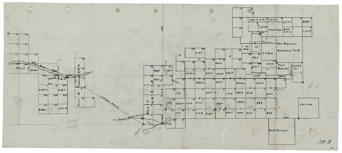
[Tie line between Indianola RR. Co. Block H and H. & G. N. RR. Co. Block G and vicinity]
Print $20.00
- Digital $50.00
[Tie line between Indianola RR. Co. Block H and H. & G. N. RR. Co. Block G and vicinity]
1904
Size: 21.9 x 10.1 inches
93007
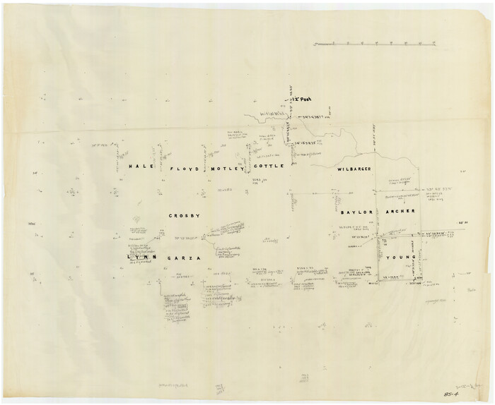
[Southeast Portion of Motley County]
Print $20.00
- Digital $50.00
[Southeast Portion of Motley County]
Size: 31.2 x 34.3 inches
91508
[Sketch of counties just south of the Panhandle]
Print $20.00
- Digital $50.00
[Sketch of counties just south of the Panhandle]
Size: 42.7 x 34.8 inches
90913
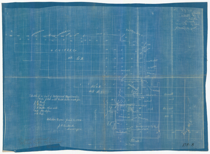
[Sketch of Surveys in Cottle, Dickens, King & Motley Counties, Texas]
Print $20.00
- Digital $50.00
[Sketch of Surveys in Cottle, Dickens, King & Motley Counties, Texas]
1913
Size: 29.6 x 23.2 inches
75830
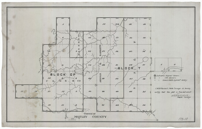
[Portion of Motley County]
Print $20.00
- Digital $50.00
[Portion of Motley County]
Size: 28.8 x 18.4 inches
91501
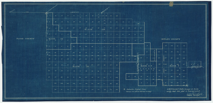
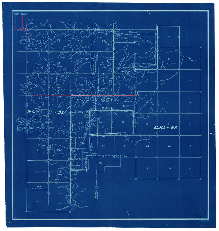
[Blocks in East Floyd County and West Motley County showing Blocks D2, D3, GM, GP and T]
Print $20.00
- Digital $50.00
[Blocks in East Floyd County and West Motley County showing Blocks D2, D3, GM, GP and T]
Size: 22.2 x 10.9 inches
92113
[Blocks GM, and D3 and Vicinity in Motley and Floyd Counties]
Print $20.00
- Digital $50.00
[Blocks GM, and D3 and Vicinity in Motley and Floyd Counties]
1904
Size: 23.8 x 17.4 inches
91502
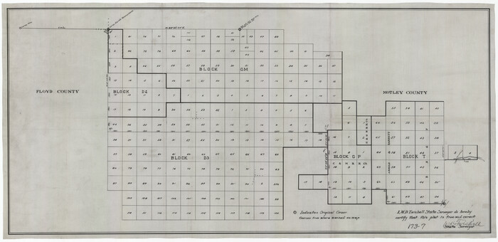
[Blocks GM, D2, D3, GP, and T]
Print $20.00
- Digital $50.00
[Blocks GM, D2, D3, GP, and T]
Size: 32.8 x 15.9 inches
91503
[Blocks 1 and 2 along River in Motley County]
Print $20.00
- Digital $50.00
[Blocks 1 and 2 along River in Motley County]
1876
Size: 21.3 x 16.6 inches
91507
[Block D3, Floyd County and Block GP, Motley County]
Print $20.00
- Digital $50.00
[Block D3, Floyd County and Block GP, Motley County]
Size: 19.1 x 20.2 inches
90836
[Block 28, Showing Edwards Ranch]
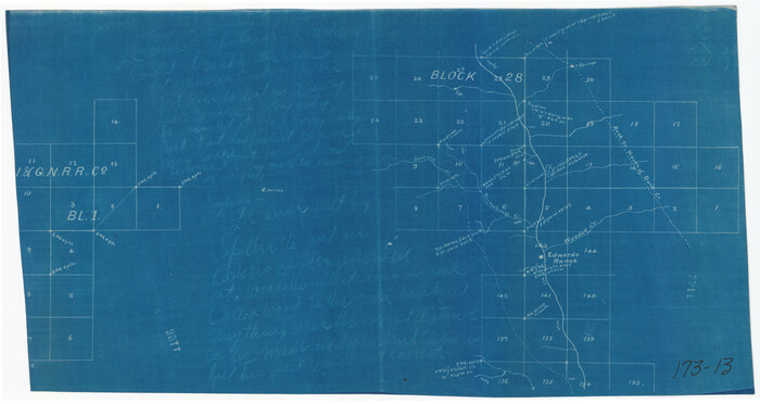
Print $3.00
- Digital $50.00
[Block 28, Showing Edwards Ranch]
Size: 17.0 x 8.9 inches
91499
[Beaty and Moulton Block A, Southern Pacific Railroad Block 2]
Print $20.00
- Digital $50.00
[Beaty and Moulton Block A, Southern Pacific Railroad Block 2]
1914
Size: 24.2 x 15.4 inches
91398
Sketch of Motley Co.

Print $20.00
- Digital $50.00
Sketch of Motley Co.
1883
Size: 19.7 x 20.2 inches
75560
Sketch in Floyd County

Print $20.00
- Digital $50.00
Sketch in Floyd County
1911
Size: 25.3 x 41.8 inches
90916
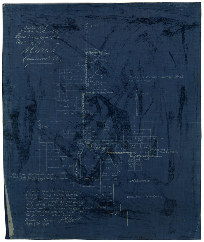
Sketch No. 1, Dickens & Motley Cos.
Print $20.00
- Digital $50.00
Sketch No. 1, Dickens & Motley Cos.
1879
Size: 17.9 x 15.5 inches
10761
Sketch H, Dickens County, Texas

Print $20.00
- Digital $50.00
Sketch H, Dickens County, Texas
1902
Size: 16.0 x 14.3 inches
4365
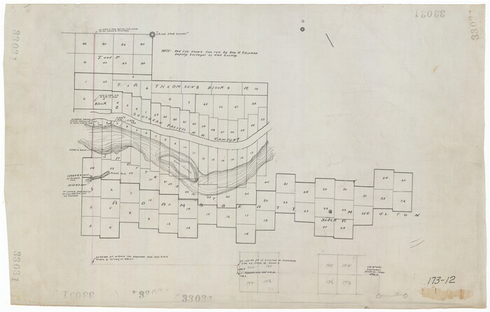
Plat Showing the Construction of Texas & Pacific Ry. Co. Blocks 3 & 4 As Located by G. A. Lider

Print $40.00
- Digital $50.00
Plat Showing the Construction of Texas & Pacific Ry. Co. Blocks 3 & 4 As Located by G. A. Lider
1913
Size: 51.4 x 36.3 inches
89931
Motley County, Texas

Print $20.00
- Digital $50.00
Motley County, Texas
1883
Size: 23.6 x 20.7 inches
743
Motley County Working Sketch Graphic Index

Print $20.00
- Digital $50.00
Motley County Working Sketch Graphic Index
1966
Size: 42.3 x 33.3 inches
76650
Motley County Working Sketch 9

Print $20.00
- Digital $50.00
Motley County Working Sketch 9
1984
Size: 32.6 x 28.9 inches
71214
Motley County Working Sketch 8

Print $20.00
- Digital $50.00
Motley County Working Sketch 8
1983
Size: 32.1 x 30.6 inches
71213
Motley County Working Sketch 7

Print $20.00
- Digital $50.00
Motley County Working Sketch 7
1983
Size: 33.8 x 42.8 inches
71212
Motley County Working Sketch 6

Print $20.00
- Digital $50.00
Motley County Working Sketch 6
1963
Size: 17.6 x 29.3 inches
71211
Motley County Working Sketch 5

Print $20.00
- Digital $50.00
Motley County Working Sketch 5
1940
Size: 22.5 x 20.3 inches
71210
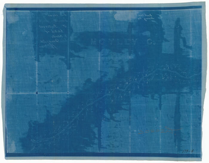
Motley County Working Sketch 4

Print $20.00
- Digital $50.00
Motley County Working Sketch 4
1914
Size: 19.9 x 10.2 inches
71209
[Tie line between Indianola RR. Co. Block H and H. & G. N. RR. Co. Block G and vicinity]
Print $20.00
- Digital $50.00
[Tie line between Indianola RR. Co. Block H and H. & G. N. RR. Co. Block G and vicinity]
1904
-
Size
21.9 x 10.1 inches
-
Map/Doc
93007
-
Creation Date
1904
[Southeast Portion of Motley County]
Print $20.00
- Digital $50.00
[Southeast Portion of Motley County]
-
Size
31.2 x 34.3 inches
-
Map/Doc
91508
[Sketch of counties just south of the Panhandle]
Print $20.00
- Digital $50.00
[Sketch of counties just south of the Panhandle]
-
Size
42.7 x 34.8 inches
-
Map/Doc
90913
[Sketch of Surveys in Cottle, Dickens, King & Motley Counties, Texas]
Print $20.00
- Digital $50.00
[Sketch of Surveys in Cottle, Dickens, King & Motley Counties, Texas]
1913
-
Size
29.6 x 23.2 inches
-
Map/Doc
75830
-
Creation Date
1913
[Portion of Motley County]
Print $20.00
- Digital $50.00
[Portion of Motley County]
-
Size
28.8 x 18.4 inches
-
Map/Doc
91501
[Blocks in East Floyd County and West Motley County showing Blocks D2, D3, GM, GP and T]
Print $20.00
- Digital $50.00
[Blocks in East Floyd County and West Motley County showing Blocks D2, D3, GM, GP and T]
-
Size
22.2 x 10.9 inches
-
Map/Doc
92113
[Blocks GP and T]
![91509, [Blocks GP and T], Twichell Survey Records](https://historictexasmaps.com/wmedia_w700/maps/91509-1.tif.jpg)
Print $20.00
- Digital $50.00
[Blocks GP and T]
-
Size
26.0 x 24.6 inches
-
Map/Doc
91509
[Blocks GM, and D3 and Vicinity in Motley and Floyd Counties]
Print $20.00
- Digital $50.00
[Blocks GM, and D3 and Vicinity in Motley and Floyd Counties]
1904
-
Size
23.8 x 17.4 inches
-
Map/Doc
91502
-
Creation Date
1904
[Blocks GM, D2, D3, GP, and T]
Print $20.00
- Digital $50.00
[Blocks GM, D2, D3, GP, and T]
-
Size
32.8 x 15.9 inches
-
Map/Doc
91503
[Blocks D3 and GP]
![91504, [Blocks D3 and GP], Twichell Survey Records](https://historictexasmaps.com/wmedia_w700/maps/91504-1.tif.jpg)
Print $20.00
- Digital $50.00
[Blocks D3 and GP]
-
Size
18.5 x 19.9 inches
-
Map/Doc
91504
[Blocks D3 and GP]
![91505, [Blocks D3 and GP], Twichell Survey Records](https://historictexasmaps.com/wmedia_w700/maps/91505-1.tif.jpg)
Print $20.00
- Digital $50.00
[Blocks D3 and GP]
-
Size
18.9 x 20.2 inches
-
Map/Doc
91505
[Blocks D3 and GP]
![91506, [Blocks D3 and GP], Twichell Survey Records](https://historictexasmaps.com/wmedia_w700/maps/91506-1.tif.jpg)
Print $20.00
- Digital $50.00
[Blocks D3 and GP]
-
Size
18.2 x 19.3 inches
-
Map/Doc
91506
[Blocks 1 and 2 along River in Motley County]
Print $20.00
- Digital $50.00
[Blocks 1 and 2 along River in Motley County]
1876
-
Size
21.3 x 16.6 inches
-
Map/Doc
91507
-
Creation Date
1876
[Block D3, Floyd County and Block GP, Motley County]
Print $20.00
- Digital $50.00
[Block D3, Floyd County and Block GP, Motley County]
-
Size
19.1 x 20.2 inches
-
Map/Doc
90836
[Block 28, Showing Edwards Ranch]
Print $3.00
- Digital $50.00
[Block 28, Showing Edwards Ranch]
-
Size
17.0 x 8.9 inches
-
Map/Doc
91499
[Beaty and Moulton Block A, Southern Pacific Railroad Block 2]
Print $20.00
- Digital $50.00
[Beaty and Moulton Block A, Southern Pacific Railroad Block 2]
1914
-
Size
24.2 x 15.4 inches
-
Map/Doc
91398
-
Creation Date
1914
Young Territory

Print $20.00
- Digital $50.00
Young Territory
1865
-
Size
29.7 x 30.5 inches
-
Map/Doc
1978
-
Creation Date
1865
Sketch of Motley Co.
Print $20.00
- Digital $50.00
Sketch of Motley Co.
1883
-
Size
19.7 x 20.2 inches
-
Map/Doc
75560
-
Creation Date
1883
Sketch in Floyd County
Print $20.00
- Digital $50.00
Sketch in Floyd County
1911
-
Size
25.3 x 41.8 inches
-
Map/Doc
90916
-
Creation Date
1911
Sketch No. 1, Dickens & Motley Cos.
Print $20.00
- Digital $50.00
Sketch No. 1, Dickens & Motley Cos.
1879
-
Size
17.9 x 15.5 inches
-
Map/Doc
10761
-
Creation Date
1879
Sketch H, Dickens County, Texas
Print $20.00
- Digital $50.00
Sketch H, Dickens County, Texas
1902
-
Size
16.0 x 14.3 inches
-
Map/Doc
4365
-
Creation Date
1902
Plat Showing the Construction of Texas & Pacific Ry. Co. Blocks 3 & 4 As Located by G. A. Lider
Print $40.00
- Digital $50.00
Plat Showing the Construction of Texas & Pacific Ry. Co. Blocks 3 & 4 As Located by G. A. Lider
1913
-
Size
51.4 x 36.3 inches
-
Map/Doc
89931
-
Creation Date
1913
Motley County, Texas
Print $20.00
- Digital $50.00
Motley County, Texas
1883
-
Size
23.6 x 20.7 inches
-
Map/Doc
743
-
Creation Date
1883
Motley County Working Sketch Graphic Index
Print $20.00
- Digital $50.00
Motley County Working Sketch Graphic Index
1966
-
Size
42.3 x 33.3 inches
-
Map/Doc
76650
-
Creation Date
1966
Motley County Working Sketch 9
Print $20.00
- Digital $50.00
Motley County Working Sketch 9
1984
-
Size
32.6 x 28.9 inches
-
Map/Doc
71214
-
Creation Date
1984
Motley County Working Sketch 8
Print $20.00
- Digital $50.00
Motley County Working Sketch 8
1983
-
Size
32.1 x 30.6 inches
-
Map/Doc
71213
-
Creation Date
1983
Motley County Working Sketch 7
Print $20.00
- Digital $50.00
Motley County Working Sketch 7
1983
-
Size
33.8 x 42.8 inches
-
Map/Doc
71212
-
Creation Date
1983
Motley County Working Sketch 6
Print $20.00
- Digital $50.00
Motley County Working Sketch 6
1963
-
Size
17.6 x 29.3 inches
-
Map/Doc
71211
-
Creation Date
1963
Motley County Working Sketch 5
Print $20.00
- Digital $50.00
Motley County Working Sketch 5
1940
-
Size
22.5 x 20.3 inches
-
Map/Doc
71210
-
Creation Date
1940
Motley County Working Sketch 4
Print $20.00
- Digital $50.00
Motley County Working Sketch 4
1914
-
Size
19.9 x 10.2 inches
-
Map/Doc
71209
-
Creation Date
1914