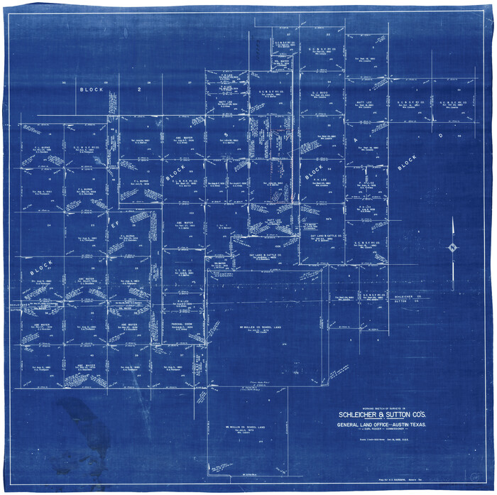
Schleicher County Working Sketch 27

Print $20.00
- Digital $50.00
Schleicher County Working Sketch 27
1974
Size: 26.2 x 31.8 inches
63829
Schleicher County Sketch File 45

Print $22.00
- Digital $50.00
Schleicher County Sketch File 45
1972
Size: 4.2 x 8.8 inches
36552
Schleicher County Rolled Sketch 25

Print $20.00
- Digital $50.00
Schleicher County Rolled Sketch 25
1969
Size: 32.3 x 37.9 inches
9908
Schleicher County Sketch File 43

Print $6.00
- Digital $50.00
Schleicher County Sketch File 43
1965
Size: 17.0 x 11.0 inches
36548
Schleicher County Sketch File 41

Print $6.00
- Digital $50.00
Schleicher County Sketch File 41
1963
Size: 16.2 x 9.9 inches
36544
Schleicher County Sketch File 42

Print $40.00
- Digital $50.00
Schleicher County Sketch File 42
1963
Size: 16.3 x 14.4 inches
36546
Menard County Sketch File 29

Print $20.00
- Digital $50.00
Menard County Sketch File 29
1962
Size: 21.0 x 41.1 inches
10543
Schleicher County Working Sketch 26

Print $20.00
- Digital $50.00
Schleicher County Working Sketch 26
1962
Size: 27.3 x 30.0 inches
63828
Schleicher County Rolled Sketch 23

Print $20.00
- Digital $50.00
Schleicher County Rolled Sketch 23
1961
Size: 30.7 x 22.9 inches
7762
Sutton County Sketch File 57

Print $24.00
- Digital $50.00
Sutton County Sketch File 57
1961
Size: 11.2 x 8.8 inches
37542
General Highway Map, Schleicher County, Sutton County, Texas

Print $20.00
General Highway Map, Schleicher County, Sutton County, Texas
1961
Size: 18.2 x 24.3 inches
79649
Sutton County Rolled Sketch 59

Print $40.00
- Digital $50.00
Sutton County Rolled Sketch 59
1960
Size: 86.1 x 42.5 inches
9977
Schleicher County Rolled Sketch 21

Print $20.00
- Digital $50.00
Schleicher County Rolled Sketch 21
1959
Size: 47.4 x 31.5 inches
9907
Sutton County Working Sketch 61

Print $20.00
- Digital $50.00
Sutton County Working Sketch 61
1959
Size: 44.1 x 38.6 inches
62404
Sutton County Working Sketch 62

Print $20.00
- Digital $50.00
Sutton County Working Sketch 62
1959
Size: 31.3 x 38.1 inches
62405
Schleicher County Rolled Sketch 20

Print $20.00
- Digital $50.00
Schleicher County Rolled Sketch 20
1958
Size: 35.5 x 20.0 inches
9906
Schleicher County Working Sketch 25

Print $20.00
- Digital $50.00
Schleicher County Working Sketch 25
1958
Size: 29.2 x 13.2 inches
63827
Schleicher County Sketch File 40

Print $6.00
- Digital $50.00
Schleicher County Sketch File 40
1958
Size: 11.2 x 8.9 inches
36541
Schleicher County Sketch File 46

Print $4.00
- Digital $50.00
Schleicher County Sketch File 46
1958
Size: 3.7 x 8.8 inches
36554
Schleicher County Sketch File 39

Print $9.00
- Digital $50.00
Schleicher County Sketch File 39
1958
Size: 14.8 x 9.4 inches
36538
Crockett County Working Sketch 62

Print $40.00
- Digital $50.00
Crockett County Working Sketch 62
1956
Size: 35.4 x 66.1 inches
63760
Crockett County Working Sketch 62

Print $40.00
- Digital $50.00
Crockett County Working Sketch 62
1956
Size: 121.8 x 37.1 inches
68395
Schleicher County Working Sketch 24
Print $20.00
- Digital $50.00
Schleicher County Working Sketch 24
1955
Size: 42.6 x 43.3 inches
63826
Schleicher County Sketch File 47

Print $4.00
- Digital $50.00
Schleicher County Sketch File 47
1953
Size: 4.4 x 8.7 inches
36556
Schleicher County Working Sketch 23

Print $20.00
- Digital $50.00
Schleicher County Working Sketch 23
1953
Size: 42.6 x 40.6 inches
63825
Tom Green County Rolled Sketch 14

Print $20.00
- Digital $50.00
Tom Green County Rolled Sketch 14
1953
Size: 28.3 x 30.9 inches
7999
Tom Green County Rolled Sketch 14

Print $20.00
- Digital $50.00
Tom Green County Rolled Sketch 14
1953
Size: 26.7 x 28.4 inches
8000
Schleicher County Sketch File 48

Print $4.00
- Digital $50.00
Schleicher County Sketch File 48
1953
Size: 11.2 x 8.7 inches
36558
Schleicher County Working Sketch 22

Print $20.00
- Digital $50.00
Schleicher County Working Sketch 22
1953
Size: 26.2 x 15.3 inches
63824
Schleicher County Working Sketch 21

Print $20.00
- Digital $50.00
Schleicher County Working Sketch 21
1953
Size: 26.6 x 10.8 inches
63823
Schleicher County Working Sketch 27
Print $20.00
- Digital $50.00
Schleicher County Working Sketch 27
1974
-
Size
26.2 x 31.8 inches
-
Map/Doc
63829
-
Creation Date
1974
Schleicher County Sketch File 45
Print $22.00
- Digital $50.00
Schleicher County Sketch File 45
1972
-
Size
4.2 x 8.8 inches
-
Map/Doc
36552
-
Creation Date
1972
Schleicher County Rolled Sketch 25
Print $20.00
- Digital $50.00
Schleicher County Rolled Sketch 25
1969
-
Size
32.3 x 37.9 inches
-
Map/Doc
9908
-
Creation Date
1969
Schleicher County Sketch File 43
Print $6.00
- Digital $50.00
Schleicher County Sketch File 43
1965
-
Size
17.0 x 11.0 inches
-
Map/Doc
36548
-
Creation Date
1965
Schleicher County Sketch File 41
Print $6.00
- Digital $50.00
Schleicher County Sketch File 41
1963
-
Size
16.2 x 9.9 inches
-
Map/Doc
36544
-
Creation Date
1963
Schleicher County Sketch File 42
Print $40.00
- Digital $50.00
Schleicher County Sketch File 42
1963
-
Size
16.3 x 14.4 inches
-
Map/Doc
36546
-
Creation Date
1963
Menard County Sketch File 29
Print $20.00
- Digital $50.00
Menard County Sketch File 29
1962
-
Size
21.0 x 41.1 inches
-
Map/Doc
10543
-
Creation Date
1962
Schleicher County Working Sketch 26
Print $20.00
- Digital $50.00
Schleicher County Working Sketch 26
1962
-
Size
27.3 x 30.0 inches
-
Map/Doc
63828
-
Creation Date
1962
Schleicher County Rolled Sketch 23
Print $20.00
- Digital $50.00
Schleicher County Rolled Sketch 23
1961
-
Size
30.7 x 22.9 inches
-
Map/Doc
7762
-
Creation Date
1961
Sutton County Sketch File 57
Print $24.00
- Digital $50.00
Sutton County Sketch File 57
1961
-
Size
11.2 x 8.8 inches
-
Map/Doc
37542
-
Creation Date
1961
General Highway Map, Schleicher County, Sutton County, Texas
Print $20.00
General Highway Map, Schleicher County, Sutton County, Texas
1961
-
Size
18.2 x 24.3 inches
-
Map/Doc
79649
-
Creation Date
1961
Sutton County Rolled Sketch 59
Print $40.00
- Digital $50.00
Sutton County Rolled Sketch 59
1960
-
Size
86.1 x 42.5 inches
-
Map/Doc
9977
-
Creation Date
1960
Schleicher County Rolled Sketch 21
Print $20.00
- Digital $50.00
Schleicher County Rolled Sketch 21
1959
-
Size
47.4 x 31.5 inches
-
Map/Doc
9907
-
Creation Date
1959
Sutton County Working Sketch 61
Print $20.00
- Digital $50.00
Sutton County Working Sketch 61
1959
-
Size
44.1 x 38.6 inches
-
Map/Doc
62404
-
Creation Date
1959
Sutton County Working Sketch 62
Print $20.00
- Digital $50.00
Sutton County Working Sketch 62
1959
-
Size
31.3 x 38.1 inches
-
Map/Doc
62405
-
Creation Date
1959
Schleicher County Rolled Sketch 20
Print $20.00
- Digital $50.00
Schleicher County Rolled Sketch 20
1958
-
Size
35.5 x 20.0 inches
-
Map/Doc
9906
-
Creation Date
1958
Schleicher County Working Sketch 25
Print $20.00
- Digital $50.00
Schleicher County Working Sketch 25
1958
-
Size
29.2 x 13.2 inches
-
Map/Doc
63827
-
Creation Date
1958
Schleicher County Sketch File 40
Print $6.00
- Digital $50.00
Schleicher County Sketch File 40
1958
-
Size
11.2 x 8.9 inches
-
Map/Doc
36541
-
Creation Date
1958
Schleicher County Sketch File 46
Print $4.00
- Digital $50.00
Schleicher County Sketch File 46
1958
-
Size
3.7 x 8.8 inches
-
Map/Doc
36554
-
Creation Date
1958
Schleicher County Sketch File 39
Print $9.00
- Digital $50.00
Schleicher County Sketch File 39
1958
-
Size
14.8 x 9.4 inches
-
Map/Doc
36538
-
Creation Date
1958
Crockett County Working Sketch 62
Print $40.00
- Digital $50.00
Crockett County Working Sketch 62
1956
-
Size
35.4 x 66.1 inches
-
Map/Doc
63760
-
Creation Date
1956
Crockett County Working Sketch 62
Print $40.00
- Digital $50.00
Crockett County Working Sketch 62
1956
-
Size
121.8 x 37.1 inches
-
Map/Doc
68395
-
Creation Date
1956
Schleicher County Working Sketch 24
Print $20.00
- Digital $50.00
Schleicher County Working Sketch 24
1955
-
Size
42.6 x 43.3 inches
-
Map/Doc
63826
-
Creation Date
1955
Schleicher County Sketch File 47
Print $4.00
- Digital $50.00
Schleicher County Sketch File 47
1953
-
Size
4.4 x 8.7 inches
-
Map/Doc
36556
-
Creation Date
1953
Schleicher County Working Sketch 23
Print $20.00
- Digital $50.00
Schleicher County Working Sketch 23
1953
-
Size
42.6 x 40.6 inches
-
Map/Doc
63825
-
Creation Date
1953
Tom Green County Rolled Sketch 14
Print $20.00
- Digital $50.00
Tom Green County Rolled Sketch 14
1953
-
Size
28.3 x 30.9 inches
-
Map/Doc
7999
-
Creation Date
1953
Tom Green County Rolled Sketch 14
Print $20.00
- Digital $50.00
Tom Green County Rolled Sketch 14
1953
-
Size
26.7 x 28.4 inches
-
Map/Doc
8000
-
Creation Date
1953
Schleicher County Sketch File 48
Print $4.00
- Digital $50.00
Schleicher County Sketch File 48
1953
-
Size
11.2 x 8.7 inches
-
Map/Doc
36558
-
Creation Date
1953
Schleicher County Working Sketch 22
Print $20.00
- Digital $50.00
Schleicher County Working Sketch 22
1953
-
Size
26.2 x 15.3 inches
-
Map/Doc
63824
-
Creation Date
1953
Schleicher County Working Sketch 21
Print $20.00
- Digital $50.00
Schleicher County Working Sketch 21
1953
-
Size
26.6 x 10.8 inches
-
Map/Doc
63823
-
Creation Date
1953