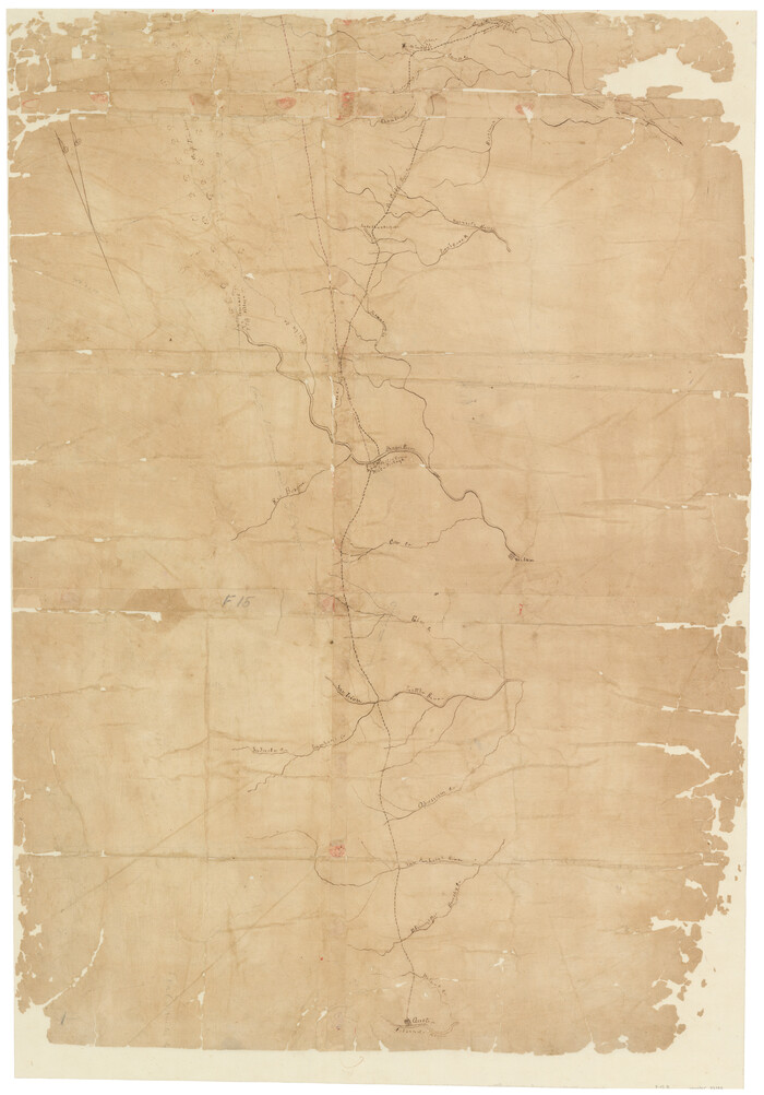
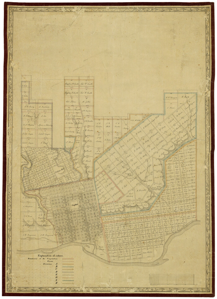
[Travis District]
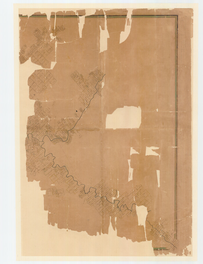
Print $40.00
- Digital $50.00
[Travis District]
1840
Size: 54.7 x 42.0 inches
88739
[Travis District]
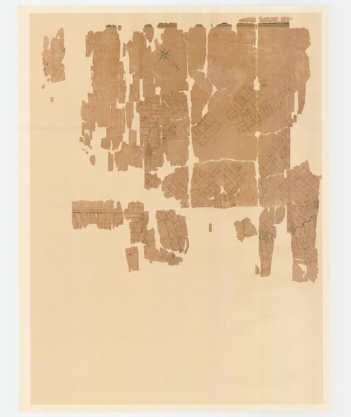
Print $40.00
- Digital $50.00
[Travis District]
1840
Size: 54.7 x 46.0 inches
88740
[Traverse up the Brazos and Colorado River showing distance from county site to county site]
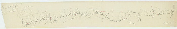
Print $40.00
- Digital $50.00
[Traverse up the Brazos and Colorado River showing distance from county site to county site]
1871
Size: 16.2 x 98.8 inches
2054
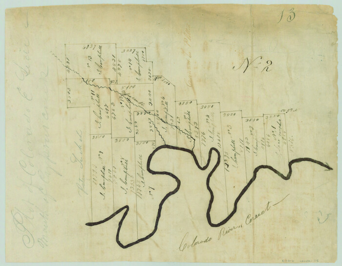
[Surveys in the Travis District along the Colorado and Pedernales Rivers]
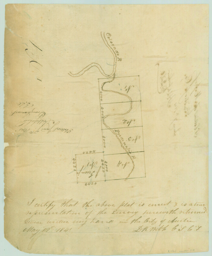
Print $2.00
- Digital $50.00
[Surveys in the Travis District along the Colorado and Pedernales Rivers]
1841
Size: 9.9 x 8.2 inches
113
[Surveys in the Travis District along the Colorado River]
Print $2.00
- Digital $50.00
[Surveys in the Travis District along the Colorado River]
1840
Size: 8.0 x 10.2 inches
115
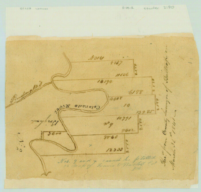
[Surveys in the Travis District along the Colorado River]
Print $2.00
- Digital $50.00
[Surveys in the Travis District along the Colorado River]
1841
Size: 7.0 x 7.3 inches
3180
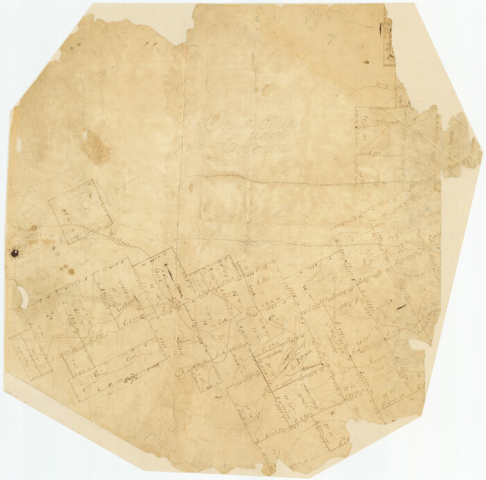
[Surveys in Milam's Colony between the Colorado River and northwest of the San Antonio Road]
Print $20.00
- Digital $50.00
[Surveys in Milam's Colony between the Colorado River and northwest of the San Antonio Road]
Size: 22.0 x 27.4 inches
29
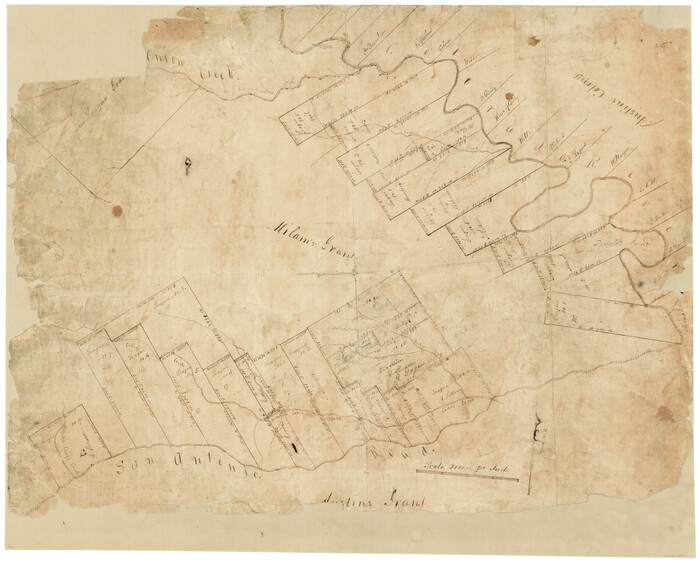
[Surveys in Milam's Colony along the Colorado River and Onion Creek]
Print $20.00
- Digital $50.00
[Surveys in Milam's Colony along the Colorado River and Onion Creek]
1835
Size: 24.7 x 25.0 inches
91
[Surveys by Brown in Austin's Little Colony along the Colorado River and Walnut Creek]
Print $20.00
- Digital $50.00
[Surveys by Brown in Austin's Little Colony along the Colorado River and Walnut Creek]
1832
Size: 33.2 x 23.3 inches
196
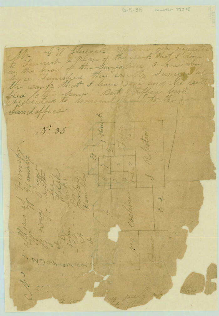
[Surveys along the San Gabriel River]
Print $2.00
- Digital $50.00
[Surveys along the San Gabriel River]
Size: 9.0 x 6.3 inches
78375
[Surveys along Gilleland and Wilbarger Creek in the Travis District]
Print $2.00
- Digital $50.00
[Surveys along Gilleland and Wilbarger Creek in the Travis District]
1841
Size: 8.1 x 11.2 inches
111
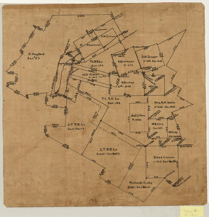
[Surveying sketch of S. Hayford, E. T. R.R. Co., T. C. R. R. Co., et al in Travis County, Texas]
Print $20.00
- Digital $50.00
[Surveying sketch of S. Hayford, E. T. R.R. Co., T. C. R. R. Co., et al in Travis County, Texas]
Size: 18.0 x 17.3 inches
10753
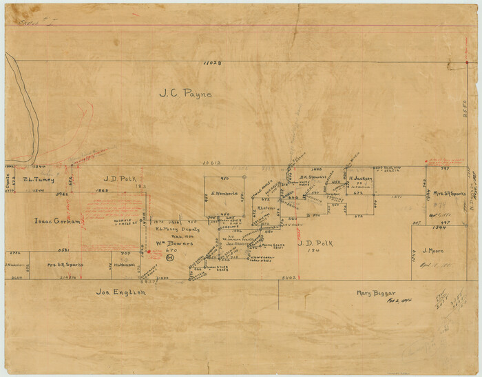
[Surveying sketch of J.C. Payne, J.D. Polk, Jos. English, et al in Travis County, Texas]
Print $20.00
- Digital $50.00
[Surveying sketch of J.C. Payne, J.D. Polk, Jos. English, et al in Travis County, Texas]
Size: 18.3 x 23.5 inches
75801
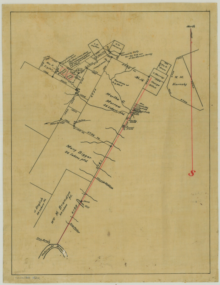
[Surveying Sketch of Martha G. Morrow, Mary Bigger, et al in Travis County]
Print $3.00
- Digital $50.00
[Surveying Sketch of Martha G. Morrow, Mary Bigger, et al in Travis County]
Size: 12.4 x 9.6 inches
522
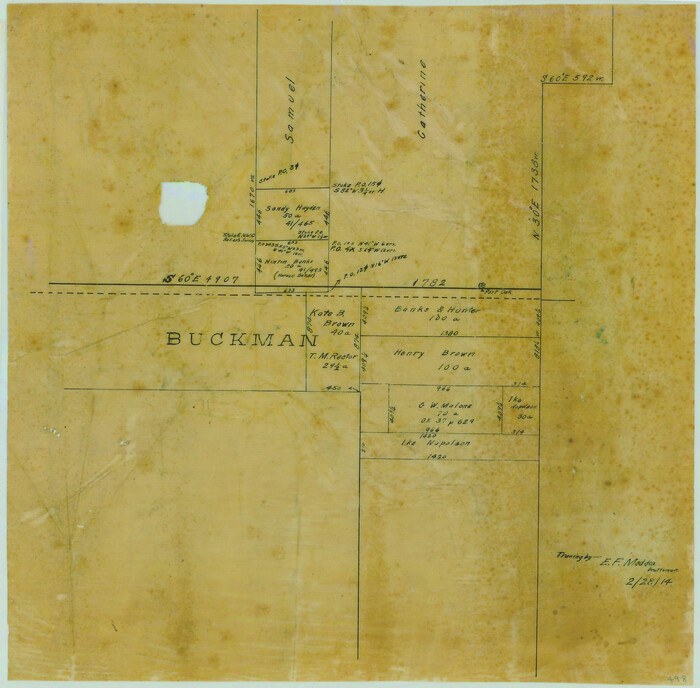
[Surveying Sketch of Buckman, et al in Unknown County]
Print $3.00
- Digital $50.00
[Surveying Sketch of Buckman, et al in Unknown County]
Size: 11.7 x 11.9 inches
498
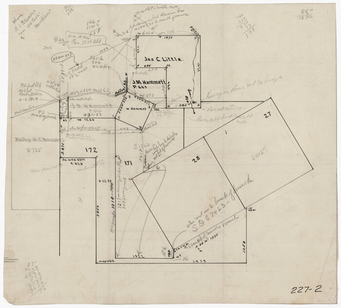
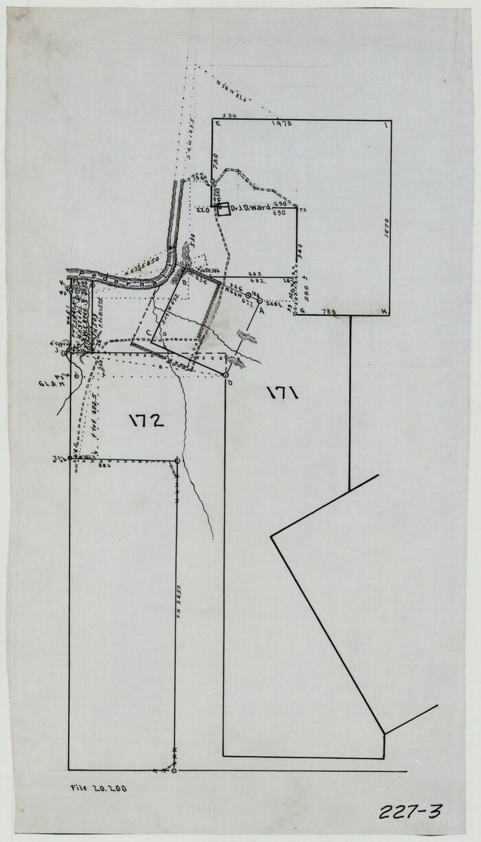
[Sketch of surveys in the vicinity of sections 171 and 172 along Pedernales]
Print $20.00
- Digital $50.00
[Sketch of surveys in the vicinity of sections 171 and 172 along Pedernales]
Size: 15.8 x 14.3 inches
91880
[Sketch of surveys in the vicinity of sections 171 and 172 along Pedernales]
Print $2.00
- Digital $50.00
[Sketch of surveys in the vicinity of sections 171 and 172 along Pedernales]
Size: 8.6 x 14.4 inches
91881
[Sketch of surveys in the vicinity of sections 171 and 172 along Pedernales]
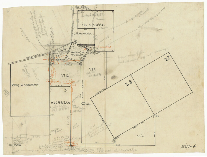
Print $20.00
- Digital $50.00
[Sketch of surveys in the vicinity of sections 171 and 172 along Pedernales]
Size: 17.2 x 12.9 inches
91882
[Sketch of area around R. D. Price and Berry Doolittle Surveys]
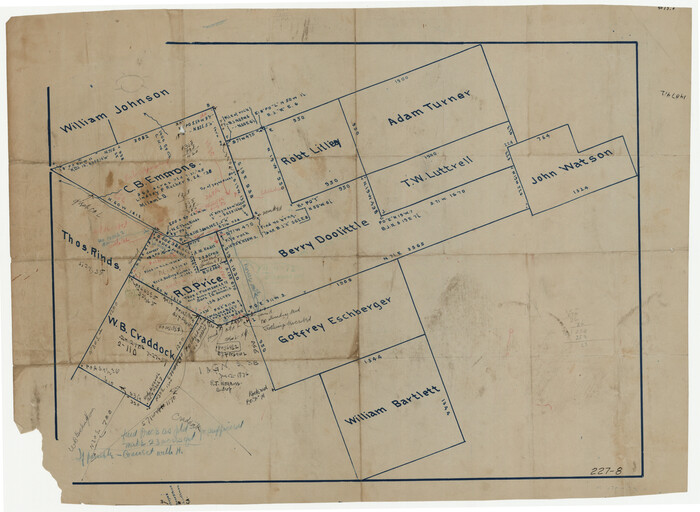
Print $20.00
- Digital $50.00
[Sketch of area around R. D. Price and Berry Doolittle Surveys]
Size: 27.4 x 19.8 inches
91878
[Sketch of Norwood's Homestead]
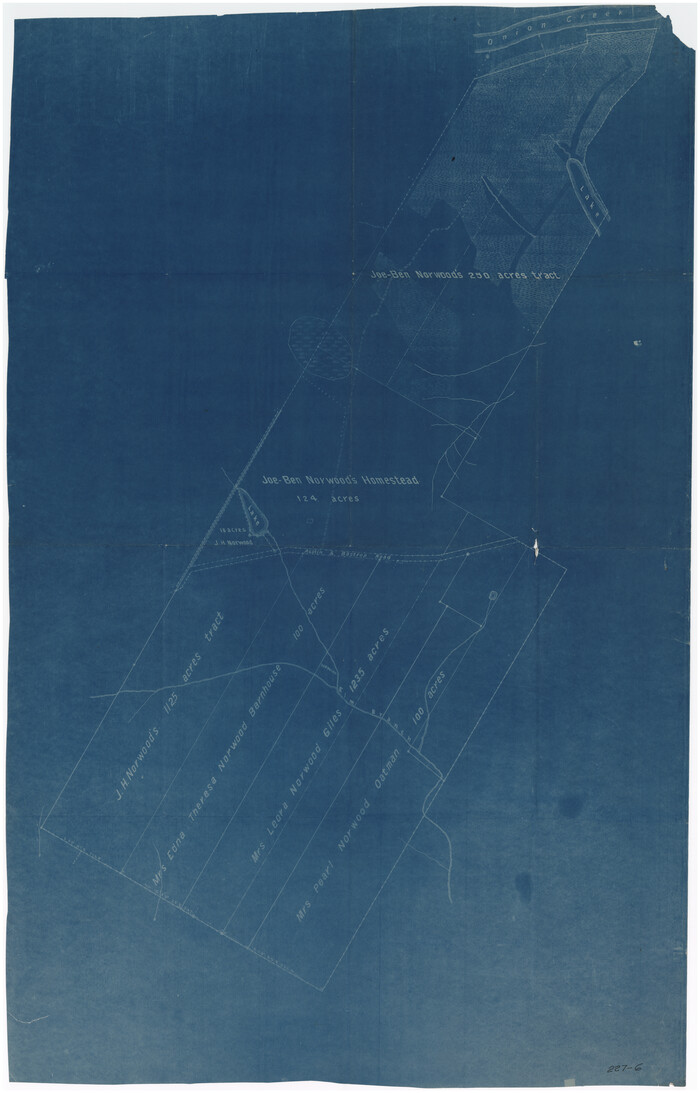
Print $40.00
- Digital $50.00
[Sketch of Norwood's Homestead]
Size: 31.8 x 49.7 inches
89646
[Sketch of Col. Cooke's Military Road expedition from Red River to Austin]
Print $20.00
- Digital $50.00
[Sketch of Col. Cooke's Military Road expedition from Red River to Austin]
Size: 33.4 x 23.4 inches
82146
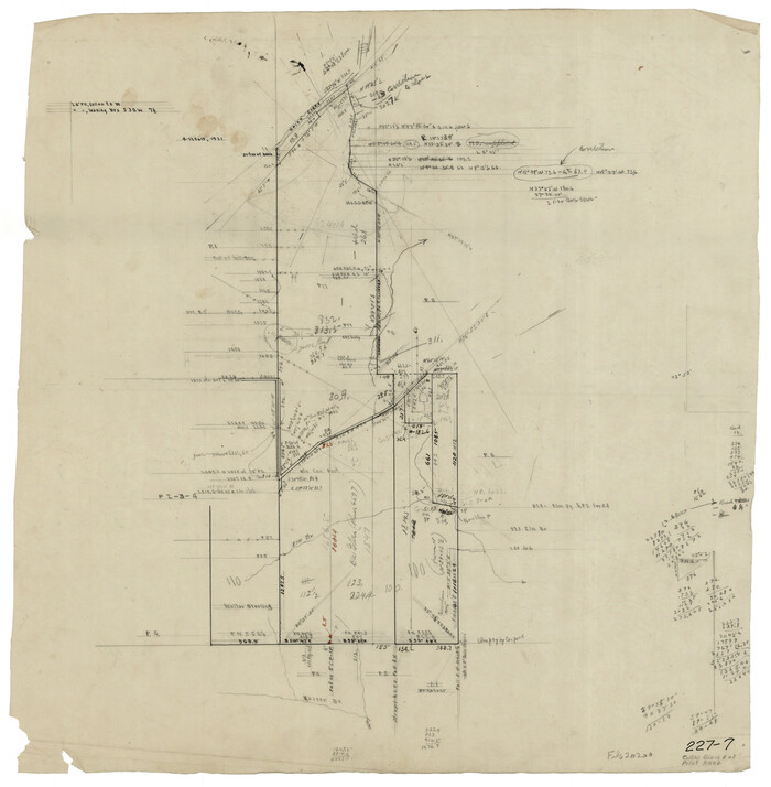
[Skeleton Sketch of Unlabeled Surveys in Travis County, Texas]

Print $20.00
- Digital $50.00
[Skeleton Sketch of Unlabeled Surveys in Travis County, Texas]
Size: 28.9 x 36.8 inches
382
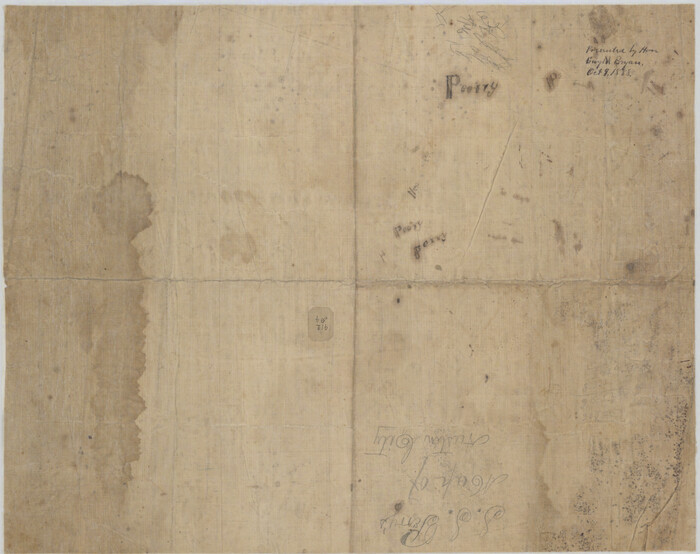
[Reverse of] Plan of the City of Austin
Print $20.00
[Reverse of] Plan of the City of Austin
1839
Size: 19.2 x 24.3 inches
76228
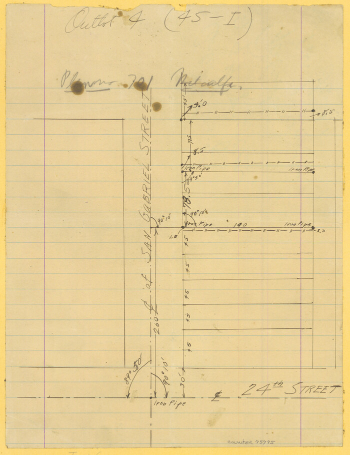
[Plat Showing San Gabriel & 24th Street Intersection, Outlot 4, Travis County, Texas]
Print $2.00
- Digital $50.00
[Plat Showing San Gabriel & 24th Street Intersection, Outlot 4, Travis County, Texas]
Size: 11.4 x 8.7 inches
75795
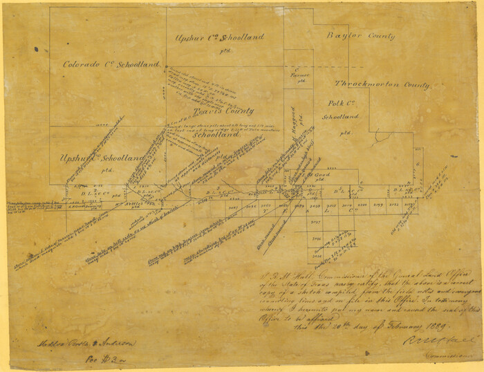
[Plat Showing Colorado, Upshur & Travis County School Land and Surrounding Area in Baylor & Throckmorton Counties, Texas]
Print $20.00
- Digital $50.00
[Plat Showing Colorado, Upshur & Travis County School Land and Surrounding Area in Baylor & Throckmorton Counties, Texas]
1889
Size: 15.8 x 20.5 inches
75790
[Norwood Homestead]
Print $20.00
- Digital $50.00
[Norwood Homestead]
Size: 21.1 x 21.8 inches
91879
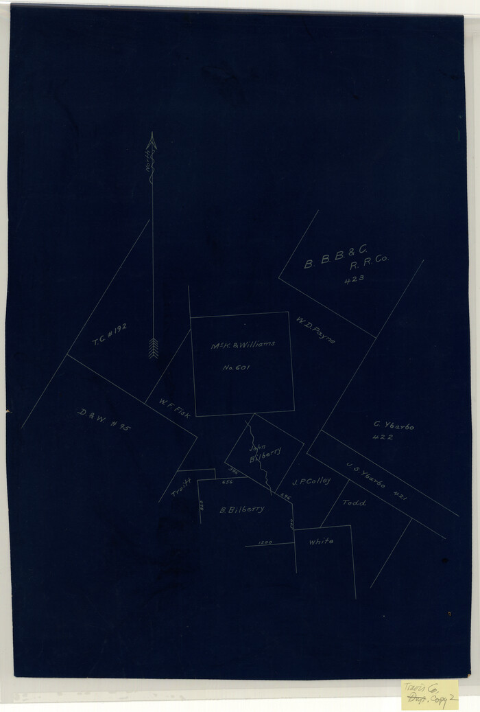
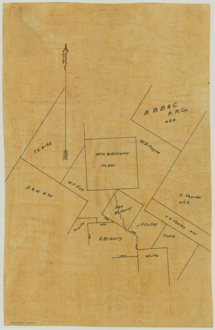
[McK. & Williams No. 601 and surrounding surveys, Travis County]
Print $20.00
- Digital $50.00
[McK. & Williams No. 601 and surrounding surveys, Travis County]
Size: 18.3 x 12.3 inches
10782
[McK. & Williams No. 601 and surrounding surveys, Travis County]
Print $3.00
- Digital $50.00
[McK. & Williams No. 601 and surrounding surveys, Travis County]
Size: 16.3 x 10.7 inches
75553
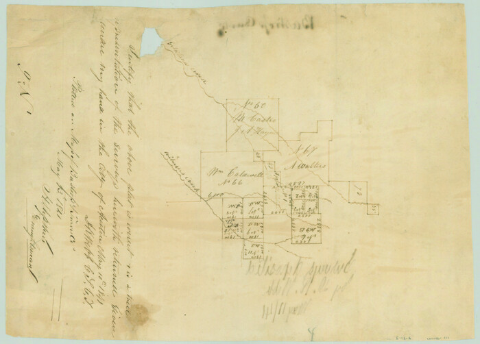
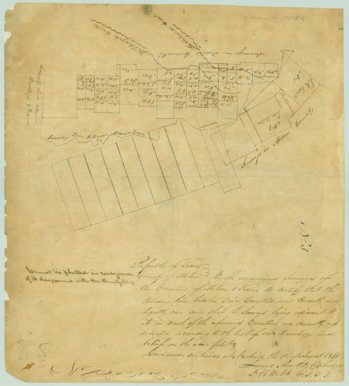
[Map of the dividing line between Milam and Travis Counties]
Print $20.00
- Digital $50.00
[Map of the dividing line between Milam and Travis Counties]
1841
Size: 14.2 x 12.8 inches
110
[Map of the City of Austin]
Print $20.00
- Digital $50.00
[Map of the City of Austin]
1856
Size: 29.1 x 21.5 inches
4802
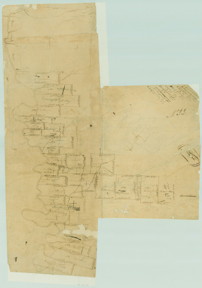
[Travis District]
Print $40.00
- Digital $50.00
[Travis District]
1840
-
Size
54.7 x 42.0 inches
-
Map/Doc
88739
-
Creation Date
1840
[Travis District]
Print $40.00
- Digital $50.00
[Travis District]
1840
-
Size
54.7 x 46.0 inches
-
Map/Doc
88740
-
Creation Date
1840
[Traverse up the Brazos and Colorado River showing distance from county site to county site]
Print $40.00
- Digital $50.00
[Traverse up the Brazos and Colorado River showing distance from county site to county site]
1871
-
Size
16.2 x 98.8 inches
-
Map/Doc
2054
-
Creation Date
1871
[Surveys in the Travis District along the Colorado and Pedernales Rivers]
Print $2.00
- Digital $50.00
[Surveys in the Travis District along the Colorado and Pedernales Rivers]
1841
-
Size
9.9 x 8.2 inches
-
Map/Doc
113
-
Creation Date
1841
[Surveys in the Travis District along the Colorado River]
Print $2.00
- Digital $50.00
[Surveys in the Travis District along the Colorado River]
1840
-
Size
8.0 x 10.2 inches
-
Map/Doc
115
-
Creation Date
1840
[Surveys in the Travis District along the Colorado River]
Print $2.00
- Digital $50.00
[Surveys in the Travis District along the Colorado River]
1841
-
Size
7.0 x 7.3 inches
-
Map/Doc
3180
-
Creation Date
1841
[Surveys in Milam's Colony between the Colorado River and northwest of the San Antonio Road]
Print $20.00
- Digital $50.00
[Surveys in Milam's Colony between the Colorado River and northwest of the San Antonio Road]
-
Size
22.0 x 27.4 inches
-
Map/Doc
29
[Surveys in Milam's Colony along the Colorado River and Onion Creek]
Print $20.00
- Digital $50.00
[Surveys in Milam's Colony along the Colorado River and Onion Creek]
1835
-
Size
24.7 x 25.0 inches
-
Map/Doc
91
-
Creation Date
1835
[Surveys by Brown in Austin's Little Colony along the Colorado River and Walnut Creek]
Print $20.00
- Digital $50.00
[Surveys by Brown in Austin's Little Colony along the Colorado River and Walnut Creek]
1832
-
Size
33.2 x 23.3 inches
-
Map/Doc
196
-
Creation Date
1832
[Surveys along the San Gabriel River]
Print $2.00
- Digital $50.00
[Surveys along the San Gabriel River]
-
Size
9.0 x 6.3 inches
-
Map/Doc
78375
[Surveys along Gilleland and Wilbarger Creek in the Travis District]
Print $2.00
- Digital $50.00
[Surveys along Gilleland and Wilbarger Creek in the Travis District]
1841
-
Size
8.1 x 11.2 inches
-
Map/Doc
111
-
Creation Date
1841
[Surveying sketch of S. Hayford, E. T. R.R. Co., T. C. R. R. Co., et al in Travis County, Texas]
Print $20.00
- Digital $50.00
[Surveying sketch of S. Hayford, E. T. R.R. Co., T. C. R. R. Co., et al in Travis County, Texas]
-
Size
18.0 x 17.3 inches
-
Map/Doc
10753
[Surveying sketch of J.C. Payne, J.D. Polk, Jos. English, et al in Travis County, Texas]
Print $20.00
- Digital $50.00
[Surveying sketch of J.C. Payne, J.D. Polk, Jos. English, et al in Travis County, Texas]
-
Size
18.3 x 23.5 inches
-
Map/Doc
75801
[Surveying Sketch of Martha G. Morrow, Mary Bigger, et al in Travis County]
Print $3.00
- Digital $50.00
[Surveying Sketch of Martha G. Morrow, Mary Bigger, et al in Travis County]
-
Size
12.4 x 9.6 inches
-
Map/Doc
522
[Surveying Sketch of Buckman, et al in Unknown County]
Print $3.00
- Digital $50.00
[Surveying Sketch of Buckman, et al in Unknown County]
-
Size
11.7 x 11.9 inches
-
Map/Doc
498
[Sketch of surveys in the vicinity of sections 171 and 172 along Pedernales]
Print $20.00
- Digital $50.00
[Sketch of surveys in the vicinity of sections 171 and 172 along Pedernales]
-
Size
15.8 x 14.3 inches
-
Map/Doc
91880
[Sketch of surveys in the vicinity of sections 171 and 172 along Pedernales]
Print $2.00
- Digital $50.00
[Sketch of surveys in the vicinity of sections 171 and 172 along Pedernales]
-
Size
8.6 x 14.4 inches
-
Map/Doc
91881
[Sketch of surveys in the vicinity of sections 171 and 172 along Pedernales]
Print $20.00
- Digital $50.00
[Sketch of surveys in the vicinity of sections 171 and 172 along Pedernales]
-
Size
17.2 x 12.9 inches
-
Map/Doc
91882
[Sketch of area around R. D. Price and Berry Doolittle Surveys]
Print $20.00
- Digital $50.00
[Sketch of area around R. D. Price and Berry Doolittle Surveys]
-
Size
27.4 x 19.8 inches
-
Map/Doc
91878
[Sketch of Norwood's Homestead]
Print $40.00
- Digital $50.00
[Sketch of Norwood's Homestead]
-
Size
31.8 x 49.7 inches
-
Map/Doc
89646
[Sketch of Col. Cooke's Military Road expedition from Red River to Austin]
Print $20.00
- Digital $50.00
[Sketch of Col. Cooke's Military Road expedition from Red River to Austin]
-
Size
33.4 x 23.4 inches
-
Map/Doc
82146
[Skeleton Sketch of Unlabeled Surveys in Travis County, Texas]
Print $20.00
- Digital $50.00
[Skeleton Sketch of Unlabeled Surveys in Travis County, Texas]
-
Size
28.9 x 36.8 inches
-
Map/Doc
382
[Reverse of] Plan of the City of Austin
Print $20.00
[Reverse of] Plan of the City of Austin
1839
-
Size
19.2 x 24.3 inches
-
Map/Doc
76228
-
Creation Date
1839
[Plat Showing San Gabriel & 24th Street Intersection, Outlot 4, Travis County, Texas]
Print $2.00
- Digital $50.00
[Plat Showing San Gabriel & 24th Street Intersection, Outlot 4, Travis County, Texas]
-
Size
11.4 x 8.7 inches
-
Map/Doc
75795
[Plat Showing Colorado, Upshur & Travis County School Land and Surrounding Area in Baylor & Throckmorton Counties, Texas]
Print $20.00
- Digital $50.00
[Plat Showing Colorado, Upshur & Travis County School Land and Surrounding Area in Baylor & Throckmorton Counties, Texas]
1889
-
Size
15.8 x 20.5 inches
-
Map/Doc
75790
-
Creation Date
1889
[Norwood Homestead]
Print $20.00
- Digital $50.00
[Norwood Homestead]
-
Size
21.1 x 21.8 inches
-
Map/Doc
91879
[McK. & Williams No. 601 and surrounding surveys, Travis County]
Print $20.00
- Digital $50.00
[McK. & Williams No. 601 and surrounding surveys, Travis County]
-
Size
18.3 x 12.3 inches
-
Map/Doc
10782
[McK. & Williams No. 601 and surrounding surveys, Travis County]
Print $3.00
- Digital $50.00
[McK. & Williams No. 601 and surrounding surveys, Travis County]
-
Size
16.3 x 10.7 inches
-
Map/Doc
75553
[Map of the dividing line between Milam and Travis Counties]
Print $20.00
- Digital $50.00
[Map of the dividing line between Milam and Travis Counties]
1841
-
Size
14.2 x 12.8 inches
-
Map/Doc
110
-
Creation Date
1841
[Map of the City of Austin]
Print $20.00
- Digital $50.00
[Map of the City of Austin]
1856
-
Size
29.1 x 21.5 inches
-
Map/Doc
4802
-
Creation Date
1856