[Surveys on the waters of Pine Creeke of the Neches]
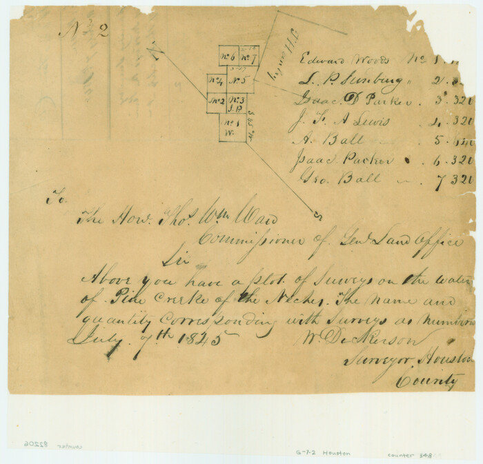
Print $2.00
- Digital $50.00
[Surveys on the waters of Pine Creeke of the Neches]
1845
Size: 7.9 x 8.2 inches
348
[Surveys along Elm Creek]
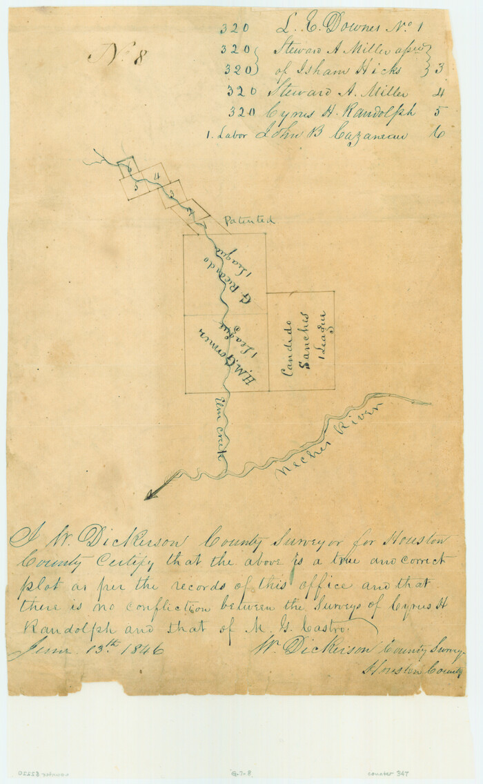
Print $2.00
- Digital $50.00
[Surveys along Elm Creek]
1846
Size: 12.0 x 7.4 inches
347
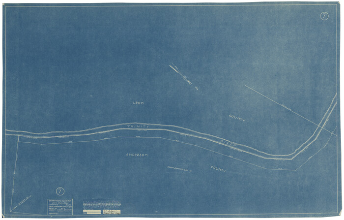
[Sketch for Mineral Application 27669 - Trinity River, Frank R. Graves]
Print $20.00
- Digital $50.00
[Sketch for Mineral Application 27669 - Trinity River, Frank R. Graves]
1934
Size: 24.9 x 36.0 inches
2856
[Sketch for Mineral Application 27669 - Trinity River, Frank R. Graves]
Print $40.00
- Digital $50.00
[Sketch for Mineral Application 27669 - Trinity River, Frank R. Graves]
1934
Size: 28.3 x 83.2 inches
2858
[Sketch for Mineral Application 27669 - Trinity River, Frank R. Graves]
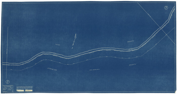
Print $40.00
- Digital $50.00
[Sketch for Mineral Application 27669 - Trinity River, Frank R. Graves]
1934
Size: 27.9 x 51.7 inches
2859
[Sketch for Mineral Application 27669 - Trinity River, Frank R. Graves]
Print $20.00
- Digital $50.00
[Sketch for Mineral Application 27669 - Trinity River, Frank R. Graves]
1934
Size: 27.4 x 42.7 inches
2860
[Sketch for Mineral Application 27669 - Trinity River, Frank R. Graves]
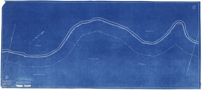
Print $40.00
- Digital $50.00
[Sketch for Mineral Application 27669 - Trinity River, Frank R. Graves]
1934
Size: 27.4 x 61.6 inches
2861
[Jose Antonio Sepulveda grant]
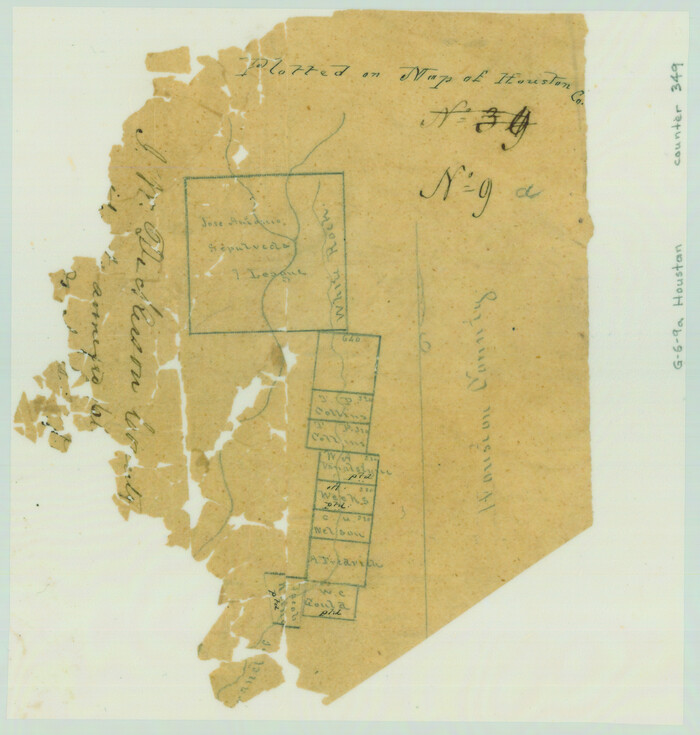
Print $2.00
- Digital $50.00
[Jose Antonio Sepulveda grant]
Size: 5.9 x 5.7 inches
349
Trinity County, Texas

Print $20.00
- Digital $50.00
Trinity County, Texas
1882
Size: 20.3 x 17.4 inches
485
Trinity County, Texas

Print $20.00
- Digital $50.00
Trinity County, Texas
1879
Size: 15.8 x 23.8 inches
761
Trinity County Working Sketch Graphic Index

Print $20.00
- Digital $50.00
Trinity County Working Sketch Graphic Index
1946
Size: 41.3 x 41.6 inches
76718
Trinity County Working Sketch 9

Print $20.00
- Digital $50.00
Trinity County Working Sketch 9
1947
Size: 23.5 x 28.1 inches
69458
Trinity County Working Sketch 8

Print $3.00
- Digital $50.00
Trinity County Working Sketch 8
1941
Size: 14.7 x 10.8 inches
69457
Trinity County Working Sketch 7b

Print $20.00
- Digital $50.00
Trinity County Working Sketch 7b
1939
Size: 27.4 x 24.7 inches
69456
Trinity County Working Sketch 7a

Print $20.00
- Digital $50.00
Trinity County Working Sketch 7a
1933
Size: 39.7 x 27.3 inches
69455
Trinity County Working Sketch 6

Print $20.00
- Digital $50.00
Trinity County Working Sketch 6
1920
Size: 19.6 x 14.6 inches
69454
Trinity County Working Sketch 5

Print $20.00
- Digital $50.00
Trinity County Working Sketch 5
1914
Size: 18.3 x 23.9 inches
69453
Trinity County Working Sketch 4

Print $20.00
- Digital $50.00
Trinity County Working Sketch 4
1908
Size: 21.3 x 18.5 inches
69452
Trinity County Working Sketch 3

Print $20.00
- Digital $50.00
Trinity County Working Sketch 3
1905
Size: 26.7 x 19.2 inches
69451
Trinity County Working Sketch 27

Print $20.00
- Digital $50.00
Trinity County Working Sketch 27
2010
Size: 26.8 x 36.8 inches
90069
Trinity County Working Sketch 26

Print $20.00
- Digital $50.00
Trinity County Working Sketch 26
2010
Size: 21.0 x 34.1 inches
89601
Trinity County Working Sketch 25

Print $20.00
- Digital $50.00
Trinity County Working Sketch 25
2010
Size: 39.7 x 28.7 inches
89600
Trinity County Working Sketch 24

Print $20.00
- Digital $50.00
Trinity County Working Sketch 24
2010
Size: 18.2 x 36.5 inches
89599
Trinity County Working Sketch 23

Print $20.00
- Digital $50.00
Trinity County Working Sketch 23
2010
Size: 23.4 x 33.6 inches
89259
Trinity County Working Sketch 22

Print $40.00
- Digital $50.00
Trinity County Working Sketch 22
2009
Size: 32.0 x 52.1 inches
89068
Trinity County Working Sketch 21

Print $20.00
- Digital $50.00
Trinity County Working Sketch 21
1992
Size: 23.1 x 23.1 inches
69470
Trinity County Working Sketch 20

Print $20.00
- Digital $50.00
Trinity County Working Sketch 20
Size: 25.9 x 29.7 inches
69469
Trinity County Working Sketch 2

Print $20.00
- Digital $50.00
Trinity County Working Sketch 2
1905
Size: 16.7 x 13.6 inches
69450
Trinity County Working Sketch 19

Print $20.00
- Digital $50.00
Trinity County Working Sketch 19
1982
Size: 14.7 x 11.1 inches
69468
Trinity County Working Sketch 18

Print $20.00
- Digital $50.00
Trinity County Working Sketch 18
1982
Size: 13.4 x 11.1 inches
69467
[Surveys on the waters of Pine Creeke of the Neches]
Print $2.00
- Digital $50.00
[Surveys on the waters of Pine Creeke of the Neches]
1845
-
Size
7.9 x 8.2 inches
-
Map/Doc
348
-
Creation Date
1845
[Surveys along Elm Creek]
Print $2.00
- Digital $50.00
[Surveys along Elm Creek]
1846
-
Size
12.0 x 7.4 inches
-
Map/Doc
347
-
Creation Date
1846
[Sketch for Mineral Application 27669 - Trinity River, Frank R. Graves]
Print $20.00
- Digital $50.00
[Sketch for Mineral Application 27669 - Trinity River, Frank R. Graves]
1934
-
Size
24.9 x 36.0 inches
-
Map/Doc
2856
-
Creation Date
1934
[Sketch for Mineral Application 27669 - Trinity River, Frank R. Graves]
Print $40.00
- Digital $50.00
[Sketch for Mineral Application 27669 - Trinity River, Frank R. Graves]
1934
-
Size
28.3 x 83.2 inches
-
Map/Doc
2858
-
Creation Date
1934
[Sketch for Mineral Application 27669 - Trinity River, Frank R. Graves]
Print $40.00
- Digital $50.00
[Sketch for Mineral Application 27669 - Trinity River, Frank R. Graves]
1934
-
Size
27.9 x 51.7 inches
-
Map/Doc
2859
-
Creation Date
1934
[Sketch for Mineral Application 27669 - Trinity River, Frank R. Graves]
Print $20.00
- Digital $50.00
[Sketch for Mineral Application 27669 - Trinity River, Frank R. Graves]
1934
-
Size
27.4 x 42.7 inches
-
Map/Doc
2860
-
Creation Date
1934
[Sketch for Mineral Application 27669 - Trinity River, Frank R. Graves]
Print $40.00
- Digital $50.00
[Sketch for Mineral Application 27669 - Trinity River, Frank R. Graves]
1934
-
Size
27.4 x 61.6 inches
-
Map/Doc
2861
-
Creation Date
1934
[Jose Antonio Sepulveda grant]
Print $2.00
- Digital $50.00
[Jose Antonio Sepulveda grant]
-
Size
5.9 x 5.7 inches
-
Map/Doc
349
Trinity County, Texas
Print $20.00
- Digital $50.00
Trinity County, Texas
1882
-
Size
20.3 x 17.4 inches
-
Map/Doc
485
-
Creation Date
1882
Trinity County, Texas
Print $20.00
- Digital $50.00
Trinity County, Texas
1879
-
Size
15.8 x 23.8 inches
-
Map/Doc
761
-
Creation Date
1879
Trinity County Working Sketch Graphic Index
Print $20.00
- Digital $50.00
Trinity County Working Sketch Graphic Index
1946
-
Size
41.3 x 41.6 inches
-
Map/Doc
76718
-
Creation Date
1946
Trinity County Working Sketch 9
Print $20.00
- Digital $50.00
Trinity County Working Sketch 9
1947
-
Size
23.5 x 28.1 inches
-
Map/Doc
69458
-
Creation Date
1947
Trinity County Working Sketch 8
Print $3.00
- Digital $50.00
Trinity County Working Sketch 8
1941
-
Size
14.7 x 10.8 inches
-
Map/Doc
69457
-
Creation Date
1941
Trinity County Working Sketch 7b
Print $20.00
- Digital $50.00
Trinity County Working Sketch 7b
1939
-
Size
27.4 x 24.7 inches
-
Map/Doc
69456
-
Creation Date
1939
Trinity County Working Sketch 7a
Print $20.00
- Digital $50.00
Trinity County Working Sketch 7a
1933
-
Size
39.7 x 27.3 inches
-
Map/Doc
69455
-
Creation Date
1933
Trinity County Working Sketch 6
Print $20.00
- Digital $50.00
Trinity County Working Sketch 6
1920
-
Size
19.6 x 14.6 inches
-
Map/Doc
69454
-
Creation Date
1920
Trinity County Working Sketch 5
Print $20.00
- Digital $50.00
Trinity County Working Sketch 5
1914
-
Size
18.3 x 23.9 inches
-
Map/Doc
69453
-
Creation Date
1914
Trinity County Working Sketch 4
Print $20.00
- Digital $50.00
Trinity County Working Sketch 4
1908
-
Size
21.3 x 18.5 inches
-
Map/Doc
69452
-
Creation Date
1908
Trinity County Working Sketch 3
Print $20.00
- Digital $50.00
Trinity County Working Sketch 3
1905
-
Size
26.7 x 19.2 inches
-
Map/Doc
69451
-
Creation Date
1905
Trinity County Working Sketch 27
Print $20.00
- Digital $50.00
Trinity County Working Sketch 27
2010
-
Size
26.8 x 36.8 inches
-
Map/Doc
90069
-
Creation Date
2010
Trinity County Working Sketch 26
Print $20.00
- Digital $50.00
Trinity County Working Sketch 26
2010
-
Size
21.0 x 34.1 inches
-
Map/Doc
89601
-
Creation Date
2010
Trinity County Working Sketch 25
Print $20.00
- Digital $50.00
Trinity County Working Sketch 25
2010
-
Size
39.7 x 28.7 inches
-
Map/Doc
89600
-
Creation Date
2010
Trinity County Working Sketch 24
Print $20.00
- Digital $50.00
Trinity County Working Sketch 24
2010
-
Size
18.2 x 36.5 inches
-
Map/Doc
89599
-
Creation Date
2010
Trinity County Working Sketch 23
Print $20.00
- Digital $50.00
Trinity County Working Sketch 23
2010
-
Size
23.4 x 33.6 inches
-
Map/Doc
89259
-
Creation Date
2010
Trinity County Working Sketch 22
Print $40.00
- Digital $50.00
Trinity County Working Sketch 22
2009
-
Size
32.0 x 52.1 inches
-
Map/Doc
89068
-
Creation Date
2009
Trinity County Working Sketch 21
Print $20.00
- Digital $50.00
Trinity County Working Sketch 21
1992
-
Size
23.1 x 23.1 inches
-
Map/Doc
69470
-
Creation Date
1992
Trinity County Working Sketch 20
Print $20.00
- Digital $50.00
Trinity County Working Sketch 20
-
Size
25.9 x 29.7 inches
-
Map/Doc
69469
Trinity County Working Sketch 2
Print $20.00
- Digital $50.00
Trinity County Working Sketch 2
1905
-
Size
16.7 x 13.6 inches
-
Map/Doc
69450
-
Creation Date
1905
Trinity County Working Sketch 19
Print $20.00
- Digital $50.00
Trinity County Working Sketch 19
1982
-
Size
14.7 x 11.1 inches
-
Map/Doc
69468
-
Creation Date
1982
Trinity County Working Sketch 18
Print $20.00
- Digital $50.00
Trinity County Working Sketch 18
1982
-
Size
13.4 x 11.1 inches
-
Map/Doc
69467
-
Creation Date
1982