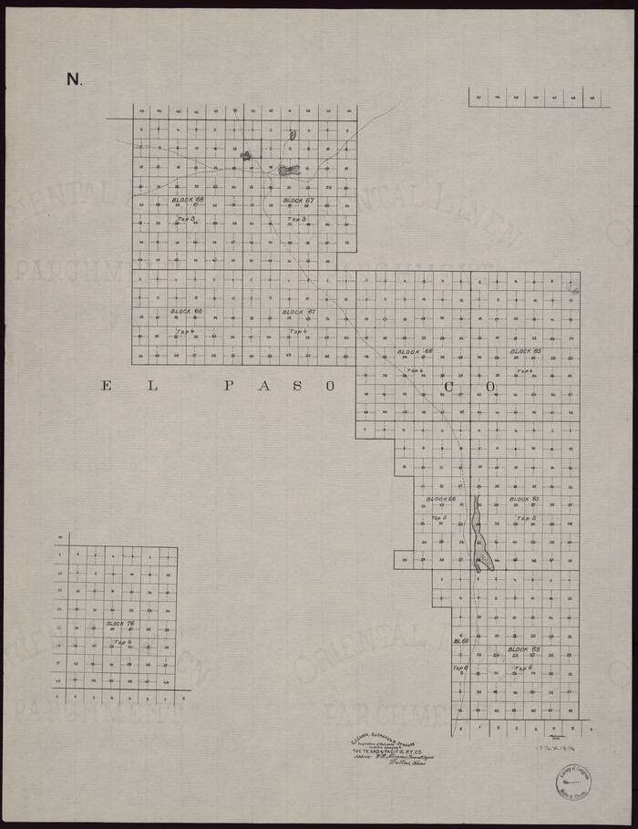
[Map showing T&P Lands in El Paso County]
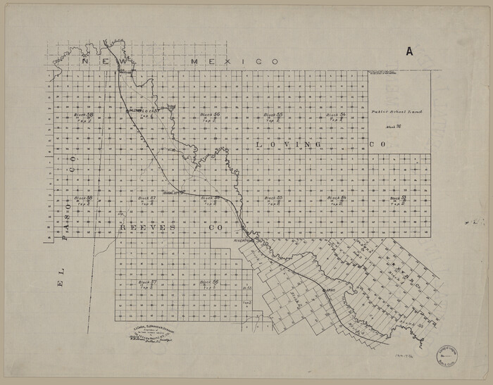
Print $20.00
[Map showing T&P Lands in El Paso County]
Size: 17.5 x 22.3 inches
88930
[Map showing T&P Lands in El Paso County]
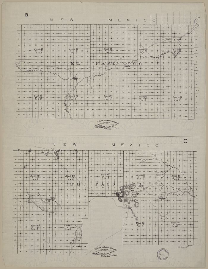
Print $20.00
[Map showing T&P Lands in El Paso County]
Size: 22.4 x 17.3 inches
88931
[Map showing T&P Lands in El Paso County]
Print $20.00
[Map showing T&P Lands in El Paso County]
Size: 22.2 x 17.1 inches
88932
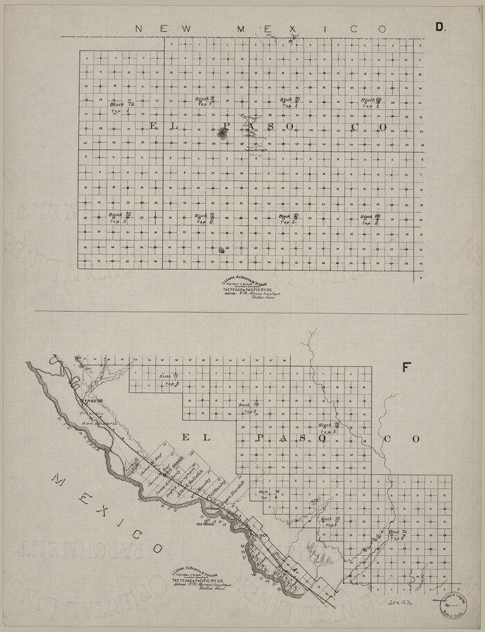
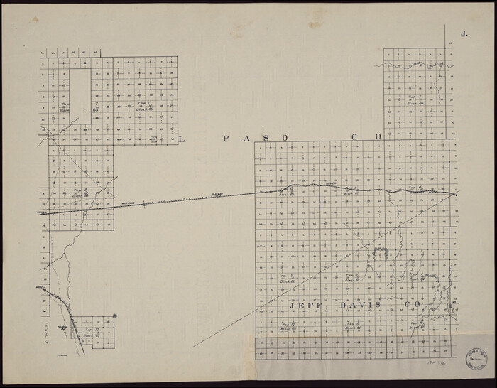
[Map showing T&P Lands in El Paso County]
Print $20.00
[Map showing T&P Lands in El Paso County]
Size: 17.2 x 22.1 inches
88933
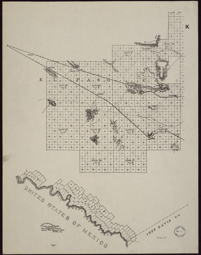
[Map showing T&P Lands in El Paso County]
Print $20.00
[Map showing T&P Lands in El Paso County]
Size: 17.3 x 22.2 inches
88934
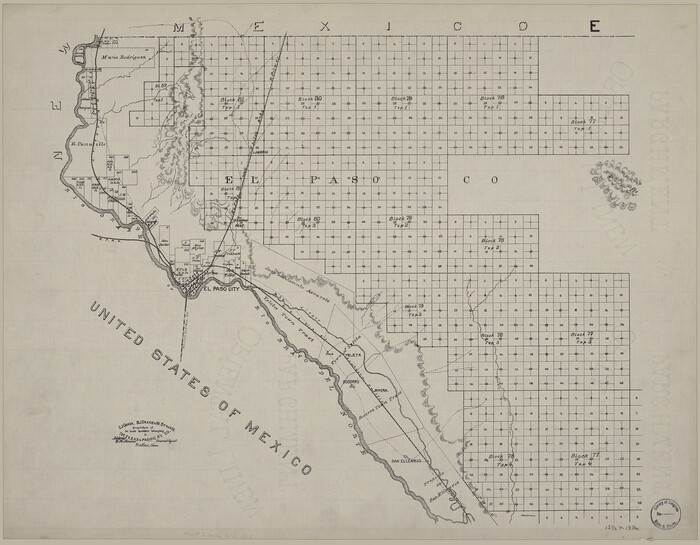
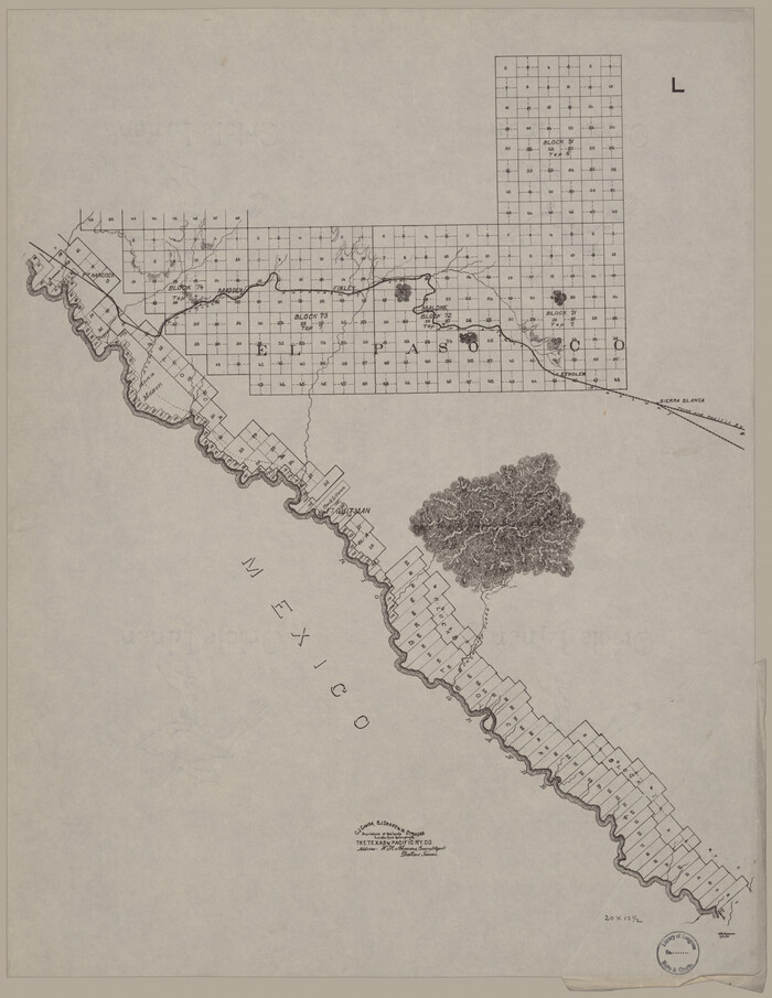
[Map showing T&P Lands in El Paso County]
Print $20.00
[Map showing T&P Lands in El Paso County]
Size: 22.2 x 17.4 inches
88935
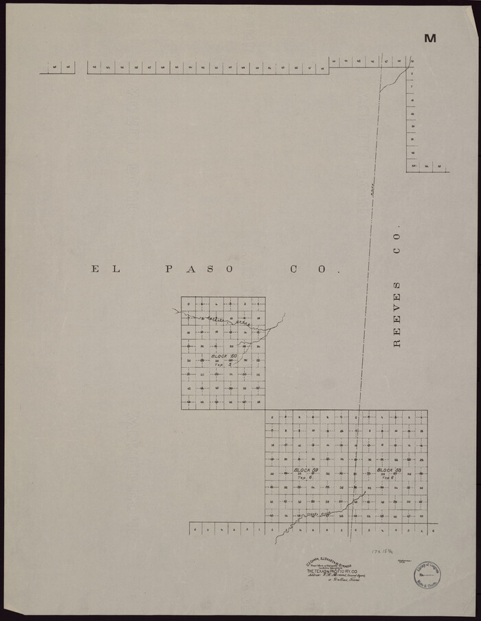
[Map showing T&P Lands in El Paso County]
Print $20.00
[Map showing T&P Lands in El Paso County]
Size: 22.6 x 17.5 inches
88936
[Map showing T&P Lands in El Paso County]
Print $20.00
[Map showing T&P Lands in El Paso County]
Size: 22.3 x 17.3 inches
88937
[Map showing T&P Lands in El Paso County]
Print $20.00
[Map showing T&P Lands in El Paso County]
Size: 22.4 x 17.2 inches
88938
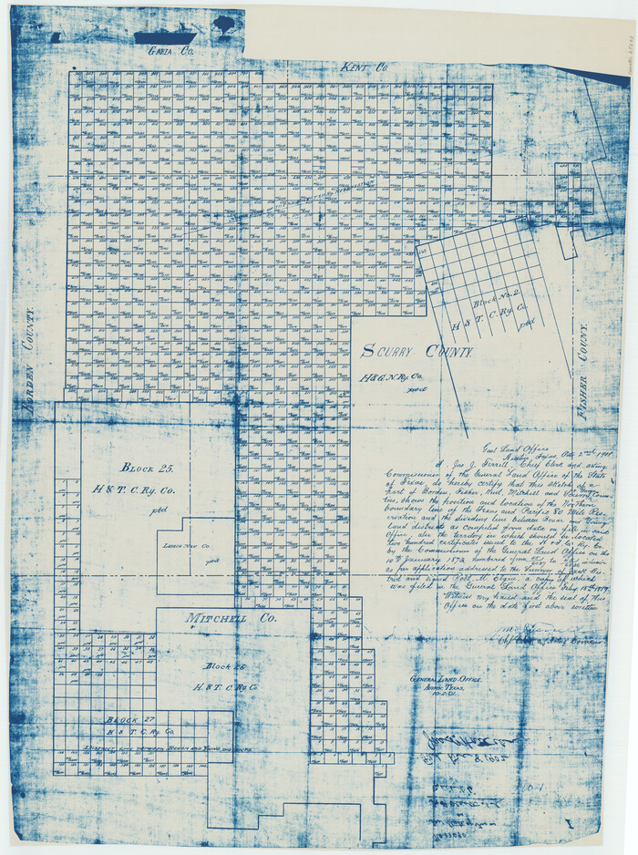
[Map of Block 97, Borden and Scurry Co (Exhibit A); Map of Southeastern part of Young Territory; Map of part of of Borden, Fisher, Kent, Mitchell, Scurry and Garza Cos. Showing the north boundary line of the T&P 80 mile reservation]
Print $20.00
- Digital $50.00
[Map of Block 97, Borden and Scurry Co (Exhibit A); Map of Southeastern part of Young Territory; Map of part of of Borden, Fisher, Kent, Mitchell, Scurry and Garza Cos. Showing the north boundary line of the T&P 80 mile reservation]
1901
Size: 31.2 x 23.3 inches
65693
[Letters to and from Maj. W. J. Powell regarding surveys of Texas and Pacific Ry. Lands west of the Pecos. Blks 53-55, Township 1 & 2 map within]
![2249, [Letters to and from Maj. W. J. Powell regarding surveys of Texas and Pacific Ry. Lands west of the Pecos. Blks 53-55, Township 1 & 2 map within], General Map Collection](https://historictexasmaps.com/wmedia_w700/pdf_converted_jpg/qi_pdf_thumbnail_1039.jpg)
Print $124.00
- Digital $50.00
[Letters to and from Maj. W. J. Powell regarding surveys of Texas and Pacific Ry. Lands west of the Pecos. Blks 53-55, Township 1 & 2 map within]
1934
Size: 10.2 x 15.4 inches
2249
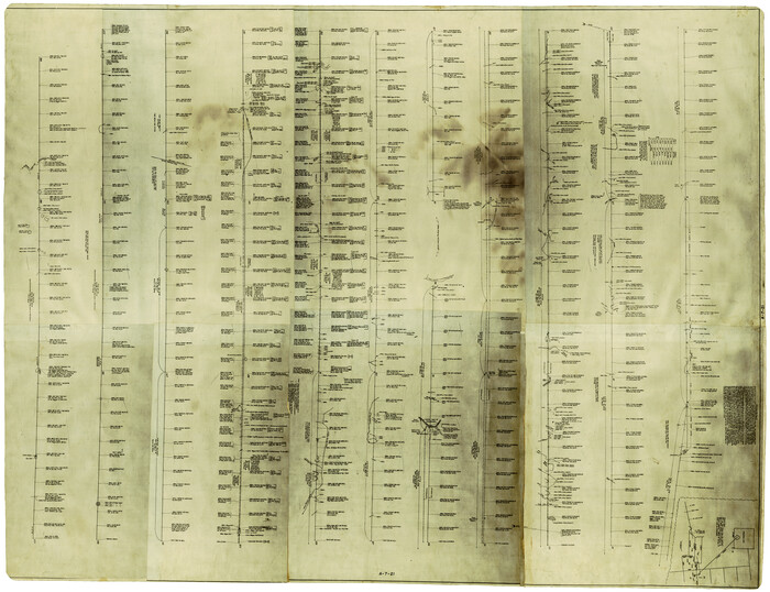
[Index map of T. & P. Ry. Company’s 80-mile Trans-Pecos Reserve’s perpetuated corners - South Part]
Print $40.00
- Digital $50.00
[Index map of T. & P. Ry. Company’s 80-mile Trans-Pecos Reserve’s perpetuated corners - South Part]
Size: 23.1 x 90.1 inches
69766
[Index map of T. & P. Ry. Company’s 80-mile Trans-Pecos Reserve’s perpetuated corners - North Part]
Print $40.00
- Digital $50.00
[Index map of T. & P. Ry. Company’s 80-mile Trans-Pecos Reserve’s perpetuated corners - North Part]
Size: 25.4 x 92.1 inches
89622
[Center Line of the Texas and Pacific Railroad Company 16 Mile Reserve]
Print $40.00
- Digital $50.00
[Center Line of the Texas and Pacific Railroad Company 16 Mile Reserve]
1876
Size: 43.1 x 55.6 inches
3125
The State of Texas vs. Chas. J. Canda, et al, T. & P. Ry. Co., No. 10351

Print $522.00
- Digital $50.00
The State of Texas vs. Chas. J. Canda, et al, T. & P. Ry. Co., No. 10351
1893
Size: 10.0 x 17.0 inches
3048
Texas and Pacific Railway and its connections.

Print $20.00
Texas and Pacific Railway and its connections.
1876
Size: 17.3 x 34.3 inches
93601
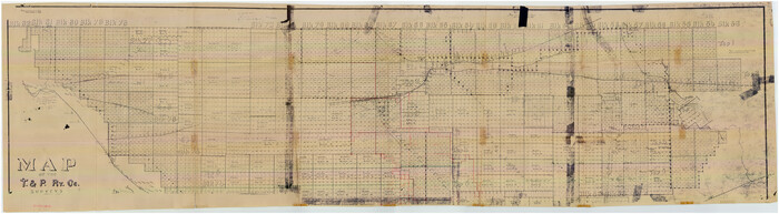
Texas Pacific Land Trust, Preliminary Plat Blocks 64-65-66 Tsp. 7 & 8 T&P RR Co. Surveys

Print $40.00
- Digital $50.00
Texas Pacific Land Trust, Preliminary Plat Blocks 64-65-66 Tsp. 7 & 8 T&P RR Co. Surveys
1962
Size: 54.6 x 43.0 inches
87210
T&P Ry. from Texarkana to Atlanta

Print $40.00
- Digital $50.00
T&P Ry. from Texarkana to Atlanta
1910
Size: 19.8 x 77.4 inches
2327
Statement of Facts - State of Texas vs. F. B. Olcott, Cause 17090, 12/18/1902

Print $2.00
- Digital $50.00
Statement of Facts - State of Texas vs. F. B. Olcott, Cause 17090, 12/18/1902
1902
Size: 14.3 x 8.9 inches
65724
Southern Pacific Lines Map of Texas

Print $20.00
- Digital $50.00
Southern Pacific Lines Map of Texas
1928
Size: 27.4 x 22.4 inches
95774
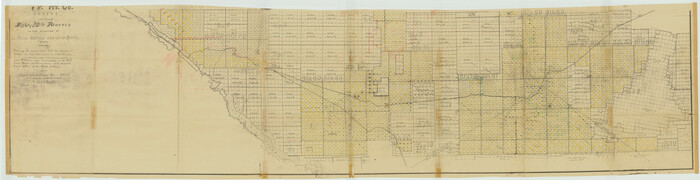
Sectional Map No. 3 of the lands and of the line of the Texas & Pacific Ry. Co. in Reeves and parts of Tom Green, Pecos, Presidio & El Paso Cos.

Print $20.00
- Digital $50.00
Sectional Map No. 3 of the lands and of the line of the Texas & Pacific Ry. Co. in Reeves and parts of Tom Green, Pecos, Presidio & El Paso Cos.
1885
Size: 22.3 x 17.4 inches
2303
Report of a resurvey of Texas & Pacific Ry. Lands in the 80 mile reservation made in 1930-31 for Kloh, Rumsey, and Abrams by W. J. Powell, Consulting Eng.

Print $77.00
- Digital $50.00
Report of a resurvey of Texas & Pacific Ry. Lands in the 80 mile reservation made in 1930-31 for Kloh, Rumsey, and Abrams by W. J. Powell, Consulting Eng.
1931
Size: 11.3 x 8.8 inches
2247
Red River County, Texas

Print $20.00
- Digital $50.00
Red River County, Texas
Size: 22.2 x 17.2 inches
95756
Paul McCombs Field Book on 80 Mile Reservation west of the Pecos

Print $148.00
- Digital $50.00
Paul McCombs Field Book on 80 Mile Reservation west of the Pecos
1883
Size: 7.8 x 6.0 inches
2238
Map of the United States showing the Texas & Pacific Railway and its connections

Print $20.00
- Digital $50.00
Map of the United States showing the Texas & Pacific Railway and its connections
1875
Size: 11.9 x 16.8 inches
93960
Map of the Texas and Pacific Railway and connections

Print $20.00
- Digital $50.00
Map of the Texas and Pacific Railway and connections
1925
Size: 8.2 x 9.3 inches
95772
Map of the Texas and Pacific Railway and connections

Print $20.00
- Digital $50.00
Map of the Texas and Pacific Railway and connections
1927
Size: 8.2 x 9.4 inches
95773
Map of the Texas and Pacific Railway and Connections

Print $20.00
Map of the Texas and Pacific Railway and Connections
1897
Size: 17.7 x 36.1 inches
76298
Map of the Texas and Pacific Railway and Connections

Print $20.00
Map of the Texas and Pacific Railway and Connections
1897
Size: 17.6 x 36.3 inches
76299
Map of the Texas and Pacific Railway and Connections

Print $20.00
Map of the Texas and Pacific Railway and Connections
1897
Size: 19.3 x 24.4 inches
79328
[Map showing T&P Lands in El Paso County]
Print $20.00
[Map showing T&P Lands in El Paso County]
-
Size
17.5 x 22.3 inches
-
Map/Doc
88930
[Map showing T&P Lands in El Paso County]
Print $20.00
[Map showing T&P Lands in El Paso County]
-
Size
22.4 x 17.3 inches
-
Map/Doc
88931
[Map showing T&P Lands in El Paso County]
Print $20.00
[Map showing T&P Lands in El Paso County]
-
Size
22.2 x 17.1 inches
-
Map/Doc
88932
[Map showing T&P Lands in El Paso County]
Print $20.00
[Map showing T&P Lands in El Paso County]
-
Size
17.2 x 22.1 inches
-
Map/Doc
88933
[Map showing T&P Lands in El Paso County]
Print $20.00
[Map showing T&P Lands in El Paso County]
-
Size
17.3 x 22.2 inches
-
Map/Doc
88934
[Map showing T&P Lands in El Paso County]
Print $20.00
[Map showing T&P Lands in El Paso County]
-
Size
22.2 x 17.4 inches
-
Map/Doc
88935
[Map showing T&P Lands in El Paso County]
Print $20.00
[Map showing T&P Lands in El Paso County]
-
Size
22.6 x 17.5 inches
-
Map/Doc
88936
[Map showing T&P Lands in El Paso County]
Print $20.00
[Map showing T&P Lands in El Paso County]
-
Size
22.3 x 17.3 inches
-
Map/Doc
88937
[Map showing T&P Lands in El Paso County]
Print $20.00
[Map showing T&P Lands in El Paso County]
-
Size
22.4 x 17.2 inches
-
Map/Doc
88938
[Map of Block 97, Borden and Scurry Co (Exhibit A); Map of Southeastern part of Young Territory; Map of part of of Borden, Fisher, Kent, Mitchell, Scurry and Garza Cos. Showing the north boundary line of the T&P 80 mile reservation]
Print $20.00
- Digital $50.00
[Map of Block 97, Borden and Scurry Co (Exhibit A); Map of Southeastern part of Young Territory; Map of part of of Borden, Fisher, Kent, Mitchell, Scurry and Garza Cos. Showing the north boundary line of the T&P 80 mile reservation]
1901
-
Size
31.2 x 23.3 inches
-
Map/Doc
65693
-
Creation Date
1901
[Letters to and from Maj. W. J. Powell regarding surveys of Texas and Pacific Ry. Lands west of the Pecos. Blks 53-55, Township 1 & 2 map within]
Print $124.00
- Digital $50.00
[Letters to and from Maj. W. J. Powell regarding surveys of Texas and Pacific Ry. Lands west of the Pecos. Blks 53-55, Township 1 & 2 map within]
1934
-
Size
10.2 x 15.4 inches
-
Map/Doc
2249
-
Creation Date
1934
[Index map of T. & P. Ry. Company’s 80-mile Trans-Pecos Reserve’s perpetuated corners - South Part]
Print $40.00
- Digital $50.00
[Index map of T. & P. Ry. Company’s 80-mile Trans-Pecos Reserve’s perpetuated corners - South Part]
-
Size
23.1 x 90.1 inches
-
Map/Doc
69766
[Index map of T. & P. Ry. Company’s 80-mile Trans-Pecos Reserve’s perpetuated corners - North Part]
Print $40.00
- Digital $50.00
[Index map of T. & P. Ry. Company’s 80-mile Trans-Pecos Reserve’s perpetuated corners - North Part]
-
Size
25.4 x 92.1 inches
-
Map/Doc
89622
[Center Line of the Texas and Pacific Railroad Company 16 Mile Reserve]
Print $40.00
- Digital $50.00
[Center Line of the Texas and Pacific Railroad Company 16 Mile Reserve]
1876
-
Size
43.1 x 55.6 inches
-
Map/Doc
3125
-
Creation Date
1876
The State of Texas vs. Chas. J. Canda, et al, T. & P. Ry. Co., No. 10351
Print $522.00
- Digital $50.00
The State of Texas vs. Chas. J. Canda, et al, T. & P. Ry. Co., No. 10351
1893
-
Size
10.0 x 17.0 inches
-
Map/Doc
3048
-
Creation Date
1893
Texas and Pacific Railway and its connections.
Print $20.00
Texas and Pacific Railway and its connections.
1876
-
Size
17.3 x 34.3 inches
-
Map/Doc
93601
-
Creation Date
1876
Texas Pacific Land Trust, Preliminary Plat Blocks 64-65-66 Tsp. 7 & 8 T&P RR Co. Surveys
Print $40.00
- Digital $50.00
Texas Pacific Land Trust, Preliminary Plat Blocks 64-65-66 Tsp. 7 & 8 T&P RR Co. Surveys
1962
-
Size
54.6 x 43.0 inches
-
Map/Doc
87210
-
Creation Date
1962
T&P Ry. from Texarkana to Atlanta
Print $40.00
- Digital $50.00
T&P Ry. from Texarkana to Atlanta
1910
-
Size
19.8 x 77.4 inches
-
Map/Doc
2327
-
Creation Date
1910
Statement of Facts - State of Texas vs. F. B. Olcott, Cause 17090, 12/18/1902
Print $2.00
- Digital $50.00
Statement of Facts - State of Texas vs. F. B. Olcott, Cause 17090, 12/18/1902
1902
-
Size
14.3 x 8.9 inches
-
Map/Doc
65724
-
Creation Date
1902
Southern Pacific Lines Map of Texas
Print $20.00
- Digital $50.00
Southern Pacific Lines Map of Texas
1928
-
Size
27.4 x 22.4 inches
-
Map/Doc
95774
-
Creation Date
1928
Sectional Map No. 3 of the lands and of the line of the Texas & Pacific Ry. Co. in Reeves and parts of Tom Green, Pecos, Presidio & El Paso Cos.
Print $20.00
- Digital $50.00
Sectional Map No. 3 of the lands and of the line of the Texas & Pacific Ry. Co. in Reeves and parts of Tom Green, Pecos, Presidio & El Paso Cos.
1885
-
Size
22.3 x 17.4 inches
-
Map/Doc
2303
-
Creation Date
1885
Report of a resurvey of Texas & Pacific Ry. Lands in the 80 mile reservation made in 1930-31 for Kloh, Rumsey, and Abrams by W. J. Powell, Consulting Eng.
Print $77.00
- Digital $50.00
Report of a resurvey of Texas & Pacific Ry. Lands in the 80 mile reservation made in 1930-31 for Kloh, Rumsey, and Abrams by W. J. Powell, Consulting Eng.
1931
-
Size
11.3 x 8.8 inches
-
Map/Doc
2247
-
Creation Date
1931
Red River County, Texas
Print $20.00
- Digital $50.00
Red River County, Texas
-
Size
22.2 x 17.2 inches
-
Map/Doc
95756
Paul McCombs Field Book on 80 Mile Reservation west of the Pecos
Print $148.00
- Digital $50.00
Paul McCombs Field Book on 80 Mile Reservation west of the Pecos
1883
-
Size
7.8 x 6.0 inches
-
Map/Doc
2238
-
Creation Date
1883
Map of the United States showing the Texas & Pacific Railway and its connections
Print $20.00
- Digital $50.00
Map of the United States showing the Texas & Pacific Railway and its connections
1875
-
Size
11.9 x 16.8 inches
-
Map/Doc
93960
-
Creation Date
1875
Map of the Texas and Pacific Railway and connections
Print $20.00
- Digital $50.00
Map of the Texas and Pacific Railway and connections
1925
-
Size
8.2 x 9.3 inches
-
Map/Doc
95772
-
Creation Date
1925
Map of the Texas and Pacific Railway and connections
Print $20.00
- Digital $50.00
Map of the Texas and Pacific Railway and connections
1927
-
Size
8.2 x 9.4 inches
-
Map/Doc
95773
-
Creation Date
1927
Map of the Texas and Pacific Railway and Connections
Print $20.00
Map of the Texas and Pacific Railway and Connections
1897
-
Size
17.7 x 36.1 inches
-
Map/Doc
76298
-
Creation Date
1897
Map of the Texas and Pacific Railway and Connections
Print $20.00
Map of the Texas and Pacific Railway and Connections
1897
-
Size
17.6 x 36.3 inches
-
Map/Doc
76299
-
Creation Date
1897
Map of the Texas and Pacific Railway and Connections
Print $20.00
Map of the Texas and Pacific Railway and Connections
1897
-
Size
19.3 x 24.4 inches
-
Map/Doc
79328
-
Creation Date
1897