Zapata County Rolled Sketch 12A
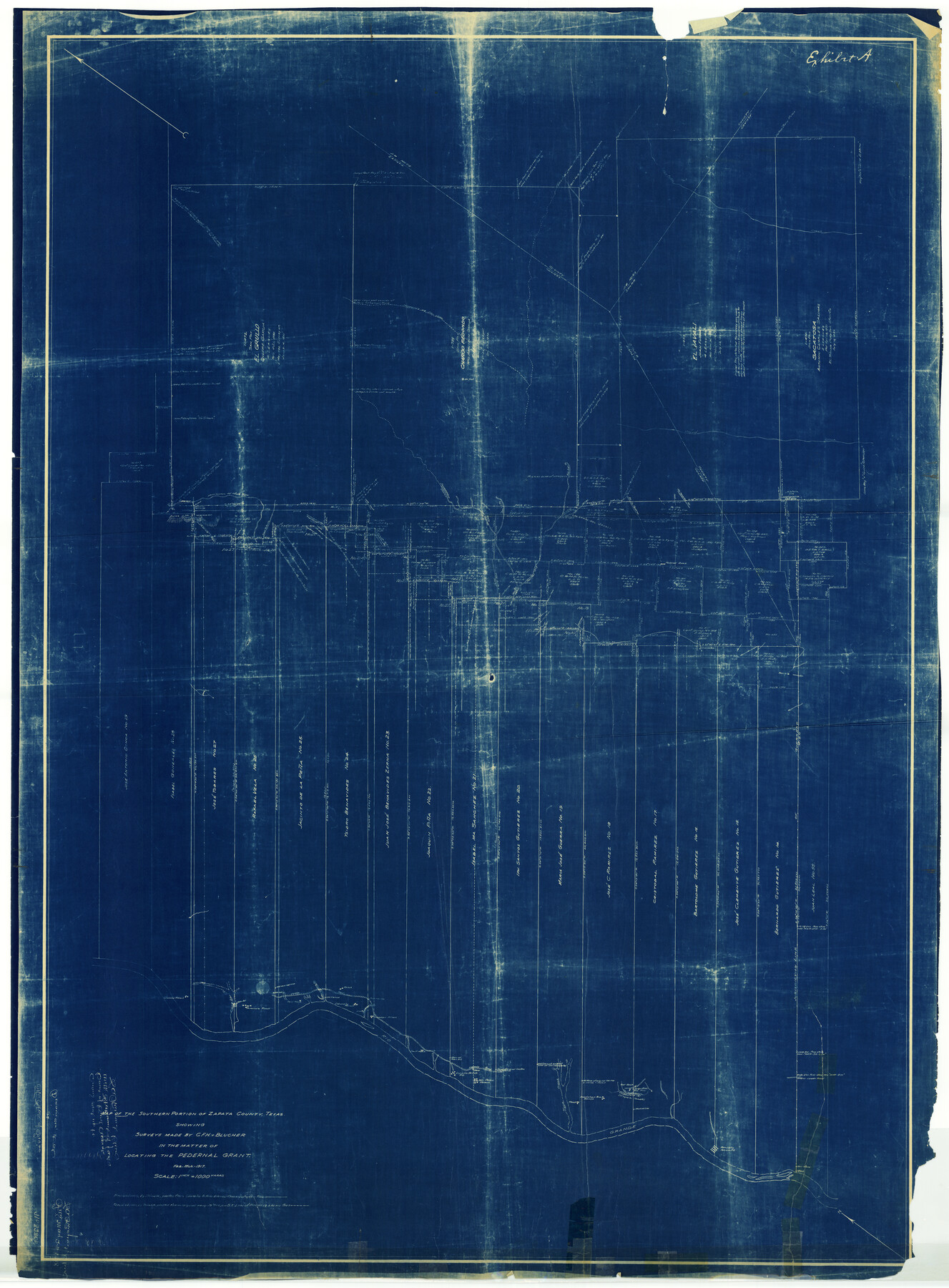
Map of the southern portion of Zapata County, Texas showing surveys made by C.F.H. v. Blucher in the matter of locating the Pedernal grant
-
Map/Doc
10165
-
Collection
General Map Collection
-
Object Dates
3/1917 (Creation Date)
-
People and Organizations
C.F.H. von Blucher (Surveyor/Engineer)
-
Counties
Zapata
-
Subjects
Surveying Rolled Sketch
-
Height x Width
54.0 x 40.0 inches
137.2 x 101.6 cm
-
Medium
blueprint/diazo
-
Scale
1" = 1000 varas
Part of: General Map Collection
Pecos County Rolled Sketch 151

Print $20.00
- Digital $50.00
Pecos County Rolled Sketch 151
Size 40.6 x 23.6 inches
Map/Doc 7281
Kimble County Working Sketch 28

Print $20.00
- Digital $50.00
Kimble County Working Sketch 28
1938
Size 29.4 x 23.2 inches
Map/Doc 70096
Wilson County Working Sketch 4

Print $20.00
- Digital $50.00
Wilson County Working Sketch 4
1953
Size 30.8 x 28.5 inches
Map/Doc 72584
Harris County Working Sketch 57

Print $20.00
- Digital $50.00
Harris County Working Sketch 57
1951
Size 21.7 x 20.0 inches
Map/Doc 65949
Bee County Sketch File 14

Print $40.00
- Digital $50.00
Bee County Sketch File 14
1878
Size 14.5 x 12.5 inches
Map/Doc 14297
Dimmit County Sketch File 3

Print $4.00
- Digital $50.00
Dimmit County Sketch File 3
1874
Size 10.1 x 8.0 inches
Map/Doc 21058
Dimmit County Sketch File 1

Print $42.00
- Digital $50.00
Dimmit County Sketch File 1
1851
Size 8.8 x 7.5 inches
Map/Doc 21050
Jefferson County NRC Article 33.136 Sketch 8

Print $20.00
- Digital $50.00
Jefferson County NRC Article 33.136 Sketch 8
2007
Size 20.1 x 18.7 inches
Map/Doc 87503
Northern Part of Laguna Madre

Print $20.00
- Digital $50.00
Northern Part of Laguna Madre
1935
Size 44.4 x 35.1 inches
Map/Doc 73522
Galveston Bay Entrance - Galveston and Texas City Harbors

Print $40.00
- Digital $50.00
Galveston Bay Entrance - Galveston and Texas City Harbors
1971
Size 33.4 x 50.1 inches
Map/Doc 69861
Howard County Working Sketch 13

Print $20.00
- Digital $50.00
Howard County Working Sketch 13
1983
Size 33.3 x 37.3 inches
Map/Doc 66281
Wichita County Rolled Sketch 14A

Print $40.00
- Digital $50.00
Wichita County Rolled Sketch 14A
Size 28.0 x 59.9 inches
Map/Doc 10138
You may also like
Crockett County Sketch File 13

Print $22.00
- Digital $50.00
Crockett County Sketch File 13
Size 8.9 x 3.6 inches
Map/Doc 19665
Bowie County Working Sketch 8

Print $20.00
- Digital $50.00
Bowie County Working Sketch 8
1953
Size 25.9 x 24.0 inches
Map/Doc 67412
Webb County Working Sketch 85

Print $20.00
- Digital $50.00
Webb County Working Sketch 85
1981
Size 21.1 x 29.0 inches
Map/Doc 72452
Brewster County Working Sketch 56

Print $20.00
- Digital $50.00
Brewster County Working Sketch 56
1953
Size 19.3 x 25.5 inches
Map/Doc 67657
Eastern and Central Texas, Prepared by Order of Maj. Gen. N.P. Banks. Major D.C. Houston, Chief of Engineers

Print $20.00
Eastern and Central Texas, Prepared by Order of Maj. Gen. N.P. Banks. Major D.C. Houston, Chief of Engineers
1864
Size 32.6 x 23.7 inches
Map/Doc 88596
Brewster County Rolled Sketch 55

Print $40.00
- Digital $50.00
Brewster County Rolled Sketch 55
1935
Size 24.2 x 58.8 inches
Map/Doc 5227
Brazos Island Harbor, Texas - Dredging Entrance Channel Plan

Print $20.00
- Digital $50.00
Brazos Island Harbor, Texas - Dredging Entrance Channel Plan
1990
Size 14.6 x 20.0 inches
Map/Doc 83337
[Surveying sketch of Dan'l. Dunham, O. de Santangelo, et al in Zavala County]
![708, [Surveying sketch of Dan'l. Dunham, O. de Santangelo, et al in Zavala County], Maddox Collection](https://historictexasmaps.com/wmedia_w700/maps/0708.tif.jpg)
Print $20.00
- Digital $50.00
[Surveying sketch of Dan'l. Dunham, O. de Santangelo, et al in Zavala County]
Size 16.2 x 16.0 inches
Map/Doc 708
Val Verde County Sketch File 48

Print $20.00
- Digital $50.00
Val Verde County Sketch File 48
1950
Size 18.2 x 28.9 inches
Map/Doc 12589
Flight Mission No. DCL-6C, Frame 124, Kenedy County

Print $20.00
- Digital $50.00
Flight Mission No. DCL-6C, Frame 124, Kenedy County
1943
Size 18.6 x 22.4 inches
Map/Doc 85954
Starr County Sketch File 19

Print $20.00
- Digital $50.00
Starr County Sketch File 19
1887
Size 22.6 x 22.0 inches
Map/Doc 12330
[Blocks M-22 and M-25 and vicinity]
![91138, [Blocks M-22 and M-25 and vicinity], Twichell Survey Records](https://historictexasmaps.com/wmedia_w700/maps/91138-1.tif.jpg)
Print $20.00
- Digital $50.00
[Blocks M-22 and M-25 and vicinity]
Size 18.7 x 16.6 inches
Map/Doc 91138