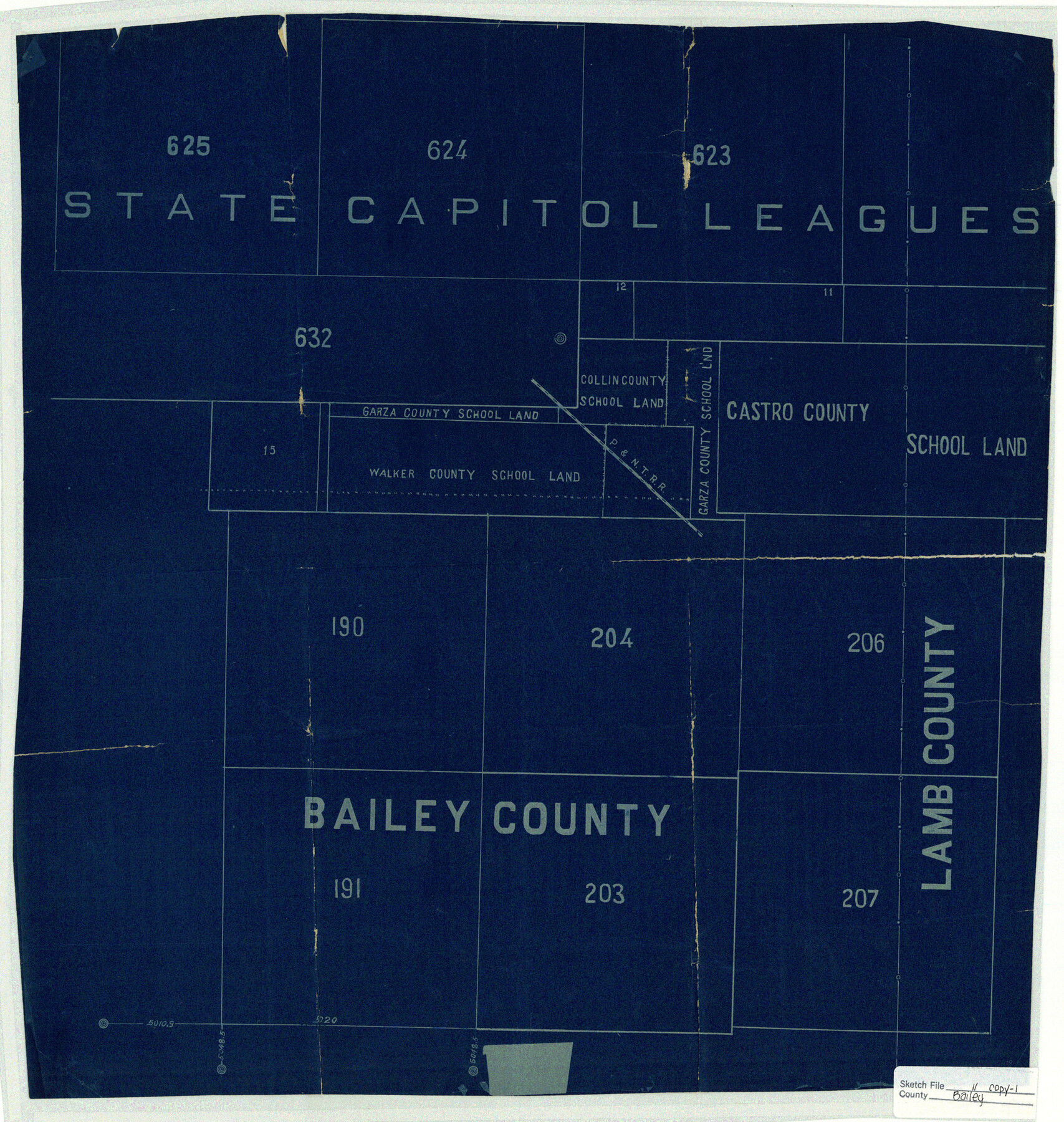
Bailey County Sketch File 11
[Sketch of area around League 204]
-
Map/Doc
10886
-
Collection
General Map Collection
-
Counties
Bailey Lamb
-
Subjects
Surveying Sketch File
-
Height x Width
21.6 x 20.5 inches
54.9 x 52.1 cm
-
Medium
blueprint/diazo
-
Features
P&NT
Part of: General Map Collection
Leon County Working Sketch 30

Print $20.00
- Digital $50.00
Leon County Working Sketch 30
1972
Size 33.1 x 45.1 inches
Map/Doc 70429
Webb County Sketch File 4-2

Print $20.00
- Digital $50.00
Webb County Sketch File 4-2
1925
Size 26.3 x 18.1 inches
Map/Doc 12615
Newton County Rolled Sketch JFB

Print $20.00
- Digital $50.00
Newton County Rolled Sketch JFB
1936
Size 16.0 x 38.3 inches
Map/Doc 6858
Galveston County Sketch File 63

Print $52.00
- Digital $50.00
Galveston County Sketch File 63
Size 11.3 x 8.9 inches
Map/Doc 23681
Brewster County Sketch File 50

Print $32.00
- Digital $50.00
Brewster County Sketch File 50
1995
Size 14.8 x 8.5 inches
Map/Doc 16336
Flight Mission No. DAG-24K, Frame 48, Matagorda County

Print $20.00
- Digital $50.00
Flight Mission No. DAG-24K, Frame 48, Matagorda County
1953
Size 18.5 x 22.1 inches
Map/Doc 86535

Map of Comal County

Print $20.00
- Digital $50.00
Map of Comal County
1871
Size 16.0 x 19.7 inches
Map/Doc 3430
Harris County Sketch File 102

Print $163.00
- Digital $50.00
Harris County Sketch File 102
1985
Size 11.4 x 8.9 inches
Map/Doc 25915
Runnels County Working Sketch 17

Print $20.00
- Digital $50.00
Runnels County Working Sketch 17
1950
Size 27.1 x 21.5 inches
Map/Doc 63613
Henderson County Sketch File 8

Print $6.00
- Digital $50.00
Henderson County Sketch File 8
1853
Size 9.8 x 8.2 inches
Map/Doc 26331
Kleberg County NRC Article 33.136 Sketch 1

Print $143.00
- Digital $50.00
Kleberg County NRC Article 33.136 Sketch 1
2000
Size 18.5 x 23.6 inches
Map/Doc 6555
You may also like
Hunt County Sketch File 12

Print $40.00
- Digital $50.00
Hunt County Sketch File 12
1852
Size 12.7 x 16.0 inches
Map/Doc 27104
Levelland, Hockley County, Texas

Print $20.00
- Digital $50.00
Levelland, Hockley County, Texas
1950
Size 13.1 x 14.9 inches
Map/Doc 92241
San Jacinto County Rolled Sketch 16

Print $20.00
- Digital $50.00
San Jacinto County Rolled Sketch 16
Size 10.7 x 17.6 inches
Map/Doc 93727
Shelby County Working Sketch 13

Print $40.00
- Digital $50.00
Shelby County Working Sketch 13
1946
Size 52.0 x 33.7 inches
Map/Doc 63866
United States - Gulf Coast - Galveston to Rio Grande

Print $20.00
- Digital $50.00
United States - Gulf Coast - Galveston to Rio Grande
1941
Size 27.2 x 18.2 inches
Map/Doc 72753
Map of the Surveyed Part of Young District

Print $40.00
- Digital $50.00
Map of the Surveyed Part of Young District
1860
Size 56.3 x 32.6 inches
Map/Doc 87373
Reagan County Rolled Sketch 29A

Print $20.00
- Digital $50.00
Reagan County Rolled Sketch 29A
1954
Size 36.4 x 36.3 inches
Map/Doc 9825
Coast Chart No. 205 - Galveston Bay to Oyster Bay, Texas

Print $20.00
- Digital $50.00
Coast Chart No. 205 - Galveston Bay to Oyster Bay, Texas
1907
Size 34.3 x 40.5 inches
Map/Doc 69927
Flight Mission No. CRC-4R, Frame 102, Chambers County

Print $20.00
- Digital $50.00
Flight Mission No. CRC-4R, Frame 102, Chambers County
1956
Size 18.5 x 22.4 inches
Map/Doc 84899
Randall County Boundary File 5

Print $14.00
- Digital $50.00
Randall County Boundary File 5
Size 8.9 x 7.8 inches
Map/Doc 58134
Blanco County Rolled Sketch 15

Print $20.00
- Digital $50.00
Blanco County Rolled Sketch 15
Size 12.9 x 13.7 inches
Map/Doc 5151
Terrell County Working Sketch 55

Print $20.00
- Digital $50.00
Terrell County Working Sketch 55
1959
Size 25.9 x 43.4 inches
Map/Doc 62148