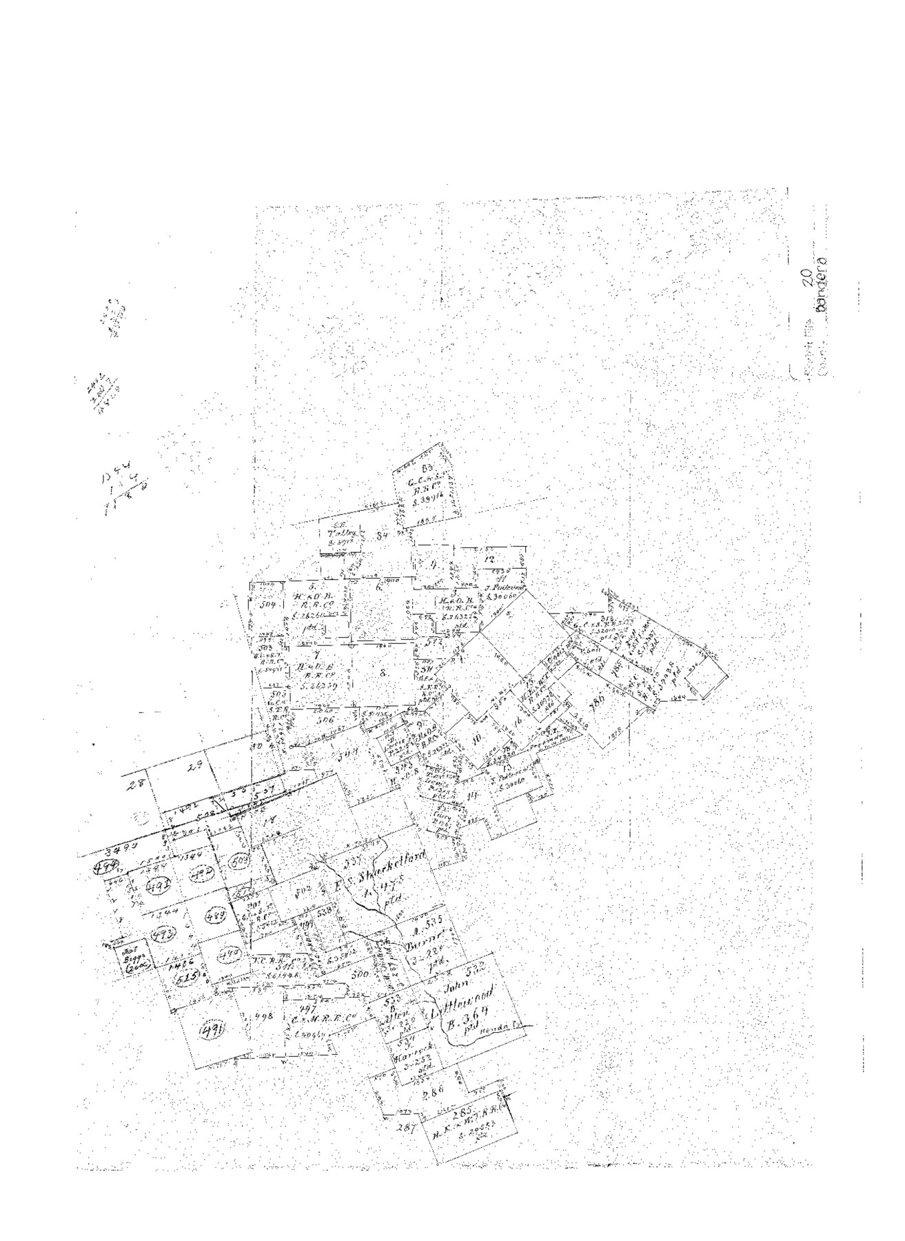
Bandera County Sketch File 20
[Office sketch of surveys in southwest part of county]
-
Map/Doc
10894
-
Collection
General Map Collection
-
Counties
Bandera
-
Subjects
Surveying Sketch File
-
Height x Width
18.7 x 13.6 inches
47.5 x 34.5 cm
-
Medium
paper, manuscript
-
Features
Hondo Creek
Part of: General Map Collection
Terrell County Rolled Sketch 47

Print $20.00
- Digital $50.00
Terrell County Rolled Sketch 47
1958
Size 20.0 x 18.4 inches
Map/Doc 7949
Dickens County

Print $20.00
- Digital $50.00
Dickens County
1915
Size 42.4 x 39.3 inches
Map/Doc 4722
Leon County Working Sketch 41

Print $40.00
- Digital $50.00
Leon County Working Sketch 41
1980
Size 61.2 x 43.2 inches
Map/Doc 70440
Plan of the town of Austin

Print $20.00
- Digital $50.00
Plan of the town of Austin
Size 18.4 x 13.0 inches
Map/Doc 94117
La Salle County Sketch File 27

Print $22.00
- Digital $50.00
La Salle County Sketch File 27
Size 8.8 x 14.1 inches
Map/Doc 29553
Cherokee County Working Sketch 7

Print $20.00
- Digital $50.00
Cherokee County Working Sketch 7
1954
Size 22.2 x 22.7 inches
Map/Doc 67962
Edwards County Rolled Sketch 22

Print $20.00
- Digital $50.00
Edwards County Rolled Sketch 22
1951
Size 46.0 x 25.4 inches
Map/Doc 8845
Val Verde County Sketch File 44A

Print $10.00
- Digital $50.00
Val Verde County Sketch File 44A
1940
Size 14.5 x 8.8 inches
Map/Doc 39311
Van Zandt County Sketch File 16 1/2

Print $4.00
- Digital $50.00
Van Zandt County Sketch File 16 1/2
1858
Size 11.0 x 7.8 inches
Map/Doc 39414
Kent County Working Sketch 5

Print $40.00
- Digital $50.00
Kent County Working Sketch 5
1950
Size 36.7 x 50.1 inches
Map/Doc 70012

Live Oak County Rolled Sketch 7

Print $20.00
- Digital $50.00
Live Oak County Rolled Sketch 7
1951
Size 31.3 x 36.9 inches
Map/Doc 6635
You may also like
General Highway Map, Panola County, Texas

Print $20.00
General Highway Map, Panola County, Texas
1961
Size 18.1 x 24.5 inches
Map/Doc 79624
Fisher County

Print $20.00
- Digital $50.00
Fisher County
1880
Size 29.4 x 25.3 inches
Map/Doc 75772
Presidio County Working Sketch 36

Print $20.00
- Digital $50.00
Presidio County Working Sketch 36
1947
Size 27.9 x 40.7 inches
Map/Doc 71713
Map of Encinal County

Print $20.00
- Digital $50.00
Map of Encinal County
1872
Size 30.5 x 20.3 inches
Map/Doc 3513
[T. & P. Blocks 43-45, Townships 1S and 1N]
![90878, [T. & P. Blocks 43-45, Townships 1S and 1N], Twichell Survey Records](https://historictexasmaps.com/wmedia_w700/maps/90878-2.tif.jpg)
Print $20.00
- Digital $50.00
[T. & P. Blocks 43-45, Townships 1S and 1N]
Size 22.9 x 18.0 inches
Map/Doc 90878
Hudspeth County Working Sketch 21

Print $20.00
- Digital $50.00
Hudspeth County Working Sketch 21
1966
Size 22.8 x 41.6 inches
Map/Doc 66303
Carte de la Louisiane et Pays Voisins Pour servir a l'Histoire Generale des Voyages

Print $20.00
Carte de la Louisiane et Pays Voisins Pour servir a l'Histoire Generale des Voyages
1757
Size 9.6 x 14.9 inches
Map/Doc 94572
[Surveys on San Antonio River and Aransas Bay area]
![141, [Surveys on San Antonio River and Aransas Bay area], General Map Collection](https://historictexasmaps.com/wmedia_w700/maps/141.tif.jpg)
Print $20.00
- Digital $50.00
[Surveys on San Antonio River and Aransas Bay area]
1840
Size 24.1 x 33.0 inches
Map/Doc 141
Gaines County Working Sketch 9

Print $40.00
- Digital $50.00
Gaines County Working Sketch 9
1951
Size 75.2 x 20.8 inches
Map/Doc 69309
Gulf, Texas & Western Railway

Print $40.00
- Digital $50.00
Gulf, Texas & Western Railway
1913
Size 19.8 x 64.7 inches
Map/Doc 64441
[Blk. B, Secs. 111-114 and vicinity]
![90340, [Blk. B, Secs. 111-114 and vicinity], Twichell Survey Records](https://historictexasmaps.com/wmedia_w700/maps/90340-1.tif.jpg)
Print $20.00
- Digital $50.00
[Blk. B, Secs. 111-114 and vicinity]
Size 31.3 x 38.7 inches
Map/Doc 90340
[Part of Wichita County in the vicinity of Elizabeth Stanley survey 812 and W. M. Rivers survey 810]
![91971, [Part of Wichita County in the vicinity of Elizabeth Stanley survey 812 and W. M. Rivers survey 810], Twichell Survey Records](https://historictexasmaps.com/wmedia_w700/maps/91971-1.tif.jpg)
Print $3.00
- Digital $50.00
[Part of Wichita County in the vicinity of Elizabeth Stanley survey 812 and W. M. Rivers survey 810]
1920
Size 11.5 x 11.7 inches
Map/Doc 91971