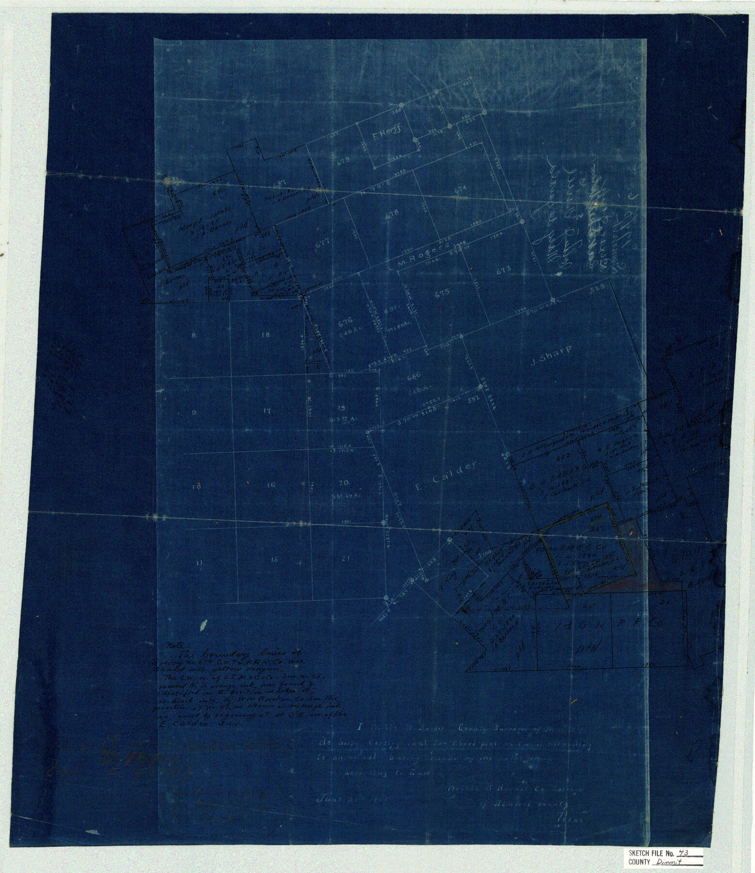
Dimmit County Sketch File 43
W. W. Barker's Sk., around the E. Calder Sur.
-
Map/Doc
11353
-
Collection
General Map Collection
-
Object Dates
1905/6/26 (Creation Date)
-
People and Organizations
Willis W. Barker (Surveyor/Engineer)
-
Counties
Dimmit
-
Subjects
Surveying Sketch File
-
Height x Width
22.1 x 19.2 inches
56.1 x 48.8 cm
-
Medium
blueprint/diazo
Part of: General Map Collection
Pecos County Sketch File 114

Print $18.00
- Digital $50.00
Pecos County Sketch File 114
1912
Size 13.3 x 8.9 inches
Map/Doc 34074
Val Verde County Sketch File 22

Print $20.00
- Digital $50.00
Val Verde County Sketch File 22
Size 14.3 x 22.3 inches
Map/Doc 12571
Pecos County Rolled Sketch 128

Print $40.00
- Digital $50.00
Pecos County Rolled Sketch 128
1949
Size 43.6 x 54.0 inches
Map/Doc 9725
Hidalgo County Sketch File 11

Print $40.00
- Digital $50.00
Hidalgo County Sketch File 11
1908
Size 18.5 x 13.6 inches
Map/Doc 26429
Parker County Working Sketch 24

Print $20.00
- Digital $50.00
Parker County Working Sketch 24
2008
Map/Doc 88814
Galveston County Sketch File 73h

Print $20.00
- Digital $50.00
Galveston County Sketch File 73h
Size 29.4 x 36.8 inches
Map/Doc 10461
Crockett County Working Sketch 59

Print $20.00
- Digital $50.00
Crockett County Working Sketch 59
1955
Size 46.1 x 29.3 inches
Map/Doc 68392
Rockwall County Boundary File 7

Print $4.00
- Digital $50.00
Rockwall County Boundary File 7
Size 11.5 x 8.8 inches
Map/Doc 58426
Shackelford County Working Sketch 8

Print $20.00
- Digital $50.00
Shackelford County Working Sketch 8
1973
Size 31.9 x 28.7 inches
Map/Doc 63848
Hood County Working Sketch 21

Print $20.00
- Digital $50.00
Hood County Working Sketch 21
1991
Size 28.4 x 24.9 inches
Map/Doc 66215
San Augustine County Working Sketch 12

Print $20.00
- Digital $50.00
San Augustine County Working Sketch 12
1951
Size 29.0 x 21.0 inches
Map/Doc 63700
Zavala County Working Sketch 23

Print $40.00
- Digital $50.00
Zavala County Working Sketch 23
1980
Size 77.3 x 43.6 inches
Map/Doc 62098
You may also like
[Right of Way and Track Map, the Missouri, Kansas and Texas Ry. of Texas - Henrietta Division]
![64766, [Right of Way and Track Map, the Missouri, Kansas and Texas Ry. of Texas - Henrietta Division], General Map Collection](https://historictexasmaps.com/wmedia_w700/maps/64766.tif.jpg)
Print $20.00
- Digital $50.00
[Right of Way and Track Map, the Missouri, Kansas and Texas Ry. of Texas - Henrietta Division]
1918
Size 11.8 x 26.9 inches
Map/Doc 64766
Nueces County Sketch File 86

Print $2.00
- Digital $50.00
Nueces County Sketch File 86
Map/Doc 81935
Trace of a copy of the map captured at the battle of Resaca de la Palma

Print $20.00
- Digital $50.00
Trace of a copy of the map captured at the battle of Resaca de la Palma
Size 18.3 x 27.3 inches
Map/Doc 73056
Stonewall County Sketch File 16

Print $16.00
- Digital $50.00
Stonewall County Sketch File 16
1902
Size 12.8 x 8.3 inches
Map/Doc 37266
Map of Comal County

Print $20.00
- Digital $50.00
Map of Comal County
1862
Size 18.6 x 22.0 inches
Map/Doc 3429
Outer Continental Shelf Leasing Maps (Texas Offshore Operations)

Print $20.00
- Digital $50.00
Outer Continental Shelf Leasing Maps (Texas Offshore Operations)
Size 24.0 x 18.4 inches
Map/Doc 75853
S. M. S. Throckmorton Ranch, Throckmorton, Haskell, Baylor Cos.

Print $20.00
- Digital $50.00
S. M. S. Throckmorton Ranch, Throckmorton, Haskell, Baylor Cos.
1955
Size 33.8 x 45.1 inches
Map/Doc 2104
Upton County Sketch File 14a

Print $18.00
- Digital $50.00
Upton County Sketch File 14a
1927
Size 14.5 x 9.1 inches
Map/Doc 38864
Calhoun County Rolled Sketch 22

Print $20.00
- Digital $50.00
Calhoun County Rolled Sketch 22
Size 35.0 x 37.0 inches
Map/Doc 8552
Lampasas County Boundary File 13

Print $8.00
- Digital $50.00
Lampasas County Boundary File 13
Size 14.1 x 8.6 inches
Map/Doc 56194
Travis County Sketch File 4

Print $9.00
- Digital $50.00
Travis County Sketch File 4
1853
Size 13.1 x 8.2 inches
Map/Doc 38275
General Highway Map, Hood County, Somervell County, Texas

Print $20.00
General Highway Map, Hood County, Somervell County, Texas
1961
Size 18.1 x 24.6 inches
Map/Doc 79523