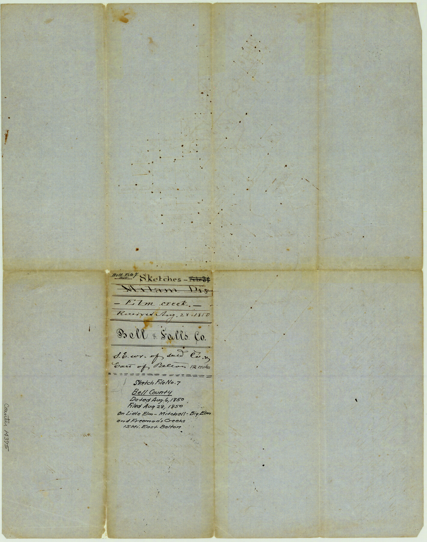
Bell County Sketch File 7
[Sketch of surveys on Little Elm, Mitchell, Big Elm and Freeman's Creeks, east of Belton]
-
Map/Doc
14375
-
Collection
General Map Collection
-
Object Dates
1850/8/6 (Creation Date)
1850/8/28 (File Date)
-
People and Organizations
G.B. Erath (Surveyor/Engineer)
James Howlet (Surveyor/Engineer)
W.W. Oxsheer (Surveyor/Engineer)
-
Counties
Bell Falls
-
Subjects
Surveying Sketch File
-
Height x Width
15.8 x 12.5 inches
40.1 x 31.8 cm
-
Medium
paper, manuscript
Part of: General Map Collection
Flight Mission No. CLL-3N, Frame 43, Willacy County
![87101, Flight Mission No. CLL-3N, Frame 43, Willacy County, General Map Collection](https://historictexasmaps.com/wmedia_w700/pdf_converted_jpg/qi_pdf_thumbnail_34235.jpg)
Print $20.00
- Digital $50.00
Flight Mission No. CLL-3N, Frame 43, Willacy County
1954
Size 18.3 x 22.0 inches
Map/Doc 87101
Bosque County Sketch File 31
![14830, Bosque County Sketch File 31, General Map Collection](https://historictexasmaps.com/wmedia_w700/pdf_converted_jpg/qi_pdf_thumbnail_9508.jpg)
Print $6.00
- Digital $50.00
Bosque County Sketch File 31
1867
Size 8.5 x 10.5 inches
Map/Doc 14830
Smith County Working Sketch 5
![63890, Smith County Working Sketch 5, General Map Collection](https://historictexasmaps.com/wmedia_w700/maps/63890.tif.jpg)
Print $20.00
- Digital $50.00
Smith County Working Sketch 5
Size 32.2 x 22.4 inches
Map/Doc 63890
Instruccion Publica
![Instruccion Publica](https://historictexasmaps.com/wmedia_w700/maps/96801.tif.jpg)
Print $20.00
- Digital $50.00
Instruccion Publica
Size 26.0 x 34.2 inches
Map/Doc 96801
Cuadro Historico-Geroglifico de la Peregrinacion de las Tribus Aztecas que Poblaron el Valle de Mexico (Num. 1)
![Cuadro Historico-Geroglifico de la Peregrinacion de las Tribus Aztecas que Poblaron el Valle de Mexico (Num. 1)](https://historictexasmaps.com/wmedia_w700/maps/97013.tif.jpg)
Print $20.00
- Digital $50.00
Cuadro Historico-Geroglifico de la Peregrinacion de las Tribus Aztecas que Poblaron el Valle de Mexico (Num. 1)
Size 22.9 x 31.2 inches
Map/Doc 97013
Chambers County NRC Article 33.136 Sketch 10
![94498, Chambers County NRC Article 33.136 Sketch 10, General Map Collection](https://historictexasmaps.com/wmedia_w700/pdf_converted_jpg/qi_pdf_thumbnail_39110.jpg)
Print $44.00
- Digital $50.00
Chambers County NRC Article 33.136 Sketch 10
2014
Size 24.0 x 36.0 inches
Map/Doc 94498
Red River County Sketch File 17
![35141, Red River County Sketch File 17, General Map Collection](https://historictexasmaps.com/wmedia_w700/pdf_converted_jpg/qi_pdf_thumbnail_13852.jpg)
Print $26.00
- Digital $50.00
Red River County Sketch File 17
1868
Size 12.8 x 8.2 inches
Map/Doc 35141
DeWitt County Sketch File 11
![11314, DeWitt County Sketch File 11, General Map Collection](https://historictexasmaps.com/wmedia_w700/pdf_converted_jpg/qi_pdf_thumbnail_7796.jpg)
Print $20.00
- Digital $50.00
DeWitt County Sketch File 11
1851
Size 24.5 x 35.2 inches
Map/Doc 11314
Lynn County Sketch File 4
![30458, Lynn County Sketch File 4, General Map Collection](https://historictexasmaps.com/wmedia_w700/pdf_converted_jpg/qi_pdf_thumbnail_12826.jpg)
Print $12.00
- Digital $50.00
Lynn County Sketch File 4
1902
Size 12.8 x 8.2 inches
Map/Doc 30458
Flight Mission No. CGI-3N, Frame 148, Cameron County
![84621, Flight Mission No. CGI-3N, Frame 148, Cameron County, General Map Collection](https://historictexasmaps.com/wmedia_w700/pdf_converted_jpg/qi_pdf_thumbnail_31836.jpg)
Print $20.00
- Digital $50.00
Flight Mission No. CGI-3N, Frame 148, Cameron County
1954
Size 18.5 x 22.2 inches
Map/Doc 84621
PSL Field Notes for Block CS in Dallam County
![81649, PSL Field Notes for Block CS in Dallam County, General Map Collection](https://historictexasmaps.com/wmedia_w700/pdf_converted_jpg/qi_pdf_thumbnail_30412.jpg)
PSL Field Notes for Block CS in Dallam County
Map/Doc 81649
Map of east part of West Bay & SW part of Galveston Bay, Galveston County showing subdivision for mineral development
![65804, Map of east part of West Bay & SW part of Galveston Bay, Galveston County showing subdivision for mineral development, General Map Collection](https://historictexasmaps.com/wmedia_w700/maps/65804.tif.jpg)
Print $40.00
- Digital $50.00
Map of east part of West Bay & SW part of Galveston Bay, Galveston County showing subdivision for mineral development
Size 69.6 x 48.0 inches
Map/Doc 65804
You may also like
Matagorda Bay Including Lavaca and Tres Palacios Bays
![73366, Matagorda Bay Including Lavaca and Tres Palacios Bays, General Map Collection](https://historictexasmaps.com/wmedia_w700/maps/73366.tif.jpg)
Print $20.00
- Digital $50.00
Matagorda Bay Including Lavaca and Tres Palacios Bays
1992
Size 37.0 x 47.8 inches
Map/Doc 73366
Map of Coryell Co.
![4921, Map of Coryell Co., General Map Collection](https://historictexasmaps.com/wmedia_w700/maps/4921-GC.tif.jpg)
Print $40.00
- Digital $50.00
Map of Coryell Co.
1896
Size 49.8 x 43.1 inches
Map/Doc 4921
Newton County Sketch File 48
![32460, Newton County Sketch File 48, General Map Collection](https://historictexasmaps.com/wmedia_w700/pdf_converted_jpg/qi_pdf_thumbnail_13317.jpg)
Print $4.00
- Digital $50.00
Newton County Sketch File 48
Size 12.4 x 7.9 inches
Map/Doc 32460
Flight Mission No. CRC-2R, Frame 180, Chambers County
![84758, Flight Mission No. CRC-2R, Frame 180, Chambers County, General Map Collection](https://historictexasmaps.com/wmedia_w700/pdf_converted_jpg/qi_pdf_thumbnail_31973.jpg)
Print $20.00
- Digital $50.00
Flight Mission No. CRC-2R, Frame 180, Chambers County
1956
Size 18.7 x 22.4 inches
Map/Doc 84758
[South line of Blocks B24, B25, and B26]
![90463, [South line of Blocks B24, B25, and B26], Twichell Survey Records](https://historictexasmaps.com/wmedia_w700/maps/90463-1.tif.jpg)
Print $2.00
- Digital $50.00
[South line of Blocks B24, B25, and B26]
1936
Size 14.6 x 9.0 inches
Map/Doc 90463
Rains County Working Sketch 10
![71836, Rains County Working Sketch 10, General Map Collection](https://historictexasmaps.com/wmedia_w700/maps/71836.tif.jpg)
Print $20.00
- Digital $50.00
Rains County Working Sketch 10
Size 36.1 x 34.7 inches
Map/Doc 71836
Newton County Sketch File 45
![32445, Newton County Sketch File 45, General Map Collection](https://historictexasmaps.com/wmedia_w700/pdf_converted_jpg/qi_pdf_thumbnail_13315.jpg)
Print $12.00
- Digital $50.00
Newton County Sketch File 45
1957
Size 14.1 x 8.7 inches
Map/Doc 32445
[Sketch for Mineral Application 26501 - Sabine River, T. A. Oldhausen]
![2847, [Sketch for Mineral Application 26501 - Sabine River, T. A. Oldhausen], General Map Collection](https://historictexasmaps.com/wmedia_w700/maps/2847.tif.jpg)
Print $20.00
- Digital $50.00
[Sketch for Mineral Application 26501 - Sabine River, T. A. Oldhausen]
1931
Size 24.7 x 37.1 inches
Map/Doc 2847
San Jacinto River and Tributaries, Texas - Survey of 1939
![3153, San Jacinto River and Tributaries, Texas - Survey of 1939, General Map Collection](https://historictexasmaps.com/wmedia_w700/maps/3153.tif.jpg)
Print $20.00
- Digital $50.00
San Jacinto River and Tributaries, Texas - Survey of 1939
1939
Size 28.1 x 40.5 inches
Map/Doc 3153
Sketch Showing Original Corners Affecting Block I and Adjacent Surveys from Actual Connections by W. D. Twichell
![90162, Sketch Showing Original Corners Affecting Block I and Adjacent Surveys from Actual Connections by W. D. Twichell, Twichell Survey Records](https://historictexasmaps.com/wmedia_w700/maps/90162-1.tif.jpg)
Print $20.00
- Digital $50.00
Sketch Showing Original Corners Affecting Block I and Adjacent Surveys from Actual Connections by W. D. Twichell
Size 23.4 x 24.4 inches
Map/Doc 90162
Reeves County Working Sketch 31
![63474, Reeves County Working Sketch 31, General Map Collection](https://historictexasmaps.com/wmedia_w700/maps/63474.tif.jpg)
Print $20.00
- Digital $50.00
Reeves County Working Sketch 31
Size 27.6 x 36.5 inches
Map/Doc 63474
[D. & S. E. Surs., G. C. & S. F. Blk. 9 west of University Land Blks. 49 and 50]
![90308, [D. & S. E. Surs., G. C. & S. F. Blk. 9 west of University Land Blks. 49 and 50], Twichell Survey Records](https://historictexasmaps.com/wmedia_w700/maps/90308-1.tif.jpg)
Print $3.00
- Digital $50.00
[D. & S. E. Surs., G. C. & S. F. Blk. 9 west of University Land Blks. 49 and 50]
Size 11.3 x 15.4 inches
Map/Doc 90308