Falls County Sketch File 3

Print $3.00
- Digital $50.00
Falls County Sketch File 3
1847
Size: 10.8 x 16.5 inches
11465
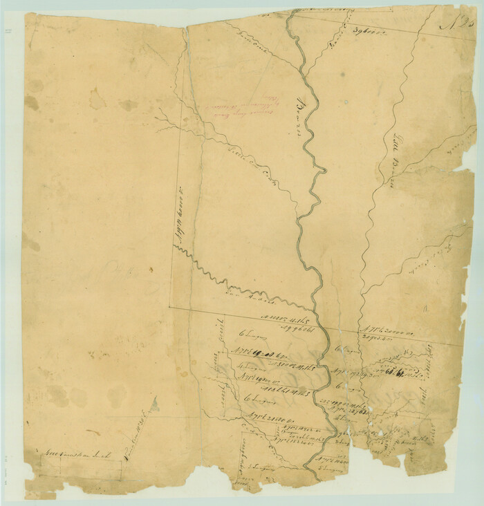
Falls County Sketch File 16a

Print $20.00
- Digital $50.00
Falls County Sketch File 16a
1871
Size: 30.6 x 21.0 inches
11466
Falls County Sketch File 23

Print $20.00
- Digital $50.00
Falls County Sketch File 23
1921
Size: 24.8 x 36.3 inches
11467
Falls County Sketch File 32

Print $20.00
- Digital $50.00
Falls County Sketch File 32
Size: 36.3 x 24.7 inches
11468
Limestone County Sketch File 4

Print $20.00
- Digital $50.00
Limestone County Sketch File 4
1847
Size: 15.2 x 34.1 inches
12001
Set of new maps of Austin's Colony by G. Borden, Jr.

Print $20.00
- Digital $50.00
Set of new maps of Austin's Colony by G. Borden, Jr.
1833
Size: 25.0 x 17.0 inches
131
Bell County Sketch File 7

Print $40.00
- Digital $50.00
Bell County Sketch File 7
1850
Size: 15.8 x 12.5 inches
14375
Bell County Sketch File 12

Print $4.00
- Digital $50.00
Bell County Sketch File 12
1852
Size: 8.1 x 12.5 inches
14385
[Surveys in Austin's Colony along the Brazos River]
Print $20.00
- Digital $50.00
[Surveys in Austin's Colony along the Brazos River]
1833
Size: 25.0 x 23.9 inches
164
Falls County Sketch File 1

Print $4.00
- Digital $50.00
Falls County Sketch File 1
1852
Size: 10.7 x 8.6 inches
22330
Falls County Sketch File 2

Print $4.00
- Digital $50.00
Falls County Sketch File 2
1854
Size: 13.1 x 8.3 inches
22332
Falls County Sketch File 2a

Print $2.00
- Digital $50.00
Falls County Sketch File 2a
1856
Size: 8.4 x 10.9 inches
22334
Falls County Sketch File 4

Print $4.00
- Digital $50.00
Falls County Sketch File 4
1856
Size: 10.3 x 8.3 inches
22335
Falls County Sketch File 5

Print $9.00
- Digital $50.00
Falls County Sketch File 5
1857
Size: 12.5 x 8.7 inches
22337
Falls County Sketch File 6

Print $4.00
- Digital $50.00
Falls County Sketch File 6
1848
Size: 12.8 x 8.3 inches
22341
Falls County Sketch File 9

Print $4.00
- Digital $50.00
Falls County Sketch File 9
Size: 13.0 x 8.5 inches
22343
Falls County Sketch File 10

Print $14.00
- Digital $50.00
Falls County Sketch File 10
Size: 12.9 x 8.4 inches
22345
Falls County Sketch File 11

Print $13.00
- Digital $50.00
Falls County Sketch File 11
1859
Size: 12.6 x 9.8 inches
22352
Falls County Sketch File 11a

Print $8.00
- Digital $50.00
Falls County Sketch File 11a
1871
Size: 12.9 x 8.2 inches
22358
Falls County Sketch File 11b

Print $4.00
- Digital $50.00
Falls County Sketch File 11b
1871
Size: 10.4 x 8.5 inches
22362
Falls County Sketch File 12

Print $8.00
- Digital $50.00
Falls County Sketch File 12
1870
Size: 8.2 x 10.1 inches
22364
Falls County Sketch File 13

Print $4.00
- Digital $50.00
Falls County Sketch File 13
1870
Size: 10.3 x 8.7 inches
22368
Falls County Sketch File 14

Print $40.00
- Digital $50.00
Falls County Sketch File 14
Size: 15.9 x 12.9 inches
22370
Falls County Sketch File 15

Print $4.00
- Digital $50.00
Falls County Sketch File 15
Size: 13.0 x 8.2 inches
22372
Falls County Sketch File 16

Print $8.00
- Digital $50.00
Falls County Sketch File 16
Size: 13.3 x 8.5 inches
22374
Falls County Sketch File 17

Print $6.00
- Digital $50.00
Falls County Sketch File 17
1872
Size: 8.4 x 13.1 inches
22377
Falls County Sketch File 18

Print $4.00
- Digital $50.00
Falls County Sketch File 18
Size: 10.3 x 8.2 inches
22380
Falls County Sketch File 18a

Print $8.00
- Digital $50.00
Falls County Sketch File 18a
Size: 13.3 x 9.0 inches
22382
Falls County Sketch File 19

Print $4.00
- Digital $50.00
Falls County Sketch File 19
1871
Size: 12.8 x 8.4 inches
22386
Falls County Sketch File 3
Print $3.00
- Digital $50.00
Falls County Sketch File 3
1847
-
Size
10.8 x 16.5 inches
-
Map/Doc
11465
-
Creation Date
1847
Falls County Sketch File 16a
Print $20.00
- Digital $50.00
Falls County Sketch File 16a
1871
-
Size
30.6 x 21.0 inches
-
Map/Doc
11466
-
Creation Date
1871
Falls County Sketch File 23
Print $20.00
- Digital $50.00
Falls County Sketch File 23
1921
-
Size
24.8 x 36.3 inches
-
Map/Doc
11467
-
Creation Date
1921
Falls County Sketch File 32
Print $20.00
- Digital $50.00
Falls County Sketch File 32
-
Size
36.3 x 24.7 inches
-
Map/Doc
11468
Limestone County Sketch File 4
Print $20.00
- Digital $50.00
Limestone County Sketch File 4
1847
-
Size
15.2 x 34.1 inches
-
Map/Doc
12001
-
Creation Date
1847
Set of new maps of Austin's Colony by G. Borden, Jr.
Print $20.00
- Digital $50.00
Set of new maps of Austin's Colony by G. Borden, Jr.
1833
-
Size
25.0 x 17.0 inches
-
Map/Doc
131
-
Creation Date
1833
Bell County Sketch File 7
Print $40.00
- Digital $50.00
Bell County Sketch File 7
1850
-
Size
15.8 x 12.5 inches
-
Map/Doc
14375
-
Creation Date
1850
Bell County Sketch File 12
Print $4.00
- Digital $50.00
Bell County Sketch File 12
1852
-
Size
8.1 x 12.5 inches
-
Map/Doc
14385
-
Creation Date
1852
[Surveys in Austin's Colony along the Brazos River]
Print $20.00
- Digital $50.00
[Surveys in Austin's Colony along the Brazos River]
1833
-
Size
25.0 x 23.9 inches
-
Map/Doc
164
-
Creation Date
1833
Falls County

Print $20.00
- Digital $50.00
Falls County
1919
-
Size
40.9 x 44.4 inches
-
Map/Doc
1824
-
Creation Date
1919
Falls County Sketch File 1
Print $4.00
- Digital $50.00
Falls County Sketch File 1
1852
-
Size
10.7 x 8.6 inches
-
Map/Doc
22330
-
Creation Date
1852
Falls County Sketch File 2
Print $4.00
- Digital $50.00
Falls County Sketch File 2
1854
-
Size
13.1 x 8.3 inches
-
Map/Doc
22332
-
Creation Date
1854
Falls County Sketch File 2a
Print $2.00
- Digital $50.00
Falls County Sketch File 2a
1856
-
Size
8.4 x 10.9 inches
-
Map/Doc
22334
-
Creation Date
1856
Falls County Sketch File 4
Print $4.00
- Digital $50.00
Falls County Sketch File 4
1856
-
Size
10.3 x 8.3 inches
-
Map/Doc
22335
-
Creation Date
1856
Falls County Sketch File 5
Print $9.00
- Digital $50.00
Falls County Sketch File 5
1857
-
Size
12.5 x 8.7 inches
-
Map/Doc
22337
-
Creation Date
1857
Falls County Sketch File 6
Print $4.00
- Digital $50.00
Falls County Sketch File 6
1848
-
Size
12.8 x 8.3 inches
-
Map/Doc
22341
-
Creation Date
1848
Falls County Sketch File 9
Print $4.00
- Digital $50.00
Falls County Sketch File 9
-
Size
13.0 x 8.5 inches
-
Map/Doc
22343
Falls County Sketch File 10
Print $14.00
- Digital $50.00
Falls County Sketch File 10
-
Size
12.9 x 8.4 inches
-
Map/Doc
22345
Falls County Sketch File 11
Print $13.00
- Digital $50.00
Falls County Sketch File 11
1859
-
Size
12.6 x 9.8 inches
-
Map/Doc
22352
-
Creation Date
1859
Falls County Sketch File 11a
Print $8.00
- Digital $50.00
Falls County Sketch File 11a
1871
-
Size
12.9 x 8.2 inches
-
Map/Doc
22358
-
Creation Date
1871
Falls County Sketch File 11b
Print $4.00
- Digital $50.00
Falls County Sketch File 11b
1871
-
Size
10.4 x 8.5 inches
-
Map/Doc
22362
-
Creation Date
1871
Falls County Sketch File 12
Print $8.00
- Digital $50.00
Falls County Sketch File 12
1870
-
Size
8.2 x 10.1 inches
-
Map/Doc
22364
-
Creation Date
1870
Falls County Sketch File 13
Print $4.00
- Digital $50.00
Falls County Sketch File 13
1870
-
Size
10.3 x 8.7 inches
-
Map/Doc
22368
-
Creation Date
1870
Falls County Sketch File 14
Print $40.00
- Digital $50.00
Falls County Sketch File 14
-
Size
15.9 x 12.9 inches
-
Map/Doc
22370
Falls County Sketch File 15
Print $4.00
- Digital $50.00
Falls County Sketch File 15
-
Size
13.0 x 8.2 inches
-
Map/Doc
22372
Falls County Sketch File 16
Print $8.00
- Digital $50.00
Falls County Sketch File 16
-
Size
13.3 x 8.5 inches
-
Map/Doc
22374
Falls County Sketch File 17
Print $6.00
- Digital $50.00
Falls County Sketch File 17
1872
-
Size
8.4 x 13.1 inches
-
Map/Doc
22377
-
Creation Date
1872
Falls County Sketch File 18
Print $4.00
- Digital $50.00
Falls County Sketch File 18
-
Size
10.3 x 8.2 inches
-
Map/Doc
22380
Falls County Sketch File 18a
Print $8.00
- Digital $50.00
Falls County Sketch File 18a
-
Size
13.3 x 9.0 inches
-
Map/Doc
22382
Falls County Sketch File 19
Print $4.00
- Digital $50.00
Falls County Sketch File 19
1871
-
Size
12.8 x 8.4 inches
-
Map/Doc
22386
-
Creation Date
1871