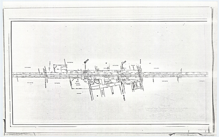
[Travis Station Map - Tracks and Structures - Lands. San Antonio & Aransas Pass Railway Co.]
Print $4.00
- Digital $50.00
[Travis Station Map - Tracks and Structures - Lands. San Antonio & Aransas Pass Railway Co.]
1919
Size: 11.7 x 18.7 inches
62564
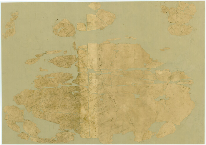
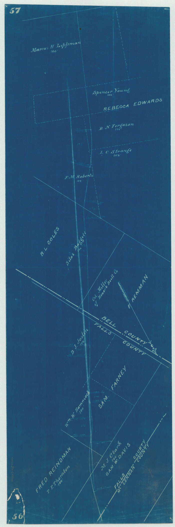
[Surveys in Robertson's Colony]
Print $20.00
- Digital $50.00
[Surveys in Robertson's Colony]
Size: 18.6 x 26.5 inches
78358
[Surveys in Austin's Colony along the Brazos River]
Print $20.00
- Digital $50.00
[Surveys in Austin's Colony along the Brazos River]
1833
Size: 25.0 x 23.9 inches
164
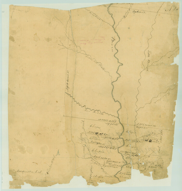
[Surveys along the Brazos River]
Print $2.00
- Digital $50.00
[Surveys along the Brazos River]
1847
Size: 12.1 x 8.4 inches
261
[Surveys along Cow and Deer Creeks]

Print $2.00
- Digital $50.00
[Surveys along Cow and Deer Creeks]
1845
Size: 15.8 x 8.6 inches
306
[Rosebud Station Map - Tracks and Structures - Lands, San Antonio and Aransas Pass Railway Co.]

Print $4.00
- Digital $50.00
[Rosebud Station Map - Tracks and Structures - Lands, San Antonio and Aransas Pass Railway Co.]
1919
Size: 11.7 x 18.6 inches
62566
[Right of Way Map, Belton Branch of the M.K.&T. RR.]
Print $20.00
- Digital $50.00
[Right of Way Map, Belton Branch of the M.K.&T. RR.]
1896
Size: 22.2 x 7.4 inches
64220
Working Sketch in Falls and Limestone Counties

Print $20.00
- Digital $50.00
Working Sketch in Falls and Limestone Counties
1922
Size: 15.9 x 34.8 inches
91088
Travis Station Map - Tracks and Structures - Lands San Antonio and Aransas Pass Railway Co.

Print $4.00
- Digital $50.00
Travis Station Map - Tracks and Structures - Lands San Antonio and Aransas Pass Railway Co.
1919
Size: 11.7 x 18.5 inches
62563
Sketch of surveys on Deer Creek, Milam District

Print $2.00
- Digital $50.00
Sketch of surveys on Deer Creek, Milam District
1846
Size: 7.8 x 10.9 inches
76046
Set of new maps of Austin's Colony by G. Borden, Jr.

Print $20.00
- Digital $50.00
Set of new maps of Austin's Colony by G. Borden, Jr.
1833
Size: 25.0 x 17.0 inches
131
Rosebud Station Map -Tracks and Structures - Lands, San Antonio and Aransas Pass Railway Co

Print $4.00
- Digital $50.00
Rosebud Station Map -Tracks and Structures - Lands, San Antonio and Aransas Pass Railway Co
1919
Size: 11.7 x 18.6 inches
62565
Right of Way and Track Map San Antonio and Aransas Pass Railway Co.

Print $4.00
- Digital $50.00
Right of Way and Track Map San Antonio and Aransas Pass Railway Co.
1919
Size: 11.9 x 18.5 inches
62562
Right of Way San Antonio and Aransas Pass Railway

Print $4.00
- Digital $50.00
Right of Way San Antonio and Aransas Pass Railway
1919
Size: 11.6 x 18.5 inches
62561
Right of Way Location Map, San Antonio & Aransas Pass, Station 656…

Print $4.00
- Digital $50.00
Right of Way Location Map, San Antonio & Aransas Pass, Station 656…
1919
Size: 11.8 x 18.6 inches
62567
Right of Way & Track Map San Antonio & Aransas Pass Railway Co.

Print $40.00
- Digital $50.00
Right of Way & Track Map San Antonio & Aransas Pass Railway Co.
1919
Size: 24.8 x 55.8 inches
64038
Right of Way & Track Map San Antonio & Aransas Pass Railway Co.

Print $40.00
- Digital $50.00
Right of Way & Track Map San Antonio & Aransas Pass Railway Co.
1919
Size: 25.7 x 56.7 inches
64039
Right of Way & Track Map San Antonio & Aransas Pass Railway Co.

Print $40.00
- Digital $50.00
Right of Way & Track Map San Antonio & Aransas Pass Railway Co.
1919
Size: 25.2 x 56.7 inches
64040
Railroad Track Map, H&TCRRCo., Falls County, Texas

Print $4.00
- Digital $50.00
Railroad Track Map, H&TCRRCo., Falls County, Texas
1918
Size: 11.7 x 18.5 inches
62831
Railroad Track Map, H&TCRRCo., Falls County, Texas

Print $4.00
- Digital $50.00
Railroad Track Map, H&TCRRCo., Falls County, Texas
1918
Size: 11.9 x 18.5 inches
62832
Railroad Track Map, H&TCRRCo., Falls County, Texas

Print $4.00
- Digital $50.00
Railroad Track Map, H&TCRRCo., Falls County, Texas
1918
Size: 11.7 x 18.5 inches
62833
Railroad Track Map, H&TCRRCo., Falls County, Texas

Print $4.00
- Digital $50.00
Railroad Track Map, H&TCRRCo., Falls County, Texas
1918
Size: 11.6 x 18.6 inches
62834
Railroad Track Map, H&TCRRCo., Falls County, Texas

Print $4.00
- Digital $50.00
Railroad Track Map, H&TCRRCo., Falls County, Texas
1918
Size: 11.7 x 18.6 inches
62835
Railroad Track Map, H&TCRRCo., Falls County, Texas

Print $4.00
- Digital $50.00
Railroad Track Map, H&TCRRCo., Falls County, Texas
1918
Size: 11.8 x 18.6 inches
62836
Railroad Track Map, H&TCRRCo., Falls County, Texas

Print $4.00
- Digital $50.00
Railroad Track Map, H&TCRRCo., Falls County, Texas
1918
Size: 11.8 x 18.5 inches
62837
Railroad Track Map, H&TCRRCo., Falls County, Texas

Print $4.00
- Digital $50.00
Railroad Track Map, H&TCRRCo., Falls County, Texas
1918
Size: 11.8 x 18.4 inches
62838
Railroad Track Map, H&TCRRCo., Falls County, Texas

Print $4.00
- Digital $50.00
Railroad Track Map, H&TCRRCo., Falls County, Texas
1918
Size: 11.7 x 18.5 inches
62839
Railroad Track Map, H&TCRRCo., Falls County, Texas

Print $4.00
- Digital $50.00
Railroad Track Map, H&TCRRCo., Falls County, Texas
1918
Size: 11.8 x 18.6 inches
62840
Railroad Track Map, H&TCRRCo., Falls County, Texas

Print $4.00
- Digital $50.00
Railroad Track Map, H&TCRRCo., Falls County, Texas
1918
Size: 11.7 x 18.7 inches
62841
Railroad Track Map, H&TCRRCo., Falls County, Texas

Print $4.00
- Digital $50.00
Railroad Track Map, H&TCRRCo., Falls County, Texas
1918
Size: 11.7 x 18.5 inches
62842
[Travis Station Map - Tracks and Structures - Lands. San Antonio & Aransas Pass Railway Co.]
Print $4.00
- Digital $50.00
[Travis Station Map - Tracks and Structures - Lands. San Antonio & Aransas Pass Railway Co.]
1919
-
Size
11.7 x 18.7 inches
-
Map/Doc
62564
-
Creation Date
1919
[Surveys in Robertson's Colony]
Print $20.00
- Digital $50.00
[Surveys in Robertson's Colony]
-
Size
18.6 x 26.5 inches
-
Map/Doc
78358
[Surveys in Austin's Colony along the Brazos River]
Print $20.00
- Digital $50.00
[Surveys in Austin's Colony along the Brazos River]
1833
-
Size
25.0 x 23.9 inches
-
Map/Doc
164
-
Creation Date
1833
[Surveys along the Brazos River]
Print $2.00
- Digital $50.00
[Surveys along the Brazos River]
1847
-
Size
12.1 x 8.4 inches
-
Map/Doc
261
-
Creation Date
1847
[Surveys along Cow and Deer Creeks]
Print $2.00
- Digital $50.00
[Surveys along Cow and Deer Creeks]
1845
-
Size
15.8 x 8.6 inches
-
Map/Doc
306
-
Creation Date
1845
[Rosebud Station Map - Tracks and Structures - Lands, San Antonio and Aransas Pass Railway Co.]
Print $4.00
- Digital $50.00
[Rosebud Station Map - Tracks and Structures - Lands, San Antonio and Aransas Pass Railway Co.]
1919
-
Size
11.7 x 18.6 inches
-
Map/Doc
62566
-
Creation Date
1919
[Right of Way Map, Belton Branch of the M.K.&T. RR.]
Print $20.00
- Digital $50.00
[Right of Way Map, Belton Branch of the M.K.&T. RR.]
1896
-
Size
22.2 x 7.4 inches
-
Map/Doc
64220
-
Creation Date
1896
Working Sketch in Falls and Limestone Counties
Print $20.00
- Digital $50.00
Working Sketch in Falls and Limestone Counties
1922
-
Size
15.9 x 34.8 inches
-
Map/Doc
91088
-
Creation Date
1922
Travis Station Map - Tracks and Structures - Lands San Antonio and Aransas Pass Railway Co.
Print $4.00
- Digital $50.00
Travis Station Map - Tracks and Structures - Lands San Antonio and Aransas Pass Railway Co.
1919
-
Size
11.7 x 18.5 inches
-
Map/Doc
62563
-
Creation Date
1919
Sketch of surveys on Deer Creek, Milam District
Print $2.00
- Digital $50.00
Sketch of surveys on Deer Creek, Milam District
1846
-
Size
7.8 x 10.9 inches
-
Map/Doc
76046
-
Creation Date
1846
Set of new maps of Austin's Colony by G. Borden, Jr.
Print $20.00
- Digital $50.00
Set of new maps of Austin's Colony by G. Borden, Jr.
1833
-
Size
25.0 x 17.0 inches
-
Map/Doc
131
-
Creation Date
1833
Rosebud Station Map -Tracks and Structures - Lands, San Antonio and Aransas Pass Railway Co
Print $4.00
- Digital $50.00
Rosebud Station Map -Tracks and Structures - Lands, San Antonio and Aransas Pass Railway Co
1919
-
Size
11.7 x 18.6 inches
-
Map/Doc
62565
-
Creation Date
1919
Right of Way and Track Map San Antonio and Aransas Pass Railway Co.
Print $4.00
- Digital $50.00
Right of Way and Track Map San Antonio and Aransas Pass Railway Co.
1919
-
Size
11.9 x 18.5 inches
-
Map/Doc
62562
-
Creation Date
1919
Right of Way San Antonio and Aransas Pass Railway
Print $4.00
- Digital $50.00
Right of Way San Antonio and Aransas Pass Railway
1919
-
Size
11.6 x 18.5 inches
-
Map/Doc
62561
-
Creation Date
1919
Right of Way Location Map, San Antonio & Aransas Pass, Station 656…
Print $4.00
- Digital $50.00
Right of Way Location Map, San Antonio & Aransas Pass, Station 656…
1919
-
Size
11.8 x 18.6 inches
-
Map/Doc
62567
-
Creation Date
1919
Right of Way & Track Map San Antonio & Aransas Pass Railway Co.
Print $40.00
- Digital $50.00
Right of Way & Track Map San Antonio & Aransas Pass Railway Co.
1919
-
Size
24.8 x 55.8 inches
-
Map/Doc
64038
-
Creation Date
1919
Right of Way & Track Map San Antonio & Aransas Pass Railway Co.
Print $40.00
- Digital $50.00
Right of Way & Track Map San Antonio & Aransas Pass Railway Co.
1919
-
Size
25.7 x 56.7 inches
-
Map/Doc
64039
-
Creation Date
1919
Right of Way & Track Map San Antonio & Aransas Pass Railway Co.
Print $40.00
- Digital $50.00
Right of Way & Track Map San Antonio & Aransas Pass Railway Co.
1919
-
Size
25.2 x 56.7 inches
-
Map/Doc
64040
-
Creation Date
1919
Railroad Track Map, H&TCRRCo., Falls County, Texas
Print $4.00
- Digital $50.00
Railroad Track Map, H&TCRRCo., Falls County, Texas
1918
-
Size
11.7 x 18.5 inches
-
Map/Doc
62831
-
Creation Date
1918
Railroad Track Map, H&TCRRCo., Falls County, Texas
Print $4.00
- Digital $50.00
Railroad Track Map, H&TCRRCo., Falls County, Texas
1918
-
Size
11.9 x 18.5 inches
-
Map/Doc
62832
-
Creation Date
1918
Railroad Track Map, H&TCRRCo., Falls County, Texas
Print $4.00
- Digital $50.00
Railroad Track Map, H&TCRRCo., Falls County, Texas
1918
-
Size
11.7 x 18.5 inches
-
Map/Doc
62833
-
Creation Date
1918
Railroad Track Map, H&TCRRCo., Falls County, Texas
Print $4.00
- Digital $50.00
Railroad Track Map, H&TCRRCo., Falls County, Texas
1918
-
Size
11.6 x 18.6 inches
-
Map/Doc
62834
-
Creation Date
1918
Railroad Track Map, H&TCRRCo., Falls County, Texas
Print $4.00
- Digital $50.00
Railroad Track Map, H&TCRRCo., Falls County, Texas
1918
-
Size
11.7 x 18.6 inches
-
Map/Doc
62835
-
Creation Date
1918
Railroad Track Map, H&TCRRCo., Falls County, Texas
Print $4.00
- Digital $50.00
Railroad Track Map, H&TCRRCo., Falls County, Texas
1918
-
Size
11.8 x 18.6 inches
-
Map/Doc
62836
-
Creation Date
1918
Railroad Track Map, H&TCRRCo., Falls County, Texas
Print $4.00
- Digital $50.00
Railroad Track Map, H&TCRRCo., Falls County, Texas
1918
-
Size
11.8 x 18.5 inches
-
Map/Doc
62837
-
Creation Date
1918
Railroad Track Map, H&TCRRCo., Falls County, Texas
Print $4.00
- Digital $50.00
Railroad Track Map, H&TCRRCo., Falls County, Texas
1918
-
Size
11.8 x 18.4 inches
-
Map/Doc
62838
-
Creation Date
1918
Railroad Track Map, H&TCRRCo., Falls County, Texas
Print $4.00
- Digital $50.00
Railroad Track Map, H&TCRRCo., Falls County, Texas
1918
-
Size
11.7 x 18.5 inches
-
Map/Doc
62839
-
Creation Date
1918
Railroad Track Map, H&TCRRCo., Falls County, Texas
Print $4.00
- Digital $50.00
Railroad Track Map, H&TCRRCo., Falls County, Texas
1918
-
Size
11.8 x 18.6 inches
-
Map/Doc
62840
-
Creation Date
1918
Railroad Track Map, H&TCRRCo., Falls County, Texas
Print $4.00
- Digital $50.00
Railroad Track Map, H&TCRRCo., Falls County, Texas
1918
-
Size
11.7 x 18.7 inches
-
Map/Doc
62841
-
Creation Date
1918
Railroad Track Map, H&TCRRCo., Falls County, Texas
Print $4.00
- Digital $50.00
Railroad Track Map, H&TCRRCo., Falls County, Texas
1918
-
Size
11.7 x 18.5 inches
-
Map/Doc
62842
-
Creation Date
1918