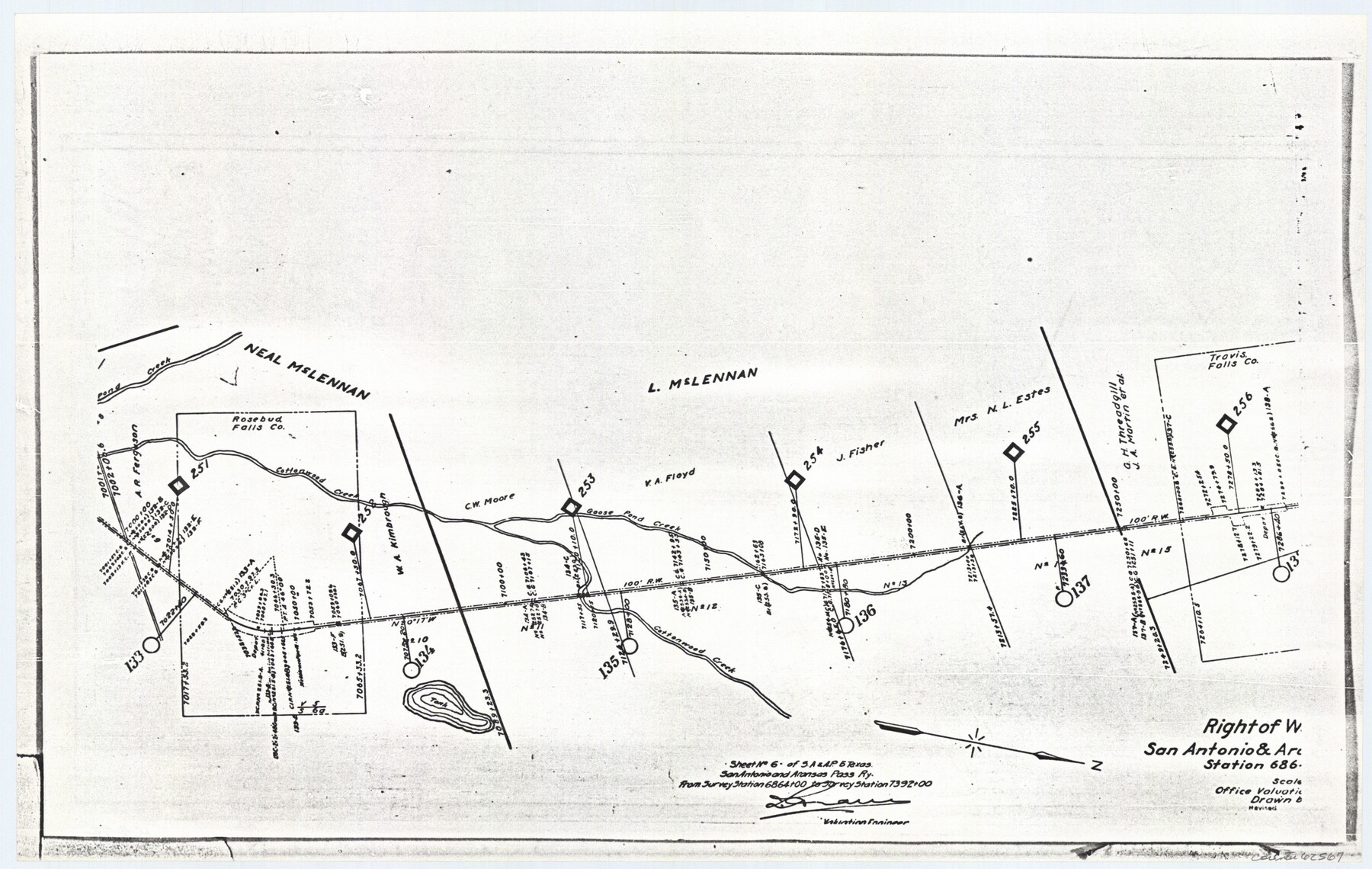
Right of Way Location Map, San Antonio & Aransas Pass, Station 656…
Z-2-72, K-7-72
-
Map/Doc
62567
-
Collection
General Map Collection
-
Object Dates
1919 (Creation Date)
-
Counties
Falls
-
Subjects
Railroads
-
Height x Width
11.8 x 18.6 inches
30.0 x 47.2 cm
-
Medium
paper, photocopy
-
Features
SA&AP
Pond Creek
Cottonwood Creek
Goose Pond Creek
Part of: General Map Collection
Brazoria County NRC Article 33.136 Sketch 14

Print $36.00
- Digital $50.00
Brazoria County NRC Article 33.136 Sketch 14
2013
Size 24.0 x 36.0 inches
Map/Doc 95057
Pecos County Working Sketch 37

Print $20.00
- Digital $50.00
Pecos County Working Sketch 37
1939
Size 30.0 x 43.0 inches
Map/Doc 71509
Bexar County Sketch File 60

Print $4.00
- Digital $50.00
Bexar County Sketch File 60
2009
Size 11.0 x 8.5 inches
Map/Doc 93669
Kimble County Rolled Sketch 28

Print $20.00
- Digital $50.00
Kimble County Rolled Sketch 28
1964
Size 19.7 x 20.6 inches
Map/Doc 6518
Segunda parte del Mapa, que comprende la Frontera, de los Dominios del Rey, en la America Septentrional

Print $40.00
- Digital $50.00
Segunda parte del Mapa, que comprende la Frontera, de los Dominios del Rey, en la America Septentrional
1769
Size 26.7 x 63.8 inches
Map/Doc 4667
Angelina County Sketch File 21a

Print $24.00
- Digital $50.00
Angelina County Sketch File 21a
1883
Size 8.3 x 12.6 inches
Map/Doc 13041
Flight Mission No. CGI-1N, Frame 222, Cameron County

Print $20.00
- Digital $50.00
Flight Mission No. CGI-1N, Frame 222, Cameron County
1955
Size 18.4 x 22.1 inches
Map/Doc 84532
San Patricio County Boundary File 76

Print $25.00
- Digital $50.00
San Patricio County Boundary File 76
Size 9.2 x 7.6 inches
Map/Doc 58563
Edwards County Sketch File 16a

Print $24.00
- Digital $50.00
Edwards County Sketch File 16a
1903
Size 14.3 x 8.8 inches
Map/Doc 21720
Bandera County

Print $40.00
- Digital $50.00
Bandera County
1947
Size 34.2 x 54.7 inches
Map/Doc 1777
Terry County Rolled Sketch 8

Print $20.00
- Digital $50.00
Terry County Rolled Sketch 8
Size 31.7 x 22.3 inches
Map/Doc 7982
Gray County Boundary File 7

Print $4.00
- Digital $50.00
Gray County Boundary File 7
Size 8.0 x 8.8 inches
Map/Doc 53898
You may also like
Childress County School Land Situated in Bailey and Cochran Counties

Print $20.00
- Digital $50.00
Childress County School Land Situated in Bailey and Cochran Counties
Size 21.8 x 25.4 inches
Map/Doc 92499
[Block 6T and Vicinity]
![91521, [Block 6T and Vicinity], Twichell Survey Records](https://historictexasmaps.com/wmedia_w700/maps/91521-1.tif.jpg)
Print $20.00
- Digital $50.00
[Block 6T and Vicinity]
Size 19.9 x 15.7 inches
Map/Doc 91521
Approaches to Galveston Bay

Print $40.00
- Digital $50.00
Approaches to Galveston Bay
1982
Size 53.1 x 36.7 inches
Map/Doc 69884
Wood County Boundary File 7

Print $34.00
- Digital $50.00
Wood County Boundary File 7
Size 13.3 x 8.8 inches
Map/Doc 60187
United States - Gulf Coast - Galveston to Rio Grande

Print $20.00
- Digital $50.00
United States - Gulf Coast - Galveston to Rio Grande
1919
Size 26.7 x 18.2 inches
Map/Doc 72744
[Sketch of area around Mary Fury and John P. Rohus Surveys]
![91917, [Sketch of area around Mary Fury and John P. Rohus Surveys], Twichell Survey Records](https://historictexasmaps.com/wmedia_w700/maps/91917-1.tif.jpg)
Print $20.00
- Digital $50.00
[Sketch of area around Mary Fury and John P. Rohus Surveys]
Size 19.4 x 19.7 inches
Map/Doc 91917
Anderson County Working Sketch 46

Print $20.00
- Digital $50.00
Anderson County Working Sketch 46
2000
Size 29.2 x 34.2 inches
Map/Doc 67046
Hammond's continental map of the United States

Digital $50.00
Hammond's continental map of the United States
1940
Size 33.2 x 50.2 inches
Map/Doc 3118
Houston County Working Sketch 5

Print $20.00
- Digital $50.00
Houston County Working Sketch 5
Size 24.9 x 28.1 inches
Map/Doc 66235
Borden County Sketch File 10a

Print $40.00
- Digital $50.00
Borden County Sketch File 10a
Size 21.0 x 37.5 inches
Map/Doc 10935
Wichita County Rolled Sketch 18

Print $20.00
- Digital $50.00
Wichita County Rolled Sketch 18
1923
Size 25.7 x 38.0 inches
Map/Doc 8254
Map of Lands in King County, Texas owned and leased by the Louisville Land and Cattle Company

Print $20.00
- Digital $50.00
Map of Lands in King County, Texas owned and leased by the Louisville Land and Cattle Company
Size 32.1 x 25.9 inches
Map/Doc 5070