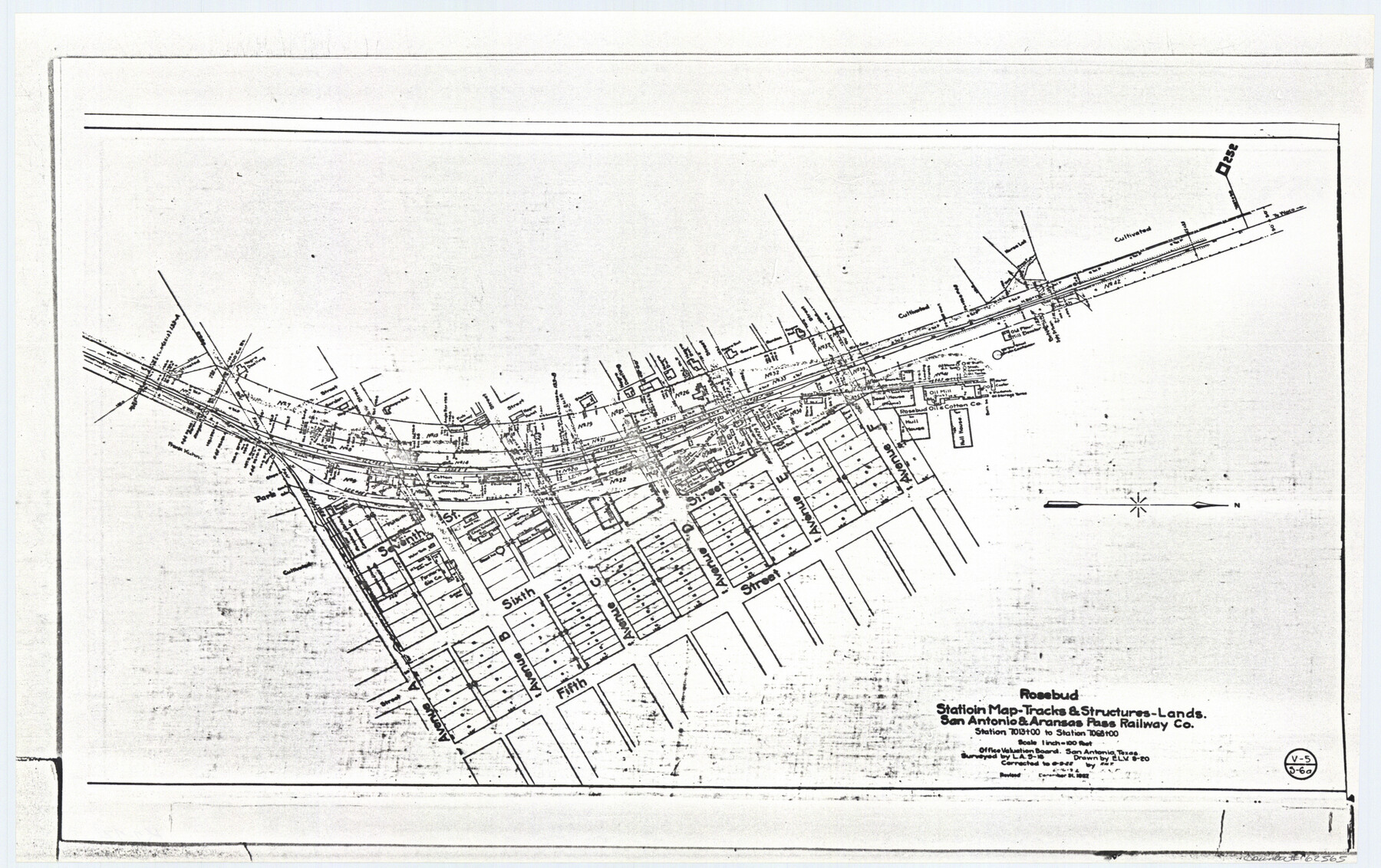
Rosebud Station Map -Tracks and Structures - Lands, San Antonio and Aransas Pass Railway Co
Z-2-72, K-7-72
-
Map/Doc
62565
-
Collection
General Map Collection
-
Object Dates
1927/12/31 (Revision Date)
1919 (Creation Date)
-
People and Organizations
L. A. (Surveyor/Engineer)
E. L. V. (Draftsman)
-
Counties
Falls
-
Subjects
Railroads
-
Height x Width
11.7 x 18.6 inches
29.7 x 47.2 cm
-
Medium
paper, photocopy
-
Scale
1 inch = 100 feet
-
Comments
Right of Way Location Map
-
Features
SA&AP
Avenue A
Avenue B
Avenue C
Avenue D
Avenue E
Avenue F
Fifth Street
Sixth Street
Seventh Street
Hull House
Oil Mill
Part of: General Map Collection
San Patricio County Working Sketch 9

Print $40.00
- Digital $50.00
San Patricio County Working Sketch 9
1937
Size 52.8 x 44.0 inches
Map/Doc 63771
Terrell County Working Sketch 43

Print $20.00
- Digital $50.00
Terrell County Working Sketch 43
1957
Size 45.0 x 38.4 inches
Map/Doc 62136
No. 1 - Survey for a road from the Brazo Santiago to the Rio Grande

Print $20.00
- Digital $50.00
No. 1 - Survey for a road from the Brazo Santiago to the Rio Grande
1847
Size 18.4 x 27.3 inches
Map/Doc 72875
Bosque County Sketch File 26

Print $4.00
- Digital $50.00
Bosque County Sketch File 26
1868
Size 8.1 x 7.5 inches
Map/Doc 14811
Howard County Rolled Sketch 6

Print $20.00
- Digital $50.00
Howard County Rolled Sketch 6
Size 17.3 x 18.1 inches
Map/Doc 6235
Right of Way and Track Map International & Gt Northern Ry. operated by the International & Gt. Northern Ry. Co., San Antonio Division

Print $40.00
- Digital $50.00
Right of Way and Track Map International & Gt Northern Ry. operated by the International & Gt. Northern Ry. Co., San Antonio Division
1917
Size 26.2 x 58.6 inches
Map/Doc 64788
[Missouri, Kansas & Texas] E. L. & R. R. Railroad, Morris Co.
![64273, [Missouri, Kansas & Texas] E. L. & R. R. Railroad, Morris Co., General Map Collection](https://historictexasmaps.com/wmedia_w700/maps/64273.tif.jpg)
Print $20.00
- Digital $50.00
[Missouri, Kansas & Texas] E. L. & R. R. Railroad, Morris Co.
1906
Size 13.1 x 28.4 inches
Map/Doc 64273

Southern Part of Laguna Madre

Print $20.00
- Digital $50.00
Southern Part of Laguna Madre
1949
Size 44.5 x 35.4 inches
Map/Doc 73535

Crockett County Working Sketch 76

Print $20.00
- Digital $50.00
Crockett County Working Sketch 76
1964
Size 34.3 x 36.3 inches
Map/Doc 68409
Reeves County Rolled Sketch 14

Print $20.00
- Digital $50.00
Reeves County Rolled Sketch 14
Size 17.7 x 21.8 inches
Map/Doc 7482
You may also like
Travis County Working Sketch 53

Print $40.00
- Digital $50.00
Travis County Working Sketch 53
1964
Size 42.7 x 53.0 inches
Map/Doc 69437
Matagorda County Sketch File 7a

Print $8.00
- Digital $50.00
Matagorda County Sketch File 7a
1890
Size 14.2 x 8.9 inches
Map/Doc 30740
Texas, Matagorda Peninsula, Cotton Bayou

Print $6.00
- Digital $50.00
Texas, Matagorda Peninsula, Cotton Bayou
Size 31.5 x 34.6 inches
Map/Doc 69986
Milam Empresario Colony. January 12, 1826

Print $20.00
Milam Empresario Colony. January 12, 1826
2020
Size 14.2 x 21.8 inches
Map/Doc 96000
Calhoun County Rolled Sketch 29B

Print $20.00
- Digital $50.00
Calhoun County Rolled Sketch 29B
Size 43.4 x 45.0 inches
Map/Doc 8558
Kimble County Sketch File 43

Print $16.00
- Digital $50.00
Kimble County Sketch File 43
2021
Size 11.0 x 8.5 inches
Map/Doc 96811
Floyd County Sketch File 32a

Print $20.00
- Digital $50.00
Floyd County Sketch File 32a
1952
Size 36.5 x 33.1 inches
Map/Doc 10451
San Jacinto County Sketch File 21

Print $2.00
San Jacinto County Sketch File 21
1873
Size 10.4 x 8.4 inches
Map/Doc 35802
Crockett County Rolled Sketch 74

Print $20.00
- Digital $50.00
Crockett County Rolled Sketch 74
1949
Size 19.4 x 24.9 inches
Map/Doc 5615
Hardin County Sketch File 8

Print $8.00
- Digital $50.00
Hardin County Sketch File 8
1870
Size 12.6 x 8.1 inches
Map/Doc 25102
Bowie County Sketch File 7e

Print $10.00
- Digital $50.00
Bowie County Sketch File 7e
1927
Size 10.5 x 8.4 inches
Map/Doc 14867
Texas - Rand McNally Indexed Pocket Map - Tourists' and Shippers' Guide - Main Highways, Railroads, and Electric Lines, Counties, Cities, Towns, Villages, Post Offices, Lakes, Rivers, etc.

Texas - Rand McNally Indexed Pocket Map - Tourists' and Shippers' Guide - Main Highways, Railroads, and Electric Lines, Counties, Cities, Towns, Villages, Post Offices, Lakes, Rivers, etc.
1924
Map/Doc 95854