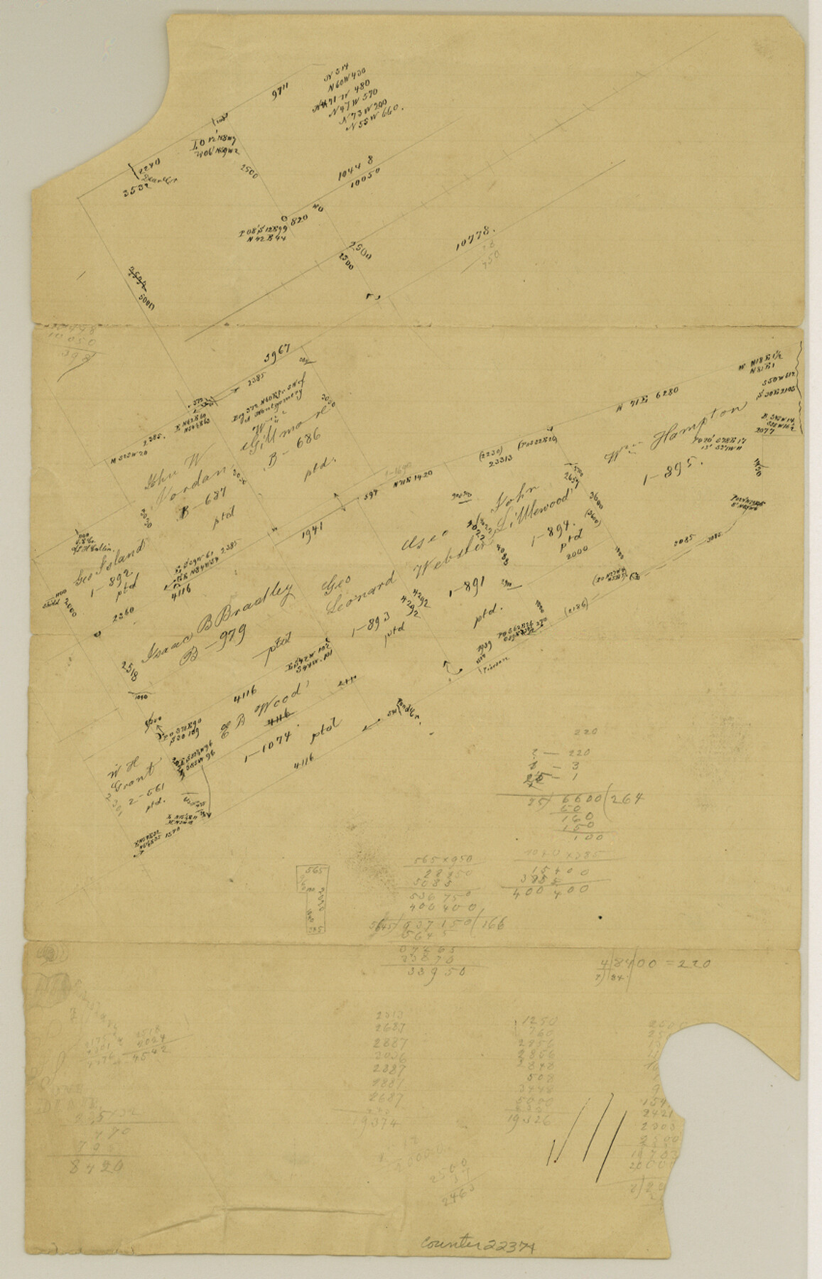
Falls County Sketch File 16
[Sketch regarding the Jose Maria Sanches 1 1/4 league grant, west of the Brazos]
-
Map/Doc
22374
-
Collection
General Map Collection
-
Counties
Falls
-
Subjects
Surveying Sketch File
-
Height x Width
13.3 x 8.5 inches
33.8 x 21.6 cm
-
Medium
paper, manuscript
-
Features
[Brazos River]
Part of: General Map Collection
Kerr County Rolled Sketch 19

Print $20.00
- Digital $50.00
Kerr County Rolled Sketch 19
1954
Size 43.4 x 28.4 inches
Map/Doc 6501
Loving County Working Sketch 10

Print $20.00
- Digital $50.00
Loving County Working Sketch 10
1952
Size 20.0 x 37.4 inches
Map/Doc 70642
Upshur County Sketch File 5

Print $4.00
- Digital $50.00
Upshur County Sketch File 5
1855
Size 8.3 x 12.9 inches
Map/Doc 38740
Lynn County Rolled Sketch S

Print $20.00
- Digital $50.00
Lynn County Rolled Sketch S
Size 21.1 x 38.7 inches
Map/Doc 6654
Kimble County Working Sketch 80

Print $20.00
- Digital $50.00
Kimble County Working Sketch 80
1971
Size 32.3 x 24.3 inches
Map/Doc 70148
Lavaca County Sketch File 9

Print $22.00
- Digital $50.00
Lavaca County Sketch File 9
Size 7.2 x 13.4 inches
Map/Doc 29646
Coast Chart No. 212 - From Latitude 26° 33' to the Rio Grande Texas

Print $20.00
- Digital $50.00
Coast Chart No. 212 - From Latitude 26° 33' to the Rio Grande Texas
1886
Size 18.3 x 27.4 inches
Map/Doc 72825
Eastland County Working Sketch 40

Print $20.00
- Digital $50.00
Eastland County Working Sketch 40
1970
Size 27.9 x 26.0 inches
Map/Doc 68821
Upton County Working Sketch 58

Print $20.00
- Digital $50.00
Upton County Working Sketch 58
1988
Size 29.1 x 37.8 inches
Map/Doc 69555
Red River County Red River District

Print $20.00
- Digital $50.00
Red River County Red River District
1879
Size 24.9 x 21.8 inches
Map/Doc 3976
Garza County Sketch File H

Print $20.00
- Digital $50.00
Garza County Sketch File H
Size 43.1 x 38.7 inches
Map/Doc 10472
Nolan County Sketch File 8

Print $2.00
- Digital $50.00
Nolan County Sketch File 8
Size 11.3 x 8.8 inches
Map/Doc 32464
You may also like
Medina County Sketch File 19

Print $20.00
- Digital $50.00
Medina County Sketch File 19
1989
Size 32.5 x 21.0 inches
Map/Doc 12071
Shelby County Working Sketch 21

Print $20.00
- Digital $50.00
Shelby County Working Sketch 21
1981
Size 31.0 x 23.3 inches
Map/Doc 63874
Orange County Working Sketch 15

Print $20.00
- Digital $50.00
Orange County Working Sketch 15
1928
Size 19.3 x 24.6 inches
Map/Doc 71347
[G. W. Carlisle Waco Manufacturing Co. Block 1]
![90669, [G. W. Carlisle Waco Manufacturing Co. Block 1], Twichell Survey Records](https://historictexasmaps.com/wmedia_w700/maps/90669-1.tif.jpg)
Print $2.00
- Digital $50.00
[G. W. Carlisle Waco Manufacturing Co. Block 1]
Size 8.4 x 10.9 inches
Map/Doc 90669
Williamson County Sketch File 16

Print $20.00
- Digital $50.00
Williamson County Sketch File 16
Size 16.8 x 25.5 inches
Map/Doc 12693
Hays County Working Sketch 16

Print $20.00
- Digital $50.00
Hays County Working Sketch 16
1970
Size 34.3 x 38.0 inches
Map/Doc 66090
Portions of Galveston and East Bays and the Gulf of Mexico in Galveston County, showing Subdivision for Mineral Development

Print $20.00
- Digital $50.00
Portions of Galveston and East Bays and the Gulf of Mexico in Galveston County, showing Subdivision for Mineral Development
1978
Size 38.1 x 25.8 inches
Map/Doc 1904
Winkler County

Print $20.00
- Digital $50.00
Winkler County
1932
Size 39.4 x 39.5 inches
Map/Doc 63132
Travis County Rolled Sketch 47

Print $40.00
- Digital $50.00
Travis County Rolled Sketch 47
1923
Size 57.3 x 26.5 inches
Map/Doc 10626
[Southeast part of County near Jas. H. Price Survey]
![91888, [Southeast part of County near Jas. H. Price Survey], Twichell Survey Records](https://historictexasmaps.com/wmedia_w700/maps/91888-1.tif.jpg)
Print $20.00
- Digital $50.00
[Southeast part of County near Jas. H. Price Survey]
Size 19.3 x 19.3 inches
Map/Doc 91888
Sketch of surveys in Dimmit, Maverick and Webb Cos.

Print $20.00
- Digital $50.00
Sketch of surveys in Dimmit, Maverick and Webb Cos.
1876
Size 17.9 x 14.7 inches
Map/Doc 5050
Platt [sic] of Late Surveys on Carancahua, Jackson County
![78360, Platt [sic] of Late Surveys on Carancahua, Jackson County, General Map Collection](https://historictexasmaps.com/wmedia_w700/maps/78360.tif.jpg)
Print $2.00
- Digital $50.00
Platt [sic] of Late Surveys on Carancahua, Jackson County
Size 10.9 x 8.0 inches
Map/Doc 78360