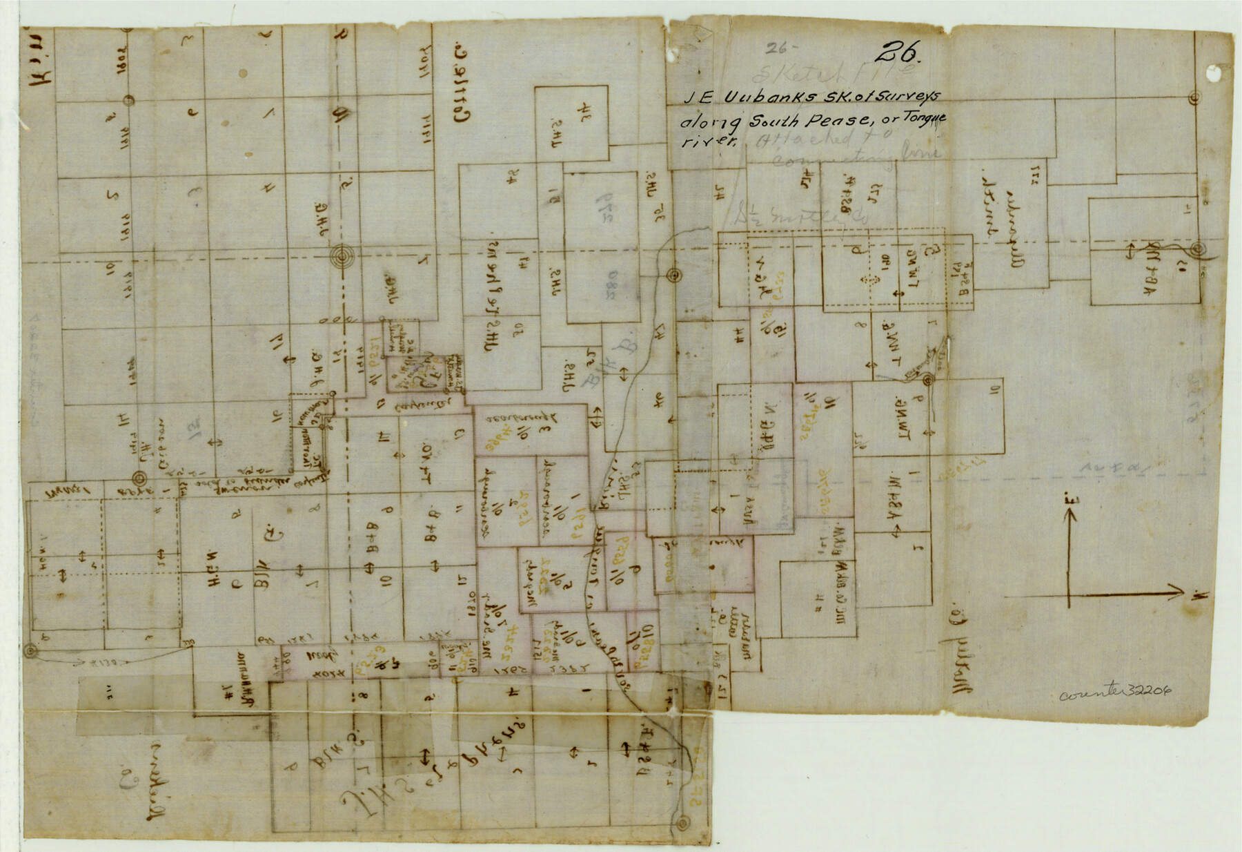
Motley County Sketch File 26 (S)
[Sketch of surveys along South Pease or Tongue River]
-
Map/Doc
32206
-
Collection
General Map Collection
-
People and Organizations
J.E. Eubanks (Surveyor/Engineer)
-
Counties
Motley Cottle Dickens King
-
Subjects
Surveying Sketch File
-
Height x Width
10.7 x 15.6 inches
27.2 x 39.6 cm
-
Medium
paper, manuscript
-
Features
Salt Creek
Tanmantes [?] Creek
South Pease River
Tongue River
Part of: General Map Collection
Maverick County Sketch File 18

Print $14.00
- Digital $50.00
Maverick County Sketch File 18
1886
Size 12.8 x 8.1 inches
Map/Doc 31121
Limestone County Working Sketch 22

Print $40.00
- Digital $50.00
Limestone County Working Sketch 22
1980
Size 43.3 x 60.2 inches
Map/Doc 70572
Jefferson County Sketch File 4

Print $4.00
- Digital $50.00
Jefferson County Sketch File 4
Size 13.0 x 8.3 inches
Map/Doc 28101
Flight Mission No. CGI-4N, Frame 185, Cameron County

Print $20.00
- Digital $50.00
Flight Mission No. CGI-4N, Frame 185, Cameron County
1955
Size 18.6 x 22.3 inches
Map/Doc 84688
Bandera County Working Sketch 34

Print $20.00
- Digital $50.00
Bandera County Working Sketch 34
1963
Size 36.5 x 29.2 inches
Map/Doc 67630
[Sketches in McMullen County, San Patricio District]
![69747, [Sketches in McMullen County, San Patricio District], General Map Collection](https://historictexasmaps.com/wmedia_w700/maps/69747.tif.jpg)
Print $2.00
- Digital $50.00
[Sketches in McMullen County, San Patricio District]
1842
Size 10.5 x 8.0 inches
Map/Doc 69747
Brazoria County NRC Article 33.136 Sketch 11

Print $24.00
- Digital $50.00
Brazoria County NRC Article 33.136 Sketch 11
2012
Size 24.0 x 18.0 inches
Map/Doc 94777
McMullen County Working Sketch 23

Print $20.00
- Digital $50.00
McMullen County Working Sketch 23
1950
Size 37.6 x 33.2 inches
Map/Doc 70724
Kleberg County Rolled Sketch 10

Print $20.00
- Digital $50.00
Kleberg County Rolled Sketch 10
1952
Size 42.8 x 37.3 inches
Map/Doc 9397
Irion County Rolled Sketch 18C

Print $40.00
- Digital $50.00
Irion County Rolled Sketch 18C
Size 84.7 x 45.5 inches
Map/Doc 9254
Flight Mission No. DQO-8K, Frame 88, Galveston County

Print $20.00
- Digital $50.00
Flight Mission No. DQO-8K, Frame 88, Galveston County
1952
Size 18.7 x 22.4 inches
Map/Doc 85190
Tom Green County Sketch File 79A

Print $4.00
- Digital $50.00
Tom Green County Sketch File 79A
1970
Size 14.5 x 8.8 inches
Map/Doc 38258
You may also like
Louisiana and Texas Intracoastal Waterway, Section 7, Galveston Bay to Brazos River and Section 8, Brazos River to Matagorda Bay

Print $20.00
- Digital $50.00
Louisiana and Texas Intracoastal Waterway, Section 7, Galveston Bay to Brazos River and Section 8, Brazos River to Matagorda Bay
1929
Size 30.8 x 43.0 inches
Map/Doc 61842
Plat Showing the Construction of Texas & Pacific Ry. Co. Blocks 3 & 4 As Located by G. A. Lider

Print $40.00
- Digital $50.00
Plat Showing the Construction of Texas & Pacific Ry. Co. Blocks 3 & 4 As Located by G. A. Lider
1913
Size 51.4 x 36.3 inches
Map/Doc 89931
Duval County Boundary File 1b

Print $48.00
- Digital $50.00
Duval County Boundary File 1b
1877
Size 12.6 x 8.0 inches
Map/Doc 52679
Flight Mission No. DAH-17M, Frame 30, Orange County

Print $20.00
- Digital $50.00
Flight Mission No. DAH-17M, Frame 30, Orange County
1953
Size 18.7 x 22.5 inches
Map/Doc 86893

Map of Swisher County

Print $40.00
- Digital $50.00
Map of Swisher County
1900
Size 48.5 x 41.1 inches
Map/Doc 16890
Jasper County Sketch File 7

Print $22.00
- Digital $50.00
Jasper County Sketch File 7
Size 12.4 x 15.4 inches
Map/Doc 27775

Hunt County Rolled Sketch 1

Print $20.00
- Digital $50.00
Hunt County Rolled Sketch 1
Size 28.3 x 18.4 inches
Map/Doc 6266
Burnet County Working Sketch 16

Print $20.00
- Digital $50.00
Burnet County Working Sketch 16
1979
Size 22.8 x 32.5 inches
Map/Doc 67859
Sabine River, Rocky Ford Crossing Sheet/Cowleach Fork of the Sabine River

Print $20.00
- Digital $50.00
Sabine River, Rocky Ford Crossing Sheet/Cowleach Fork of the Sabine River
1936
Size 38.9 x 29.2 inches
Map/Doc 65144
Reconnoissance of Sabine River and Valley
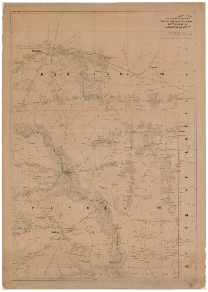
Print $20.00
Reconnoissance of Sabine River and Valley
1863
Size 42.5 x 30.3 inches
Map/Doc 97500