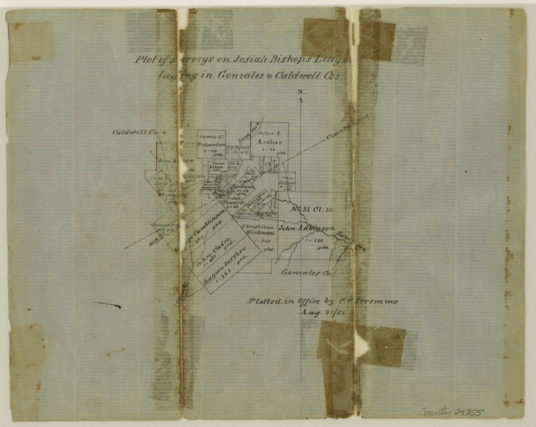
Gonzales County Sketch File 1
Surveys on J. Bishop's League
-
Map/Doc
24355
-
Collection
General Map Collection
-
Object Dates
1858/8/31 (Creation Date)
1858/8/31 (File Date)
1858 (Survey Date)
-
People and Organizations
C.C. Stremme (Draftsman)
-
Counties
Gonzales Caldwell
-
Subjects
Surveying Sketch File
-
Height x Width
8.1 x 10.2 inches
20.6 x 25.9 cm
-
Medium
paper, manuscript
-
Features
Sandy Fork of Sandy Creek
Mule Creek
Part of: General Map Collection
Trinity River, Barnes Bridge Sheet/East Fork of Trinity River

Print $4.00
- Digital $50.00
Trinity River, Barnes Bridge Sheet/East Fork of Trinity River
1936
Size 29.5 x 22.7 inches
Map/Doc 65192
Webb County Sketch File 3-1

Print $20.00
- Digital $50.00
Webb County Sketch File 3-1
1875
Size 28.0 x 22.8 inches
Map/Doc 12614
Flight Mission No. CUG-1P, Frame 5, Kleberg County

Print $20.00
- Digital $50.00
Flight Mission No. CUG-1P, Frame 5, Kleberg County
1956
Size 18.8 x 22.5 inches
Map/Doc 86108
Harris County NRC Article 33.136 Sketch 11

Print $28.00
- Digital $50.00
Harris County NRC Article 33.136 Sketch 11
2007
Size 24.0 x 36.0 inches
Map/Doc 94658
University Lands Blocks 38 to 57, Crockett-Reagan-Irion-Schleicher-Counties

Print $40.00
- Digital $50.00
University Lands Blocks 38 to 57, Crockett-Reagan-Irion-Schleicher-Counties
Size 35.1 x 53.6 inches
Map/Doc 62945
Amistad International Reservoir on Rio Grande 70a

Print $20.00
- Digital $50.00
Amistad International Reservoir on Rio Grande 70a
1949
Size 28.5 x 39.5 inches
Map/Doc 73357
Coryell County Sketch File 17 1/4

Print $4.00
- Digital $50.00
Coryell County Sketch File 17 1/4
Size 8.7 x 14.9 inches
Map/Doc 19377
Bowie County Sketch File 10

Print $8.00
- Digital $50.00
Bowie County Sketch File 10
1992
Size 11.1 x 8.8 inches
Map/Doc 14912
Flight Mission No. CRC-2R, Frame 182, Chambers County

Print $20.00
- Digital $50.00
Flight Mission No. CRC-2R, Frame 182, Chambers County
1956
Size 18.6 x 22.4 inches
Map/Doc 84760
Lamb County Rolled Sketch 10

Print $40.00
- Digital $50.00
Lamb County Rolled Sketch 10
1912
Size 31.7 x 70.6 inches
Map/Doc 9418
Flight Mission No. BRA-7M, Frame 4, Jefferson County

Print $20.00
- Digital $50.00
Flight Mission No. BRA-7M, Frame 4, Jefferson County
1953
Size 18.7 x 22.2 inches
Map/Doc 85455
Haskell County Sketch File 10

Print $8.00
- Digital $50.00
Haskell County Sketch File 10
Size 13.0 x 8.2 inches
Map/Doc 26136
You may also like
Oldham County Boundary File 1

Print $6.00
- Digital $50.00
Oldham County Boundary File 1
Size 8.8 x 7.2 inches
Map/Doc 57731
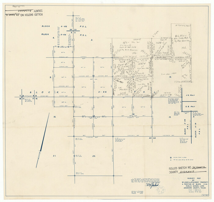
Andrews County Rolled Sketch 34
Print $20.00
- Digital $50.00
Andrews County Rolled Sketch 34
1955
Size 16.4 x 17.3 inches
Map/Doc 8916

Bandera County Sketch File 33

Print $40.00
- Digital $50.00
Bandera County Sketch File 33
1975
Size 14.4 x 17.5 inches
Map/Doc 14028
Bravo Deed, Instrument 24, Tract A and Tract B

Print $3.00
- Digital $50.00
Bravo Deed, Instrument 24, Tract A and Tract B
Size 11.4 x 14.2 inches
Map/Doc 91479
Potter County Boundary File 3b

Print $12.00
- Digital $50.00
Potter County Boundary File 3b
Size 9.8 x 6.4 inches
Map/Doc 57979
Intracoastal Waterway in Texas - Corpus Christi to Point Isabel including Arroyo Colorado to Mo. Pac. R.R. Bridge Near Harlingen

Print $20.00
- Digital $50.00
Intracoastal Waterway in Texas - Corpus Christi to Point Isabel including Arroyo Colorado to Mo. Pac. R.R. Bridge Near Harlingen
1933
Size 27.7 x 40.9 inches
Map/Doc 61859
Edwards County Rolled Sketch 30

Print $20.00
- Digital $50.00
Edwards County Rolled Sketch 30
1980
Size 31.6 x 44.0 inches
Map/Doc 8848
Stonewall County Sketch File 23

Print $6.00
- Digital $50.00
Stonewall County Sketch File 23
1951
Size 11.3 x 8.9 inches
Map/Doc 37293
Terrell County Working Sketch 7

Print $20.00
- Digital $50.00
Terrell County Working Sketch 7
1915
Size 42.2 x 31.3 inches
Map/Doc 62156
Presidio County Working Sketch 50

Print $20.00
- Digital $50.00
Presidio County Working Sketch 50
1953
Size 45.2 x 41.5 inches
Map/Doc 71727
The Republic County of Shelby. December 14, 1837

Print $20.00
The Republic County of Shelby. December 14, 1837
2020
Size 21.1 x 21.7 inches
Map/Doc 96279