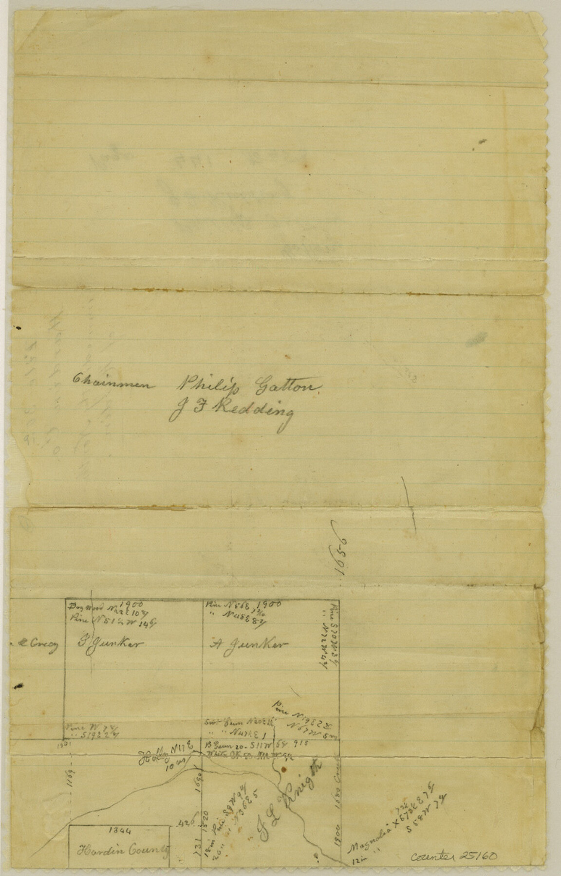
Hardin County Sketch File 30a
[Sketch immediately north of Hardin]
-
Map/Doc
25160
-
Collection
General Map Collection
-
People and Organizations
Philip Gatton (Chainman)
J.F. Redding (Chainman)
-
Counties
Hardin
-
Subjects
Surveying Sketch File
-
Height x Width
12.1 x 7.7 inches
30.7 x 19.6 cm
-
Medium
paper, manuscript
Part of: General Map Collection
Hardin County Working Sketch 39, part 2

Print $40.00
- Digital $50.00
Hardin County Working Sketch 39, part 2
1985
Size 36.0 x 48.5 inches
Map/Doc 63438
Travis County Appraisal District Plat Map 1_1808

Print $20.00
- Digital $50.00
Travis County Appraisal District Plat Map 1_1808
Size 21.5 x 26.5 inches
Map/Doc 94214
Montgomery County

Print $20.00
- Digital $50.00
Montgomery County
1901
Size 42.2 x 47.4 inches
Map/Doc 66939
Hood County Working Sketch 28

Print $20.00
- Digital $50.00
Hood County Working Sketch 28
1995
Size 17.5 x 11.4 inches
Map/Doc 66222
El Paso County

Print $40.00
- Digital $50.00
El Paso County
1881
Size 52.0 x 36.8 inches
Map/Doc 89059
Matagorda Light to Aransas Pass

Print $20.00
- Digital $50.00
Matagorda Light to Aransas Pass
1972
Size 35.9 x 44.8 inches
Map/Doc 73400
Wise County Working Sketch 10

Print $20.00
- Digital $50.00
Wise County Working Sketch 10
Size 17.4 x 18.4 inches
Map/Doc 72624
Houston County Sketch File 1b

Print $4.00
- Digital $50.00
Houston County Sketch File 1b
1857
Size 8.5 x 7.9 inches
Map/Doc 26744
Burleson County Working Sketch 42

Print $20.00
- Digital $50.00
Burleson County Working Sketch 42
1953
Size 41.6 x 33.6 inches
Map/Doc 67761
Presidio County Working Sketch 7

Print $20.00
- Digital $50.00
Presidio County Working Sketch 7
1926
Size 35.0 x 40.0 inches
Map/Doc 71681
Gillespie County Boundary File 5

Print $10.00
- Digital $50.00
Gillespie County Boundary File 5
Size 14.2 x 9.0 inches
Map/Doc 53764
Flight Mission No. DQO-8K, Frame 42, Galveston County

Print $20.00
- Digital $50.00
Flight Mission No. DQO-8K, Frame 42, Galveston County
1952
Size 18.5 x 22.3 inches
Map/Doc 85149
You may also like

Carte Geo-Hydrographique du Golfe du Mexique et de ses Isles construite d'après les mémoires les plus recens, et assujeties, pour l'emplacement de ces principales positions aux latitudes et longitudes

Print $20.00
- Digital $50.00
Carte Geo-Hydrographique du Golfe du Mexique et de ses Isles construite d'après les mémoires les plus recens, et assujeties, pour l'emplacement de ces principales positions aux latitudes et longitudes
1771
Size 15.0 x 20.5 inches
Map/Doc 94108
Sutton County Working Sketch 46

Print $40.00
- Digital $50.00
Sutton County Working Sketch 46
1953
Size 48.4 x 27.1 inches
Map/Doc 62389
Red River County Working Sketch 3

Print $20.00
- Digital $50.00
Red River County Working Sketch 3
1919
Size 14.2 x 12.8 inches
Map/Doc 71986
Flight Mission No. CRK-7P, Frame 26, Refugio County

Print $20.00
- Digital $50.00
Flight Mission No. CRK-7P, Frame 26, Refugio County
1956
Size 18.3 x 22.1 inches
Map/Doc 86946
Map of Ramon Musquiz Survey, Meanders of Lavaca & Navidad Rivers, Menefee & Redfish Lakes

Print $20.00
- Digital $50.00
Map of Ramon Musquiz Survey, Meanders of Lavaca & Navidad Rivers, Menefee & Redfish Lakes
1934
Size 24.4 x 18.0 inches
Map/Doc 65453
General Highway Map, Yoakum County Texas

Print $20.00
- Digital $50.00
General Highway Map, Yoakum County Texas
1952
Size 26.3 x 19.1 inches
Map/Doc 92815
Flight Mission No. CRE-1R, Frame 135, Jackson County

Print $20.00
- Digital $50.00
Flight Mission No. CRE-1R, Frame 135, Jackson County
1956
Size 16.2 x 15.8 inches
Map/Doc 85343
Henderson County Sketch File 17

Print $40.00
- Digital $50.00
Henderson County Sketch File 17
Size 14.2 x 14.6 inches
Map/Doc 26361
Map of the N. Orleans, Mobile and Texas Railroad and Connections

Print $20.00
- Digital $50.00
Map of the N. Orleans, Mobile and Texas Railroad and Connections
1871
Size 8.9 x 11.1 inches
Map/Doc 96611
Hemphill County Working Sketch 21

Print $40.00
- Digital $50.00
Hemphill County Working Sketch 21
1973
Size 79.0 x 32.6 inches
Map/Doc 66116
Shelby County Working Sketch 9

Print $20.00
- Digital $50.00
Shelby County Working Sketch 9
1945
Size 30.8 x 28.5 inches
Map/Doc 63862