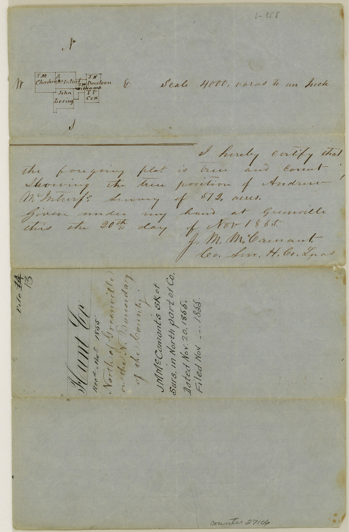
Hunt County Sketch File 13
[Sketch of surveys in north part of county]
-
Map/Doc
27106
-
Collection
General Map Collection
-
Object Dates
11/1855 (File Date)
11/20/1855 (Creation Date)
-
People and Organizations
J.M. McCamant (Surveyor/Engineer)
-
Counties
Hunt
-
Subjects
Surveying Sketch File
-
Height x Width
12.4 x 8.1 inches
31.5 x 20.6 cm
-
Medium
paper, manuscript
-
Scale
1:4000
Part of: General Map Collection
Irion County Working Sketch 11

Print $20.00
- Digital $50.00
Irion County Working Sketch 11
1959
Size 43.6 x 30.6 inches
Map/Doc 66420
Map of Texas and the countries adjacent compiled in the Bureau of the Corps of Topographical Engineers from the best authorities for the State Department

Print $20.00
- Digital $50.00
Map of Texas and the countries adjacent compiled in the Bureau of the Corps of Topographical Engineers from the best authorities for the State Department
1844
Size 26.1 x 18.2 inches
Map/Doc 72715
Flight Mission No. DJV-3P, Frame 13, Ellis County

Print $20.00
- Digital $50.00
Flight Mission No. DJV-3P, Frame 13, Ellis County
1956
Size 18.6 x 22.2 inches
Map/Doc 84975
Flight Mission No. DIX-10P, Frame 169, Aransas County

Print $20.00
- Digital $50.00
Flight Mission No. DIX-10P, Frame 169, Aransas County
1956
Size 18.7 x 22.3 inches
Map/Doc 83959
Map of Montague County

Print $20.00
- Digital $50.00
Map of Montague County
1868
Size 19.9 x 16.9 inches
Map/Doc 3888
Fort Bend County Sketch File 8

Print $6.00
- Digital $50.00
Fort Bend County Sketch File 8
Size 6.3 x 4.2 inches
Map/Doc 22894
Brewster County Working Sketch 49

Print $20.00
- Digital $50.00
Brewster County Working Sketch 49
1949
Size 37.1 x 22.6 inches
Map/Doc 67583
Terrell County Working Sketch 15

Print $20.00
- Digital $50.00
Terrell County Working Sketch 15
1927
Size 18.7 x 19.8 inches
Map/Doc 62164
Flight Mission No. BQR-12K, Frame 50, Brazoria County

Print $20.00
- Digital $50.00
Flight Mission No. BQR-12K, Frame 50, Brazoria County
1952
Size 18.7 x 22.4 inches
Map/Doc 84065
Brown County Working Sketch 7

Print $20.00
- Digital $50.00
Brown County Working Sketch 7
1954
Size 26.5 x 28.7 inches
Map/Doc 67772
Wichita County Working Sketch 16

Print $20.00
- Digital $50.00
Wichita County Working Sketch 16
1939
Size 21.4 x 34.7 inches
Map/Doc 72526
Concho County Sketch File 2

Print $4.00
- Digital $50.00
Concho County Sketch File 2
1859
Size 10.5 x 8.5 inches
Map/Doc 19122
You may also like
Current Miscellaneous File 94

Print $3.00
- Digital $50.00
Current Miscellaneous File 94
1851
Size 11.2 x 17.1 inches
Map/Doc 74268
Dickens County Rolled Sketch 7

Print $20.00
- Digital $50.00
Dickens County Rolled Sketch 7
1947
Size 33.6 x 23.6 inches
Map/Doc 5706
The Republic County of Matagorda. December 24, 1844

Print $20.00
The Republic County of Matagorda. December 24, 1844
2020
Size 21.0 x 21.7 inches
Map/Doc 96223
Brewster County Rolled Sketch 136

Print $20.00
- Digital $50.00
Brewster County Rolled Sketch 136
Size 21.4 x 13.2 inches
Map/Doc 5304
"Texas New Yorker's" Railroad Map of Texas

Print $20.00
"Texas New Yorker's" Railroad Map of Texas
1874
Size 22.8 x 32.3 inches
Map/Doc 76210

Cass County Sketch File 16

Print $4.00
- Digital $50.00
Cass County Sketch File 16
Size 8.5 x 12.8 inches
Map/Doc 17416
Borden County Sketch File 4a

Print $40.00
- Digital $50.00
Borden County Sketch File 4a
Size 27.1 x 18.1 inches
Map/Doc 10934
Robertson County Working Sketch 14

Print $40.00
- Digital $50.00
Robertson County Working Sketch 14
1988
Size 48.6 x 39.6 inches
Map/Doc 63587
Sutton County Boundary File 4

Print $20.00
- Digital $50.00
Sutton County Boundary File 4
Size 14.2 x 8.8 inches
Map/Doc 59035
Sketch Showing Original Corners Affecting Block I and Adjacent Surveys from Actual Connections by W. D. Twichell

Print $20.00
- Digital $50.00
Sketch Showing Original Corners Affecting Block I and Adjacent Surveys from Actual Connections by W. D. Twichell
Size 23.6 x 24.5 inches
Map/Doc 90156
Flight Mission No. BQY-4M, Frame 33, Harris County

Print $20.00
- Digital $50.00
Flight Mission No. BQY-4M, Frame 33, Harris County
1953
Size 18.7 x 22.4 inches
Map/Doc 85248