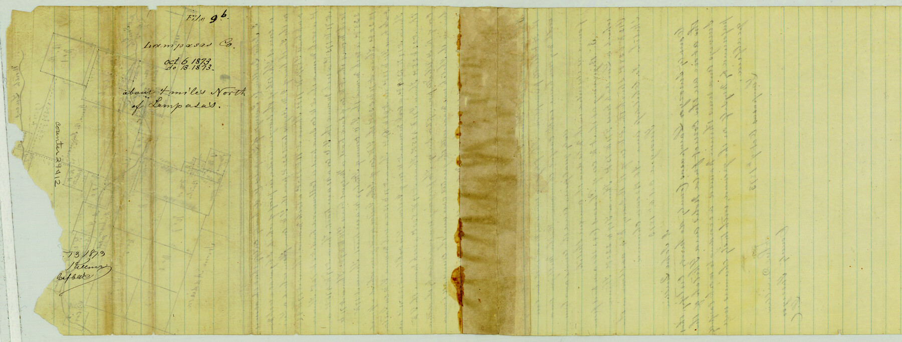
Lampasas County Sketch File 9b
[Sketch of area north of Lampasas near Little Lucy Creek]
-
Map/Doc
29412
-
Collection
General Map Collection
-
Object Dates
10/9/1873 (Creation Date)
10/13/1873 (File Date)
10/6/1873 (Survey Date)
-
People and Organizations
John Quillin (Surveyor/Engineer)
-
Counties
Lampasas
-
Subjects
Surveying Sketch File
-
Height x Width
7.6 x 20.1 inches
19.3 x 51.1 cm
-
Medium
paper, manuscript
Part of: General Map Collection
Index Map No. 1 - Rio Bravo del Norte section of boundary between the United States & Mexico; agreed upon by the Joint Commission under the Treaty of Guadalupe Hidalgo

Print $20.00
- Digital $50.00
Index Map No. 1 - Rio Bravo del Norte section of boundary between the United States & Mexico; agreed upon by the Joint Commission under the Treaty of Guadalupe Hidalgo
1852
Size 18.3 x 27.5 inches
Map/Doc 72862
Hopkins County Sketch File 4

Print $47.00
- Digital $50.00
Hopkins County Sketch File 4
Size 21.2 x 18.4 inches
Map/Doc 4565
Falls County Sketch File 33

Print $4.00
- Digital $50.00
Falls County Sketch File 33
1873
Size 10.3 x 8.3 inches
Map/Doc 22441
Flight Mission No. BRE-2P, Frame 39, Nueces County

Print $20.00
- Digital $50.00
Flight Mission No. BRE-2P, Frame 39, Nueces County
1956
Size 18.6 x 22.4 inches
Map/Doc 86741
Presidio County Rolled Sketch 105A

Print $40.00
- Digital $50.00
Presidio County Rolled Sketch 105A
1962
Size 66.8 x 45.7 inches
Map/Doc 9787
Martin County Boundary File 1

Print $10.00
- Digital $50.00
Martin County Boundary File 1
Size 11.2 x 8.7 inches
Map/Doc 56757
Harris County Sketch File 74

Print $22.00
- Digital $50.00
Harris County Sketch File 74
1944
Size 17.1 x 12.2 inches
Map/Doc 25543
Brazoria County Boundary File 2

Print $140.00
- Digital $50.00
Brazoria County Boundary File 2
Size 12.8 x 9.8 inches
Map/Doc 50704
Milam County Rolled Sketch 3A

Print $40.00
- Digital $50.00
Milam County Rolled Sketch 3A
1967
Size 49.1 x 38.8 inches
Map/Doc 43048
Shelby County Working Sketch 19

Print $20.00
- Digital $50.00
Shelby County Working Sketch 19
1969
Size 36.9 x 30.2 inches
Map/Doc 63872
Gray County Boundary File 3a

Print $4.00
- Digital $50.00
Gray County Boundary File 3a
Size 14.2 x 8.8 inches
Map/Doc 53874
Flight Mission No. BRA-7M, Frame 196, Jefferson County

Print $20.00
- Digital $50.00
Flight Mission No. BRA-7M, Frame 196, Jefferson County
1953
Size 18.5 x 22.3 inches
Map/Doc 85564
You may also like
Bastrop County Boundary File 6

Print $20.00
- Digital $50.00
Bastrop County Boundary File 6
Size 8.8 x 7.9 inches
Map/Doc 50337
Johnson County

Print $20.00
- Digital $50.00
Johnson County
1874
Size 19.9 x 18.0 inches
Map/Doc 3736
Pecos County Sketch File 30

Print $20.00
- Digital $50.00
Pecos County Sketch File 30
Size 28.9 x 22.0 inches
Map/Doc 12172
Lubbock County

Print $20.00
- Digital $50.00
Lubbock County
1968
Size 43.5 x 35.4 inches
Map/Doc 77359
The Republic County of Victoria. February 2, 1842

Print $20.00
The Republic County of Victoria. February 2, 1842
2020
Size 24.3 x 21.7 inches
Map/Doc 96299
Starr County Sketch File 27

Print $20.00
- Digital $50.00
Starr County Sketch File 27
1930
Size 22.2 x 34.0 inches
Map/Doc 12333
Tom Green County Rolled Sketch 6

Print $20.00
- Digital $50.00
Tom Green County Rolled Sketch 6
Size 21.6 x 17.1 inches
Map/Doc 7995
Matagorda County Sketch File 14

Print $40.00
- Digital $50.00
Matagorda County Sketch File 14
Size 13.5 x 14.8 inches
Map/Doc 30772
Map Showing the Relative Positions of the Various Surveys Delineated Thereon

Print $20.00
- Digital $50.00
Map Showing the Relative Positions of the Various Surveys Delineated Thereon
Size 23.0 x 18.6 inches
Map/Doc 91500

Orange County Sketch File 39

Print $20.00
- Digital $50.00
Orange County Sketch File 39
1964
Size 24.2 x 27.9 inches
Map/Doc 12127
Flight Mission No. DIX-3P, Frame 173, Aransas County

Print $20.00
- Digital $50.00
Flight Mission No. DIX-3P, Frame 173, Aransas County
1956
Size 17.8 x 17.9 inches
Map/Doc 83779