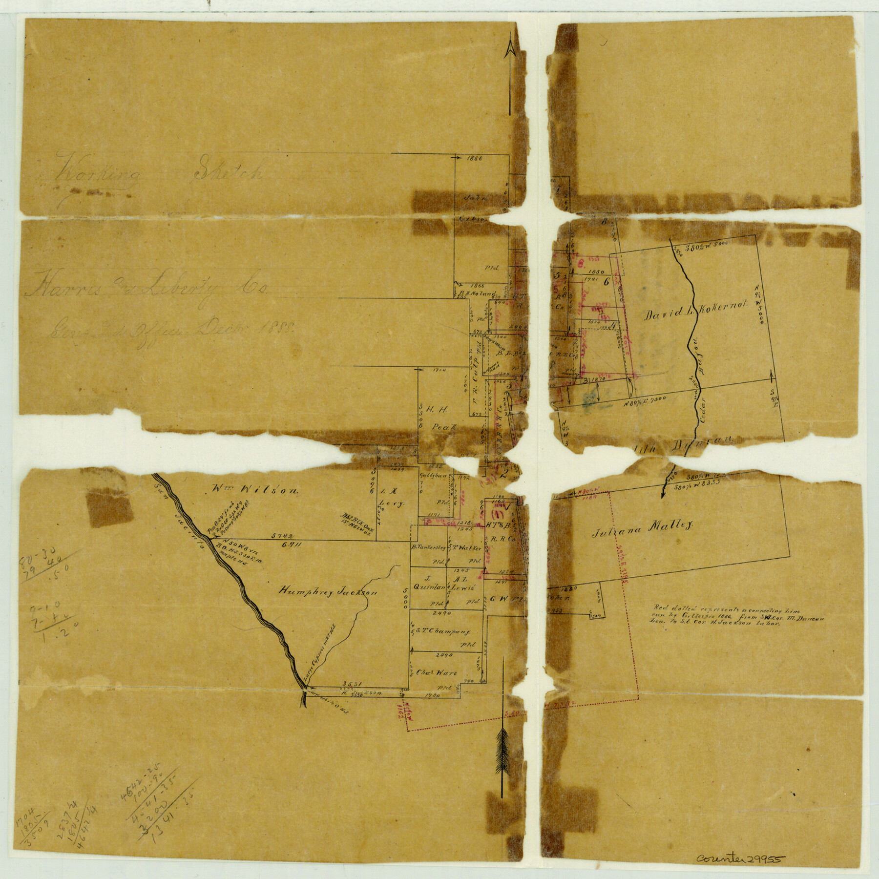
Liberty County Sketch File 29
[Office sketch of area between San Jacinto River and Cedar Bayou in Harris and Liberty Counties]
-
Map/Doc
29955
-
Collection
General Map Collection
-
Object Dates
12/1888 (Creation Date)
-
Counties
Liberty Harris
-
Subjects
Surveying Sketch File
-
Height x Width
14.9 x 14.9 inches
37.9 x 37.9 cm
-
Medium
paper, manuscript
Part of: General Map Collection
Wharton County Sketch File 11

Print $4.00
- Digital $50.00
Wharton County Sketch File 11
1891
Size 9.1 x 12.3 inches
Map/Doc 39933
Young County Boundary File 1

Print $8.00
- Digital $50.00
Young County Boundary File 1
Size 10.3 x 8.2 inches
Map/Doc 60198
San Saba County Sketch File 1

Print $46.00
- Digital $50.00
San Saba County Sketch File 1
1854
Size 9.1 x 7.8 inches
Map/Doc 36400
Haskell County Working Sketch 8

Print $20.00
- Digital $50.00
Haskell County Working Sketch 8
1957
Size 22.8 x 24.0 inches
Map/Doc 66066
Panola County Sketch File 26

Print $20.00
- Digital $50.00
Panola County Sketch File 26
1944
Size 28.5 x 27.1 inches
Map/Doc 12141
Brewster County Sketch File NS-X

Print $42.00
- Digital $50.00
Brewster County Sketch File NS-X
1882
Size 20.1 x 10.5 inches
Map/Doc 15943
Cass County Sketch File 5 1/2

Print $4.00
- Digital $50.00
Cass County Sketch File 5 1/2
1851
Size 6.1 x 8.5 inches
Map/Doc 17404
Terrell County Working Sketch 84b

Print $20.00
- Digital $50.00
Terrell County Working Sketch 84b
1992
Size 25.2 x 42.7 inches
Map/Doc 69606
Travis County Working Sketch 61

Print $20.00
- Digital $50.00
Travis County Working Sketch 61
1995
Size 20.9 x 24.7 inches
Map/Doc 69445
El Paso County

Print $40.00
- Digital $50.00
El Paso County
1881
Size 52.6 x 42.4 inches
Map/Doc 89058
Flight Mission No. DQO-3K, Frame 17, Galveston County

Print $20.00
- Digital $50.00
Flight Mission No. DQO-3K, Frame 17, Galveston County
1952
Size 18.9 x 22.5 inches
Map/Doc 85058
Lubbock County Working Sketch 5

Print $20.00
- Digital $50.00
Lubbock County Working Sketch 5
1950
Size 14.3 x 31.0 inches
Map/Doc 70665
You may also like
Flight Mission No. DCL-7C, Frame 48, Kenedy County

Print $20.00
- Digital $50.00
Flight Mission No. DCL-7C, Frame 48, Kenedy County
1943
Size 16.6 x 16.5 inches
Map/Doc 86036
Nueces County Sketch File A

Print $10.00
- Digital $50.00
Nueces County Sketch File A
1879
Size 14.9 x 10.3 inches
Map/Doc 32493
Tom Green County Boundary File 7

Print $10.00
- Digital $50.00
Tom Green County Boundary File 7
Size 14.5 x 9.2 inches
Map/Doc 59388
Starr County Rolled Sketch 15

Print $20.00
- Digital $50.00
Starr County Rolled Sketch 15
1913
Size 22.7 x 23.6 inches
Map/Doc 7800
Edwards County Sketch File 27

Print $6.00
- Digital $50.00
Edwards County Sketch File 27
1913
Size 10.5 x 16.5 inches
Map/Doc 21755
Parker County Working Sketch 19-1

Print $20.00
- Digital $50.00
Parker County Working Sketch 19-1
2004
Map/Doc 83579
Township 5 North Range 13 West, North Western District, Louisiana

Print $20.00
- Digital $50.00
Township 5 North Range 13 West, North Western District, Louisiana
1885
Size 19.8 x 24.7 inches
Map/Doc 65865
Exhibit A to the Surveyors Report, R.W. Lillard vs J.M. Taylor, et al

Print $20.00
- Digital $50.00
Exhibit A to the Surveyors Report, R.W. Lillard vs J.M. Taylor, et al
1881
Size 12.4 x 12.9 inches
Map/Doc 683
[Maps of surveys in Reeves & Culberson Cos]
![61131, [Maps of surveys in Reeves & Culberson Cos], General Map Collection](https://historictexasmaps.com/wmedia_w700/maps/61131.tif.jpg)
Print $20.00
- Digital $50.00
[Maps of surveys in Reeves & Culberson Cos]
1937
Size 30.6 x 24.8 inches
Map/Doc 61131
Callahan County Rolled Sketch 26

Print $20.00
- Digital $50.00
Callahan County Rolled Sketch 26
2010
Size 30.6 x 24.6 inches
Map/Doc 93453

Intracoastal Waterway in Texas - Corpus Christi to Point Isabel including Arroyo Colorado to Mo. Pac. R.R. Bridge Near Harlingen

Print $20.00
- Digital $50.00
Intracoastal Waterway in Texas - Corpus Christi to Point Isabel including Arroyo Colorado to Mo. Pac. R.R. Bridge Near Harlingen
1934
Size 21.6 x 32.7 inches
Map/Doc 61879