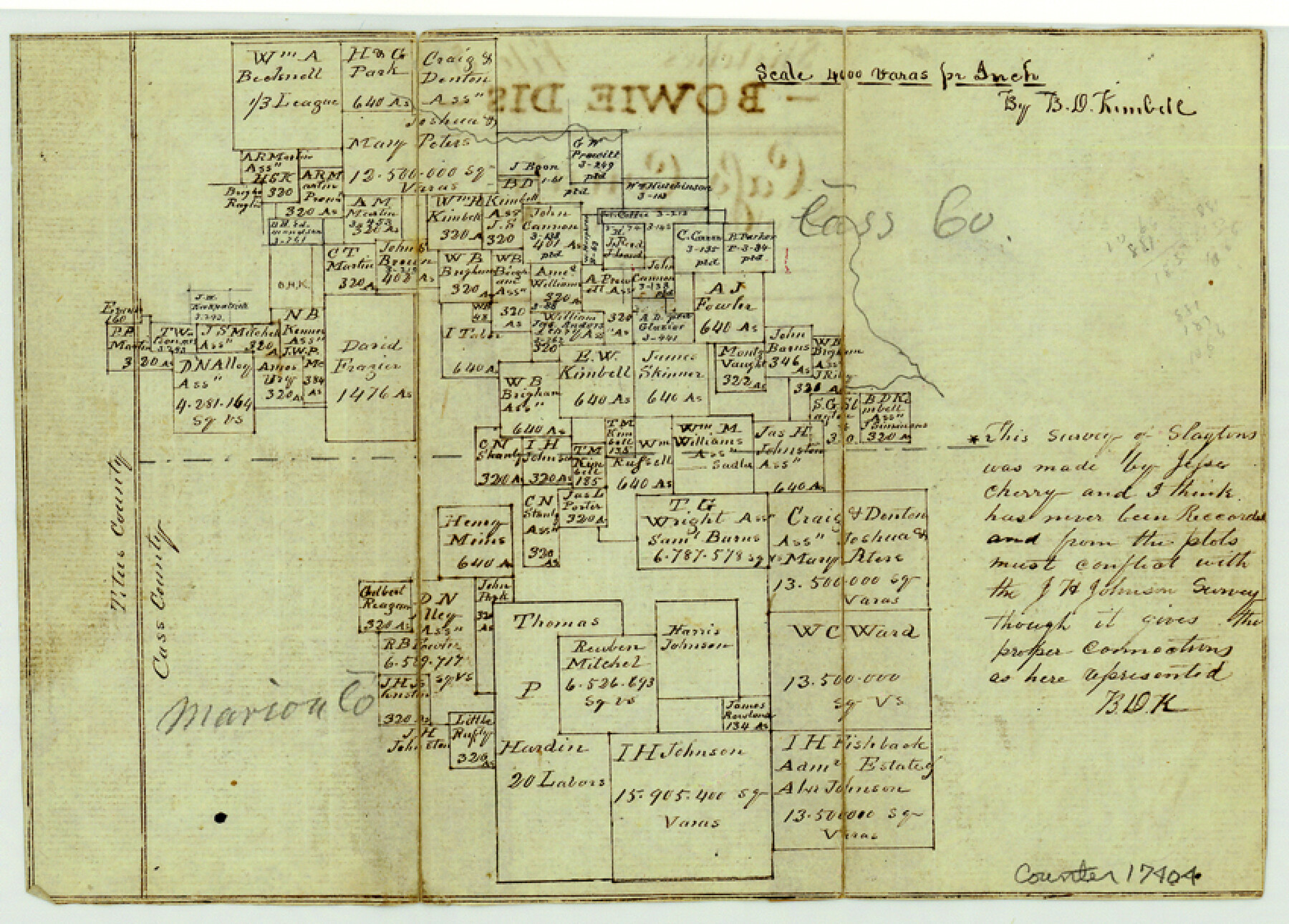
Cass County Sketch File 5 1/2
[Sketch of surveys in southwest corner of Cass County and northwest corner of Marion County]
-
Map/Doc
17404
-
Collection
General Map Collection
-
Object Dates
1851 (Creation Date)
1851 (File Date)
-
People and Organizations
B.D. Kimbell (Surveyor/Engineer)
-
Counties
Cass Marion Titus
-
Subjects
Surveying Sketch File
-
Height x Width
6.1 x 8.5 inches
15.5 x 21.6 cm
-
Medium
paper, manuscript
-
Scale
1" = 4000 varas
Part of: General Map Collection
Brewster County Rolled Sketch 112

Print $20.00
- Digital $50.00
Brewster County Rolled Sketch 112
1962
Size 28.9 x 25.7 inches
Map/Doc 5263
Taylor County Rolled Sketch 30A

Print $20.00
- Digital $50.00
Taylor County Rolled Sketch 30A
Size 17.5 x 11.3 inches
Map/Doc 76410
Val Verde County Working Sketch 83

Print $40.00
- Digital $50.00
Val Verde County Working Sketch 83
1973
Size 28.7 x 53.6 inches
Map/Doc 72218
Flight Mission No. DIX-10P, Frame 173, Aransas County

Print $20.00
- Digital $50.00
Flight Mission No. DIX-10P, Frame 173, Aransas County
1956
Size 18.5 x 22.3 inches
Map/Doc 83963
Flight Mission No. CRC-4R, Frame 109, Chambers County

Print $20.00
- Digital $50.00
Flight Mission No. CRC-4R, Frame 109, Chambers County
1956
Size 18.5 x 22.5 inches
Map/Doc 84906
Flight Mission No. CRC-4R, Frame 73, Chambers County

Print $20.00
- Digital $50.00
Flight Mission No. CRC-4R, Frame 73, Chambers County
1956
Size 18.7 x 22.5 inches
Map/Doc 84877
Zavala County Sketch File 46

Print $20.00
- Digital $50.00
Zavala County Sketch File 46
1937
Size 16.7 x 18.8 inches
Map/Doc 12734
Bandera County Working Sketch 43

Print $20.00
- Digital $50.00
Bandera County Working Sketch 43
1978
Size 27.7 x 31.6 inches
Map/Doc 67639
Dimmit County Working Sketch 29
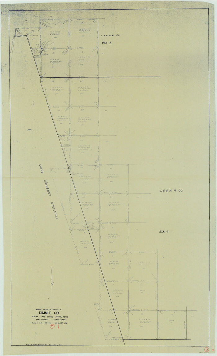
Print $40.00
- Digital $50.00
Dimmit County Working Sketch 29
1957
Size 58.1 x 36.2 inches
Map/Doc 68690
Upshur County Sketch File 13B

Print $20.00
- Digital $50.00
Upshur County Sketch File 13B
1936
Size 20.5 x 32.3 inches
Map/Doc 12504
Foard County Working Sketch 11

Print $20.00
- Digital $50.00
Foard County Working Sketch 11
1977
Size 26.7 x 35.6 inches
Map/Doc 69202
Burnet County Sketch File 28

Print $8.00
- Digital $50.00
Burnet County Sketch File 28
1874
Size 12.8 x 8.5 inches
Map/Doc 16740
You may also like
Jefferson County Sketch File 36

Print $12.00
- Digital $50.00
Jefferson County Sketch File 36
1914
Size 9.0 x 14.7 inches
Map/Doc 28207
Young County Working Sketch 4

Print $20.00
- Digital $50.00
Young County Working Sketch 4
1919
Size 14.8 x 13.4 inches
Map/Doc 62027
McMullen County Rolled Sketch 12

Print $20.00
- Digital $50.00
McMullen County Rolled Sketch 12
Size 26.5 x 33.2 inches
Map/Doc 6729
Wichita County Rolled Sketch 9

Print $20.00
- Digital $50.00
Wichita County Rolled Sketch 9
1917
Size 28.0 x 27.7 inches
Map/Doc 8246
Kaufman County

Print $40.00
- Digital $50.00
Kaufman County
1942
Size 50.0 x 41.0 inches
Map/Doc 95552
Crockett County Rolled Sketch 88M

Print $20.00
- Digital $50.00
Crockett County Rolled Sketch 88M
1964
Size 25.2 x 34.2 inches
Map/Doc 5629
Morris County Rolled Sketch 2A

Print $20.00
- Digital $50.00
Morris County Rolled Sketch 2A
Size 24.0 x 18.8 inches
Map/Doc 10240
General Highway Map, Robertson County, Texas

Print $20.00
General Highway Map, Robertson County, Texas
1940
Size 18.3 x 24.8 inches
Map/Doc 79230
Motley County Sketch File 11 (N)

Print $14.00
- Digital $50.00
Motley County Sketch File 11 (N)
1900
Size 11.1 x 8.6 inches
Map/Doc 32036
Ward County Rolled Sketch 24C

Print $40.00
- Digital $50.00
Ward County Rolled Sketch 24C
1967
Size 54.8 x 24.4 inches
Map/Doc 10114
Coke County Boundary File 6

Print $62.00
- Digital $50.00
Coke County Boundary File 6
Size 7.2 x 37.9 inches
Map/Doc 51615
Kimble County Working Sketch 4

Print $20.00
- Digital $50.00
Kimble County Working Sketch 4
1913
Size 26.8 x 21.7 inches
Map/Doc 70072