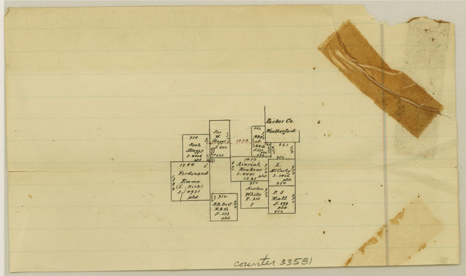
Parker County Sketch File 37
[Sketch of surveys immediately south and west of Weatherford]
-
Map/Doc
33581
-
Collection
General Map Collection
-
People and Organizations
Pressler (Surveyor/Engineer)
-
Counties
Parker
-
Subjects
Surveying Sketch File
-
Height x Width
4.8 x 8.1 inches
12.2 x 20.6 cm
-
Medium
paper, manuscript
Part of: General Map Collection
Controlled Mosaic by Jack Amman Photogrammetric Engineers, Inc - Sheet 22

Print $20.00
- Digital $50.00
Controlled Mosaic by Jack Amman Photogrammetric Engineers, Inc - Sheet 22
1954
Size 20.0 x 24.0 inches
Map/Doc 83471
Kimble County Working Sketch 32

Print $20.00
- Digital $50.00
Kimble County Working Sketch 32
1944
Size 22.6 x 16.0 inches
Map/Doc 70100
Stonewall County Working Sketch 2

Print $20.00
- Digital $50.00
Stonewall County Working Sketch 2
1915
Size 22.7 x 15.2 inches
Map/Doc 63996
Right of Way and Track Map International & Gt. Northern Ry. operated by the International & Gt. Northern Ry. Co., Columbia Branch, Gulf Division

Print $40.00
- Digital $50.00
Right of Way and Track Map International & Gt. Northern Ry. operated by the International & Gt. Northern Ry. Co., Columbia Branch, Gulf Division
1917
Size 25.1 x 56.4 inches
Map/Doc 64596
Plat Showing the Development of Texas Counties from the Original Land Districts

Print $40.00
- Digital $50.00
Plat Showing the Development of Texas Counties from the Original Land Districts
Size 49.6 x 29.5 inches
Map/Doc 73616
Harris County Sketch File 3

Print $4.00
- Digital $50.00
Harris County Sketch File 3
Size 7.0 x 6.2 inches
Map/Doc 25334
Angelina County Working Sketch 43

Print $20.00
- Digital $50.00
Angelina County Working Sketch 43
1963
Size 23.1 x 34.5 inches
Map/Doc 67126
Jeff Davis County Rolled Sketch 31

Print $20.00
- Digital $50.00
Jeff Davis County Rolled Sketch 31
1983
Size 40.6 x 44.1 inches
Map/Doc 9268
Jasper County

Print $40.00
- Digital $50.00
Jasper County
1946
Size 49.8 x 43.9 inches
Map/Doc 95542
Howard County Working Sketch 8

Print $20.00
- Digital $50.00
Howard County Working Sketch 8
1956
Size 25.3 x 31.3 inches
Map/Doc 66275
Harris County Historic Topographic 27

Print $20.00
- Digital $50.00
Harris County Historic Topographic 27
1915
Size 19.8 x 23.5 inches
Map/Doc 65838
Reeves County Sketch File 6

Print $20.00
- Digital $50.00
Reeves County Sketch File 6
Size 17.3 x 28.3 inches
Map/Doc 12242
You may also like
Outer Continental Shelf Leasing Maps (Texas Offshore Operations)

Print $20.00
- Digital $50.00
Outer Continental Shelf Leasing Maps (Texas Offshore Operations)
Size 13.4 x 19.8 inches
Map/Doc 75846
Map of Oregon, Kansas, California, and the Territories

Print $20.00
- Digital $50.00
Map of Oregon, Kansas, California, and the Territories
1885
Size 9.0 x 12.2 inches
Map/Doc 93522
Robertson County Working Sketch 1

Print $20.00
- Digital $50.00
Robertson County Working Sketch 1
1923
Size 26.2 x 36.6 inches
Map/Doc 63574
Liberty County Working Sketch Graphic Index - east part

Print $20.00
- Digital $50.00
Liberty County Working Sketch Graphic Index - east part
1977
Size 46.0 x 34.5 inches
Map/Doc 76620
Jefferson County Sketch File 36

Print $12.00
- Digital $50.00
Jefferson County Sketch File 36
1914
Size 9.0 x 14.7 inches
Map/Doc 28207
[Sketch showing G. & M. Blocks 5 and M-19 and B. S. & F. Block 9]
![91718, [Sketch showing G. & M. Blocks 5 and M-19 and B. S. & F. Block 9], Twichell Survey Records](https://historictexasmaps.com/wmedia_w700/maps/91718-1.tif.jpg)
Print $20.00
- Digital $50.00
[Sketch showing G. & M. Blocks 5 and M-19 and B. S. & F. Block 9]
Size 22.9 x 17.4 inches
Map/Doc 91718
[Blocks D3, A, D7, and RG]
![92764, [Blocks D3, A, D7, and RG], Twichell Survey Records](https://historictexasmaps.com/wmedia_w700/maps/92764-1.tif.jpg)
Print $20.00
- Digital $50.00
[Blocks D3, A, D7, and RG]
Size 36.7 x 31.1 inches
Map/Doc 92764
Aransas Pass to Baffin Bay

Print $20.00
- Digital $50.00
Aransas Pass to Baffin Bay
1992
Size 45.0 x 36.0 inches
Map/Doc 73423
Winkler County Working Sketch 7

Print $20.00
- Digital $50.00
Winkler County Working Sketch 7
1958
Size 45.4 x 30.2 inches
Map/Doc 72601
Roberts County Working Sketch 13

Print $20.00
- Digital $50.00
Roberts County Working Sketch 13
1971
Size 20.2 x 16.0 inches
Map/Doc 63539
Harris County Working Sketch 16

Print $20.00
- Digital $50.00
Harris County Working Sketch 16
1916
Size 19.8 x 21.2 inches
Map/Doc 65908
Flight Mission No. BQY-4M, Frame 114, Harris County

Print $20.00
- Digital $50.00
Flight Mission No. BQY-4M, Frame 114, Harris County
1953
Size 18.7 x 22.5 inches
Map/Doc 85281