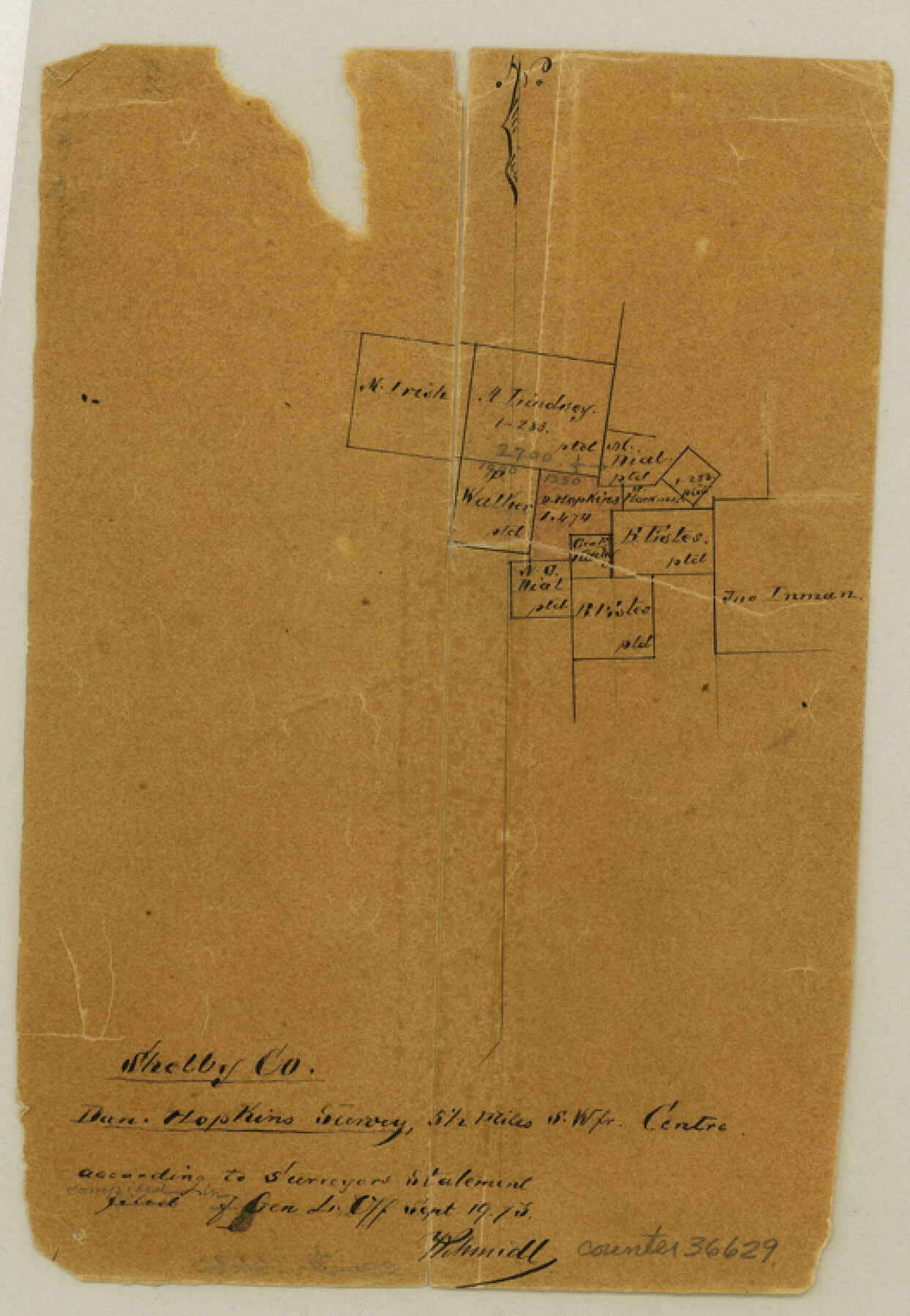
Shelby County Sketch File 16 1/2
[Sketch of the Dan. Hopkins survey and surrounding area southwest from Center]
-
Map/Doc
36629
-
Collection
General Map Collection
-
Object Dates
9/19/1873 (File Date)
-
Counties
Shelby
-
Subjects
Surveying Sketch File
-
Height x Width
7.6 x 5.3 inches
19.3 x 13.5 cm
-
Medium
paper, manuscript
Part of: General Map Collection
Sutton County Sketch File F

Print $18.00
- Digital $50.00
Sutton County Sketch File F
1906
Size 14.1 x 8.7 inches
Map/Doc 37391
Limestone County Sketch File A

Print $40.00
- Digital $50.00
Limestone County Sketch File A
1833
Size 15.7 x 12.8 inches
Map/Doc 30149
Pecos County Sketch File 47

Print $8.00
- Digital $50.00
Pecos County Sketch File 47
1935
Size 11.4 x 8.5 inches
Map/Doc 33759
Flight Mission No. DAG-24K, Frame 157, Matagorda County

Print $20.00
- Digital $50.00
Flight Mission No. DAG-24K, Frame 157, Matagorda County
1953
Size 18.6 x 22.5 inches
Map/Doc 86571
Matagorda County Aerial Photograph Index Sheet 6

Print $20.00
- Digital $50.00
Matagorda County Aerial Photograph Index Sheet 6
1953
Size 23.8 x 19.6 inches
Map/Doc 83727
Ward County Rolled Sketch 24B

Print $40.00
- Digital $50.00
Ward County Rolled Sketch 24B
1967
Size 24.7 x 56.4 inches
Map/Doc 10115
Hardin County Working Sketch 26

Print $20.00
- Digital $50.00
Hardin County Working Sketch 26
1954
Size 19.5 x 23.8 inches
Map/Doc 63424
Brewster County Working Sketch 103

Print $40.00
- Digital $50.00
Brewster County Working Sketch 103
1980
Size 48.4 x 31.1 inches
Map/Doc 67703
Cooke County Working Sketch 21

Print $20.00
- Digital $50.00
Cooke County Working Sketch 21
1959
Size 35.3 x 30.3 inches
Map/Doc 68258
[Sketch for Mineral Application 16787 - Pecos River Bed, A. T. Freet]
![2815, [Sketch for Mineral Application 16787 - Pecos River Bed, A. T. Freet], General Map Collection](https://historictexasmaps.com/wmedia_w700/maps/2815-1.tif.jpg)
Print $20.00
- Digital $50.00
[Sketch for Mineral Application 16787 - Pecos River Bed, A. T. Freet]
1927
Size 20.0 x 46.7 inches
Map/Doc 2815
Howard County Sketch File 4

Print $20.00
- Digital $50.00
Howard County Sketch File 4
Size 25.6 x 21.8 inches
Map/Doc 11793
Map of Colorado County

Print $20.00
- Digital $50.00
Map of Colorado County
1871
Size 18.0 x 18.8 inches
Map/Doc 3425
You may also like
Calhoun County Rolled Sketch 17

Print $20.00
- Digital $50.00
Calhoun County Rolled Sketch 17
1957
Size 24.6 x 30.0 inches
Map/Doc 5370
Tyler County Rolled Sketch 8

Print $20.00
- Digital $50.00
Tyler County Rolled Sketch 8
1965
Size 18.1 x 25.4 inches
Map/Doc 8058
Flight Mission No. DQO-8K, Frame 132, Galveston County

Print $20.00
- Digital $50.00
Flight Mission No. DQO-8K, Frame 132, Galveston County
1952
Size 18.8 x 22.6 inches
Map/Doc 85197
Crockett County Rolled Sketch 65

Print $20.00
- Digital $50.00
Crockett County Rolled Sketch 65
1948
Size 13.4 x 27.5 inches
Map/Doc 5608
Colorado County Sketch File 15

Print $4.00
- Digital $50.00
Colorado County Sketch File 15
Size 13.0 x 8.1 inches
Map/Doc 18943
Chambers County Working Sketch 12

Print $20.00
- Digital $50.00
Chambers County Working Sketch 12
1954
Size 35.2 x 33.8 inches
Map/Doc 67995
Hale County Sketch File 16

Print $4.00
- Digital $50.00
Hale County Sketch File 16
1888
Size 12.8 x 8.2 inches
Map/Doc 24747
Atascosa County Sketch File 14

Print $40.00
- Digital $50.00
Atascosa County Sketch File 14
1870
Size 12.5 x 15.0 inches
Map/Doc 13773
Harris County Sketch File 53

Print $20.00
- Digital $50.00
Harris County Sketch File 53
1914
Size 15.9 x 12.0 inches
Map/Doc 11654
[T. & P. Surveys in Crane, Upton, Coke Counties]
![90464, [T. & P. Surveys in Crane, Upton, Coke Counties], Twichell Survey Records](https://historictexasmaps.com/wmedia_w700/maps/90464-1.tif.jpg)
Print $20.00
- Digital $50.00
[T. & P. Surveys in Crane, Upton, Coke Counties]
Size 19.2 x 21.2 inches
Map/Doc 90464
Flight Mission No. BQY-15M, Frame 8, Harris County

Print $20.00
- Digital $50.00
Flight Mission No. BQY-15M, Frame 8, Harris County
1953
Size 18.7 x 22.4 inches
Map/Doc 85306
Newton County Working Sketch 38

Print $20.00
- Digital $50.00
Newton County Working Sketch 38
1961
Size 36.8 x 29.2 inches
Map/Doc 71284