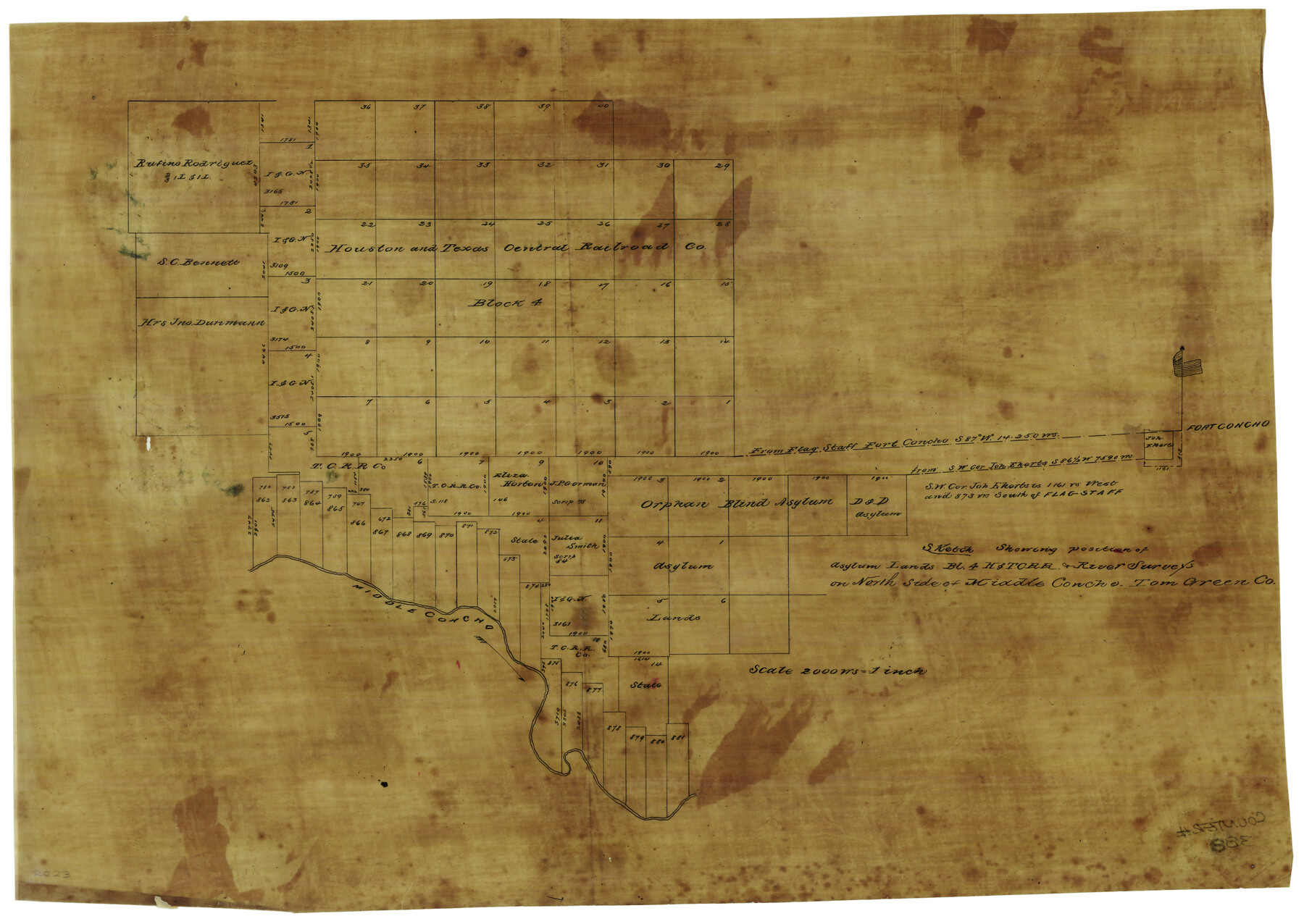
Sketch showing position of Asylum Lands Blk. 4, H. & T. C. R.R. Co. & river surveys on north side of Middle Concho, Tom Green Co.
-
Map/Doc
388
-
Collection
Maddox Collection
-
Counties
Tom Green
-
Height x Width
14.4 x 20.6 inches
36.6 x 52.3 cm
-
Medium
paper, manuscript
-
Scale
1" = 2000 varas
-
Features
Middle Concho River
Fort Concho
Part of: Maddox Collection
Titus County, Texas

Print $20.00
- Digital $50.00
Titus County, Texas
1880
Size 29.4 x 22.8 inches
Map/Doc 629
Lipscomb County, Texas

Print $20.00
- Digital $50.00
Lipscomb County, Texas
1880
Size 16.5 x 18.2 inches
Map/Doc 489
Block No. 45 of the H. & T. C. R.R. Co. and Block No. 4T of the T. & N. O. R.R. Co. in Hansford and Ochiltree Cos. as resurveyed by J.L. Long, State Surveyor

Print $20.00
- Digital $50.00
Block No. 45 of the H. & T. C. R.R. Co. and Block No. 4T of the T. & N. O. R.R. Co. in Hansford and Ochiltree Cos. as resurveyed by J.L. Long, State Surveyor
1888
Size 34.1 x 28.1 inches
Map/Doc 75820
Plat of Surveys in Hidalgo Co.

Print $20.00
- Digital $50.00
Plat of Surveys in Hidalgo Co.
Size 17.3 x 8.4 inches
Map/Doc 75547
Hansford County, Texas

Print $20.00
- Digital $50.00
Hansford County, Texas
1888
Size 22.5 x 17.8 inches
Map/Doc 731
Lubbock County, Texas

Print $20.00
- Digital $50.00
Lubbock County, Texas
1892
Size 27.8 x 22.6 inches
Map/Doc 565
Childress County, Texas

Print $20.00
- Digital $50.00
Childress County, Texas
1892
Size 29.3 x 22.0 inches
Map/Doc 697
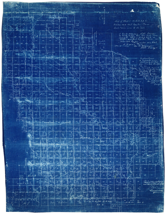
Map of Block 1, H. & G. N. R. R. Co., Dickens and Kent Counties Texas
Print $20.00
- Digital $50.00
Map of Block 1, H. & G. N. R. R. Co., Dickens and Kent Counties Texas
1908
Size 32.0 x 24.2 inches
Map/Doc 10780
[Office Sketch of Jesse McGee survey in Sabine and Newton Counties]
![543, [Office Sketch of Jesse McGee survey in Sabine and Newton Counties], Maddox Collection](https://historictexasmaps.com/wmedia_w700/maps/543.tif.jpg)
Print $20.00
- Digital $50.00
[Office Sketch of Jesse McGee survey in Sabine and Newton Counties]
1910
Size 13.4 x 15.1 inches
Map/Doc 543
Map of Concho County, Texas

Print $20.00
- Digital $50.00
Map of Concho County, Texas
1879
Size 28.8 x 23.9 inches
Map/Doc 703
Sketch of the Designation of Route of the Aransas Channel Harbor & Dock Company's Deep Water Channel

Print $3.00
- Digital $50.00
Sketch of the Designation of Route of the Aransas Channel Harbor & Dock Company's Deep Water Channel
Size 13.2 x 10.0 inches
Map/Doc 4495
[Sketch in Hutchinson County, Texas]
![76016, [Sketch in Hutchinson County, Texas], Maddox Collection](https://historictexasmaps.com/wmedia_w700/maps/76016.tif.jpg)
Print $20.00
- Digital $50.00
[Sketch in Hutchinson County, Texas]
Size 26.5 x 35.3 inches
Map/Doc 76016
You may also like
Map of Bee County

Print $20.00
- Digital $50.00
Map of Bee County
1879
Size 25.1 x 22.7 inches
Map/Doc 3289
Henderson County Working Sketch 36

Print $20.00
- Digital $50.00
Henderson County Working Sketch 36
1973
Size 27.5 x 19.0 inches
Map/Doc 66169
Concho County Working Sketch 23

Print $20.00
- Digital $50.00
Concho County Working Sketch 23
1975
Size 21.9 x 27.1 inches
Map/Doc 68205
Smith County Rolled Sketch 2

Print $20.00
- Digital $50.00
Smith County Rolled Sketch 2
Size 36.2 x 34.6 inches
Map/Doc 76010
Motley County Sketch File 20 (S)

Print $14.00
- Digital $50.00
Motley County Sketch File 20 (S)
Size 7.2 x 8.7 inches
Map/Doc 32196
Brewster County Rolled Sketch 11

Print $20.00
- Digital $50.00
Brewster County Rolled Sketch 11
1881
Size 24.9 x 23.1 inches
Map/Doc 5191
Johnson County Rolled Sketch 2

Print $20.00
- Digital $50.00
Johnson County Rolled Sketch 2
1956
Size 20.6 x 22.3 inches
Map/Doc 6447
Val Verde County Working Sketch 117

Print $20.00
- Digital $50.00
Val Verde County Working Sketch 117
1993
Size 30.9 x 37.0 inches
Map/Doc 82844
Bee County Working Sketch 10

Print $20.00
- Digital $50.00
Bee County Working Sketch 10
1941
Size 41.2 x 20.4 inches
Map/Doc 67260
Duval County Working Sketch 7

Print $20.00
- Digital $50.00
Duval County Working Sketch 7
1935
Size 24.4 x 25.0 inches
Map/Doc 68720
Harrison County Working Sketch 8

Print $20.00
- Digital $50.00
Harrison County Working Sketch 8
1956
Size 20.6 x 30.5 inches
Map/Doc 66028
Map of Hays County, Texas

Print $20.00
- Digital $50.00
Map of Hays County, Texas
1880
Size 41.8 x 35.8 inches
Map/Doc 16848