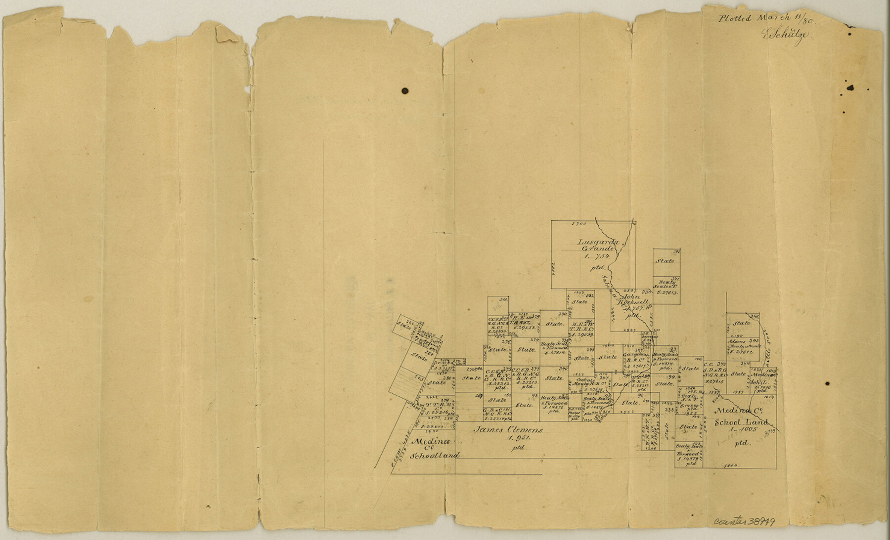
Uvalde County Sketch File 3
[Office sketch of surveys near the Sabinal River northeast from Uvalde]
-
Map/Doc
38949
-
Collection
General Map Collection
-
Object Dates
3/11/1880 (Creation Date)
-
People and Organizations
E. Schutze (Draftsman)
-
Counties
Uvalde
-
Subjects
Surveying Sketch File
-
Height x Width
9.1 x 15.0 inches
23.1 x 38.1 cm
-
Medium
paper, print
-
Features
Sabinal Creek
Little Seco Creek
Part of: General Map Collection
Sutton County Sketch File 39

Print $20.00
- Digital $50.00
Sutton County Sketch File 39
1939
Size 16.8 x 24.2 inches
Map/Doc 12389
Bell County Working Sketch 9

Print $20.00
- Digital $50.00
Bell County Working Sketch 9
1954
Size 32.3 x 27.9 inches
Map/Doc 67349
Irion County Sketch File 17

Print $20.00
- Digital $50.00
Irion County Sketch File 17
Size 26.7 x 40.5 inches
Map/Doc 10617
Bailey County Sketch File 9

Print $40.00
- Digital $50.00
Bailey County Sketch File 9
Size 22.4 x 18.1 inches
Map/Doc 10885
Brewster County Working Sketch 11

Print $20.00
- Digital $50.00
Brewster County Working Sketch 11
1919
Size 18.2 x 17.9 inches
Map/Doc 67544
Mosaic composed of aerial photographs - Houston Ship Channel, Tex.

Print $20.00
- Digital $50.00
Mosaic composed of aerial photographs - Houston Ship Channel, Tex.
1923
Size 13.7 x 38.0 inches
Map/Doc 97172
Map of Williamson County

Print $20.00
- Digital $50.00
Map of Williamson County
1876
Size 21.2 x 28.6 inches
Map/Doc 4152
Sutton County Sketch File 11

Print $10.00
- Digital $50.00
Sutton County Sketch File 11
1898
Size 14.2 x 8.8 inches
Map/Doc 37374
Flight Mission No. CGI-3N, Frame 162, Cameron County

Print $20.00
- Digital $50.00
Flight Mission No. CGI-3N, Frame 162, Cameron County
1954
Size 18.6 x 22.3 inches
Map/Doc 84626
Flight Mission No. BRE-4P, Frame 171, Nueces County

Print $20.00
- Digital $50.00
Flight Mission No. BRE-4P, Frame 171, Nueces County
1956
Size 18.6 x 22.5 inches
Map/Doc 86834
Greer County Sketch File 7

Print $40.00
- Digital $50.00
Greer County Sketch File 7
Size 12.8 x 17.5 inches
Map/Doc 24526
Cottle County

Print $20.00
- Digital $50.00
Cottle County
1908
Size 45.0 x 41.0 inches
Map/Doc 66789
You may also like
Jackson County Rolled Sketch 9

Print $40.00
- Digital $50.00
Jackson County Rolled Sketch 9
1941
Size 50.7 x 32.1 inches
Map/Doc 9258
Flight Mission No. DIX-5P, Frame 137, Aransas County

Print $20.00
- Digital $50.00
Flight Mission No. DIX-5P, Frame 137, Aransas County
1956
Size 17.6 x 17.6 inches
Map/Doc 83798
Flight Mission No. DQO-8K, Frame 11, Galveston County

Print $20.00
- Digital $50.00
Flight Mission No. DQO-8K, Frame 11, Galveston County
1952
Size 18.7 x 22.3 inches
Map/Doc 85134
Culberson County Rolled Sketch 46

Print $40.00
- Digital $50.00
Culberson County Rolled Sketch 46
1953
Size 53.1 x 43.1 inches
Map/Doc 8754
Map of Kerr County Texas

Print $20.00
- Digital $50.00
Map of Kerr County Texas
1879
Size 20.5 x 28.5 inches
Map/Doc 4575
Dimmit County Sketch File 9a

Print $4.00
- Digital $50.00
Dimmit County Sketch File 9a
Size 12.7 x 8.2 inches
Map/Doc 21073
McCulloch County

Print $40.00
- Digital $50.00
McCulloch County
1904
Size 49.2 x 35.5 inches
Map/Doc 66921
Hays County Rolled Sketch 31

Print $20.00
- Digital $50.00
Hays County Rolled Sketch 31
2001
Size 24.0 x 34.7 inches
Map/Doc 76421
Ellis County Sketch File 6

Print $24.00
- Digital $50.00
Ellis County Sketch File 6
Size 12.3 x 8.2 inches
Map/Doc 21836
Flight Mission No. CLL-1N, Frame 10, Willacy County

Print $20.00
- Digital $50.00
Flight Mission No. CLL-1N, Frame 10, Willacy County
1954
Size 18.5 x 22.1 inches
Map/Doc 86997
Kerr County Boundary File 4a

Print $16.00
- Digital $50.00
Kerr County Boundary File 4a
Size 6.1 x 8.2 inches
Map/Doc 64801
Flight Mission No. CRC-6R, Frame 35, Chambers County

Print $20.00
- Digital $50.00
Flight Mission No. CRC-6R, Frame 35, Chambers County
1956
Size 18.7 x 22.5 inches
Map/Doc 84968