Wise County Sketch File 18
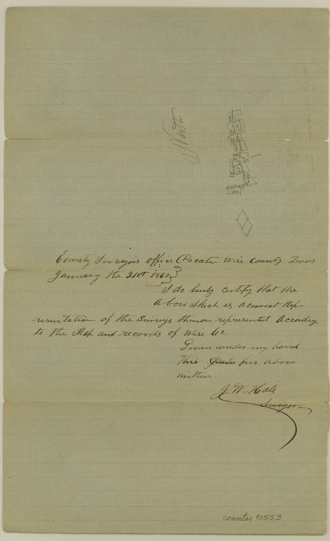
[Sketch of surveys in the vicinity of Salt Creek southwest from Decatur]
-
Map/Doc
40553
-
Collection
General Map Collection
-
Object Dates
1/21/1860 (Creation Date)
2/1/1860 (File Date)
-
People and Organizations
J.W. Hale (Surveyor/Engineer)
-
Counties
Wise
-
Subjects
Surveying Sketch File
-
Height x Width
12.8 x 7.8 inches
32.5 x 19.8 cm
-
Medium
paper, manuscript
-
Features
Salt Creek
Part of: General Map Collection
Webb County Sketch File 14b

Print $4.00
- Digital $50.00
Webb County Sketch File 14b
1897
Size 11.2 x 8.8 inches
Map/Doc 39812
Texas, Espiritu Santo Bay

Print $40.00
- Digital $50.00
Texas, Espiritu Santo Bay
1934
Size 31.7 x 48.2 inches
Map/Doc 69996
Jack County Sketch File 31

Print $40.00
- Digital $50.00
Jack County Sketch File 31
1926
Size 8.8 x 7.2 inches
Map/Doc 27565
King County Boundary File 3

Print $54.00
- Digital $50.00
King County Boundary File 3
Size 14.1 x 8.5 inches
Map/Doc 64896
Gonzales County Working Sketch 8

Print $20.00
- Digital $50.00
Gonzales County Working Sketch 8
1981
Size 19.0 x 16.7 inches
Map/Doc 63224
Real County Working Sketch 40

Print $20.00
- Digital $50.00
Real County Working Sketch 40
1952
Size 31.5 x 22.5 inches
Map/Doc 71932
Houston County Sketch File 31

Print $2.00
- Digital $50.00
Houston County Sketch File 31
1888
Size 9.1 x 7.9 inches
Map/Doc 26808
Howard County Rolled Sketch 5

Print $20.00
- Digital $50.00
Howard County Rolled Sketch 5
Size 19.6 x 16.5 inches
Map/Doc 6234
Childress County Boundary File 3

Print $48.00
- Digital $50.00
Childress County Boundary File 3
Size 9.4 x 4.5 inches
Map/Doc 51330
Matagorda County Sketch File 6

Print $4.00
- Digital $50.00
Matagorda County Sketch File 6
Size 8.0 x 4.9 inches
Map/Doc 30738
Hansford County Sketch File 6

Print $8.00
- Digital $50.00
Hansford County Sketch File 6
1926
Size 13.6 x 9.0 inches
Map/Doc 24954
Real County Working Sketch Graphic Index, Sheet 2 (Sketches 43 to Most Recent)

Print $20.00
- Digital $50.00
Real County Working Sketch Graphic Index, Sheet 2 (Sketches 43 to Most Recent)
1972
Size 43.2 x 31.1 inches
Map/Doc 76679
You may also like
La Salle County Sketch File 1

Print $5.00
- Digital $50.00
La Salle County Sketch File 1
1850
Size 14.2 x 9.2 inches
Map/Doc 29443
Sketch Showing all that Portion of Block 24 North of Santa Fe R. R. Right-of-Way in Original Town of Lubbock

Print $20.00
- Digital $50.00
Sketch Showing all that Portion of Block 24 North of Santa Fe R. R. Right-of-Way in Original Town of Lubbock
1925
Size 27.5 x 35.6 inches
Map/Doc 92810
Map of Houston, Harris County, Texas

Print $20.00
- Digital $50.00
Map of Houston, Harris County, Texas
1900
Size 38.5 x 32.0 inches
Map/Doc 93390
Brewster County Rolled Sketch 126

Print $225.00
- Digital $50.00
Brewster County Rolled Sketch 126
1908
Map/Doc 43230
Burleson County State Real Property Sketch 1

Print $80.00
- Digital $50.00
Burleson County State Real Property Sketch 1
2003
Size 37.0 x 53.6 inches
Map/Doc 81907
Real County Working Sketch 7

Print $20.00
- Digital $50.00
Real County Working Sketch 7
1928
Size 18.4 x 19.4 inches
Map/Doc 71899
Maverick County Sketch File 14

Print $4.00
- Digital $50.00
Maverick County Sketch File 14
1883
Size 11.1 x 8.5 inches
Map/Doc 31111
Sketch No. 1, Dickens & Motley Cos.

Print $20.00
- Digital $50.00
Sketch No. 1, Dickens & Motley Cos.
1879
Size 17.9 x 15.5 inches
Map/Doc 10761
A New Map of Texas with the Contiguous American & Mexican States

Print $20.00
- Digital $50.00
A New Map of Texas with the Contiguous American & Mexican States
1837
Size 12.5 x 15.1 inches
Map/Doc 96643
Motley County Sketch File 8 (S)

Print $4.00
- Digital $50.00
Motley County Sketch File 8 (S)
1883
Size 12.8 x 8.4 inches
Map/Doc 32153
Throckmorton County Working Sketch Graphic Index

Print $20.00
- Digital $50.00
Throckmorton County Working Sketch Graphic Index
1943
Size 44.6 x 36.3 inches
Map/Doc 76713
Garza County Rolled Sketch J

Print $20.00
- Digital $50.00
Garza County Rolled Sketch J
1911
Size 27.2 x 23.4 inches
Map/Doc 6004