![4449, [Surveying Sketch of Loma Blanca, Santa Rosa, San Antonio del Encinal, et al], Maddox Collection](https://historictexasmaps.com/wmedia_w1800h1800/maps/4449.tif.jpg)
[Surveying Sketch of Loma Blanca, Santa Rosa, San Antonio del Encinal, et al]
-
Map/Doc
4449
-
Collection
Maddox Collection
-
Counties
Brooks Kenedy Kleberg Jim Wells
-
Height x Width
19.0 x 22.1 inches
48.3 x 56.1 cm
-
Medium
paper, manuscript
-
Comments
re-produced for a fee of $10.00
-
Features
Rancho los Olmos
Los Olmos Creek
Paisano Creek
Laguna Loma Blanca
Palo Blanco Creek
Road crossing from San Patricio to Brownsville
San Patricio Road
Brownsville Road
Salt Lagoon
Part of: Maddox Collection
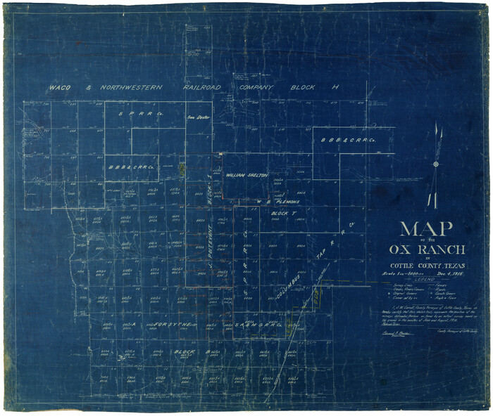
Map of the O-X Ranch in Cottle County, Texas
Print $20.00
- Digital $50.00
Map of the O-X Ranch in Cottle County, Texas
1916
Size 30.4 x 35.0 inches
Map/Doc 4438
Johnson County, Texas

Print $20.00
- Digital $50.00
Johnson County, Texas
1871
Size 18.2 x 23.3 inches
Map/Doc 734
[El Javali Grant,] Sketch of 2560 acres of land in Starr County
![474, [El Javali Grant,] Sketch of 2560 acres of land in Starr County, Maddox Collection](https://historictexasmaps.com/wmedia_w700/maps/0474-1.tif.jpg)
Print $20.00
- Digital $50.00
[El Javali Grant,] Sketch of 2560 acres of land in Starr County
Size 13.4 x 14.0 inches
Map/Doc 474
Wichita County

Print $20.00
- Digital $50.00
Wichita County
1892
Size 20.2 x 24.3 inches
Map/Doc 75804
[Surveying Sketch of H. & T. C. R.R. Co. surveys, et al, unknown county]
![75988, [Surveying Sketch of H. & T. C. R.R. Co. surveys, et al, unknown county], Maddox Collection](https://historictexasmaps.com/wmedia_w700/maps/75988.tif.jpg)
Print $20.00
- Digital $50.00
[Surveying Sketch of H. & T. C. R.R. Co. surveys, et al, unknown county]
Size 21.0 x 25.7 inches
Map/Doc 75988
[Surveying Sketch of Northern Portion of Hutchinson County]
![5065, [Surveying Sketch of Northern Portion of Hutchinson County], Maddox Collection](https://historictexasmaps.com/wmedia_w700/maps/5065.tif.jpg)
Print $20.00
- Digital $50.00
[Surveying Sketch of Northern Portion of Hutchinson County]
1890
Size 26.5 x 42.5 inches
Map/Doc 5065

Mitchell County, Texas

Print $20.00
- Digital $50.00
Mitchell County, Texas
1870
Size 22.7 x 18.0 inches
Map/Doc 741
Map of Falls County, Texas

Print $20.00
- Digital $50.00
Map of Falls County, Texas
1879
Size 19.4 x 23.0 inches
Map/Doc 724
Skeleton Map of Nueces County

Print $20.00
- Digital $50.00
Skeleton Map of Nueces County
1907
Size 32.4 x 37.3 inches
Map/Doc 593
Map of Grimes County, Texas

Print $20.00
- Digital $50.00
Map of Grimes County, Texas
1880
Size 29.5 x 15.6 inches
Map/Doc 432
Map of South Brady Ranch, Concho County, Texas

Print $3.00
- Digital $50.00
Map of South Brady Ranch, Concho County, Texas
1880
Size 12.9 x 10.5 inches
Map/Doc 424
You may also like
Caldwell County Sketch File 6

Print $8.00
- Digital $50.00
Caldwell County Sketch File 6
1922
Size 14.1 x 8.1 inches
Map/Doc 35847

Notes for map of Montgomery County

Print $20.00
- Digital $50.00
Notes for map of Montgomery County
1844
Size 17.6 x 21.9 inches
Map/Doc 78370
[Northeast Portion of Hartley County]
![91118, [Northeast Portion of Hartley County], Twichell Survey Records](https://historictexasmaps.com/wmedia_w700/maps/91118-1.tif.jpg)
Print $2.00
- Digital $50.00
[Northeast Portion of Hartley County]
Size 13.9 x 8.5 inches
Map/Doc 91118
Jefferson County Working Sketch 10

Print $40.00
- Digital $50.00
Jefferson County Working Sketch 10
1942
Size 35.0 x 49.4 inches
Map/Doc 66553
Nueces County Sketch File 5

Print $4.00
- Digital $50.00
Nueces County Sketch File 5
Size 8.1 x 11.0 inches
Map/Doc 32507
General Highway Map, Dallam County, Hartley County, Texas

Print $20.00
General Highway Map, Dallam County, Hartley County, Texas
1940
Size 18.3 x 25.1 inches
Map/Doc 79065
[Tie line from Northeast Block 36, Township 5N to Northwest corner Block M]
![90559, [Tie line from Northeast Block 36, Township 5N to Northwest corner Block M], Twichell Survey Records](https://historictexasmaps.com/wmedia_w700/maps/90559-1.tif.jpg)
Print $20.00
- Digital $50.00
[Tie line from Northeast Block 36, Township 5N to Northwest corner Block M]
Size 22.3 x 10.3 inches
Map/Doc 90559
Flight Mission No. DQO-8K, Frame79, Galveston County

Print $20.00
- Digital $50.00
Flight Mission No. DQO-8K, Frame79, Galveston County
1952
Size 18.7 x 22.5 inches
Map/Doc 85183
Archer County Sketch File 29

Print $80.00
- Digital $50.00
Archer County Sketch File 29
1888
Size 21.8 x 16.5 inches
Map/Doc 10836
Flight Mission No. CLL-4N, Frame 34, Willacy County

Print $20.00
- Digital $50.00
Flight Mission No. CLL-4N, Frame 34, Willacy County
1954
Size 18.4 x 22.2 inches
Map/Doc 87107
Loving County Rolled Sketch 14

Print $20.00
- Digital $50.00
Loving County Rolled Sketch 14
2006
Size 11.4 x 17.5 inches
Map/Doc 93381