![4472, [Z. C. Collier survey owned by Pease Estate, Hutchinson County], Maddox Collection](https://historictexasmaps.com/wmedia_w1800h1800/maps/4472-1.tif.jpg)
[Z. C. Collier survey owned by Pease Estate, Hutchinson County]
-
Map/Doc
4472
-
Collection
Maddox Collection
-
Counties
Hutchinson
-
Height x Width
19.0 x 20.8 inches
48.3 x 52.8 cm
-
Medium
paper, manuscript
-
Features
Big Creek
Lugenbyhl's Field
Part of: Maddox Collection
[Sketch showing Miguel Perez, Juan Jose Solis and Francisco Antonio Villareal surveys in Starr County]
![75549, [Sketch showing Miguel Perez, Juan Jose Solis and Francisco Antonio Villareal surveys in Starr County], Maddox Collection](https://historictexasmaps.com/wmedia_w700/maps/75549.tif.jpg)
Print $20.00
- Digital $50.00
[Sketch showing Miguel Perez, Juan Jose Solis and Francisco Antonio Villareal surveys in Starr County]
1914
Size 20.9 x 13.6 inches
Map/Doc 75549
Yowards Ranche, Bee County, Texas

Print $20.00
- Digital $50.00
Yowards Ranche, Bee County, Texas
Size 13.3 x 12.4 inches
Map/Doc 381
Fayette County, Texas

Print $20.00
- Digital $50.00
Fayette County, Texas
1879
Size 19.9 x 23.0 inches
Map/Doc 419
[Surveying Sketch of Part of] Maverick County
![515, [Surveying Sketch of Part of] Maverick County, Maddox Collection](https://historictexasmaps.com/wmedia_w700/maps/515.tif.jpg)
Print $3.00
- Digital $50.00
[Surveying Sketch of Part of] Maverick County
1878
Size 9.8 x 13.2 inches
Map/Doc 515
Roberts County, Texas

Print $20.00
- Digital $50.00
Roberts County, Texas
1878
Size 19.2 x 18.5 inches
Map/Doc 749
Lamar County, Texas

Print $20.00
- Digital $50.00
Lamar County, Texas
1870
Size 21.5 x 18.1 inches
Map/Doc 738
McMullen County, Texas

Print $20.00
- Digital $50.00
McMullen County, Texas
1889
Size 28.7 x 22.1 inches
Map/Doc 575
Map of Navarro County, Texas

Print $20.00
- Digital $50.00
Map of Navarro County, Texas
1871
Size 23.5 x 28.7 inches
Map/Doc 662
[Robertson Co.]
![4488, [Robertson Co.], Maddox Collection](https://historictexasmaps.com/wmedia_w700/maps/4488.tif.jpg)
Print $20.00
- Digital $50.00
[Robertson Co.]
1880
Size 32.3 x 44.3 inches
Map/Doc 4488
Working Sketch in Dickens and Crosby Cos.

Print $20.00
- Digital $50.00
Working Sketch in Dickens and Crosby Cos.
1910
Size 35.5 x 24.8 inches
Map/Doc 75799
[Sketch Showing G. H. & H. R.R. Co. Block 3B and A. B. & M. Block M16, Hutchinson County, Texas]
![75813, [Sketch Showing G. H. & H. R.R. Co. Block 3B and A. B. & M. Block M16, Hutchinson County, Texas], Maddox Collection](https://historictexasmaps.com/wmedia_w700/maps/75813.tif.jpg)
Print $20.00
- Digital $50.00
[Sketch Showing G. H. & H. R.R. Co. Block 3B and A. B. & M. Block M16, Hutchinson County, Texas]
Size 20.7 x 21.5 inches
Map/Doc 75813
Sketch of the Designation of Route of the Aransas Channel Harbor & Dock Company's Deep Water Channel

Print $3.00
- Digital $50.00
Sketch of the Designation of Route of the Aransas Channel Harbor & Dock Company's Deep Water Channel
Size 13.2 x 10.0 inches
Map/Doc 4495
You may also like
Fractional Township No. 8 South Range No. 13 East of the Indian Meridian, Indian Territory

Print $20.00
- Digital $50.00
Fractional Township No. 8 South Range No. 13 East of the Indian Meridian, Indian Territory
1896
Size 19.1 x 24.3 inches
Map/Doc 75224
DeWitt County Boundary File 3

Print $17.00
- Digital $50.00
DeWitt County Boundary File 3
Size 12.7 x 8.3 inches
Map/Doc 52514
Upton County Sketch File S

Print $8.00
- Digital $50.00
Upton County Sketch File S
Size 13.4 x 9.1 inches
Map/Doc 38850
Val Verde County Sketch File 44A

Print $10.00
- Digital $50.00
Val Verde County Sketch File 44A
1940
Size 14.5 x 8.8 inches
Map/Doc 39311
[Sketch showing T. & N. O. Blocks 3T and 6T, Denison and Pacific RR. Co. Block O-18 and surrounding areas]
![93001, [Sketch showing T. & N. O. Blocks 3T and 6T, Denison and Pacific RR. Co. Block O-18 and surrounding areas], Twichell Survey Records](https://historictexasmaps.com/wmedia_w700/maps/93001-1.tif.jpg)
Print $20.00
- Digital $50.00
[Sketch showing T. & N. O. Blocks 3T and 6T, Denison and Pacific RR. Co. Block O-18 and surrounding areas]
Size 21.0 x 28.5 inches
Map/Doc 93001
Bryan Walker Farm

Print $20.00
- Digital $50.00
Bryan Walker Farm
Size 17.1 x 15.5 inches
Map/Doc 92339
Burnet County Rolled Sketch T

Print $20.00
- Digital $50.00
Burnet County Rolled Sketch T
Size 24.7 x 18.3 inches
Map/Doc 5359
Maverick County Sketch File 17

Print $20.00
- Digital $50.00
Maverick County Sketch File 17
Size 15.4 x 18.2 inches
Map/Doc 12052
Nueces County NRC Article 33.136 Sketch 18

Print $74.00
- Digital $50.00
Nueces County NRC Article 33.136 Sketch 18
2014
Size 22.0 x 34.0 inches
Map/Doc 94714
Coleman County Working Sketch 22
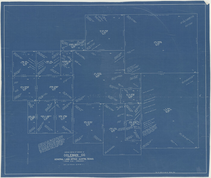
Print $20.00
- Digital $50.00
Coleman County Working Sketch 22
1953
Size 34.6 x 41.0 inches
Map/Doc 68088
Garza County Sketch File G

Print $8.00
- Digital $50.00
Garza County Sketch File G
1904
Size 14.3 x 8.6 inches
Map/Doc 24026
Stonewall County Sketch File 8

Print $14.00
- Digital $50.00
Stonewall County Sketch File 8
1896
Size 8.7 x 7.7 inches
Map/Doc 37222