![4488, [Robertson Co.], Maddox Collection](https://historictexasmaps.com/wmedia_w1800h1800/maps/4488.tif.jpg)
[Robertson Co.]
-
Map/Doc
4488
-
Collection
Maddox Collection
-
Object Dates
[1880-1889] (Creation Date)
-
People and Organizations
General Land Office (Publisher)
-
Counties
Robertson
-
Height x Width
32.3 x 44.3 inches
82.0 x 112.5 cm
Part of: Maddox Collection
Map of Frio County, Texas

Print $20.00
- Digital $50.00
Map of Frio County, Texas
1879
Size 22.8 x 21.9 inches
Map/Doc 545
Revised Sectional Map No. 5 showing land surveys in parts of counties of El Paso, Jeff Davis, Presidio and Brewster, Texas

Print $20.00
- Digital $50.00
Revised Sectional Map No. 5 showing land surveys in parts of counties of El Paso, Jeff Davis, Presidio and Brewster, Texas
Size 19.0 x 23.7 inches
Map/Doc 4476
Glasscock County, Texas

Print $20.00
- Digital $50.00
Glasscock County, Texas
1889
Size 21.7 x 18.1 inches
Map/Doc 730
[Z. C. Collier survey owned by Pease Estate, Hutchinson County]
![4472, [Z. C. Collier survey owned by Pease Estate, Hutchinson County], Maddox Collection](https://historictexasmaps.com/wmedia_w700/maps/4472-1.tif.jpg)
Print $20.00
- Digital $50.00
[Z. C. Collier survey owned by Pease Estate, Hutchinson County]
Size 19.0 x 20.8 inches
Map/Doc 4472
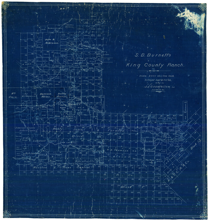
S.B. Burnett's King County Ranch
Print $20.00
- Digital $50.00
S.B. Burnett's King County Ranch
1902
Size 32.3 x 30.6 inches
Map/Doc 4441
Map of the north west portion of Hutchinson County showing the proposed resurvey of Block M24

Print $20.00
- Digital $50.00
Map of the north west portion of Hutchinson County showing the proposed resurvey of Block M24
Size 29.1 x 31.9 inches
Map/Doc 75814
[Robertson Co.]
![4488, [Robertson Co.], Maddox Collection](https://historictexasmaps.com/wmedia_w700/maps/4488.tif.jpg)
Print $20.00
- Digital $50.00
[Robertson Co.]
1880
Size 32.3 x 44.3 inches
Map/Doc 4488
[Sketch in Hutchinson County, Texas]
![4491, [Sketch in Hutchinson County, Texas], Maddox Collection](https://historictexasmaps.com/wmedia_w700/maps/4491.tif.jpg)
Print $20.00
- Digital $50.00
[Sketch in Hutchinson County, Texas]
Size 36.2 x 31.1 inches
Map/Doc 4491
[Surveying Sketch of A. Forsythe Block B and R. M. Thomson Block M in Cottle County, Texas]
![523, [Surveying Sketch of A. Forsythe Block B and R. M. Thomson Block M in Cottle County, Texas], Maddox Collection](https://historictexasmaps.com/wmedia_w700/maps/523.tif.jpg)
Print $3.00
- Digital $50.00
[Surveying Sketch of A. Forsythe Block B and R. M. Thomson Block M in Cottle County, Texas]
1912
Size 11.0 x 15.8 inches
Map/Doc 523
[Map of the San Antonio del Encinal as Corrected]
![4459, [Map of the San Antonio del Encinal as Corrected], Maddox Collection](https://historictexasmaps.com/wmedia_w700/maps/4459.tif.jpg)
Print $20.00
- Digital $50.00
[Map of the San Antonio del Encinal as Corrected]
Size 28.5 x 30.7 inches
Map/Doc 4459
Map of Galveston County, Texas

Print $20.00
- Digital $50.00
Map of Galveston County, Texas
1879
Size 18.3 x 26.6 inches
Map/Doc 546
Goliad Co. Sketch

Print $3.00
- Digital $50.00
Goliad Co. Sketch
1900
Size 15.6 x 11.3 inches
Map/Doc 417
You may also like
Dickens County Rolled Sketch B

Print $20.00
- Digital $50.00
Dickens County Rolled Sketch B
1894
Size 24.9 x 26.9 inches
Map/Doc 5709
[El Javali Grant,] Sketch of 2560 acres of land in Starr County
![474, [El Javali Grant,] Sketch of 2560 acres of land in Starr County, Maddox Collection](https://historictexasmaps.com/wmedia_w700/maps/0474-1.tif.jpg)
Print $20.00
- Digital $50.00
[El Javali Grant,] Sketch of 2560 acres of land in Starr County
Size 13.4 x 14.0 inches
Map/Doc 474
Erath County Sketch File 14

Print $4.00
- Digital $50.00
Erath County Sketch File 14
1872
Size 13.0 x 8.5 inches
Map/Doc 22290
[Right of Way Map, Belton Branch of the M.K.&T. RR.]
![64220, [Right of Way Map, Belton Branch of the M.K.&T. RR.], General Map Collection](https://historictexasmaps.com/wmedia_w700/maps/64220.tif.jpg)
Print $20.00
- Digital $50.00
[Right of Way Map, Belton Branch of the M.K.&T. RR.]
1896
Size 22.2 x 7.4 inches
Map/Doc 64220
Hill County Sketch File 23

Print $8.00
- Digital $50.00
Hill County Sketch File 23
1862
Size 7.9 x 8.3 inches
Map/Doc 26512
Edwards County Sketch File 28

Print $5.00
- Digital $50.00
Edwards County Sketch File 28
Size 27.3 x 25.6 inches
Map/Doc 11431
Ward County Working Sketch 47

Print $20.00
- Digital $50.00
Ward County Working Sketch 47
1974
Size 41.3 x 33.9 inches
Map/Doc 72353
Hardeman County Working Sketch 3

Print $20.00
- Digital $50.00
Hardeman County Working Sketch 3
1919
Size 32.7 x 35.1 inches
Map/Doc 63384
Hutchinson County Sketch File 17

Print $4.00
- Digital $50.00
Hutchinson County Sketch File 17
Size 6.9 x 8.8 inches
Map/Doc 27218
Travis County Appraisal District Plat Map 2_0404

Print $20.00
- Digital $50.00
Travis County Appraisal District Plat Map 2_0404
Size 20.5 x 24.1 inches
Map/Doc 94228
Johnson County Working Sketch 12

Print $20.00
- Digital $50.00
Johnson County Working Sketch 12
1959
Size 22.9 x 22.6 inches
Map/Doc 66625
Archer County Sketch File 28-2

Print $40.00
- Digital $50.00
Archer County Sketch File 28-2
Size 21.4 x 16.9 inches
Map/Doc 10835